close
-
Layers w
- Weather Layers
- Pro
- Pro
- Pro
- Pro
- Pro
- Pro
- More Layers
- Pro
- Pro
- Pro
- Pro
-
Upgrade to

3D
Trail Conditions
- Unknown
- Snow Groomed
- Snow Packed
- Snow Covered
- Snow Cover Partial
- Freeze/thaw Cycle
- Icy
- Prevalent Mud
- Wet
- Variable
- Ideal
- Dry
- Very Dry
Trail Flow (Ridden Direction)
Trailforks scans users ridelogs to determine the most popular direction each trail is ridden. A good flowing trail network will have most trails flowing in a single direction according to their intension.
The colour categories are based on what percentage of riders are riding a trail in its intended direction.
The colour categories are based on what percentage of riders are riding a trail in its intended direction.
- > 96%
- > 90%
- > 80%
- > 70%
- > 50%
- < 50%
- bi-directional trail
- no data
Trail Last Ridden
Trailforks scans ridelogs to determine the last time a trail was ridden.
- < 2 days
- < 1 week
- < 2 weeks
- < 1 month
- < 6 months
- > 6 months
Trail Ridden Direction
The intended direction a trail should be ridden.
- Downhill Only
- Downhill Primary
- Both Directions
- Uphill Primary
- Uphill Only
- One Direction
Contribute Details
Colors indicate trail is missing specified detail.
- Description
- Photos
- Description & Photos
- Videos
Trail Popularity ?
Trailforks scans ridelogs to determine which trails are ridden the most in the last 9 months.
Trails are compared with nearby trails in the same city region with a possible 25 colour shades.
Think of this as a heatmap, more rides = more kinetic energy = warmer colors.
- most popular
- popular
- less popular
- not popular
ATV/ORV/OHV Filter
Max Vehicle Width
inches
US Cell Coverage
Legend

Radar Time
Activity Recordings
Trailforks uses anonymized public activity data.
?
Activity Recordings
Trailforks uses anonymized public activity data.
?
Personal Heatmap
▶
Activity Types
all
/
none
▶
Options
2
Date range
month
–
Winter Trails
Warning
A routing network for winter maps does not exist. Selecting trails using the winter trails layer has been disabled.
Missing Trails
Most Popular
Least Popular
Trails are colored based on popularity. The more popular a trail is, the more red. Less popular trails trend towards green.
Jump Magnitude Heatmap
Heatmap of where riders jump on trails. Zoom in to see individual jumps, click circles to view jump details.
BC Backroad Status
![map legend]()
Service Road Atlas is a free to use, community-driven service for viewing and creating reports on the numerous back-country service roads around B.C. and Alberta.

Slope Aspect
Direction the slope faces
Trails Deemphasized
Trails are shown in grey.
Only show trails with no bike usage.
Suggested Layers
Based on selected activity type
Save the current map location and zoom level as your default home location whenever this page is loaded.
SaveActivities Click to view
- Mountain Bike
13 trails
- E-Bike
11 trails
- Hike
12 trails
- Trail Running
11 trails
Region Details
- 1
- 1
- 6
- 5
Region Status
Caution as of Apr 16, 2026Stats
- Avg Trail Rating
- Trails (view details)
- 13
- Trails Mountain Bike
- 13
- Trails E-Bike
- 11
- Trails Hike
- 12
- Trails Trail Running
- 11
- Total Distance
- 11 miles
- Total Descent Distance
- 4 miles
- Total Descent
- 2,274 ft
- Total Vertical
- 540 ft
- Highest Trailhead
- 2,424 ft
- Reports
- 16
- Photos
- 23
- Ridden Counter
- 116
Popular Eastside Mountain Biking Trails
• 35 ★ 5.0 • 4,987 ft • 378 ft • 41 •
This trail is the closest thing you will get in the greater Vegas area to a bike park. No shuttle capabilities but the climb isn't too difficult and the way down is well worth it. Lots of jumps, drops, and one wood bridge. Super fun...
• 30 ★ 5.0 • 2,930 ft • 44 ft • 16 •
There are chunky rock spots and some drops in certain areas, to be careful of. On the actual ridge, the path is well defined, with excellent views of the city. (This is view is a must see, if you're already riding out in this area.)...
• 5 ★ 5.0 • 2,615 ft • 297 ft • 9 •
Steep drop starting at the top of the trail, when riding down the mountain. This drop is rideable, but care should be given. Rest of the trail can be taken with speed and is fun going down or up towards the mountain.
• 5 ★ 0.0 • 3 miles • 679 ft • 8 •
This was more than likely an old dirt bike track, and due to this it has a few "hike bike sections." However, it's still a very fun single track. You will see a lot of branching out trails, so pay attention to the map as you navigate,...
• 20 ★ 0.0 • 1,414 ft • 140 ft • 5 •
The beginning is fairly easy going. As You get close to the , it has a stepper elevation change.
• 35 ★ 0.0 • 3,675 ft • 212 ft • 5 •
Less popular blue difficulty singletrack. This multi-use trail can be used both directions. On average it takes 3 minutes to complete this trail.
• 5 ★ 0.0 • 2 miles • 474 ft • 5 •
This is a very fun single track that will work your suspension. Its very chunky and raw in some sections, and will require technical riding. Bring your elbow and knee pads just in case. This trail does have undulations (up & down)...
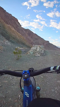
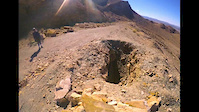
Photos of Eastside Mountain Bike
Videos of Eastside Mountain Bike
trail: Frenchman's Freeride
0:29 |
37 |
Sep 3, 2025
trail: Frenchman's Freeride
0:21 |
607 |
Mar 4, 2018
Recent Trail Reports
| status | trail | date | condition | info | user |
|---|---|---|---|---|---|
| View Pt Route | Apr 16, 2026 @ 7:11pm (America/Los_Angeles) Apr 16, 2026 | Dry | dangersmurf14 | ||
| Base Access Rd | Apr 16, 2026 @ 7:11pm (America/Los_Angeles) Apr 16, 2026 | Dry | dangersmurf14 | ||
| Easy Peasy | Mar 4, 2025 @ 10:42pm Mar 4, 2025 | Dry | natemekis1 | ||
| Lost Child | Mar 4, 2025 @ 10:29pm Mar 4, 2025 | Unknown | natemekis1 | ||
| East Coast View | Mar 4, 2025 @ 10:07pm Mar 4, 2025 | Very Dry | natemekis1 | ||
| Last Lap | Mar 4, 2025 @ 10:01pm Mar 4, 2025 | Very Dry | natemekis1 | ||
| In N Out | Dec 15, 2023 @ 12:06pm Dec 15, 2023 | Dry | IAmGroot1833 | ||
| Frenchman's Freeride | Apr 23, 2021 @ 5:40pm Apr 23, 2021 | Very Dry | iBam | ||
| Dirt Runner | Feb 5, 2021 @ 2:42pm Feb 5, 2021 | Dry | fly-navy |
Activity Feed
| username | action | type | title | date |
|---|---|---|---|---|
| ApexApe | add | photo | activity #96675428 and 4 more | Jun 10, 2026 @ 8:38am Jun 10, 2026 |
| Swissdelphine | ridden | trail | activity #95616524 | May 26, 2026 @ 11:44pm May 26, 2026 |
| hardyr4 | add | photo | activity #94540436 | May 11, 2026 @ 10:43pm May 11, 2026 |
| dangersmurf14 | add | report | activity #92790939 and 1 more | Apr 17, 2026 @ 8:45am Apr 17, 2026 |
| Aaron2RF4eM | wishlist | trail | activity #87354721 and 1 more | Jan 17, 2026 @ 11:28am Jan 17, 2026 |
Recent Comments
| username | type | title | comment | date |
|---|---|---|---|---|
| trail | Trail is definitely rideable now. Ladder... | Sep 3, 2025 @ 1:37pm Sep 3, 2025 | ||
| trail | I used to be able to ride all of this trail... | Mar 4, 2025 @ 10:41pm Mar 4, 2025 | ||
| trail | I didn’t ride this trail but I see why it... | Mar 4, 2025 @ 10:25pm Mar 4, 2025 | ||
| trail | Very sad to say this trail is no longer... | Dec 1, 2024 @ 1:02pm Dec 1, 2024 | ||
| trail | This is the longest single track that is... | Sep 28, 2024 @ 7:00pm Sep 28, 2024 |
Nearby Areas
| name | distance | ||||
|---|---|---|---|---|---|
| Rainbow Gardens | 2.9 km | ||||
| Clark County Wetlands Park | 4 | 6.1 km | |||
| Craig Ranch Regional Park | 8.7 km | ||||
| Sunset Park | 10 km | ||||
| Tule Springs Fossil Beds National Monument | 1 | 12.7 km |
Activity Type Stats
| activitytype | trails | distance | descent | descent distance | total vertical | rating | global rank | state rank | photos | reports | routes | ridelogs |
|---|---|---|---|---|---|---|---|---|---|---|---|---|
| Mountain Bike | 13 | 11 miles | 2,274 ft | 4 miles | 541 ft | #5,419 | #1,966 | 24 | 16 | 152 | ||
| E-Bike | 11 | 9 miles | 2,093 ft | 4 miles | 456 ft | #7,468 | #2,193 | 14 | 72 | |||
| Hike | 12 | 10 miles | 2,093 ft | 4 miles | 541 ft | #13,194 | #5,565 | 15 | 9 | |||
| Trail Running | 11 | 9 miles | 2,034 ft | 4 miles | 541 ft | #12,565 | #5,046 | 15 | 5 |
Frequently Asked Questions About Eastside
▼
What are the highest rated mountain biking trails in Eastside?
The highest rated mountain biking trails in Eastside are:
- View Pt Route (4.1/5)
- Easy Peasy (4.1/5)
- Super Saiyan (4.1/5)
- Frenchman's Freeride (4.1/5)
- Dirt Runner (0/5)
▼
What is the best time of the year to ride in Eastside?
Based on ride log data, the most popular months to ride in Eastside are:
- October (10 activities)
- May (3 activities)
- December (3 activities)
▼
Where can I park to ride in Eastside?
Check the Eastside trail map for trailhead and parking information. Community members regularly update access and parking details for trails in the area.
▼
What is the longest trail in Eastside?
The longest trail in Eastside is Lost Child at 2.7 miles. View all trails sorted by distance.
- By Dnssnchz & contributors
- Admins: Las Vegas, BLM NV GBNM
- #43787 - 2,300 views
- eastside activity log | embed map of Eastside mountain bike trails |
Downloading of trail gps tracks in kml & gpx formats is enabled for Eastside.
You must login to download files.