close
-
Layers w
- Weather Layers
- Pro
- Pro
- Pro
- Pro
- Pro
- Pro
- More Layers
- Pro
- Pro
- Pro
- Pro
-
Upgrade to

3D
Trail Conditions
- Unknown
- Snow Groomed
- Snow Packed
- Snow Covered
- Snow Cover Partial
- Freeze/thaw Cycle
- Icy
- Prevalent Mud
- Wet
- Variable
- Ideal
- Dry
- Very Dry
Trail Flow (Ridden Direction)
Trailforks scans users ridelogs to determine the most popular direction each trail is ridden. A good flowing trail network will have most trails flowing in a single direction according to their intension.
The colour categories are based on what percentage of riders are riding a trail in its intended direction.
The colour categories are based on what percentage of riders are riding a trail in its intended direction.
- > 96%
- > 90%
- > 80%
- > 70%
- > 50%
- < 50%
- bi-directional trail
- no data
Trail Last Ridden
Trailforks scans ridelogs to determine the last time a trail was ridden.
- < 2 days
- < 1 week
- < 2 weeks
- < 1 month
- < 6 months
- > 6 months
Trail Ridden Direction
The intended direction a trail should be ridden.
- Downhill Only
- Downhill Primary
- Both Directions
- Uphill Primary
- Uphill Only
- One Direction
Contribute Details
Colors indicate trail is missing specified detail.
- Description
- Photos
- Description & Photos
- Videos
Trail Popularity ?
Trailforks scans ridelogs to determine which trails are ridden the most in the last 9 months.
Trails are compared with nearby trails in the same city region with a possible 25 colour shades.
Think of this as a heatmap, more rides = more kinetic energy = warmer colors.
- most popular
- popular
- less popular
- not popular
ATV/ORV/OHV Filter
Max Vehicle Width
inches
US Cell Coverage
Legend

Radar Time
Activity Recordings
Trailforks uses anonymized public activity data.
?
Activity Recordings
Trailforks uses anonymized public activity data.
?
Personal Heatmap
▶
Activity Types
all
/
none
▶
Options
2
Date range
month
–
Winter Trails
Warning
A routing network for winter maps does not exist. Selecting trails using the winter trails layer has been disabled.
Missing Trails
Most Popular
Least Popular
Trails are colored based on popularity. The more popular a trail is, the more red. Less popular trails trend towards green.
Jump Magnitude Heatmap
Heatmap of where riders jump on trails. Zoom in to see individual jumps, click circles to view jump details.
BC Backroad Status
![map legend]()
Service Road Atlas is a free to use, community-driven service for viewing and creating reports on the numerous back-country service roads around B.C. and Alberta.

Slope Aspect
Direction the slope faces
Trails Deemphasized
Trails are shown in grey.
Only show trails with no bike usage.
Suggested Layers
Based on selected activity type
Save the current map location and zoom level as your default home location whenever this page is loaded.
Save
No description for Eastsound has been added yet!
Login or register to submit one.
Activities Click to view
- Mountain Bike
39 trails
- E-Bike
30 trails
- Gravel Bike
0 trails
- Adaptive Bike
0 trails
- Horse
5 trails
- Hike
61 trails
- Trail Running
61 trails
Region Details
- 6
- 11
- 15
- 3
- 3
Region Status
Open as of Jun 13, 2026Stats
- Avg Trail Rating
- Trails (view details)
- 58
- Trails Mountain Bike
- 39
- Trails E-Bike
- 30
- Trails Horse
- 5
- Trails Hike
- 61
- Trails Trail Running
- 61
- Trails Dirtbike/Moto
- 1
- Trails Observed Trials
- 1
- Trails ATV/ORV/OHV
- 1
- Total Distance
- 63 miles
- Total Descent
- 18,595 ft
- Total Vertical
- 2,385 ft
- Highest Trailhead
- 2,403 ft
- Reports
- 269
- Photos
- 99
- Ridden Counter
- 8,436
Sub Regions
-
Cresent Beach Preserve
- 1
-
Jones Island Marine State Park
-
Moran State Park
- 8
- 12
- 3
- 3
-
Obstruction Pass State Park
- 1
- 1
-
Turtleback Mountain Preserve
- 1
- 2
Popular Eastsound Mountain Biking Trails
• 100 ★ 4.2 • 1 mile • 57 ft • 587 •
Nice and flowy multi-use trail with great views. Open for biking only September 15 to May 15!
• 95 ★ 4.8 • 3 miles • 482 ft • 533 •
Trail is a beauty, one of the best at Moran State Park - currently open September 15 to May 15 to bikes Use this to connect back up to the Trail for a nice lollipop loop from the Cascade Falls TH, or connect with the s to trail for a...
• 95 ★ 4.7 • 3 miles • 272 ft • 448 •
Subject to seasonal closure to MTB in busy months, only open to MTB September 15 thru May 15. Narrow in spots. This trail is the most commonly used route in the park, and makes a nice climb or descent. The trail is multi use and you may...
• 85 ★ 4.4 • 3 miles • 126 ft • 423 •
Primarily DH route from to Moran State Park main entrance lot. Hikers do utilize this to hike up Mount Constitution from the main lot. Mountain biking is only open from mid September to mid May! Tight and rocky top with many switchbacks...
• 75 ★ 4.5 • 2 miles • 24 ft • 321 •
Commonly referred to as Power Line, the West Boundary Trail follows the power line from the top of Mount Constitution down to the park's entrance. Popular for many hips and gaps, not for the faint of skill or confidence. Split out at...
• 80 ★ 4.4 • 1 mile • 342 ft • 240 •
Great access trail from the main Cascade Lake day-use area to the Cascade Falls TH. Also provides access to Midway Campground sites 18-66 and Primitive Campsites 137-151. Watch out for deer, they are plenty in the lush grass meadows...
• 80 ★ 0.0 • 2,398 ft • 61 ft • 228 •
Popular green difficulty family friendly singletrack. This multi-use trail can be used both directions and has a easy overall physical rating with a 61 ft green climb. On average it takes 5 minutes to complete this trail.
• 85 ★ 5.0 • 814 ft • 0 ft • 224 •
Connector from Mt Pickett trail to the south end of
Eastsound Mountain Bike Routes
★ 3.6 • 9 miles • 477 ft • 9 • Shuttled •
Intermediate shuttle route which gets you the most elevation value per shuttle on the mountain.
13 miles • 2,313 ft • 3 •
Up the road and down the best blue square trails on Mt. Constitution
4 miles • 206 ft • 1 • Point to Point •
Given an intermediate designation due to speed and exposure of the single track
• 17 miles • 2,967 ft • 8 •
• 16 miles • 3,102 ft • 4 •
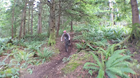
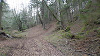
Photos of Eastsound Mountain Bike
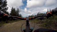
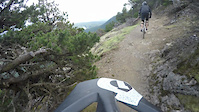
Videos of Eastsound Mountain Bike
0:38 |
295 |
Jan 21, 2020
trail: Power Line Trail
0:10 |
1105 |
Jan 16, 2020

7:11 |
368 |
May 12, 2018
trail: Power Line Trail
5:35 |
2126 |
Apr 4, 2017
trail: Power Line Trail
4:45 |
1295 |
May 16, 2016

trail: Power Line Trail
8:15 |
985 |
Nov 2, 2022 , Eastsound

trail: Power Line Trail
0:49 |
459 |
Oct 25, 2022 , Eastsound

trail: Power Line Trail
43:28 |
749 |
Jul 7, 2021 , Eastsound
Recent Trail Reports
Activity Feed
| username | action | type | title | date |
|---|---|---|---|---|
| marke9265 | add | report | activity #96917115 | Jun 13, 2026 @ 2:32pm Jun 13, 2026 |
| HelenZEdgaz | wishlist | trail | activity #96587598 | Jun 8, 2026 @ 11:37pm Jun 8, 2026 |
| roman777xxx | wishlist | trail | activity #96282535 | Jun 5, 2026 @ 2:26am Jun 5, 2026 |
| AnastasiaxVgMsk | ridden | trail | activity #96252186 | Jun 4, 2026 @ 2:27pm Jun 4, 2026 |
| marke9265 | add | report | activity #95449602 and 1 more | May 24, 2026 @ 3:17pm May 24, 2026 |
Recent Comments
| username | type | title | comment | date |
|---|---|---|---|---|
| trail | I would not recommend riding this as a... | Apr 11, 2026 @ 5:19pm Apr 11, 2026 | ||
| trail | Not a bad way to climb up mt constitution. The... | Apr 4, 2026 @ 5:20pm Apr 4, 2026 | ||
| trail | H | Aug 17, 2025 @ 1:40pm Aug 17, 2025 | ||
| trail | no mountain bike or e-bike allowed. clearly marked | Apr 8, 2025 @ 1:20pm Apr 8, 2025 | ||
| trail | No mtb | Mar 31, 2025 @ 1:51pm Mar 31, 2025 |
Local Badges
-

Epic Ride Climb 2k34 awarded -

Climbing 10k Badge14 awarded -

Climbing 100k Badge0 awarded -

Epic Ride Descent 2k69 awarded -

Descent 10k Badge23 awarded -

Descent 100k Badge0 awarded
Activity Type Stats
| activitytype | trails | distance | descent | descent distance | total vertical | rating | global rank | state rank | photos | reports | routes | ridelogs |
|---|---|---|---|---|---|---|---|---|---|---|---|---|
| Mountain Bike | 39 | 46 miles | 14,075 ft | 23 miles | 2,375 ft | #2,872 | #1,016 | 96 | 267 | 4 | 4,638 | |
| E-Bike | 30 | 44 miles | 13,553 ft | 22 miles | 2,372 ft | #3,357 | #1,192 | 248 | 340 | |||
| Horse | 5 | 6 miles | 886 ft | 2 miles | 1,348 ft | #2,895 | #1,622 | 46 | ||||
| Hike | 61 | 63 miles | 18,596 ft | 32 miles | 2,385 ft | #3,625 | #1,275 | 4 | 269 | 1,325 | ||
| Trail Running | 61 | 63 miles | 18,596 ft | 32 miles | 2,385 ft | #3,373 | #999 | 269 | 516 | |||
| Dirtbike/Moto | 1 | 2,595 ft | 167 ft | 2,398 ft | 167 ft | 43 | ||||||
| Observed Trials | 1 | 2,595 ft | 167 ft | 2,398 ft | 167 ft | |||||||
| ATV/ORV/OHV | 1 | 2,595 ft | 167 ft | 2,398 ft | 167 ft | 43 | 1 |
Frequently Asked Questions About Eastsound
▼
What are the best places to ride in Eastsound?
Eastsound has 6 areas to explore for mountain biking. The top rated areas are:
▼
What are the highest rated mountain biking trails in Eastsound?
The highest rated mountain biking trails in Eastsound are:
- Mountain Lake (4.5/5)
- Mt. Constitution Trail (4.4/5)
- Power Line Trail (4.4/5)
- Connector Trail (4.2/5)
- Cold Spring (4.2/5)
▼
What is the best time of the year to ride in Eastsound?
Based on ride log data, the most popular months to ride in Eastsound are:
- May (68 activities)
- September (59 activities)
- October (52 activities)
▼
Where can I park to ride in Eastsound?
There are 13 parking locations listed in Eastsound. The most popular parking spots are: View all parking and trailhead locations on the map to plan your visit.
Activities
Trails
Points of Interest
- Mount Constitution Summit
- Obstruction Pass Beach Sight
- Cascadia Camp Camping
- Jones Island South Camp Camping
- Shelter Cabin
- Jones Island North Camp Camping
- Ship Peak Summit
- Ship Peak Summit
- Turtleback Mountain Summit
- Orcas Knob Lookout Summit
- Mount Constitution (2,398 ft)
- False Summit (2,287 ft)
- Little Summit (2,011 ft)
- By jebike
 & contributors
 - Admins: EMBA-C2S
- #5513 - 3,453 views
- eastsound activity log | embed map of Eastsound mountain bike trails | eastsound mountain biking points of interest
Downloading of trail gps tracks in kml & gpx formats is enabled for Eastsound.
You must login to download files.