close
-
Layers w
- Weather Layers
- Pro
- Pro
- Pro
- Pro
- Pro
- Pro
- More Layers
- Pro
- Pro
- Pro
- Pro
-
Upgrade to

3D
Trail Conditions
- Unknown
- Snow Groomed
- Snow Packed
- Snow Covered
- Snow Cover Partial
- Freeze/thaw Cycle
- Icy
- Prevalent Mud
- Wet
- Variable
- Ideal
- Dry
- Very Dry
Trail Flow (Ridden Direction)
Trailforks scans users ridelogs to determine the most popular direction each trail is ridden. A good flowing trail network will have most trails flowing in a single direction according to their intension.
The colour categories are based on what percentage of riders are riding a trail in its intended direction.
The colour categories are based on what percentage of riders are riding a trail in its intended direction.
- > 96%
- > 90%
- > 80%
- > 70%
- > 50%
- < 50%
- bi-directional trail
- no data
Trail Last Ridden
Trailforks scans ridelogs to determine the last time a trail was ridden.
- < 2 days
- < 1 week
- < 2 weeks
- < 1 month
- < 6 months
- > 6 months
Trail Ridden Direction
The intended direction a trail should be ridden.
- Downhill Only
- Downhill Primary
- Both Directions
- Uphill Primary
- Uphill Only
- One Direction
Contribute Details
Colors indicate trail is missing specified detail.
- Description
- Photos
- Description & Photos
- Videos
Trail Popularity ?
Trailforks scans ridelogs to determine which trails are ridden the most in the last 9 months.
Trails are compared with nearby trails in the same city region with a possible 25 colour shades.
Think of this as a heatmap, more rides = more kinetic energy = warmer colors.
- most popular
- popular
- less popular
- not popular
ATV/ORV/OHV Filter
Max Vehicle Width
inches
US Cell Coverage
Legend

Radar Time
Activity Recordings
Trailforks uses anonymized public activity data.
?
Activity Recordings
Trailforks uses anonymized public activity data.
?
Personal Heatmap
▶
Activity Types
all
/
none
▶
Options
2
Date range
month
–
Winter Trails
Warning
A routing network for winter maps does not exist. Selecting trails using the winter trails layer has been disabled.
Missing Trails
Most Popular
Least Popular
Trails are colored based on popularity. The more popular a trail is, the more red. Less popular trails trend towards green.
Jump Magnitude Heatmap
Heatmap of where riders jump on trails. Zoom in to see individual jumps, click circles to view jump details.
BC Backroad Status
![map legend]()
Service Road Atlas is a free to use, community-driven service for viewing and creating reports on the numerous back-country service roads around B.C. and Alberta.

Slope Aspect
Direction the slope faces
Trails Deemphasized
Trails are shown in grey.
Only show trails with no bike usage.
Suggested Layers
Based on selected activity type
Save the current map location and zoom level as your default home location whenever this page is loaded.
Save
No description for Ebensee has been added yet!
Login or register to submit one.
This region uses the Uk/Euro style trail grading system.
Activities Click to view
- Mountain Bike
11 trails
- E-Bike
9 trails
- Adaptive Bike
0 trails
- Winter Fat Bike
0 trails
- Hike
9 trails
- Trail Running
9 trails
Region Details
- 1
- 1
- 1
- 1
- 2
Region Status
Open as of Jun 15, 2026Stats
- Avg Trail Rating
- Trails (view details)
- 7
- Trails Mountain Bike
- 11
- Trails E-Bike
- 9
- Trails Horse
- 1
- Trails Hike
- 9
- Trails Trail Running
- 9
- Trails Backcountry Ski
- 1
- Total Distance
- 12 miles
- Total Descent
- 5,566 ft
- Total Vertical
- 4,271 ft
- Highest Trailhead
- 5,729 ft
- Reports
- 29
- Photos
- 95
- Ridden Counter
- 94
Popular Ebensee Mountain Biking Trails
• 70 ★ 4.4 • 3 miles • 75 ft • 34 •
The downhill track on Feuerkogel is what the locals call "dark black". It's natural, old school and very steep. Ascent is via Feuerkogel gondola, which runs every twenty minutes. Then it's all downhill from the top. Trail was re-worked...
• 100 ★ 5.0 • 2,871 ft • 0 ft • 17 •
Natural single-trail on forest-ground with a few roots and stones. Not very technical. It is an offical and legal singletrack, as it is a section of the " -Offensee-MTB-Tour" which was published by the tourism-agency of Salzkammergut....
• 5 ★ 3.0 • 1,795 ft • 0 ft • 2 •
Kurzer Singletrail am Ende des Weges von der Hochsteinalm zum Gasthof Windlegern. Teil der ( )
• 50 ★ 5.0 • 2,411 ft • 22 ft • 2 •
Mostly easy single trail with some short technical sections, unfortunately, access only possible via pushing up Wanderweg 840
• 5 ★ 0.0 • 1,168 ft • 8 ft • 1 •
Short but spicy steep trail leading to , unfortunately only accesible via pushing up.
Photos of Ebensee Mountain Bike
Videos of Ebensee Mountain Bike
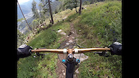
trail: 50 Grad Downhill Feuerkogel
0:33 |
70 |
Aug 10, 2024

trail: 50 Grad Downhill Feuerkogel
82 |
Jun 25, 2025 , Ebensee

trail: 50 Grad Downhill Feuerkogel
20:41 |
698 |
Jun 3, 2021 , Ebensee

trail: 50 Grad Downhill Feuerkogel
1535 |
May 6, 2017 , Ebensee

trail: 50 Grad Downhill Feuerkogel
1033 |
Jun 14, 2016 , Ebensee
Recent Trail Reports
| status | trail | date | condition | info | user |
|---|---|---|---|---|---|
| Fahrnau Trail | Jun 15, 2026 @ 4:35pm (Europe/Vienna) Jun 15, 2026 | Ideal | robsnomad | ||
| 50 Grad Downhill Feuerkogel | Aug 8, 2025 @ 8:14am Aug 8, 2025 | Ideal | crisotop UpperTrails | ||
| Angerl | Oct 14, 2024 @ 9:13am Oct 14, 2024 | Variable | robsnomad | ||
| Windlegern Trail | Sep 25, 2024 @ 10:58am Sep 25, 2024 | Variable | robsnomad | ||
| Feuerkogel Uphill | May 29, 2024 @ 2:08pm May 29, 2024 | Ideal | vielhaber | ||
| Cableway "Feuerkogel-Seilbahn" | May 29, 2024 @ 2:08pm May 29, 2024 | Ideal | vielhaber |
Activity Feed
| username | action | type | title | date |
|---|---|---|---|---|
| robsnomad | add | report | activity #97044590 | Jun 15, 2026 @ 8:52am Jun 15, 2026 |
| SaintSpinny | wishlist | trail | activity #96825635 and 1 more | Jun 12, 2026 @ 1:40pm Jun 12, 2026 |
| robsnomad | add | report | activity #96527416 | Jun 8, 2026 @ 2:36am Jun 8, 2026 |
| robsnomad | add | report | activity #95474578 | May 25, 2026 @ 3:17am May 25, 2026 |
| SteezyCheezy | wishlist | trail | activity #94630705 | May 13, 2026 @ 8:57am May 13, 2026 |
Recent Comments
| username | type | title | comment | date |
|---|---|---|---|---|
| report | thx, weitergeleitet an TVB | Apr 30, 2025 @ 11:47pm Apr 30, 2025 | ||
| trail | Weg ist teilweise weggebrochen. Eher S3 von... | Aug 12, 2024 @ 7:10am Aug 12, 2024 | ||
| trail | Challenging track, you should know what to do... | Apr 17, 2022 @ 8:58am Apr 17, 2022 | ||
| trail | nice trail, parts are really flowy, but a lot... | May 17, 2021 @ 2:01am May 17, 2021 | ||
| trail | Nothing to add. If you want to punish yourself... | Aug 14, 2020 @ 11:35am Aug 14, 2020 |
Local Badges
-

Epic Mountain Bike Climb 2k0 awarded -

Climbing 10k Badge0 awarded -

Mountain Biking 100k Badge0 awarded -

Big Ride 30k1 awarded -

Epic Ride 50k1 awarded
Activity Type Stats
| activitytype | trails | distance | descent | descent distance | total vertical | rating | global rank | state rank | photos | reports | routes | ridelogs |
|---|---|---|---|---|---|---|---|---|---|---|---|---|
| Mountain Bike | 11 | 10 miles | 5,217 ft | 5 miles | 3,737 ft | #3,604 | #33 | 95 | 29 | 375 | ||
| E-Bike | 9 | 7 miles | 1,657 ft | 2 miles | 3,737 ft | #3,001 | #38 | 22 | 82 | |||
| Horse | 1 | 1,795 ft | 246 ft | 1,795 ft | 246 ft | 1 | ||||||
| Hike | 9 | 7 miles | 1,657 ft | 2 miles | 3,737 ft | #5,040 | #55 | 19 | 232 | |||
| Trail Running | 9 | 7 miles | 1,657 ft | 2 miles | 3,737 ft | #4,472 | #52 | 19 | 4 | |||
| Backcountry Ski | 1 | 2 miles | 351 ft | 3,153 ft | 640 ft | 10 |
Frequently Asked Questions About Ebensee
▼
What are the highest rated mountain biking trails in Ebensee?
The highest rated mountain biking trails in Ebensee are:
- 50 Grad Downhill Feuerkogel (4.2/5)
- Fahrnau Trail (4.2/5)
- Angerl (4.1/5)
- Windlegern Trail (3.8/5)
- Windlegern Spice (0/5)
▼
What is the best time of the year to ride in Ebensee?
Based on ride log data, the most popular months to ride in Ebensee are:
- April (10 activities)
- December (8 activities)
- February (6 activities)
▼
Where can I park to ride in Ebensee?
There are 3 parking locations listed in Ebensee. The most popular parking spots are: View all parking and trailhead locations on the map to plan your visit.
▼
What is the longest trail in Ebensee?
The longest trail in Ebensee is 50 Grad Downhill Feuerkogel at 2.9 miles. View all trails sorted by distance.
Activities
Trails
- By lines
 TRAILFORKS & contributors
 - Admins: UpperTrails, ktm-boy-69
- #14518 - 3,820 views
- ebensee activity log | embed map of Ebensee mountain bike trails | ebensee mountain biking points of interest
Downloading of trail gps tracks in kml & gpx formats is enabled for Ebensee.
You must login to download files.