close
-
Layers w
- Weather Layers
- Pro
- Pro
- Pro
- Pro
- Pro
- Pro
- More Layers
- Pro
- Pro
- Pro
- Pro
-
Upgrade to

3D
Trail Conditions
- Unknown
- Snow Groomed
- Snow Packed
- Snow Covered
- Snow Cover Partial
- Freeze/thaw Cycle
- Icy
- Prevalent Mud
- Wet
- Variable
- Ideal
- Dry
- Very Dry
Trail Flow (Ridden Direction)
Trailforks scans users ridelogs to determine the most popular direction each trail is ridden. A good flowing trail network will have most trails flowing in a single direction according to their intension.
The colour categories are based on what percentage of riders are riding a trail in its intended direction.
The colour categories are based on what percentage of riders are riding a trail in its intended direction.
- > 96%
- > 90%
- > 80%
- > 70%
- > 50%
- < 50%
- bi-directional trail
- no data
Trail Last Ridden
Trailforks scans ridelogs to determine the last time a trail was ridden.
- < 2 days
- < 1 week
- < 2 weeks
- < 1 month
- < 6 months
- > 6 months
Trail Ridden Direction
The intended direction a trail should be ridden.
- Downhill Only
- Downhill Primary
- Both Directions
- Uphill Primary
- Uphill Only
- One Direction
Contribute Details
Colors indicate trail is missing specified detail.
- Description
- Photos
- Description & Photos
- Videos
Trail Popularity ?
Trailforks scans ridelogs to determine which trails are ridden the most in the last 9 months.
Trails are compared with nearby trails in the same city region with a possible 25 colour shades.
Think of this as a heatmap, more rides = more kinetic energy = warmer colors.
- most popular
- popular
- less popular
- not popular
ATV/ORV/OHV Filter
Max Vehicle Width
inches
US Cell Coverage
Legend

Radar Time
Activity Recordings
Trailforks uses anonymized public activity data.
?
Activity Recordings
Trailforks uses anonymized public activity data.
?
Personal Heatmap
▶
Activity Types
all
/
none
▶
Options
2
Date range
month
–
Winter Trails
Warning
A routing network for winter maps does not exist. Selecting trails using the winter trails layer has been disabled.
Missing Trails
Most Popular
Least Popular
Trails are colored based on popularity. The more popular a trail is, the more red. Less popular trails trend towards green.
Jump Magnitude Heatmap
Heatmap of where riders jump on trails. Zoom in to see individual jumps, click circles to view jump details.
BC Backroad Status
![map legend]()
Service Road Atlas is a free to use, community-driven service for viewing and creating reports on the numerous back-country service roads around B.C. and Alberta.

Slope Aspect
Direction the slope faces
Trails Deemphasized
Trails are shown in grey.
Only show trails with no bike usage.
Suggested Layers
Based on selected activity type
Save the current map location and zoom level as your default home location whenever this page is loaded.
SaveA network of 30+ miles of fast and flowy trails that are 20 minutes from Chelan and Manson. The trails will appeal to almost all levels of riders but their is little technical riding. Over the last 5 years we have built 10 miles of new singletrack that provide excellent descents/climbs and can be combined into large loops (see routes section). Make sure to ride these trails on your visit: Switchback Alley, Shoe, Divine Intervention, Minor Threat, Dust To Glory, Outback, Mallory's Trail and Bob's Trail. The trails are fast and flowy......
For the best downhill riding you need to start your ride from Echo Valley Area at the end of the pavement between the red parking signs. This is USFS land and open to parking. Please respect the nearby cabins privacy. Start your climb on one of these trails to the top (Switchback Alley, Bergman Gulch , or Waterbar Heaven). Note that Bergman Gulch is closed to mountain bikes until July 1st and is a primary equestrian route that locals rarely ride anymore.
Shuttling is very easy and provides multiple descent options from the Lower Echo Parking Lot, North Junction, and High Five Junction. North Junction at the upper part of Waterbar Heaven and Lower Echo Parking Lot at the top of Minor Threat and Divine Intervention are the easiest and most popular shuttle drop offs
Trails are very well signed and most of the trail intersections have maps posted, and you can scan the QR codes on the maps for a map download. However, just use Trailforks.
Also, there are great trails for the little rippers in the family. See routes section and do the beginner loop.
No Camping or campfires are permitted within the trail system or at Trailheads but there are a wide variety of accommodations nearby.
Typical Conditions:
Spring - The trail system is normally is open for riding in early-mid April with good trail conditions. Trails on the west side of the system melt out first. Great wildflowers into May-June.
Summer - Between the elevation gain on the drive up to the trailheads and the hilltop location, the trails are a bit cooler than down at the lake. To beat the summer heat just ride early in the morning or late evening. Trails on the east side of the system provide some shade but trails on the west side are exposed and there is little tree cover. Trails can get dusty later in the summer.
Fall - Great conditions in the fall after a few rain storms. Trails are usually snow free well into November.
Winter - Specific trails are open to fatbikes in the winter. Contact the Chelan Ranger District for current info at 509-682-4960.
There is NO WATER here, so be sure to bring plenty.
Primary Trail Type: Cross-Country
eBikes Allowed:
No
Shuttleable: YES
Land Status: National Forest
Land Manager: USFS Chelan Ranger District
 google parking directions
 Disclaimer:
E-Bikes (with full electric motor power or pedal assist) are not allowed on Echo Ridge trails or any forest trail designated non-motorized.
Links
Activities Click to view
- Mountain Bike
44 trails
- Hike
44 trails
- Trail Running
43 trails
- Snowshoe
12 trails
- Nordic Ski
29 trails
Region Details
- 2
- 16
- 24
- 2
Region Status
Open as of 5 hoursStats
- Avg Trail Rating
- Trails (view details)
- 44
- Trails Mountain Bike
- 44
- Trails E-Bike
- 2
- Trails Gravel Bike
- 1
- Trails Horse
- 2
- Trails Hike
- 44
- Trails Trail Running
- 43
- Trails Dirtbike/Moto
- 1
- Trails ATV/ORV/OHV
- 2
- Trails Snowmobile
- 3
- Trails Snowshoe
- 12
- Trails Backcountry Ski
- 1
- Trails Nordic Ski
- 29
- Total Distance
- 47 miles
- Total Descent
- 7,723 ft
- Total Vertical
- 1,718 ft
- Highest Trailhead
- 4,330 ft
- Reports
- 1,341
- Photos
- 245
- Ridden Counter
- 8,485
Popular Echo Ridge Mountain Biking Trails
• 100 ★ 4.9 • 5 miles • 529 ft • 508 •
Must ride at Echo Ridge. Trail built in 2018-2020. Rides very well in both directions but preferred direction is "clockwise" to get the most downhill. If ridden "counterclockwise" there are some small but fun features on the first 1.5...
• 100 ★ 4.5 • 2 miles • 193 ft • 448 •
Fun and flowy XC trail. Rides well in both directions.
• 95 ★ 4.2 • 4,426 ft • 30 ft • 443 •
Fun descent north to south but easily ridden in both directions.
• 95 ★ 3.8 • 1,611 ft • 0 ft • 345 •
This is a one of kind trail at Echo Ridge.....Fun swoopy "bike only" ride down a short drainage that is the start to one of the longer continuous downhills. The exit is the cruz for those only comfortable on blue squares. Gets dusty in...
• 100 ★ 3.0 • 1,362 ft • 6 ft • 338 •
Connector from Upper Lot to Lower Lot or the other way around so you can skip the gravel road
• 95 ★ 2.8 • 3,885 ft • 133 ft • 335 •
Popular blue difficulty singletrack. This multi-use trail can be used both directions and has a moderate overall physical rating with a 133 ft blue climb. On average it takes 6 minutes to complete this trail.
• 85 ★ 2.7 • 1,867 ft • 88 ft • 333 •
Popular blue difficulty singletrack. This multi-use trail can be used downhill primary and has a moderate overall physical rating with a 88 ft black diamond climb. Winter use: Classic / Skating snow grooming. On average it takes 3 minutes to complete this trail.
• 90 ★ 4.6 • 4,288 ft • 9 ft • 308 •
Awesome little singletrack finish to the ski hill ... combine with and or from the Lower Echo Parking Lot lot for a flowy and fast 2 mile descent!
Echo Ridge Mountain Bike Routes
★ 4.5 • 19 miles • 2,386 ft • 15 • Loop •
The Echo Super Loop is a combination of the best trails at Echo Ridge. Loop can be ridden in either...
★ 5.0 • 3 miles • 25 ft • 4 • Shuttled •
Another one of the best descents at Echo, and super easy to shuttle if you are so inclined. After a short...
★ 5.0 • 6 miles • 31 ft • 4 • Point to Point •
This is the longest descent at Echo Ridge @ 5+ miles. It's a combo of new school flow and old school...
★ 5.0 • 2 miles • 5 • Shuttled •
Great descent that starts with our only Black Diamond trail, , then uses north half Trail and . Popular...
14 miles • 2,060 ft • 4 •
Echo Ridge 14.2 mile loop ride starting and ending at the parking area.
13 miles • 1,517 ft • 12 • Loop •
In the area and need a quick lap? Or just off work and need to spin? Check out this quick loop to get some...
Photos of Echo Ridge Mountain Bike
Videos of Echo Ridge Mountain Bike
trail: Switchback Alley
3:15 |
19 |
May 27, 2026
trail: Outback
2:21 |
54 |
Nov 12, 2025
trail: Mallory's Trail
2:36 |
28 |
Nov 11, 2025
trail: Bob's Trail
18:07 |
738 |
Jun 6, 2019
trail: Far East
7:13 |
258 |
Jun 5, 2019
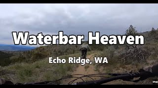
trail: Waterbar Heaven
6:50 |
686 |
May 31, 2022 , Chelan

2:06 |
494 |
May 24, 2019

749 |
Oct 28, 2016
Current Trail Warnings
| status | trail | date | condition | user | info |
|---|---|---|---|---|---|
| Bergman Gulch | Jun 25, 2026 @ 5:41pm (America/Los_Angeles) 5 hours | Ideal | kb7rsk | Trail closed until July for mtb due to... |
Recent Trail Reports
Activity Feed
| username | action | type | title | date |
|---|---|---|---|---|
| kb7rsk | add | report | activity #97805023 and 5 more | Jun 25, 2026 @ 5:40pm 5 hours |
| jlejle | wishlist | route | activity #97249882 | Jun 18, 2026 @ 7:13am Jun 18, 2026 |
| Codycarter | difficultyvote | trail | activity #96968390 | Jun 14, 2026 @ 7:51am Jun 14, 2026 |
| Codycarter | vote | trail | activity #96773344 | Jun 11, 2026 @ 5:48pm Jun 11, 2026 |
| Waynebird | ridden | trail | activity #96694325 | Jun 10, 2026 @ 1:48pm Jun 10, 2026 |
Recent Comments
| username | type | title | comment | date |
|---|---|---|---|---|
| trail | Sand and gravel single-track on old road. Nice... | Oct 19, 2025 @ 7:51pm Oct 19, 2025 | ||
| trail | Sandy trail on old road. | Oct 19, 2025 @ 1:58pm Oct 19, 2025 | ||
| trail | Smooth, sandy single-track on old road. This... | Oct 19, 2025 @ 1:57pm Oct 19, 2025 | ||
| trail | Great, flowy single-track. | Oct 19, 2025 @ 1:56pm Oct 19, 2025 | ||
| trail | Fun and fast to descend. Like most trails in... | May 24, 2025 @ 6:18pm May 24, 2025 |
Nearby Areas
| name | distance | ||||
|---|---|---|---|---|---|
| Alta Lake State Park | 1 | 7.8 km | |||
| Lake Chelan State Park | 8.1 km | ||||
| Angels Staircase / Uno Peak | 3 | 18 | 13 | 1 | 21.9 km |
| Mad River - Entiat | 5 | 47 | 18 | 22.4 km | |
| Lookout Mountain | 1 | 1 | 26.6 km |
Local Badges
-

Completionist0 awarded
Local Products
Activity Type Stats
| activitytype | trails | distance | descent | descent distance | total vertical | rating | global rank | state rank | photos | reports | routes | ridelogs |
|---|---|---|---|---|---|---|---|---|---|---|---|---|
| Mountain Bike | 44 | 47 miles | 7,723 ft | 22 miles | 1,719 ft | #3,306 | #1,159 | 246 | 1,339 | 10 | 2,324 | |
| E-Bike | 2 | 4 miles | 23 ft | 705 ft | 827 ft | 925 | 149 | |||||
| Gravel Bike | 1 | 3 miles | 650 ft | 2 miles | 522 ft | #1,198 | #640 | 150 | 2 | |||
| Horse | 2 | 4 miles | 23 ft | 705 ft | 827 ft | 518 | ||||||
| Hike | 44 | 47 miles | 7,723 ft | 22 miles | 1,719 ft | #4,760 | #1,711 | 1,300 | 4 | 111 | ||
| Trail Running | 43 | 47 miles | 7,589 ft | 22 miles | 1,719 ft | #3,841 | #1,071 | 1,300 | 4 | 91 | ||
| Dirtbike/Moto | 1 | 1 mile | 23 ft | 653 ft | 456 ft | 507 | 7 | |||||
| ATV/ORV/OHV | 2 | 4 miles | 23 ft | 705 ft | 827 ft | 508 | ||||||
| Snowmobile | 3 | 5 miles | 325 ft | 1 mile | 906 ft | 5 | ||||||
| Snowshoe | 12 | 17 miles | 2,782 ft | 8 miles | 1,368 ft | #629 | #263 | 166 | 13 | |||
| Backcountry Ski | 1 | 2 miles | 52 ft | 797 ft | 35 | |||||||
| Nordic Ski | 29 | 31 miles | 4,272 ft | 13 miles | 1,368 ft | #468 | #136 | 1 | 207 | 222 |
Frequently Asked Questions About Echo Ridge
▼
What are the highest rated mountain biking trails in Echo Ridge?
The highest rated mountain biking trails in Echo Ridge are:
- Bob's Trail (4.6/5)
- Switchback Alley (4.3/5)
- Dust to Glory (4.3/5)
- Mallory's Trail (4.2/5)
- Waterbar Heaven (4.2/5)
▼
What is the best time of the year to ride in Echo Ridge?
Based on ride log data, the most popular months to ride in Echo Ridge are:
- July (121 activities)
- June (104 activities)
- May (86 activities)
▼
Where can I park to ride in Echo Ridge?
There are 6 parking locations listed in Echo Ridge. The most popular parking spots are:
- Parking OK at bottom of Waterbar Trail, not at cabin rental office or Echo Valley Ski Area
- North Junction Trailhead
- Lower Echo Trailhead
- Switchback Alley TH
- Shoe Trailhead
▼
What is the longest trail in Echo Ridge?
The longest trail in Echo Ridge is Bob's Trail at 5.0 miles. View all trails sorted by distance.
Activities
Trails
- By boxxerace
 TRAILFORKS EMBA-BOD & contributors
 - Admins: LCTA, EMBA-CC, CDLT, EMBA-CC
- #16257 - 19,812 views
- echo ridge activity log | embed map of Echo Ridge mountain bike trails | echo ridge mountain biking points of interest
Downloading of trail gps tracks in kml & gpx formats is enabled for Echo Ridge.
You must login to download files.