close
-
Layers w
- Weather Layers
- Pro
- Pro
- Pro
- Pro
- Pro
- Pro
- More Layers
- Pro
- Pro
- Pro
- Pro
-
Upgrade to

3D
Trail Conditions
- Unknown
- Snow Groomed
- Snow Packed
- Snow Covered
- Snow Cover Partial
- Freeze/thaw Cycle
- Icy
- Prevalent Mud
- Wet
- Variable
- Ideal
- Dry
- Very Dry
Trail Flow (Ridden Direction)
Trailforks scans users ridelogs to determine the most popular direction each trail is ridden. A good flowing trail network will have most trails flowing in a single direction according to their intension.
The colour categories are based on what percentage of riders are riding a trail in its intended direction.
The colour categories are based on what percentage of riders are riding a trail in its intended direction.
- > 96%
- > 90%
- > 80%
- > 70%
- > 50%
- < 50%
- bi-directional trail
- no data
Trail Last Ridden
Trailforks scans ridelogs to determine the last time a trail was ridden.
- < 2 days
- < 1 week
- < 2 weeks
- < 1 month
- < 6 months
- > 6 months
Trail Ridden Direction
The intended direction a trail should be ridden.
- Downhill Only
- Downhill Primary
- Both Directions
- Uphill Primary
- Uphill Only
- One Direction
Contribute Details
Colors indicate trail is missing specified detail.
- Description
- Photos
- Description & Photos
- Videos
Trail Popularity ?
Trailforks scans ridelogs to determine which trails are ridden the most in the last 9 months.
Trails are compared with nearby trails in the same city region with a possible 25 colour shades.
Think of this as a heatmap, more rides = more kinetic energy = warmer colors.
- most popular
- popular
- less popular
- not popular
ATV/ORV/OHV Filter
Max Vehicle Width
inches
US Cell Coverage
Legend

Radar Time
Activity Recordings
Trailforks uses anonymized public activity data.
?
Activity Recordings
Trailforks uses anonymized public activity data.
?
Personal Heatmap
▶
Activity Types
all
/
none
▶
Options
2
Date range
month
–
Winter Trails
Warning
A routing network for winter maps does not exist. Selecting trails using the winter trails layer has been disabled.
Missing Trails
Most Popular
Least Popular
Trails are colored based on popularity. The more popular a trail is, the more red. Less popular trails trend towards green.
Jump Magnitude Heatmap
Heatmap of where riders jump on trails. Zoom in to see individual jumps, click circles to view jump details.
BC Backroad Status
![map legend]()
Service Road Atlas is a free to use, community-driven service for viewing and creating reports on the numerous back-country service roads around B.C. and Alberta.

Slope Aspect
Direction the slope faces
Trails Deemphasized
Trails are shown in grey.
Only show trails with no bike usage.
Suggested Layers
Based on selected activity type
Save the current map location and zoom level as your default home location whenever this page is loaded.
Save
No description for Eden has been added yet!
Login or register to submit one.
Activities Click to view
- Mountain Bike
6 trails
- E-Bike
6 trails
- Gravel Bike
0 trails
- Adaptive Bike
0 trails
- Hike
6 trails
- Trail Running
6 trails
Region Details
- 1
- 3
- 1
- 1
Region Status
Open as of Jun 20, 2026Stats
- Avg Trail Rating
- Trails (view details)
- 12
- Trails Mountain Bike
- 6
- Trails E-Bike
- 6
- Trails Hike
- 6
- Trails Trail Running
- 6
- Total Distance
- 26 miles
- Total Descent Distance
- 12 miles
- Total Descent
- 3,620 ft
- Total Vertical
- 1,081 ft
- Highest Trailhead
- 1,085 ft
- Reports
- 981
- Photos
- 340
- Ridden Counter
- 9,616
Sub Regions
-
Gravity Eden Mountain Bike Park
- 3
- 1
- 1
Popular Eden Mountain Biking Trails
• 100 ★ 2.5 • 2 miles • 221 ft • 598 •
Beginner loop trail is a mix of mostly singletrack with some short fire road sections. Provides continuation of climb to Flow Zone or extended beginner loop from the trailhead.
• 95 ★ 4.4 • 2 miles • 419 ft • 505 •
XC / Climb Blue Shortcut climb from Adventure Zone to the upper trails of the Flow Zone. Starts out mellow and increases gradient towards the top.
• 100 ★ 4.0 • 1,401 ft • 23 ft • 503 •
Relatively flat beginner trail that is the start point to the wider network and an ideal beginner loop to build your riding skills. May be suitable for adaptive riding.
• 80 ★ 4.3 • 2 miles • 124 ft • 433 •
Flow / Jump Blue Fast and furious at the top with big berms and medium size jumps down to a bridge crossing before mellowing out into an undulating and flowing traverse back to ‘ ’ and back to the trailhead.
• 90 ★ 4.5 • 3 miles • 173 ft • 411 •
Flow Blue Fast traversing descent with open flowing berms and optional jump lines. Connects to the lower portion of ‘ ’ and onto the trailhead.
• 70 ★ 4.7 • 5 miles • 456 ft • 319 •
Adventure Blue The longest trail in the network. Begins with a flowing and undulating decent, into numerous natural rock features and steep berms into a bridge crossing. From here is a short climb out of the valley before descending and...
Eden Mountain Bike Routes
★ 4.0 • 13 miles • 1,955 ft • 5 •
Get ready for an adventure. Head the long way all the way from the carpark to the top of the hill. Stop to...
5 miles • 757 ft • 4 •
This loop is a local favourite - great for an pre or post work ride if you only have an hour to spare. A...
★ 2.0 • 8 miles • 1,240 ft • 5 •
This 'earn your turns' lap takes you through the hidden corner of Gravity Eden for a lap of , a short but...
10 miles • 1,482 ft • 6 •
Twice the fun! Local rider Panda knows how to optimise the descents! Make your way up Power Up for a run...
7 miles • 870 ft • 4 •
11km of flowy goodness. This route includes a combination of climbs and descents to make sure you get a...
11 miles • 1,742 ft • 6 • Out & Back •
A great route for an E-Bike or an enthusiastic cross country/all mountain adventure. Starting and...
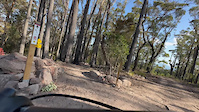
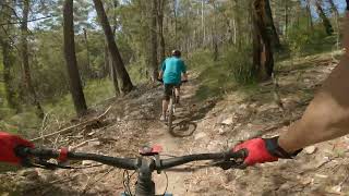
Photos of Eden Mountain Bike
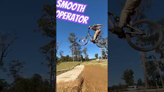
Videos of Eden Mountain Bike
trail: Straight Six
3:22 |
406 |
Oct 10, 2023
trail: Rodgie Bull
3:08 |
136 |
Oct 9, 2023
trail: Fore
2:30 |
86 |
Oct 9, 2023
trail: Straight Six
3:27 |
214 |
Oct 8, 2023
trail: Breath of Fire
6:16 |
194 |
Oct 8, 2023

youtuber
![Sui’s at Gravity Eden skills park with Ben...]()
trail: Jumps Park
0:07 |
85 |
Jul 11, 2025 , Eden
trail: Breath of Fire
15:43 |
198 |
Aug 4, 2024 , Eden
Recent Trail Reports
| status | trail | date | condition | info | user |
|---|---|---|---|---|---|
| Round the Outside | Jun 20, 2026 @ 9:18pm (Australia/Sydney) Jun 20, 2026 | Unknown | AndrewCvFa9t | ||
| Sodium | Apr 8, 2026 @ 11:13am (Australia/Sydney) Apr 7, 2026 | Ideal | jacqhedditch EMTBC | ||
| Old Tom | Apr 3, 2026 @ 1:39pm (Australia/Sydney) Apr 2, 2026 | Variable | jacqhedditch EMTBC | ||
| Snake Run | Apr 2, 2026 @ 6:12pm (Australia/Sydney) Apr 2, 2026 | Ideal | jacqhedditch EMTBC | ||
| Powerup | Mar 31, 2026 @ 4:37pm (Australia/Sydney) Mar 30, 2026 | Unknown | jacqhedditch EMTBC | ||
| Jump Stumper | Mar 29, 2026 @ 12:56pm (Australia/Sydney) Mar 28, 2026 | Unknown | Scotty13579 | ||
| Straight Six | Mar 28, 2026 @ 1:26pm (Australia/Sydney) Mar 27, 2026 | Unknown | JesseQzQiy | ||
| Fore | Feb 28, 2026 @ 1:33pm (Australia/Sydney) Feb 27, 2026 | Ideal | jacqhedditch EMTBC | ||
| Tumbles | Feb 14, 2026 @ 1:38pm (Australia/Sydney) Feb 13, 2026 | Very Dry | janinebradley EMTBC | ||
| Breath of Fire | Feb 14, 2026 @ 1:33pm (Australia/Sydney) Feb 13, 2026 | Unknown | deano2549 |
Activity Feed
| username | action | type | title | date |
|---|---|---|---|---|
| lochiec25 | ridden | trail | activity #97678419 | Jun 23, 2026 @ 11:40pm 19 hours |
| lochiec25 | ridden | trail | activity #97601001 and 1 more | Jun 22, 2026 @ 7:55pm 2 days |
| AndrewCvFa9t | add | report | activity #97380408 | Jun 20, 2026 @ 4:18am Jun 20, 2026 |
| REJB | wishlist | trail | activity #97176045 | Jun 17, 2026 @ 5:29am Jun 17, 2026 |
| REJB | ridden | region | activity #96850363 | Jun 12, 2026 @ 11:23pm Jun 12, 2026 |
Recent Comments
| username | type | title | comment | date |
|---|---|---|---|---|
| report | Thank you! | Jan 29, 2026 @ 11:00pm Jan 29, 2026 | ||
| report | 250m uphill from EP88 if that helps | Jan 29, 2026 @ 10:39pm Jan 29, 2026 | ||
| report | Ther other tree at the inspection has also... | Dec 26, 2025 @ 12:30am Dec 26, 2025 | ||
| report | Tree has been removed | Dec 26, 2025 @ 12:09am Dec 26, 2025 | ||
| report | Hmm. No GPS location? I will have to have a... | Dec 7, 2025 @ 10:10pm Dec 7, 2025 |
Local Badges
-

Epic Ride Descent 2k3 awarded -

Descent 10k Badge1 awarded -

Descent 100k Badge0 awarded
Activity Type Stats
| activitytype | trails | distance | descent | descent distance | total vertical | rating | global rank | state rank | photos | reports | routes | ridelogs |
|---|---|---|---|---|---|---|---|---|---|---|---|---|
| Mountain Bike | 6 | 7 miles | 1,447 ft | 4 miles | 896 ft | #3,913 | #158 | 286 | 981 | 19 | 3,318 | |
| E-Bike | 6 | 7 miles | 1,447 ft | 4 miles | 896 ft | #2,341 | #116 | 23 | 978 | 9 | 1,207 | |
| Hike | 6 | 18 miles | 2,172 ft | 8 miles | 217 ft | #7,732 | #239 | 3 | 171 | 1 | 74 | |
| Trail Running | 6 | 18 miles | 2,172 ft | 8 miles | 217 ft | #7,718 | #243 | 168 | 1 | 15 |
Frequently Asked Questions About Eden
▼
What are the best places to ride in Eden?
Eden has 1 areas to explore for mountain biking. The top rated areas are:
▼
What are the highest rated mountain biking trails in Eden?
The highest rated mountain biking trails in Eden are:
- Breath of Fire (4.4/5)
- Round the Outside (4.3/5)
- Jump Stumper (4.3/5)
- Garden of Eden (4.2/5)
- Straight Six (4.2/5)
▼
Where can I park to ride in Eden?
There are 3 parking locations listed in Eden. The most popular parking spots are: View all parking and trailhead locations on the map to plan your visit.
▼
What is the longest trail in Eden?
The longest trail in Eden is Round the Outside at 8.4 km. View all trails sorted by distance.
Activities
- By WillieJacobsz
 Trailforks SBP SWW & contributors
 - Admins: stuartrichardson
- #60670 - 4,973 views
- eden activity log | embed map of Eden mountain bike trails | eden mountain biking points of interest polygons
Downloading of trail gps tracks in kml & gpx formats is enabled for Eden.
You must login to download files.