close
-
Layers w
- Weather Layers
- Pro
- Pro
- Pro
- Pro
- Pro
- Pro
- More Layers
- Pro
- Pro
- Pro
- Pro
-
Upgrade to

3D
Trail Conditions
- Unknown
- Snow Groomed
- Snow Packed
- Snow Covered
- Snow Cover Partial
- Freeze/thaw Cycle
- Icy
- Prevalent Mud
- Wet
- Variable
- Ideal
- Dry
- Very Dry
Trail Flow (Ridden Direction)
Trailforks scans users ridelogs to determine the most popular direction each trail is ridden. A good flowing trail network will have most trails flowing in a single direction according to their intension.
The colour categories are based on what percentage of riders are riding a trail in its intended direction.
The colour categories are based on what percentage of riders are riding a trail in its intended direction.
- > 96%
- > 90%
- > 80%
- > 70%
- > 50%
- < 50%
- bi-directional trail
- no data
Trail Last Ridden
Trailforks scans ridelogs to determine the last time a trail was ridden.
- < 2 days
- < 1 week
- < 2 weeks
- < 1 month
- < 6 months
- > 6 months
Trail Ridden Direction
The intended direction a trail should be ridden.
- Downhill Only
- Downhill Primary
- Both Directions
- Uphill Primary
- Uphill Only
- One Direction
Contribute Details
Colors indicate trail is missing specified detail.
- Description
- Photos
- Description & Photos
- Videos
Trail Popularity ?
Trailforks scans ridelogs to determine which trails are ridden the most in the last 9 months.
Trails are compared with nearby trails in the same city region with a possible 25 colour shades.
Think of this as a heatmap, more rides = more kinetic energy = warmer colors.
- most popular
- popular
- less popular
- not popular
ATV/ORV/OHV Filter
Max Vehicle Width
inches
US Cell Coverage
Legend

Radar Time
Activity Recordings
Trailforks uses anonymized public activity data.
?
Activity Recordings
Trailforks uses anonymized public activity data.
?
Personal Heatmap
▶
Activity Types
all
/
none
▶
Options
2
Date range
month
–
Winter Trails
Warning
A routing network for winter maps does not exist. Selecting trails using the winter trails layer has been disabled.
Missing Trails
Most Popular
Least Popular
Trails are colored based on popularity. The more popular a trail is, the more red. Less popular trails trend towards green.
Jump Magnitude Heatmap
Heatmap of where riders jump on trails. Zoom in to see individual jumps, click circles to view jump details.
BC Backroad Status
![map legend]()
Service Road Atlas is a free to use, community-driven service for viewing and creating reports on the numerous back-country service roads around B.C. and Alberta.

Slope Aspect
Direction the slope faces
Trails Deemphasized
Trails are shown in grey.
Only show trails with no bike usage.
Suggested Layers
Based on selected activity type
Save the current map location and zoom level as your default home location whenever this page is loaded.
Save
No description for Edinburgh has been added yet!
Login or register to submit one.
This region uses the Uk/Euro style trail grading system.
Activities Click to view
- Mountain Bike
152 trails
- E-Bike
53 trails
- Gravel Bike
0 trails
- Adaptive Bike
0 trails
- Winter Fat Bike
0 trails
- Horse
4 trails
- Hike
170 trails
- Trail Running
170 trails
Region Details
- 29
- 48
- 57
- 15
- 3
Region Status
Caution as of May 30, 2026Local Trail Association
Stats
- Avg Trail Rating
- Trails (view details)
- 160
- Trails Mountain Bike
- 152
- Trails E-Bike
- 53
- Trails Horse
- 4
- Trails Hike
- 170
- Trails Trail Running
- 170
- Total Distance
- 111 miles
- Total Descent
- 19,939 ft
- Total Vertical
- 1,811 ft
- Highest Trailhead
- 1,837 ft
- Reports
- 898
- Photos
- 1,183
- Ridden Counter
- 33,017
Sub Regions
-
Corstorphine Hill
- 17
- 5
- 1
-
Craiglockhart Park
- 3
-
Hermitage of Braid and Blackford Hill
- 8
-
Pentland Hills
- 15
- 30
- 13
- 3
-
The SKELF Bike Park
- 3
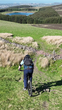
Popular Edinburgh Mountain Biking Trails
• 100 ★ 3.9 • 5,026 ft • 0 ft • 729 •
A fast and fun downhill section that is mostly gravel and rocky with some loose stones. Beginning and end sections are likely to be muddy in winter.
• 95 ★ 3.0 • 4,047 ft • 211 ft • 694 •
Gravel path with some drainage ditches/step-ups becoming steeper towards the top. Also popular with walkers at weekends.
• 100 ★ 3.8 • 3,248 ft • 67 ft • 665 •
Gate to Gate - a smooth and fast run through the valley, leading to the climb or onto the final run in this section down to the head of Loganlea.
• 100 ★ 3.4 • 1,450 ft • 17 ft • 639 •
Gate to Gate, through the valley towards .
• 90 ★ 2.8 • 1,516 ft • 160 ft • 592 •
Road with Singletrack on both sides. Fairly tech climb with lots of roots or a fast descent.
• 90 ★ 3.2 • 2,869 ft • 73 ft • 518 •
Two sections of rooty singletrack, joined with a short section of road.
• 80 ★ 3.0 • 1,695 ft • 3 ft • 498 •
Rooty singletrack in the trees alongside Harlaw. Not worth hunting out specifically - but miles better than the gravel path, if you are heading towards Bavelaw....
Edinburgh Mountain Bike Routes
★ 4.5 • 23 miles • 2,385 ft • 12 • Out & Back •
Moderate loop - leaving from Edinburgh and taking in The Craiglockhart Park trails, joining the Water of...
★ 5.0 • 155 miles • 14,741 ft • 30 • Loop •
Capital Trail takes you through some very remote and beautiful places around the Scottish Capital.
★ 1.0 • 22 miles • 2,070 ft • 9 • Out & Back •
Moderate loop - leaving from Edinburgh and taking in The Craiglockhart Park trails, joining the Water of...
★ 3.3 • 15 miles • 2,748 ft • 7 • Loop •
A loop from the Harlaw car park over the 5 peaks trail which gets you some stunning views and fun descents
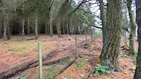
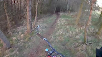
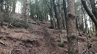
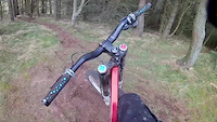
Photos of Edinburgh Mountain Bike
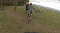
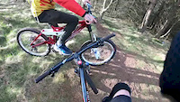
Videos of Edinburgh Mountain Bike
trail: Harbour Hill Bypass
0:00 |
32 |
Oct 5, 2023
trail: Bonaly
0:10 |
455 |
Jan 12, 2021
trail: Bonaly
0:53 |
595 |
May 4, 2019

trail: Hillend trails
0:18 |
105 |
Mar 30, 2019
trail: Hillend trails
0:52 |
59 |
Mar 30, 2019
trail: Hillend trails
0:51 |
36 |
Mar 27, 2019
trail: Hillend trails
0:30 |
56 |
Mar 27, 2019
trail: Hillend trails
0:48 |
26 |
Mar 27, 2019
Recent Trail Reports
| status | trail | date | condition | info | user |
|---|---|---|---|---|---|
| Water of Leith Walkway | May 31, 2026 @ 7:36am (Europe/London) May 30, 2026 | Unknown | Ikec111 | ||
| Water of Leith Walkway | May 31, 2026 @ 7:36am (Europe/London) May 30, 2026 | Ideal | Ikec111 | ||
| Clubbiebean | Feb 12, 2026 @ 1:42pm (Europe/London) Feb 12, 2026 | Prevalent Mud | Bizbauer | ||
| Harlaw Rd - Torduff | Feb 12, 2026 @ 1:42pm (Europe/London) Feb 12, 2026 | Wet | Bizbauer | ||
| Ranges Road (North) | Feb 12, 2026 @ 1:42pm (Europe/London) Feb 12, 2026 | Wet | Bizbauer | ||
| Kirkgate Singletrack | Feb 12, 2026 @ 1:42pm (Europe/London) Feb 12, 2026 | Prevalent Mud | Bizbauer | ||
| Access Road | Feb 12, 2026 @ 1:42pm (Europe/London) Feb 12, 2026 | Wet | Bizbauer | ||
| Threipmuir Path | Feb 12, 2026 @ 1:42pm (Europe/London) Feb 12, 2026 | Wet | Bizbauer | ||
| Access Road | Feb 12, 2026 @ 1:42pm (Europe/London) Feb 12, 2026 | Wet | Bizbauer | ||
| Exponential | Feb 12, 2026 @ 1:42pm (Europe/London) Feb 12, 2026 | Wet | Bizbauer |
Activity Feed
| username | action | type | title | date |
|---|---|---|---|---|
| trailforks | add | video | activity #97577050 | Jun 22, 2026 @ 12:00pm 3 days |
| Bally12 | wishlist | route | activity #97297256 | Jun 18, 2026 @ 10:10pm Jun 18, 2026 |
| Bally12 | wishlist | route | activity #97297196 and 1 more | Jun 18, 2026 @ 10:08pm Jun 18, 2026 |
| markswinhoe | ridden | trail | activity #96171495 | Jun 3, 2026 @ 11:51am Jun 3, 2026 |
| Ikec111 | add | report | activity #95918308 and 1 more | May 31, 2026 @ 2:33am May 31, 2026 |
Recent Comments
| username | type | title | comment | date |
|---|---|---|---|---|
| trail | Quite a few stiles that you have to lift the... | Mar 18, 2025 @ 5:34am Mar 18, 2025 | ||
| trail | In the video 'Pentland Hills Mayhem' The... | May 23, 2024 @ 3:56pm May 23, 2024 | ||
| trail | In The Classic Pentlands MTB video The Howe... | May 23, 2024 @ 3:52pm May 23, 2024 | ||
| trail | In the video Threipmuir Loop The Howe starts... | May 23, 2024 @ 3:50pm May 23, 2024 | ||
| trail | In the video 'Pentland Hills Mayhem' The Howe... | May 23, 2024 @ 3:48pm May 23, 2024 |
Local Badges
-

Epic Ride Climb 2k91 awarded -

Climbing 10k Badge243 awarded -

Climbing 100k Badge16 awarded -

Epic Ride Descent 2k92 awarded -

Descent 10k Badge238 awarded -

Descent 100k Badge16 awarded
Bike & Skill Parks
| name | type | city | rating |
|---|---|---|---|
| The SKELF Bike Park | skill park | Edinburgh | |
| Musselburgh BMX Track | skill park | Edinburgh | |
| Hunters Hall Pump Track | skill park | Edinburgh |
Activity Type Stats
| activitytype | trails | distance | descent | descent distance | total vertical | rating | global rank | state rank | photos | reports | routes | ridelogs |
|---|---|---|---|---|---|---|---|---|---|---|---|---|
| Mountain Bike | 152 | 107 miles | 18,783 ft | 50 miles | 1,811 ft | #569 | #23 | 1,183 | 896 | 11 | 85,428 | |
| E-Bike | 53 | 23 miles | 3,507 ft | 12 miles | 1,542 ft | #2,176 | #78 | 762 | 2 | 3,911 | ||
| Horse | 4 | 3 miles | 30 ft | 3,530 ft | 256 ft | #822 | #35 | 300 | ||||
| Hike | 170 | 110 miles | 19,551 ft | 50 miles | 1,811 ft | #999 | 896 | 3 | 3,348 | |||
| Trail Running | 170 | 110 miles | 19,551 ft | 50 miles | 1,811 ft | #653 | #22 | 896 | 4 | 10,594 |
Frequently Asked Questions About Edinburgh
▼
What are the best places to ride in Edinburgh?
Edinburgh has 7 areas to explore for mountain biking. The top rated areas are:
▼
What are the highest rated mountain biking trails in Edinburgh?
The highest rated mountain biking trails in Edinburgh are:
- Lang Linn Path (4.2/5)
- Johnny Davidson (4.2/5)
- Chocolate Fart (4.2/5)
- Bonaly (4.2/5)
- Scalextric (4.2/5)
▼
What is the best time of the year to ride in Edinburgh?
Based on ride log data, the most popular months to ride in Edinburgh are:
- July (239 activities)
- June (219 activities)
- May (175 activities)
▼
Where can I park to ride in Edinburgh?
There are 4 parking locations listed in Edinburgh. The most popular parking spots are: View all parking and trailhead locations on the map to plan your visit.
Activities
Trails
Points of Interest
- By swayze08 & contributors
- Admins: DMBinS, FLS
- #4042 - 14,095 views
- edinburgh activity log | embed map of Edinburgh mountain bike trails | edinburgh mountain biking points of interest polygons
Downloading of trail gps tracks in kml & gpx formats is enabled for Edinburgh.
You must login to download files.