close
-
Layers w
- Weather Layers
- Pro
- Pro
- Pro
- Pro
- Pro
- Pro
- More Layers
- Pro
- Pro
- Pro
- Pro
-
Upgrade to

3D
Trail Conditions
- Unknown
- Snow Groomed
- Snow Packed
- Snow Covered
- Snow Cover Partial
- Freeze/thaw Cycle
- Icy
- Prevalent Mud
- Wet
- Variable
- Ideal
- Dry
- Very Dry
Trail Flow (Ridden Direction)
Trailforks scans users ridelogs to determine the most popular direction each trail is ridden. A good flowing trail network will have most trails flowing in a single direction according to their intension.
The colour categories are based on what percentage of riders are riding a trail in its intended direction.
The colour categories are based on what percentage of riders are riding a trail in its intended direction.
- > 96%
- > 90%
- > 80%
- > 70%
- > 50%
- < 50%
- bi-directional trail
- no data
Trail Last Ridden
Trailforks scans ridelogs to determine the last time a trail was ridden.
- < 2 days
- < 1 week
- < 2 weeks
- < 1 month
- < 6 months
- > 6 months
Trail Ridden Direction
The intended direction a trail should be ridden.
- Downhill Only
- Downhill Primary
- Both Directions
- Uphill Primary
- Uphill Only
- One Direction
Contribute Details
Colors indicate trail is missing specified detail.
- Description
- Photos
- Description & Photos
- Videos
Trail Popularity ?
Trailforks scans ridelogs to determine which trails are ridden the most in the last 9 months.
Trails are compared with nearby trails in the same city region with a possible 25 colour shades.
Think of this as a heatmap, more rides = more kinetic energy = warmer colors.
- most popular
- popular
- less popular
- not popular
ATV/ORV/OHV Filter
Max Vehicle Width
inches
US Cell Coverage
Legend

Radar Time
Activity Recordings
Trailforks uses anonymized public activity data.
?
Activity Recordings
Trailforks uses anonymized public activity data.
?
Personal Heatmap
▶
Activity Types
all
/
none
▶
Options
2
Date range
month
–
Winter Trails
Warning
A routing network for winter maps does not exist. Selecting trails using the winter trails layer has been disabled.
Missing Trails
Most Popular
Least Popular
Trails are colored based on popularity. The more popular a trail is, the more red. Less popular trails trend towards green.
Jump Magnitude Heatmap
Heatmap of where riders jump on trails. Zoom in to see individual jumps, click circles to view jump details.
BC Backroad Status
![map legend]()
Service Road Atlas is a free to use, community-driven service for viewing and creating reports on the numerous back-country service roads around B.C. and Alberta.

Slope Aspect
Direction the slope faces
Trails Deemphasized
Trails are shown in grey.
Only show trails with no bike usage.
Suggested Layers
Based on selected activity type
Save the current map location and zoom level as your default home location whenever this page is loaded.
Save
No description for Edolo has been added yet!
Login or register to submit one.
This region uses the Uk/Euro style trail grading system.
Activities Click to view
- Mountain Bike
33 trails
- E-Bike
19 trails
- Horse
7 trails
- Hike
31 trails
- Trail Running
33 trails
- Dirtbike/Moto
2 trails
Region Details
- 4
- 4
- 3
- 14
Region Status
Open as of May 30, 2026Stats
- Trails (view details)
- 28
- Trails Mountain Bike
- 33
- Trails E-Bike
- 19
- Trails Horse
- 7
- Trails Hike
- 31
- Trails Trail Running
- 33
- Trails Dirtbike/Moto
- 2
- Total Distance
- 30 miles
- Total Descent Distance
- 15 miles
- Total Descent
- 12,121 ft
- Total Vertical
- 5,641 ft
- Highest Trailhead
- 7,467 ft
- Reports
- 34
- Photos
- 13
- Ridden Counter
- 205
Popular Edolo Mountain Biking Trails
• 90 ★ 0.0 • 3,219 ft • 0 ft • 27 •
In un tornante del sentiero militare che collega il Piz Tri al campello di Landó si stacca un sentiero che attraversa la conca che si trova alla base della pala del Piz Tri caratterizzata dalla presenza di alcuni laghetti. Numerosi i...
• 95 ★ 0.0 • 1 mile • 0 ft • 27 •
Al bivio tra i sentieri 144,7 (sx) e 95 (dx) teniamo la destra. Il sentiero attraversa delle conche, dove è necessario rilanciare sui pedali l'andatura, e dei tratti più ripidi che le colleganono. Numerosi cespugli di rododendro...
• 100 ★ 0.0 • 1 mile • 4 ft • 24 •
Sentiero militare della Grande Guerra (la vetta era una postazione della seconda linea di difesa), pendenza regolare con vari tornanti. Da utilizzare sia per guadagnarsi la vetta in salita, salendo dal Campello di Landó, sia per...
• 85 ★ 0.0 • 3,750 ft • 0 ft • 22 •
Sentiero facile che collega la conca dei fienili di Vent e seguendo lo spartiacque porta a malga Brunó (punto panoramico). Attenzione nel primo tratto della discesa ci sono delle indicazioni per fare una breve pausa e visitare una...
• 90 ★ 0.0 • 1 mile • 0 ft • 14 •
Popular green difficulty mixed. This mountain bike primary trail can be used both directions. On average it takes 9 minutes to complete this trail.
• 75 ★ 0.0 • 2 miles • 0 ft • 12 •
Popular blue difficulty singletrack. This mountain bike primary trail can be used both directions. On average it takes 12 minutes to complete this trail.
• 55 ★ 0.0 • 3,543 ft • 5 ft • 7 •
Appena sotto la casa più alta delle Muse si attraversa a sinistra il canale. Il sentiero attraversa un bosco di abeti a monte dei prati che in inverno si percorrono con gli sci. Si scende fino ad incrociare una mulattiera, si mantiene...
• 55 ★ 0.0 • 912 ft • 0 ft • 5 •
Sentiero facile che permette di andare direttamente verso le Muse senza dover andare a malga Brunó. Arrivati sulla strada forestale che arriva da malga Brunó e Vent potete andare alle Muse passando dal sentiero del Canale Muse (alla...
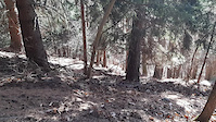
Photos of Edolo Mountain Bike
Videos of Edolo Mountain Bike
0:09 |
18 |
Jan 15, 2025
Recent Trail Reports
| status | trail | date | condition | info | user |
|---|---|---|---|---|---|
| Malga Stain DH | Nov 21, 2025 @ 5:09pm (Europe/Rome) Nov 21, 2025 | Dry | AlbiBenni97 | ||
| UPHILL Malga Stain | Nov 21, 2025 @ 5:09pm (Europe/Rome) Nov 21, 2025 | Dry | AlbiBenni97 | ||
| Dosso Toricla - Edolo (2nd step) | Oct 18, 2025 @ 12:25pm (Pacific/Midway) Oct 18, 2025 | Dry | 6io | ||
| Dosso Toricla - Edolo (first step) | Oct 18, 2025 @ 12:25pm (Pacific/Midway) Oct 18, 2025 | Ideal | 6io | ||
| Mola- Dosso Toricla | Oct 18, 2025 @ 12:25pm (Pacific/Midway) Oct 18, 2025 | Ideal | 6io | ||
| Restone - Mola | Oct 18, 2025 @ 12:25pm (Pacific/Midway) Oct 18, 2025 | Dry | 6io | ||
| Monte Faeto integrale | Aug 8, 2025 @ 8:57am Aug 8, 2025 | Variable | papapelatomtb | ||
| bivio fienili Vent - bivio Malga Brunó | Aug 8, 2025 @ 8:57am Aug 8, 2025 | Variable | papapelatomtb | ||
| bivio Laghetti - Piz Tri - bivio Vent | Aug 8, 2025 @ 8:57am Aug 8, 2025 | Variable | papapelatomtb | ||
| Bivio Piz Tri - bivio laghetti Piz Tri | Aug 8, 2025 @ 8:57am Aug 8, 2025 | Variable | papapelatomtb |
Activity Feed
| username | action | type | title | date |
|---|---|---|---|---|
| mtbbresciafederico | ridden | trail | activity #85047877 and 5 more | Dec 2, 2025 @ 2:37am Dec 2, 2025 |
| AlbiBenni97 | add | report | activity #84485061 and 1 more | Nov 21, 2025 @ 8:16am Nov 21, 2025 |
| 6io | add | report | activity #82658612 and 3 more | Oct 19, 2025 @ 9:37am Oct 19, 2025 |
| 6io | add | photo | activity #82595815 and 4 more | Oct 18, 2025 @ 12:37pm Oct 18, 2025 |
| papapelatomtb | add | report | activity #77674298 and 6 more | Aug 8, 2025 @ 9:31am Aug 8, 2025 |
Recent Comments
| username | type | title | comment | date |
|---|---|---|---|---|
| trail | eh si, un po' più verso Ovest LOL comunque... | Jul 23, 2023 @ 8:45am Jul 23, 2023 | ||
| trail | Afghanistan? | Jan 9, 2023 @ 11:18pm Jan 9, 2023 | ||
| trail | Afghanistan? | Jan 9, 2023 @ 11:17pm Jan 9, 2023 |
Local Badges
-

10 Blue Trails0 awarded -

Epic Mountain Bike Climb 2k0 awarded -

Climbing 10k Badge0 awarded -

Mountain Biking 100k Badge0 awarded -

Epic Ride Descent 2k0 awarded -

Descent 10k Badge0 awarded
Activity Type Stats
| activitytype | trails | distance | descent | descent distance | total vertical | rating | global rank | state rank | photos | reports | routes | ridelogs |
|---|---|---|---|---|---|---|---|---|---|---|---|---|
| Mountain Bike | 33 | 30 miles | 12,123 ft | 15 miles | 5,643 ft | #11,203 | #1,082 | 13 | 34 | 93 | ||
| E-Bike | 19 | 17 miles | 2,254 ft | 4 miles | 3,901 ft | #5,172 | #500 | 31 | 44 | |||
| Horse | 7 | 9 miles | 1,657 ft | 3 miles | 3,068 ft | #2,341 | #156 | |||||
| Hike | 31 | 22 miles | 11,522 ft | 14 miles | 5,643 ft | #6,562 | #346 | 34 | 67 | |||
| Trail Running | 33 | 30 miles | 12,123 ft | 15 miles | 5,643 ft | #5,321 | #262 | 34 | 9 | |||
| Dirtbike/Moto | 2 | 9 miles | 1,657 ft | 3 miles | 3,068 ft | #1,087 | #67 | 3 |
Frequently Asked Questions About Edolo
▼
What are the highest rated mountain biking trails in Edolo?
The highest rated mountain biking trails in Edolo are:
- Piz Tri - bivio (0/5)
- bivio Laghetti - Piz Tri - bivio Vent (0/5)
- Bivio Piz Tri - bivio laghetti Piz Tri (0/5)
- Faeto access (0/5)
- bivio fienili Vent - bivio Malga Brunó (0/5)
▼
Where can I park to ride in Edolo?
Check the Edolo trail map for trailhead and parking information. Community members regularly update access and parking details for trails in the area.
▼
What is the longest trail in Edolo?
The longest trail in Edolo is Malga Stain DH at 3.2 miles. View all trails sorted by distance.
▼
What are the best & highest rated hiking trails in Edolo?
- By gabrieleplona
 & contributors
 - Admins: marcoangeletti, adessoomaipiu, micheletraversi
- #55119 - 926 views
- edolo activity log | embed map of Edolo mountain bike trails |
Downloading of trail gps tracks in kml & gpx formats is enabled for Edolo.
You must login to download files.