close
-
Layers w
- Weather Layers
- Pro
- Pro
- Pro
- Pro
- Pro
- Pro
- More Layers
- Pro
- Pro
- Pro
- Pro
-
Upgrade to

3D
Trail Conditions
- Unknown
- Snow Groomed
- Snow Packed
- Snow Covered
- Snow Cover Partial
- Freeze/thaw Cycle
- Icy
- Prevalent Mud
- Wet
- Variable
- Ideal
- Dry
- Very Dry
Trail Flow (Ridden Direction)
Trailforks scans users ridelogs to determine the most popular direction each trail is ridden. A good flowing trail network will have most trails flowing in a single direction according to their intension.
The colour categories are based on what percentage of riders are riding a trail in its intended direction.
The colour categories are based on what percentage of riders are riding a trail in its intended direction.
- > 96%
- > 90%
- > 80%
- > 70%
- > 50%
- < 50%
- bi-directional trail
- no data
Trail Last Ridden
Trailforks scans ridelogs to determine the last time a trail was ridden.
- < 2 days
- < 1 week
- < 2 weeks
- < 1 month
- < 6 months
- > 6 months
Trail Ridden Direction
The intended direction a trail should be ridden.
- Downhill Only
- Downhill Primary
- Both Directions
- Uphill Primary
- Uphill Only
- One Direction
Contribute Details
Colors indicate trail is missing specified detail.
- Description
- Photos
- Description & Photos
- Videos
Trail Popularity ?
Trailforks scans ridelogs to determine which trails are ridden the most in the last 9 months.
Trails are compared with nearby trails in the same city region with a possible 25 colour shades.
Think of this as a heatmap, more rides = more kinetic energy = warmer colors.
- most popular
- popular
- less popular
- not popular
ATV/ORV/OHV Filter
Max Vehicle Width
inches
US Cell Coverage
Legend

Radar Time
Activity Recordings
Trailforks uses anonymized public activity data.
?
Activity Recordings
Trailforks uses anonymized public activity data.
?
Personal Heatmap
▶
Activity Types
all
/
none
▶
Options
2
Date range
month
–
Winter Trails
Warning
A routing network for winter maps does not exist. Selecting trails using the winter trails layer has been disabled.
Missing Trails
Most Popular
Least Popular
Trails are colored based on popularity. The more popular a trail is, the more red. Less popular trails trend towards green.
Jump Magnitude Heatmap
Heatmap of where riders jump on trails. Zoom in to see individual jumps, click circles to view jump details.
BC Backroad Status
![map legend]()
Service Road Atlas is a free to use, community-driven service for viewing and creating reports on the numerous back-country service roads around B.C. and Alberta.

Slope Aspect
Direction the slope faces
Trails Deemphasized
Trails are shown in grey.
Only show trails with no bike usage.
Suggested Layers
Based on selected activity type
Save the current map location and zoom level as your default home location whenever this page is loaded.
Save
No description for Edwardsville has been added yet!
Login or register to submit one.
Activities Click to view
- Mountain Bike
62 trails
- Gravel Bike
0 trails
- Hike
69 trails
- Trail Running
63 trails
Region Details
- 50
- 2
- 9
Region Status
Caution as of Jun 7, 2026Stats
- Avg Trail Rating
- Trails (view details)
- 68
- Trails Mountain Bike
- 62
- Trails E-Bike
- 1
- Trails Hike
- 69
- Trails Trail Running
- 63
- Total Distance
- 145 miles
- Total Descent
- 2,236 ft
- Total Vertical
- 207 ft
- Highest Trailhead
- 612 ft
- Reports
- 166
- Photos
- 69
- Ridden Counter
- 2,059
Sub Regions
-
Silver Lake
-
Southern Illinois University- Edwardsville
- 2
- 9
Popular Edwardsville Mountain Biking Trails
• 100 ★ 4.2 • 1 mile • 249 ft • 164 •
Popular blue difficulty singletrack. This mountain bike primary trail can be used both directions and has a moderate overall physical rating with a 249 ft green climb. On average it takes 11 minutes to complete this trail.
• 100 ★ 4.0 • 1,821 ft • 49 ft • 152 •
Popular blue difficulty singletrack. This mountain bike primary trail can be used both directions and has a moderate overall physical rating with a 49 ft green climb. On average it takes 3 minutes to complete this trail.
• 100 ★ 4.0 • 2,438 ft • 32 ft • 145 •
Popular blue difficulty singletrack. This mountain bike primary trail can be used both directions and has a moderate overall physical rating with a 32 ft green climb. On average it takes 3 minutes to complete this trail.
• 95 ★ 3.5 • 2 miles • 211 ft • 127 •
Popular blue difficulty singletrack. This mountain bike primary trail can be used both directions and has a moderate overall physical rating with a 211 ft green climb. On average it takes 11 minutes to complete this trail.
• 90 ★ 4.0 • 1 mile • 161 ft • 107 •
Popular blue difficulty singletrack. This mountain bike primary trail can be used both directions and has a moderate overall physical rating with a 161 ft green climb. On average it takes 10 minutes to complete this trail.
• 95 ★ 0.0 • 1,526 ft • 50 ft • 102 •
Popular blue difficulty singletrack. This mountain bike primary trail can be used both directions and has a moderate overall physical rating with a 50 ft green climb. On average it takes 2 minutes to complete this trail.
• 80 ★ 4.0 • 2 miles • 121 ft • 95 •
Popular blue difficulty singletrack. This mountain bike primary trail can be used both directions and has a moderate overall physical rating with a 121 ft green climb. On average it takes 16 minutes to complete this trail.
• 95 ★ 0.0 • 397 ft • 3 ft • 65 •
A short connector trail allowing one to make new routes
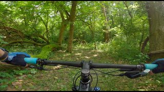
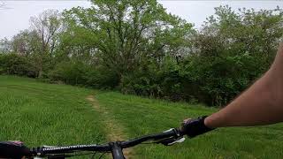
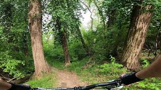
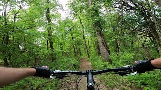
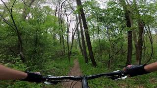
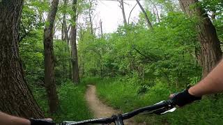
Photos of Edwardsville Mountain Bike
Videos of Edwardsville Mountain Bike

trail: Trail 2
14:44 |
40 |
Jun 27, 2025 , Edwardsville

trail: Trail 4
14:44 |
45 |
Jun 27, 2025 , Edwardsville
trail: Trail 1
14:44 |
40 |
Jun 27, 2025 , Edwardsville
trail: New Poag Connector
0:51 |
103 |
May 1, 2024 , Edwardsville
trail: Trail 6
3:00 |
158 |
May 1, 2024 , Edwardsville
trail: Trail 5
2:39 |
208 |
May 1, 2024 , Edwardsville
trail: Trail 4
4:31 |
82 |
May 1, 2024 , Edwardsville
trail: Trail 4
6:19 |
82 |
May 1, 2024 , Edwardsville
Recent Trail Reports
| status | trail | date | condition | info | user |
|---|---|---|---|---|---|
| Trail 4 | Jun 7, 2026 @ 11:55am (America/Chicago) Jun 7, 2026 | Ideal | DanSymonds CVA SORBA | ||
| Trail 3 Connector | Jun 7, 2026 @ 11:55am (America/Chicago) Jun 7, 2026 | Ideal | DanSymonds CVA SORBA | ||
| New Poag Connector | Jun 7, 2026 @ 11:55am (America/Chicago) Jun 7, 2026 | Ideal | DanSymonds CVA SORBA | ||
| Trail 3 | May 3, 2026 @ 5:11pm (America/Chicago) May 3, 2026 | Unknown | DanSymonds CVA SORBA | ||
| Trail 6 | Aug 19, 2024 @ 5:14pm Aug 19, 2024 | Dry | DanSymonds CVA SORBA | ||
| Trail 1 | Aug 7, 2024 @ 4:27pm Aug 7, 2024 | Dry | DanSymonds CVA SORBA | ||
| Trail 2 | Jun 6, 2024 @ 11:12am Jun 6, 2024 | Variable | DanSymonds CVA SORBA | ||
| MCT Nature - Schoolhouse Connector | Mar 25, 2023 @ 10:33pm Mar 25, 2023 | Dry | LindaAMwaQb | ||
| MCT Watershed Trail | Mar 26, 2023 @ 5:33am Mar 26, 2023 | Dry | LindaAMwaQb | ||
| Trail 5 | Oct 27, 2021 @ 9:17am Oct 27, 2021 | Variable | WimG FOGBP |
Activity Feed
| username | action | type | title | date |
|---|---|---|---|---|
| DanSymonds | add | report | activity #93984919 and 4 more | May 3, 2026 @ 2:38pm May 3, 2026 |
| Johnphp4sB | wishlist | trail | activity #93123916 and 1 more | Apr 21, 2026 @ 7:06pm Apr 21, 2026 |
| DaveeYc0bc | wishlist | region | activity #91479122 | Mar 28, 2026 @ 4:02pm Mar 28, 2026 |
| Codyg2hTxb | vote | trail | activity #82936338 | Oct 24, 2025 @ 12:16pm Oct 24, 2025 |
| Coop-C | add | report | activity #81237242 | Sep 27, 2025 @ 2:56pm Sep 27, 2025 |
Recent Comments
| username | type | title | comment | date |
|---|---|---|---|---|
| trail | All these trails are great fun. We’re from... | Oct 8, 2022 @ 9:45am Oct 8, 2022 | ||
| trail | There is currently a tree down that you have... | Jun 5, 2022 @ 12:57pm Jun 5, 2022 | ||
| trail | Trail was mostly good today. Slightly... | Sep 12, 2021 @ 6:30pm Sep 12, 2021 | ||
| trail | Trail is a wider dirt trail. Mainly used for... | Feb 28, 2019 @ 5:16pm Feb 28, 2019 | ||
| trail | This has the fastest section in the trail network. | Apr 19, 2018 @ 3:04pm Apr 19, 2018 |
Local Badges
-

Epic Ride Climb 2k1 awarded -

Climbing 10k Badge16 awarded -

Climbing 100k Badge0 awarded -

Epic Ride Descent 2k1 awarded -

Descent 10k Badge16 awarded -

Descent 100k Badge0 awarded
Activity Type Stats
| activitytype | trails | distance | descent | descent distance | total vertical | rating | global rank | state rank | photos | reports | routes | ridelogs |
|---|---|---|---|---|---|---|---|---|---|---|---|---|
| Mountain Bike | 62 | 139 miles | 2,067 ft | 38 miles | 203 ft | #2,296 | #825 | 68 | 161 | 5,509 | ||
| E-Bike | 1 | 4,183 ft | 82 ft | 3,258 ft | 59 ft | 142 | 137 | |||||
| Hike | 69 | 145 miles | 2,238 ft | 39 miles | 207 ft | #1,943 | #835 | 161 | 109 | |||
| Trail Running | 63 | 141 miles | 2,021 ft | 38 miles | 207 ft | #1,608 | #553 | 161 | 200 |
Frequently Asked Questions About Edwardsville
▼
What are the best places to ride in Edwardsville?
Edwardsville has 5 areas to explore for mountain biking. The top rated areas are:
▼
What are the highest rated mountain biking trails in Edwardsville?
The highest rated mountain biking trails in Edwardsville are:
- Trail 4 (4.1/5)
- Trail 3 (4/5)
- New Poag Connector (4/5)
- Trail 6 (4/5)
- Trail 2 (4/5)
▼
What is the best time of the year to ride in Edwardsville?
Based on ride log data, the most popular months to ride in Edwardsville are:
- August (38 activities)
- June (37 activities)
- May (34 activities)
▼
Where can I park to ride in Edwardsville?
There are 10 parking locations listed in Edwardsville. The most popular parking spots are: View all parking and trailhead locations on the map to plan your visit.
Activities
Trails
Points of Interest
- By pilznr
 GORC & contributors
 - Admins: GORC, SMBA
- #10080 - 3,519 views
- edwardsville activity log | embed map of Edwardsville mountain bike trails | edwardsville mountain biking points of interest
Downloading of trail gps tracks in kml & gpx formats is enabled for Edwardsville.
You must login to download files.