close
-
Layers w
- Weather Layers
- Pro
- Pro
- Pro
- Pro
- Pro
- Pro
- More Layers
- Pro
- Pro
- Pro
- Pro
-
Upgrade to

3D
Trail Conditions
- Unknown
- Snow Groomed
- Snow Packed
- Snow Covered
- Snow Cover Partial
- Freeze/thaw Cycle
- Icy
- Prevalent Mud
- Wet
- Variable
- Ideal
- Dry
- Very Dry
Trail Flow (Ridden Direction)
Trailforks scans users ridelogs to determine the most popular direction each trail is ridden. A good flowing trail network will have most trails flowing in a single direction according to their intension.
The colour categories are based on what percentage of riders are riding a trail in its intended direction.
The colour categories are based on what percentage of riders are riding a trail in its intended direction.
- > 96%
- > 90%
- > 80%
- > 70%
- > 50%
- < 50%
- bi-directional trail
- no data
Trail Last Ridden
Trailforks scans ridelogs to determine the last time a trail was ridden.
- < 2 days
- < 1 week
- < 2 weeks
- < 1 month
- < 6 months
- > 6 months
Trail Ridden Direction
The intended direction a trail should be ridden.
- Downhill Only
- Downhill Primary
- Both Directions
- Uphill Primary
- Uphill Only
- One Direction
Contribute Details
Colors indicate trail is missing specified detail.
- Description
- Photos
- Description & Photos
- Videos
Trail Popularity ?
Trailforks scans ridelogs to determine which trails are ridden the most in the last 9 months.
Trails are compared with nearby trails in the same city region with a possible 25 colour shades.
Think of this as a heatmap, more rides = more kinetic energy = warmer colors.
- most popular
- popular
- less popular
- not popular
ATV/ORV/OHV Filter
Max Vehicle Width
inches
US Cell Coverage
Legend

Radar Time
Activity Recordings
Trailforks uses anonymized public activity data.
?
Activity Recordings
Trailforks uses anonymized public activity data.
?
Personal Heatmap
▶
Activity Types
all
/
none
▶
Options
2
Date range
month
–
Winter Trails
Warning
A routing network for winter maps does not exist. Selecting trails using the winter trails layer has been disabled.
Missing Trails
Most Popular
Least Popular
Trails are colored based on popularity. The more popular a trail is, the more red. Less popular trails trend towards green.
Jump Magnitude Heatmap
Heatmap of where riders jump on trails. Zoom in to see individual jumps, click circles to view jump details.
BC Backroad Status
![map legend]()
Service Road Atlas is a free to use, community-driven service for viewing and creating reports on the numerous back-country service roads around B.C. and Alberta.

Slope Aspect
Direction the slope faces
Trails Deemphasized
Trails are shown in grey.
Only show trails with no bike usage.
Suggested Layers
Based on selected activity type
Save the current map location and zoom level as your default home location whenever this page is loaded.
Save
No description for Egypt has been added yet!
Login or register to submit one.
Stats
- Avg Trail Rating
- Trails (view details)
- 238
- Trails Mountain Bike
- 243
- Trails E-Bike
- 2
- Trails Horse
- 2
- Trails Hike
- 236
- Trails Trail Running
- 238
- Trails Dirtbike/Moto
- 2
- Trails ATV/ORV/OHV
- 2
- Total Distance
- 298 miles
- Total Descent
- 46,628 ft
- Total Vertical
- 8,354 ft
- Highest Trailhead
- 8,445 ft
- Reports
- 174
- Photos
- 78
- Ridden Counter
- 4,605
Sub Regions
- Eastern Desert (0)
- Sinai (8)
- Nuweiba (6)
- Saint Catherine (2)
- Nuweiba (6)
- Cairo (230)
Popular Egypt Mountain Biking Trails
• 100 ★ 5.0 • 2,275 ft • 119 ft • 66 •
One of two climbs from/descents back to the Wadi Degla main entrance. Although not very technical, it has a couple of little sections which can be treacherous at high speeds. The last bit has been modified by the protectorate management...
• 100 ★ 5.0 • 2 miles • 144 ft • 52 •
Easy, pedally doubletrack/jeep trail with some fun bits in the middle. The bread and butter of the Wadi's beginner rides.
• 100 ★ 0.0 • 2,627 ft • 33 ft • 50 •
Popular green difficulty singletrack. This mountain bike primary trail can be used both directions. On average it takes 3 minutes to complete this trail.
• 90 ★ 0.0 • 1,888 ft • 13 ft • 45 •
Popular green difficulty singletrack. This mountain bike primary trail can be used both directions. On average it takes 3 minutes to complete this trail.
• 5 ★ 0.0 • 1,447 ft • 0 ft • 43 •
A short, fast and fun singletrack descent
• 100 ★ 0.0 • 5,177 ft • 52 ft • 42 •
Popular blue difficulty singletrack. This mountain bike primary trail can be used both directions. On average it takes 8 minutes to complete this trail.
• 75 ★ 0.0 • 1,066 ft • 87 ft • 41 •
One of two short and steep access climbs to and Quarry trails.
• 95 ★ 0.0 • 2,735 ft • 170 ft • 40 •
Popular blue difficulty singletrack. This mountain bike primary trail can be used downhill primary. On average it takes 7 minutes to complete this trail.
Egypt Mountain Bike Routes
★ 5.0 • 10 miles • 797 ft • 3 • Loop •
The classic beginners/quick ride loop in the Wadi.
19 miles • 1,693 ft • 5 • Loop •
Great loop for a 2.5-4 hour ride, depending on how fit you are. This is the basic version that ends the...
12 miles • 1,147 ft • 10 • Loop •
One of three popular loops in the Wadi, this one being the middle ground of distance and technical...
17 miles • 1,968 ft • 7 •
A route that takes riders around the main Wadi Degla protected area. Lots of fun trails and quite...
3 miles • 402 ft • 5 • Loop •
MTB Egypt's XCO loop for upcoming African Continental Championships
★ 1.0 • 21 miles • 1,998 ft • 13 •
Nice mix of Wadi Degla single tracks
Photos of Egypt Mountain Bike
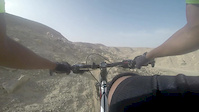
Videos of Egypt Mountain Bike
trail: Dog Face
3:52 |
183 |
Jun 14, 2015

trail: Ras Abu Gallum
0:17 |
40 |
Oct 11, 2025 , Nuweiba

trail: Hosni's Hairline descent
1060 |
Sep 28, 2016 , Cairo

trail: Hosni's Hairline descent
902 |
Sep 28, 2016 , Cairo
Recent Comments
| username | type | title | comment | date |
|---|---|---|---|---|
| report | Good afternoon | Feb 25, 2023 @ 2:37am Feb 25, 2023 | ||
| report | Hello | Feb 25, 2023 @ 12:18am Feb 25, 2023 | ||
| report | *Rode the coastal part of the trail from Blue... | May 24, 2022 @ 1:15pm May 24, 2022 | ||
| report | Thanks Peter. | Dec 19, 2021 @ 6:30pm Dec 19, 2021 | ||
| report | In a good shape. Although marked blue, it's... | May 28, 2021 @ 12:38pm May 28, 2021 |
Activity Type Stats
| activitytype | trails | distance | descent | descent distance | total vertical | rating | global rank | state rank | photos | reports | routes | ridelogs |
|---|---|---|---|---|---|---|---|---|---|---|---|---|
| Mountain Bike | 241 | 298 miles | 46,627 ft | 156 miles | 8,353 ft | #61 | 77 | 175 | 14 | 15,772 | ||
| E-Bike | 2 | 2 miles | 43 ft | 1,539 ft | 174 ft | #116 | 96 | 51 | ||||
| Horse | 2 | 2 miles | 43 ft | 1,539 ft | 174 ft | #82 | 44 | |||||
| Hike | 236 | 295 miles | 46,168 ft | 155 miles | 8,353 ft | #69 | 165 | 966 | ||||
| Trail Running | 238 | 296 miles | 46,385 ft | 155 miles | 8,353 ft | #64 | 165 | 1 | 282 | |||
| Dirtbike/Moto | 2 | 2 miles | 43 ft | 1,539 ft | 174 ft | #78 | 1 | 44 | 1 | |||
| ATV/ORV/OHV | 2 | 2 miles | 43 ft | 1,539 ft | 174 ft | #58 | 44 | 4 |
Trails
- By lummaa & contributors
- Admins: MTB Egypt
- #8472 - 11,703 views
- egypt activity log | embed map of Egypt mountain bike trails | egypt mountain biking points of interest
Downloading of trail gps tracks in kml & gpx formats is enabled for Egypt.
You must login to download files.