close
-
Layers w
- Weather Layers
- Pro
- Pro
- Pro
- Pro
- Pro
- Pro
- More Layers
- Pro
- Pro
- Pro
- Pro
-
Upgrade to

3D
Trail Conditions
- Unknown
- Snow Groomed
- Snow Packed
- Snow Covered
- Snow Cover Partial
- Freeze/thaw Cycle
- Icy
- Prevalent Mud
- Wet
- Variable
- Ideal
- Dry
- Very Dry
Trail Flow (Ridden Direction)
Trailforks scans users ridelogs to determine the most popular direction each trail is ridden. A good flowing trail network will have most trails flowing in a single direction according to their intension.
The colour categories are based on what percentage of riders are riding a trail in its intended direction.
The colour categories are based on what percentage of riders are riding a trail in its intended direction.
- > 96%
- > 90%
- > 80%
- > 70%
- > 50%
- < 50%
- bi-directional trail
- no data
Trail Last Ridden
Trailforks scans ridelogs to determine the last time a trail was ridden.
- < 2 days
- < 1 week
- < 2 weeks
- < 1 month
- < 6 months
- > 6 months
Trail Ridden Direction
The intended direction a trail should be ridden.
- Downhill Only
- Downhill Primary
- Both Directions
- Uphill Primary
- Uphill Only
- One Direction
Contribute Details
Colors indicate trail is missing specified detail.
- Description
- Photos
- Description & Photos
- Videos
Trail Popularity ?
Trailforks scans ridelogs to determine which trails are ridden the most in the last 9 months.
Trails are compared with nearby trails in the same city region with a possible 25 colour shades.
Think of this as a heatmap, more rides = more kinetic energy = warmer colors.
- most popular
- popular
- less popular
- not popular
ATV/ORV/OHV Filter
Max Vehicle Width
inches
US Cell Coverage
Legend

Radar Time
Activity Recordings
Trailforks uses anonymized public activity data.
?
Activity Recordings
Trailforks uses anonymized public activity data.
?
Personal Heatmap
▶
Activity Types
all
/
none
▶
Options
2
Date range
month
–
Winter Trails
Warning
A routing network for winter maps does not exist. Selecting trails using the winter trails layer has been disabled.
Missing Trails
Most Popular
Least Popular
Trails are colored based on popularity. The more popular a trail is, the more red. Less popular trails trend towards green.
Jump Magnitude Heatmap
Heatmap of where riders jump on trails. Zoom in to see individual jumps, click circles to view jump details.
BC Backroad Status
![map legend]()
Service Road Atlas is a free to use, community-driven service for viewing and creating reports on the numerous back-country service roads around B.C. and Alberta.

Slope Aspect
Direction the slope faces
Trails Deemphasized
Trails are shown in grey.
Only show trails with no bike usage.
Suggested Layers
Based on selected activity type
Save the current map location and zoom level as your default home location whenever this page is loaded.
Save
No description for El Granada has been added yet!
Login or register to submit one.
Activities Click to view
- Mountain Bike
56 trails
- E-Bike
27 trails
- Gravel Bike
0 trails
- Adaptive Bike
0 trails
- Horse
7 trails
- Hike
49 trails
- Trail Running
50 trails
Region Details
- 13
- 1
- 14
- 13
- 8
- 1
Region Status
Open as of Jun 11, 2026Stats
- Avg Trail Rating
- Trails (view details)
- 51
- Trails Mountain Bike
- 56
- Trails E-Bike
- 27
- Trails Horse
- 7
- Trails Hike
- 49
- Trails Trail Running
- 50
- Total Distance
- 34 miles
- Total Descent
- 7,379 ft
- Total Vertical
- 1,779 ft
- Highest Trailhead
- 1,790 ft
- Reports
- 621
- Photos
- 78
- Ridden Counter
- 12,230
Sub Regions
-
Quarry Park
- 7
- 6
- 5
- 1
Popular El Granada Mountain Biking Trails
• 95 ★ 4.8 • 1,148 ft • 0 ft • 553 •
flowy track with jumps, berms, and small drops, although there are alternate lines around most features.
• 90 ★ 3.0 • 1,637 ft • 77 ft • 530 •
Trail quickly diverts left off pavement (driveway, not road), becoming a single-track path that climbs onto the .
• 90 ★ 4.9 • 1,870 ft • 0 ft • 478 •
Highly rated popular blue difficulty singletrack. This mountain bike primary trail and has a easy overall physical rating. It features berm, drop, jump and pump track. Trail visibility is always easy to follow. On average it takes 3 minutes to complete this trail.
• 100 ★ 5.0 • 522 ft • 28 ft • 477 •
Popular blue difficulty singletrack. This mountain bike primary trail. On average it takes 1 minutes to complete this trail.
• 85 ★ 4.5 • 1,752 ft • 0 ft • 460 •
Steep, twisty trail with lots of drops and sharp turns into steep downhill bits.
• 75 ★ 4.2 • 2,277 ft • 0 ft • 452 •
some mild berms a few small 1' drops. Lower Girl Scouts section is wide old fire road dumps you out into the neighborhood
• 100 ★ 3.0 • 676 ft • 3 ft • 421 •
Popular blue difficulty singletrack. This multi-use trail and has a easy overall physical rating. It features berm and log ride. Trail visibility is always easy to follow. On average it takes 1 minutes to complete this trail.
• 85 ★ 3.5 • 1,184 ft • 19 ft • 411 •
Popular green difficulty singletrack. This mountain bike primary trail and has a easy overall physical rating with a 19 ft green climb. It features berm. Trail visibility is always easy to follow. On average it takes 2 minutes to complete this trail.
El Granada Mountain Bike Routes
★ 4.0 • 21 miles • 3,126 ft • 8 • Loop •
Just a way to hit both God's Trail and Sully's Trail in the same loop.
19 miles • 3,134 ft • 8 • Loop •
The ride begins from the first highway near the city of El Granada. You will find several difficult hills...
★ 3.0 • 9 miles • 2,490 ft • 12 •
Hidden Trails + Upper EG bus a couple times, hidden trails called Lower EG Bus + Caveman + Area 52
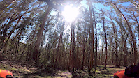
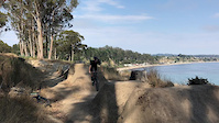
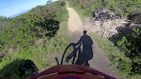
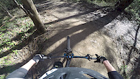
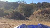
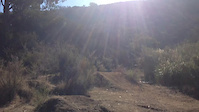
Photos of El Granada Mountain Bike
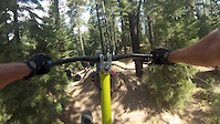
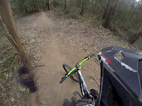
Videos of El Granada Mountain Bike
trail: Area 52
0:02 |
358 |
Oct 17, 2020
trail: Dirt Jumps
0:50 |
446 |
Sep 22, 2017
trail: Gods Trail
7:44 |
1176 |
Mar 28, 2017
trail: Dirt Jumps
0:29 |
140 |
Feb 16, 2015
trail: Dirt Jumps
0:26 |
144 |
Dec 4, 2013
trail: Dirt Jumps
0:13 |
70 |
Dec 4, 2013
trail: Dirt Jumps
0:37 |
319 |
Aug 25, 2013
trail: Dirt Jumps
2:06 |
1270 |
Mar 3, 2013
Current Trail Warnings
| status | trail | date | condition | user | info |
|---|---|---|---|---|---|
| Gods Trail | May 26, 2026 @ 1:21am (America/Los_Angeles) May 26, 2026 | Dry | RohitSengupta | Overgrown vegetation. Some parts are so... |
Recent Trail Reports
Activity Feed
| username | action | type | title | date |
|---|---|---|---|---|
| BonniJov0zEYL | difficultyvote | trail | activity #97500593 and 3 more | Jun 21, 2026 @ 10:43am 2 days |
| izaiah2 | comment | trail | activity #97296942 | Jun 18, 2026 @ 10:00pm Jun 18, 2026 |
| izaiah2 | ridden | trail | activity #97296494 and 4 more | Jun 18, 2026 @ 9:44pm Jun 18, 2026 |
| izaiah2 | ridden | trail | activity #97296223 and 6 more | Jun 18, 2026 @ 9:32pm Jun 18, 2026 |
| izaiah2 | difficultyvote | trail | activity #97296210 | Jun 18, 2026 @ 9:32pm Jun 18, 2026 |
Recent Comments
| username | type | title | comment | date |
|---|---|---|---|---|
| trail | Very fun trail, my favorite part of Moloch.... | Jun 18, 2026 @ 10:00pm Jun 18, 2026 | ||
| trail | The bridge is open. No more detour. | Nov 7, 2025 @ 8:19pm Nov 7, 2025 | ||
| trail | Overgrown in a few areas but still passable.... | Sep 28, 2025 @ 4:52pm Sep 28, 2025 | ||
| trail | My favorite trail in the area! So much fun! | Sep 7, 2025 @ 7:37pm Sep 7, 2025 | ||
| trail | Short and sweet but this is one of the best... | Aug 5, 2025 @ 3:14am Aug 5, 2025 |
Local Badges
-

Epic Mountain Bike Climb 2k1 awarded -

Climbing 10k Badge20 awarded -

Mountain Biking 100k Badge0 awarded -

Epic Ride Descent 2k1 awarded -

Descent 10k Badge20 awarded -

Descent 100k Badge0 awarded
Bike & Skill Parks
| name | type | city | rating |
|---|---|---|---|
| Quarry Park Pump Track | skill park | El Granada | |
| Quarry Park Pumptrack and skills area | skill park | El Granada |
Activity Type Stats
| activitytype | trails | distance | descent | descent distance | total vertical | rating | global rank | state rank | photos | reports | routes | ridelogs |
|---|---|---|---|---|---|---|---|---|---|---|---|---|
| Mountain Bike | 56 | 34 miles | 7,379 ft | 15 miles | 1,778 ft | #2,124 | #760 | 76 | 621 | 3 | 4,519 | |
| E-Bike | 27 | 7 miles | 3,396 ft | 5 miles | 1,207 ft | #3,113 | #1,131 | 2 | 563 | 1,567 | ||
| Horse | 7 | 6 miles | 1,545 ft | 3 miles | 830 ft | #2,165 | #1,204 | 37 | ||||
| Hike | 49 | 32 miles | 5,728 ft | 13 miles | 1,778 ft | #1,437 | #652 | 588 | 371 | |||
| Trail Running | 50 | 32 miles | 5,728 ft | 13 miles | 1,778 ft | #4,341 | #1,328 | 588 | 669 |
Frequently Asked Questions About El Granada
▼
What are the best places to ride in El Granada?
El Granada has 1 areas to explore for mountain biking. The top rated areas are:
▼
What are the highest rated mountain biking trails in El Granada?
The highest rated mountain biking trails in El Granada are:
- EG Bus (4.5/5)
- Moloch (4.4/5)
- Gods Trail (4.3/5)
- Moloch (creek exit) (4.2/5)
- Black Mamba (4.2/5)
▼
What is the best time of the year to ride in El Granada?
Based on ride log data, the most popular months to ride in El Granada are:
- February (18 activities)
- August (17 activities)
- September (11 activities)
▼
Where can I park to ride in El Granada?
There are 5 parking locations listed in El Granada. The most popular parking spots are: View all parking and trailhead locations on the map to plan your visit.
Activities
Trails
Points of Interest
- By elaguna & contributors
- Admins: COB, COB
- #43259 - 5,147 views
- el granada activity log | embed map of El Granada mountain bike trails | el granada mountain biking points of interest polygons
Downloading of trail gps tracks in kml & gpx formats is enabled for El Granada.
You must login to download files.