close
-
Layers w
- Weather Layers
- Pro
- Pro
- Pro
- Pro
- Pro
- Pro
- More Layers
- Pro
- Pro
- Pro
- Pro
-
Upgrade to

3D
Trail Conditions
- Unknown
- Snow Groomed
- Snow Packed
- Snow Covered
- Snow Cover Partial
- Freeze/thaw Cycle
- Icy
- Prevalent Mud
- Wet
- Variable
- Ideal
- Dry
- Very Dry
Trail Flow (Ridden Direction)
Trailforks scans users ridelogs to determine the most popular direction each trail is ridden. A good flowing trail network will have most trails flowing in a single direction according to their intension.
The colour categories are based on what percentage of riders are riding a trail in its intended direction.
The colour categories are based on what percentage of riders are riding a trail in its intended direction.
- > 96%
- > 90%
- > 80%
- > 70%
- > 50%
- < 50%
- bi-directional trail
- no data
Trail Last Ridden
Trailforks scans ridelogs to determine the last time a trail was ridden.
- < 2 days
- < 1 week
- < 2 weeks
- < 1 month
- < 6 months
- > 6 months
Trail Ridden Direction
The intended direction a trail should be ridden.
- Downhill Only
- Downhill Primary
- Both Directions
- Uphill Primary
- Uphill Only
- One Direction
Contribute Details
Colors indicate trail is missing specified detail.
- Description
- Photos
- Description & Photos
- Videos
Trail Popularity ?
Trailforks scans ridelogs to determine which trails are ridden the most in the last 9 months.
Trails are compared with nearby trails in the same city region with a possible 25 colour shades.
Think of this as a heatmap, more rides = more kinetic energy = warmer colors.
- most popular
- popular
- less popular
- not popular
ATV/ORV/OHV Filter
Max Vehicle Width
inches
US Cell Coverage
Legend

Radar Time
Activity Recordings
Trailforks uses anonymized public activity data.
?
Activity Recordings
Trailforks uses anonymized public activity data.
?
Personal Heatmap
▶
Activity Types
all
/
none
▶
Options
2
Date range
month
–
Winter Trails
Warning
A routing network for winter maps does not exist. Selecting trails using the winter trails layer has been disabled.
Missing Trails
Most Popular
Least Popular
Trails are colored based on popularity. The more popular a trail is, the more red. Less popular trails trend towards green.
Jump Magnitude Heatmap
Heatmap of where riders jump on trails. Zoom in to see individual jumps, click circles to view jump details.
BC Backroad Status
![map legend]()
Service Road Atlas is a free to use, community-driven service for viewing and creating reports on the numerous back-country service roads around B.C. and Alberta.

Slope Aspect
Direction the slope faces
Trails Deemphasized
Trails are shown in grey.
Only show trails with no bike usage.
Suggested Layers
Based on selected activity type
Save the current map location and zoom level as your default home location whenever this page is loaded.
SaveMountain bike trails throughout the city from green to black trails.
View region descriptions for other activity types
Generic
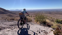
El Paso Texas has over 200 miles of trails to enjoy from hiking, mountain biking, bird watching, big horn sheep watching. There are various trail systems through the city, the largest being the Franklin Mountain State Park with various entrance points through the city and county (daily use fee required even if not passing the range station). El Paso is a desert environment with little shade, but amazing sunsets to see throughout the mountain. Take a mountain bike ride or take a hike. In the Tom May's area of the state park, there is an area to rock climbing and a paraglider launch area. Mountain Bike
Mountain bike trails throughout the city from green to black trails. E-Bike
E-Bikes are currently not allowed within the state park, but there are numerous other trails that do allow e-bikes. Horse
Not common, but you can find the occasion horseback rider within the trail system, but down on the river trail areas you will for sure see a horseback riding. Hike
Hiking can be form a flat trail to some very technical trails to the top of the mountain with 3000 feet of climbing. There are various small caves within the mountain that can be accessed. Dirtbike/Moto
Although there are no motorized vehicles allowed in the state park, there are other gravel roads and trails near El Paso that can easily be accessed. ATV/ORV/OHV
Although there are no motorized vehicles allowed in the state park, there are other gravel roads and trails near El Paso that can easily be accessed. Snowmobile
No snow in El Paso Snowshoe
No snow in El Paso Downhill Ski
No snow in El Paso Backcountry Ski
No Snow in El Paso Nordic Ski
No snow in El PasoLinks
Activities Click to view
- Mountain Bike
268 trails
- E-Bike
78 trails
- Gravel Bike
2 trails
- Adaptive Bike
0 trails
- Winter Fat Bike
0 trails
- Horse
31 trails
- Hike
300 trails
- Trail Running
306 trails
- Dirtbike/Moto
7 trails
- ATV/ORV/OHV
3 trails
Region Details
- 36
- 16
- 52
- 109
- 32
- 9
- 1
Region Status
Open as of Jun 14, 2026Stats
- Avg Trail Rating
- Trails (view details)
- 286
- Trails Mountain Bike
- 269
- Trails E-Bike
- 78
- Trails Gravel Bike
- 2
- Trails Horse
- 31
- Trails Hike
- 306
- Trails Trail Running
- 306
- Trails Dirtbike/Moto
- 7
- Trails Observed Trials
- 1
- Trails ATV/ORV/OHV
- 3
- Total Distance
- 295 miles
- Total Descent
- 31,971 ft
- Total Vertical
- 3,515 ft
- Highest Trailhead
- 7,170 ft
- Reports
- 680
- Photos
- 327
- Ridden Counter
- 15,607
Sub Regions
-
Ascarate Lake
- 3
- 5
- 1
-
Billy Rogers Arroyo Park & Nature Preserve
- 2
-
Chamizal National Memorial
-
Knapp Land Nature Preserve
-
Lost Dog
- 2
- 13
- 36
- 19
- 6
-
Mount Cristo Rey
- 1
- 1
- 1
-
North Hills
- 5
- 38
- 3
-
Palisades
- 1
- 9
- 1
- 1
- 1
-
Rio Bosque Wetlands Park
-
Rio Grande Valley Trail Network
- 5
- 3
-
Roughrider Canyon Freeride Park
- 4
-
Thunderbird / South Franklin
- 7
- 4
- 1
-
Tom Mays Park
- 3
- 13
-
Westside Community Hike & Bike Area
- 8
- 4
Popular El Paso Mountain Biking Trails
• 100 ★ 4.3 • 2 miles • 157 ft • 383 •
Highly rated popular blue difficulty singletrack. This multi-use trail. On average it takes 16 minutes to complete this trail.
• 100 ★ 4.5 • 2 miles • 375 ft • 305 •
Popular blue difficulty dirt/gravel road. This multi-use trail can be used both directions and has a easy overall physical rating with a 375 ft green climb. On average it takes 16 minutes to complete this trail.
• 100 ★ 5.0 • 2 miles • 106 ft • 300 •
Popular green difficulty singletrack. This multi-use trail can be used both directions and has a moderate overall physical rating with a 106 ft green climb. Trail visibility is always easy to follow. On average it takes 12 minutes to complete this trail.
• 100 ★ 4.6 • 2 miles • 0 ft • 298 •
Popular blue difficulty singletrack. This multi-use trail can be used both directions and has a moderate overall physical rating with a 0 ft blue climb. It features bridge. Trail visibility is always easy to follow. On average it takes 13 minutes to complete this trail.
• 50 ★ 3.0 • 5 miles • 959 ft • 296 •
Moderately popular blue difficulty singletrack. This multi-use trail can be used both directions. On average it takes 7 minutes to complete this trail.
• 100 ★ 4.8 • 2 miles • 84 ft • 256 •
This trail takes you from Bowen Ranch to the parking lot where the community bike tools are located. As far as difficulty, this trail is moderate. It does have its dips here and there. It also has several wooden ramps but riders could...
• 95 ★ 4.7 • 2 miles • 250 ft • 252 •
Popular blue difficulty singletrack. This multi-use trail. On average it takes 19 minutes to complete this trail.
El Paso Mountain Bike Routes
11 miles • 857 ft • 3 •
2023 12 Hours of Old El Paso Course - including the segment
12 miles • 1,385 ft • 5 •
Sun City Blaze Route - This field must have twenty-five characters
12 miles • 1,779 ft • 43 • Loop •
A real fun loop at Lost Dog/Tom Mays Park that includes basically all of the techy goodness. This place...
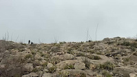
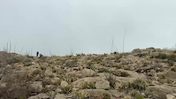
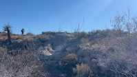
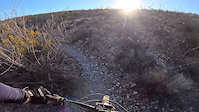
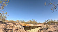
Photos of El Paso Mountain Bike
Videos of El Paso Mountain Bike
trail: Granola Bowl
0:17 |
26 |
Feb 19, 2025

trail: Granola Bowl
0:17 |
|
Feb 19, 2025
trail: Granola Bowl
0:17 |
|
Feb 19, 2025
trail: Tin Mine Hill
0:12 |
28 |
Feb 19, 2025
trail: Trans to Clydesdale (Part I)
0:12 |
40 |
Feb 19, 2025

trail: The Worm
0:00 |
18 |
Nov 11, 2024
trail: The Worm
0:19 |
34 |
Feb 25, 2024
trail: Mad Cow
0:04 |
15 |
Feb 10, 2024
Recent Trail Reports
| status | trail | date | condition | info | user |
|---|---|---|---|---|---|
| Goons Loop | Jun 14, 2026 @ 6:28am (America/Denver) Jun 14, 2026 | Ideal | ingothomas BMBA | ||
| Lost Cow Trail | Jun 14, 2026 @ 6:28am (America/Denver) Jun 14, 2026 | Dry | ingothomas BMBA | ||
| North Hills Access | Jun 14, 2026 @ 6:28am (America/Denver) Jun 14, 2026 | Ideal | ingothomas BMBA | ||
| Lazy Cow Connect | Jun 14, 2026 @ 6:28am (America/Denver) Jun 14, 2026 | Dry | ingothomas BMBA | ||
| Lazy Cow | Jun 14, 2026 @ 6:28am (America/Denver) Jun 14, 2026 | Ideal | ingothomas BMBA | ||
| Artcraft/Sunset Terrace Linear Trail | Feb 16, 2026 @ 12:16pm (America/Denver) Feb 16, 2026 | Unknown | x5rdman BMBA | ||
| Lost and Found | Feb 15, 2026 @ 10:03am (America/Denver) Feb 15, 2026 | Unknown | rburciagajr | ||
| Trans to Clydesdale (Part I) | Jan 15, 2026 @ 10:41pm (America/Denver) Jan 15, 2026 | Unknown | ABP04 | ||
| Spotted Cow | Nov 1, 2025 @ 10:06am (America/Ciudad_Juarez) Nov 1, 2025 | Dry | Santamatt | ||
| Old Tin Mine Road | Sep 20, 2025 @ 7:17am (America/Ciudad_Juarez) Sep 20, 2025 | Ideal | ingothomas BMBA |
Activity Feed
| username | action | type | title | date |
|---|---|---|---|---|
| ingothomas | add | report | activity #97010087 and 4 more | Jun 14, 2026 @ 3:47pm Jun 14, 2026 |
| x5rdman | add | trail | activity #95907561 and 1 more | May 30, 2026 @ 8:23pm May 30, 2026 |
| MiguelGHzwe | wishlist | region | activity #95887472 | May 30, 2026 @ 2:27pm May 30, 2026 |
| MiguelGHzwe | wishlist | region | activity #95887320 | May 30, 2026 @ 2:24pm May 30, 2026 |
| Wiley2049 | vote | poi | activity #95291328 and 1 more | May 22, 2026 @ 11:08pm May 22, 2026 |
Recent Comments
| username | type | title | comment | date |
|---|---|---|---|---|
| trail | Rode it counter clockwise. It's not flowing... | May 5, 2026 @ 6:13pm May 5, 2026 | ||
| trail | This trail is mostly for hiking. Tight turns,... | May 5, 2026 @ 6:08pm May 5, 2026 | ||
| trail | O | Apr 7, 2026 @ 9:21am Apr 7, 2026 | ||
| trail | Nice downhill coming back from Grim. Good... | Apr 5, 2025 @ 5:25pm Apr 5, 2025 | ||
| trail | Just rode the segment from the Bruno’s... | Apr 5, 2025 @ 5:23pm Apr 5, 2025 |
Local Badges
-

Completionist0 awarded -

Big Ride 30k4,529 awarded -

Epic Ride 50k2,073 awarded -

Top 10 Trails5 awarded -
Completionist0 awarded -
Completionist0 awarded
Bike & Skill Parks
| name | type | city | rating |
|---|---|---|---|
| Desert Downs BMX | skill park | El Paso | |
| Cimarron Park Pump Track | skill park | El Paso | |
| Sun City BMX | skill park | El Paso | |
| Westside Community Skillpark | skill park | El Paso |
Activity Type Stats
| activitytype | trails | distance | descent | descent distance | total vertical | rating | global rank | state rank | photos | reports | routes | ridelogs |
|---|---|---|---|---|---|---|---|---|---|---|---|---|
| Mountain Bike | 268 | 272 miles | 27,369 ft | 110 miles | 3,494 ft | #442 | #163 | 310 | 680 | 35 | 30,015 | |
| E-Bike | 78 | 103 miles | 2,936 ft | 39 miles | 1,404 ft | #363 | #697 | 1 | 516 | 5 | 837 | |
| Gravel Bike | 2 | #392 | #978 | 1 | 7 | 6 | 101 | |||||
| Horse | 31 | 85 miles | 3,537 ft | 43 miles | 1,526 ft | #567 | #517 | 84 | ||||
| Hike | 300 | 295 miles | 31,946 ft | 118 miles | 3,514 ft | #404 | #187 | 10 | 679 | 3 | 1,170 | |
| Trail Running | 306 | 295 miles | 31,946 ft | 118 miles | 3,514 ft | #330 | #131 | 3 | 680 | 7 | 978 | |
| Dirtbike/Moto | 7 | 22 miles | 236 ft | 12 miles | 417 ft | #694 | #241 | 77 | 35 | |||
| Observed Trials | 1 | 8 miles | 177 ft | 4 miles | 144 ft | 1 | ||||||
| ATV/ORV/OHV | 3 | 18 miles | 213 ft | 11 miles | 325 ft | #545 | #199 | 77 | 6 |
Frequently Asked Questions About El Paso
▼
What are the best places to ride in El Paso?
El Paso has 15 areas to explore for mountain biking. The top rated areas are:
▼
What are the highest rated mountain biking trails in El Paso?
The highest rated mountain biking trails in El Paso are:
- Brujos Stairs (4.4/5)
- Tin Mine Hill (4.3/5)
- Wandering Dog (4.3/5)
- Antler Run (4.3/5)
- Mad Cow (4.3/5)
▼
What is the best time of the year to ride in El Paso?
Based on ride log data, the most popular months to ride in El Paso are:
- May (238 activities)
- September (232 activities)
- December (227 activities)
▼
Where can I park to ride in El Paso?
There are 35 parking locations listed in El Paso. The most popular parking spots are: View all parking and trailhead locations on the map to plan your visit.
Activities
Trails
Points of Interest
- North Franklin Mountain Summit
- Trail Sign Information
- Shelter Other
- Old Corral and Windmill Sight
- Tin Mines Viewpoint
- Sotol Pass Viewpoint
- Anthony Gap Cave Sight
- Old Refrigerator Sight
- P2 Wooden Jump TTF
- Trail Map and Information Board
- Sierra Gallego (2,251 m)
- Cerro El Crinolino (2,251 m)
- Sierra el Espinazo del Diablo (2,211 m)
- By brenthillier
 NSMBA TRAILFORKS & contributors
 - Admins: BMBA
- #3711 - 23,632 views
- el paso activity log | embed map of El Paso mountain bike trails | el paso mountain biking points of interest polygons
Downloading of trail gps tracks in kml & gpx formats is enabled for El Paso.
You must login to download files.