close
-
Layers w
- Weather Layers
- Pro
- Pro
- Pro
- Pro
- Pro
- Pro
- More Layers
- Pro
- Pro
- Pro
- Pro
-
Upgrade to

3D
Trail Conditions
- Unknown
- Snow Groomed
- Snow Packed
- Snow Covered
- Snow Cover Partial
- Freeze/thaw Cycle
- Icy
- Prevalent Mud
- Wet
- Variable
- Ideal
- Dry
- Very Dry
Trail Flow (Ridden Direction)
Trailforks scans users ridelogs to determine the most popular direction each trail is ridden. A good flowing trail network will have most trails flowing in a single direction according to their intension.
The colour categories are based on what percentage of riders are riding a trail in its intended direction.
The colour categories are based on what percentage of riders are riding a trail in its intended direction.
- > 96%
- > 90%
- > 80%
- > 70%
- > 50%
- < 50%
- bi-directional trail
- no data
Trail Last Ridden
Trailforks scans ridelogs to determine the last time a trail was ridden.
- < 2 days
- < 1 week
- < 2 weeks
- < 1 month
- < 6 months
- > 6 months
Trail Ridden Direction
The intended direction a trail should be ridden.
- Downhill Only
- Downhill Primary
- Both Directions
- Uphill Primary
- Uphill Only
- One Direction
Contribute Details
Colors indicate trail is missing specified detail.
- Description
- Photos
- Description & Photos
- Videos
Trail Popularity ?
Trailforks scans ridelogs to determine which trails are ridden the most in the last 9 months.
Trails are compared with nearby trails in the same city region with a possible 25 colour shades.
Think of this as a heatmap, more rides = more kinetic energy = warmer colors.
- most popular
- popular
- less popular
- not popular
ATV/ORV/OHV Filter
Max Vehicle Width
inches
US Cell Coverage
Legend

Radar Time
Activity Recordings
Trailforks uses anonymized public activity data.
?
Activity Recordings
Trailforks uses anonymized public activity data.
?
Personal Heatmap
▶
Activity Types
all
/
none
▶
Options
2
Date range
month
–
Winter Trails
Warning
A routing network for winter maps does not exist. Selecting trails using the winter trails layer has been disabled.
Missing Trails
Most Popular
Least Popular
Trails are colored based on popularity. The more popular a trail is, the more red. Less popular trails trend towards green.
Jump Magnitude Heatmap
Heatmap of where riders jump on trails. Zoom in to see individual jumps, click circles to view jump details.
BC Backroad Status
![map legend]()
Service Road Atlas is a free to use, community-driven service for viewing and creating reports on the numerous back-country service roads around B.C. and Alberta.

Slope Aspect
Direction the slope faces
Trails Deemphasized
Trails are shown in grey.
Only show trails with no bike usage.
Suggested Layers
Based on selected activity type
Save the current map location and zoom level as your default home location whenever this page is loaded.
SaveSin duda, una de las zonas de Bizkaia con una red de senderos de uso eminentemente ciclista más impresionante: flow, variedad, desnivel...
El clásico DH Galdakao pone a este área en el candelero cada año. ¡ Descúbrela
El clásico DH Galdakao pone a este área en el candelero cada año. ¡ Descúbrela
 google parking directions
Links
This region uses the Uk/Euro style trail grading system.
Activities Click to view
- Mountain Bike
233 trails
- E-Bike
231 trails
- Horse
2 trails
- Hike
230 trails
- Trail Running
230 trails
Region Details
- 60
- 88
- 47
- 17
Region Status
Open as of 9 hoursStats
- Avg Trail Rating
- Trails (view details)
- 212
- Trails Mountain Bike
- 233
- Trails E-Bike
- 231
- Trails Gravel Bike
- 17
- Trails Adaptive Bike
- 4
- Trails Horse
- 2
- Trails Hike
- 230
- Trails Trail Running
- 230
- Total Distance
- 57 miles
- Total Descent
- 15,617 ft
- Total Vertical
- 1,398 ft
- Highest Trailhead
- 1,557 ft
- Reports
- 2,176
- Photos
- 236
- Ridden Counter
- 8,219
Popular El Vivero Mountain Biking Trails
• 95 ★ 0.0 • 3,615 ft • 37 ft • 202 •
Sendero sencillo que discurre paralelo a la carretera
• 95 ★ 4.9 • 1,273 ft • 0 ft • 147 •
Pista que baja desde las antenas del monte a la carretera donde esta el acceso a la . Tiene peraltes y muchos saltos de diferente altura
• 95 ★ 5.0 • 525 ft • 26 ft • 137 •
Conexion singletrack entre caminos que une la campa de Txaketolandea con la fuente de
• 85 ★ 4.4 • 1 mile • 0 ft • 134 •
Mítico descenso de DH de hace años, actualmente no pasa de dificultad roja con bici de enduro. Tan solo tiene un par de puntos de raíces en los que hay que pasar con cuidado
• 90 ★ 5.0 • 1,263 ft • 0 ft • 100 •
Sendero natural con todo, raíces, bancadas, pendiente, curvas cerradas...
• 85 ★ 4.0 • 1,932 ft • 0 ft • 88 •
Sendero que nos lleva a la cima del Ganguren (buenas vistas) y desde ahí al trail por un sendero entre arboles que va casi paralelo. Esta puesto very difficult porque bajar montado desde la cima es realmente complicado, es un paso de...
• 90 ★ 4.8 • 1,142 ft • 0 ft • 85 •
Segunda versión del trail , con punto menos de dificultad técnica y algo más de flow. Saltos y peraltes en todo el recorrido.
El Vivero Mountain Bike Routes
★ 4.0 • 23 miles • 5,895 ft • 31 • Loop •
Combinación para hacer las mejores bajadas endureras del Vivero en una sola ruta
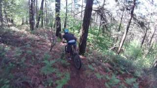
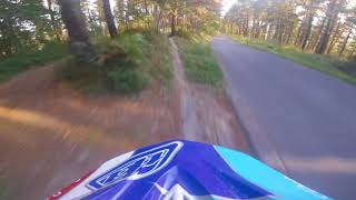
Photos of El Vivero Mountain Bike
Videos of El Vivero Mountain Bike
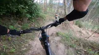
trail: Golf
0:28 |
34 |
Oct 16, 2013
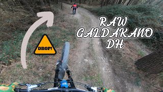
trail: Maxxis Jump
3:52 |
42 |
Dec 1, 2025 , Galdakao
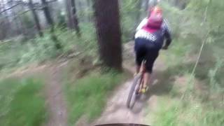
trail: Maxxis
3:32 |
664 |
Jan 31, 2024 , Galdakao

trail: Maxxis
4:14 |
238 |
Jan 1, 2023 , Galdakao
trail: Altamira
2:06 |
406 |
Apr 30, 2020 , Galdakao

trail: New Golf
4:17 |
448 |
Feb 8, 2020 , Galdakao
trail: Sendero Central
3:29 |
377 |
May 1, 2019 , Galdakao
trail: Maxxis
4:07 |
751 |
May 1, 2019 , Galdakao
Current Trail Warnings
| status | trail | date | condition | user | info |
|---|---|---|---|---|---|
| Otalarre 2 | Jun 8, 2026 @ 11:31am (Europe/Madrid) Jun 8, 2026 | Variable | kotxerra | ||
| Otalarre 3 | Jun 8, 2026 @ 11:31am (Europe/Madrid) Jun 8, 2026 | Variable | kotxerra | ||
| Errekatxo | Jun 8, 2026 @ 11:31am (Europe/Madrid) Jun 8, 2026 | Variable | kotxerra | Trabajos forestales |
Recent Trail Reports
| status | trail | date | condition | info | user |
|---|---|---|---|---|---|
| Acceso Charcos | Jun 28, 2026 @ 9:31am (Europe/Madrid) 9 hours | Ideal | ikeretxebarria | ||
| Maxxis Jump | Jun 26, 2026 @ 3:56pm (Europe/Madrid) 2 days | Unknown | Hodeimtb | ||
| Solozarreta | Jun 20, 2026 @ 4:14pm (Europe/Madrid) Jun 20, 2026 | Unknown | Hodeimtb | ||
| Altamira | Jun 20, 2026 @ 4:12pm (Europe/Madrid) Jun 20, 2026 | Unknown | Hodeimtb | ||
| New Golf | Jun 20, 2026 @ 4:12pm (Europe/Madrid) Jun 20, 2026 | Unknown | Hodeimtb | ||
| Trincheras | Jun 20, 2026 @ 4:12pm (Europe/Madrid) Jun 20, 2026 | Unknown | Hodeimtb | ||
| Zuzen | Jun 20, 2026 @ 4:11pm (Europe/Madrid) Jun 20, 2026 | Unknown | Hodeimtb | ||
| Padrola | Jun 20, 2026 @ 4:10pm (Europe/Madrid) Jun 20, 2026 | Unknown | Hodeimtb | ||
| Txita | Jun 20, 2026 @ 4:09pm (Europe/Madrid) Jun 20, 2026 | Unknown | Hodeimtb | ||
| Gallomerendero | Jun 20, 2026 @ 4:09pm (Europe/Madrid) Jun 20, 2026 | Unknown | Hodeimtb |
Activity Feed
| username | action | type | title | date |
|---|---|---|---|---|
| ikeretxebarria | add | report | activity #97985363 | Jun 28, 2026 @ 6:54am 3 hours |
| Hodeimtb | add | report | activity #97831174 | Jun 26, 2026 @ 6:56am 2 days |
| Txakal86 | add | trail | activity #97545420 | Jun 21, 2026 @ 11:34pm Jun 21, 2026 |
| Txakal86 | add | trail | activity #97470405 | Jun 21, 2026 @ 4:10am Jun 21, 2026 |
| Txakal86 | update | trail | activity #97470121 | Jun 21, 2026 @ 4:05am Jun 21, 2026 |
Recent Comments
| username | type | title | comment | date |
|---|---|---|---|---|
| trail | Yo marcaría esta como roja… | Jun 15, 2026 @ 4:16am Jun 15, 2026 | ||
| trail | Cada año que pasa está peor, sucia, dejada y... | Jun 3, 2026 @ 2:28pm Jun 3, 2026 | ||
| trail | Itxita zegoen gaur | Feb 24, 2026 @ 2:44pm Feb 24, 2026 | ||
| trail | En mi opinión es azul tirando para rojo, pero... | Jan 22, 2026 @ 12:45pm Jan 22, 2026 | ||
| report | Desde abajo hay que subir las escaleras que... | Jan 6, 2026 @ 9:54am Jan 6, 2026 |
Nearby Areas
| name | distance | ||||
|---|---|---|---|---|---|
| Ollargan | 11 | 22 | 2.5 km | ||
| Upo/Mandoia | 12 | 13 | 4.2 km | ||
| Txorierri | 23 | 25 | 4.3 km | ||
| Artxanda | 19 | 26 | 4.7 km | ||
| Pagasarri | 21 | 48 | 6.8 km |
Local Badges
-

Completionist0 awarded
Bike & Skill Parks
| name | type | city | rating |
|---|---|---|---|
| Circuito XCO Lezama | skill park | Galdakao | |
| Basauri motocross | skill park | Galdakao |
Activity Type Stats
| activitytype | trails | distance | descent | descent distance | total vertical | rating | global rank | state rank | photos | reports | routes | ridelogs |
|---|---|---|---|---|---|---|---|---|---|---|---|---|
| Mountain Bike | 233 | 57 miles | 15,617 ft | 27 miles | 1,398 ft | #874 | #68 | 219 | 2,176 | 2 | 4,794 | |
| E-Bike | 231 | 55 miles | 14,652 ft | 25 miles | 1,398 ft | #756 | #260 | 9 | 2,118 | 1 | 777 | |
| Gravel Bike | 17 | #5,782 | #178 | 9 | 22 | |||||||
| Adaptive Bike | 4 | #5,750 | #179 | 9 | ||||||||
| Horse | 2 | 4,688 ft | 69 ft | 823 ft | 1,093 ft | #919 | #57 | 43 | ||||
| Hike | 230 | 57 miles | 15,617 ft | 27 miles | 1,398 ft | #1,361 | #179 | 7 | 2,148 | 1 | 203 | |
| Trail Running | 230 | 57 miles | 15,617 ft | 27 miles | 1,398 ft | #768 | #150 | 1 | 2,149 | 1 | 151 |
Frequently Asked Questions About El Vivero
▼
What are the highest rated mountain biking trails in El Vivero?
The highest rated mountain biking trails in El Vivero are:
- Maxxis Jump (4.5/5)
- Gallomerendero (4.4/5)
- Golf (4.4/5)
- Maxxis (4.4/5)
- Altamira (4.4/5)
▼
What is the best time of the year to ride in El Vivero?
Based on ride log data, the most popular months to ride in El Vivero are:
- September (24 activities)
- May (22 activities)
- June (20 activities)
▼
Where can I park to ride in El Vivero?
There are 2 parking locations listed in El Vivero. The most popular parking spots are:
▼
What is the longest trail in El Vivero?
The longest trail in El Vivero is Ganguren cresta at 1.5 miles. View all trails sorted by distance.
Activities
Trails
Points of Interest
- By IMBAEuskadi
 & contributors
 - Admins: Altavoz, krasty1002, Txakal86
- #36174 - 5,967 views
- el vivero activity log | embed map of El Vivero mountain bike trails | el vivero mountain biking points of interest
Downloading of trail gps tracks in kml & gpx formats is enabled for El Vivero.
You must login to download files.