close
-
Layers w
- Weather Layers
- Pro
- Pro
- Pro
- Pro
- Pro
- Pro
- More Layers
- Pro
- Pro
- Pro
- Pro
-
Upgrade to

3D
Trail Conditions
- Unknown
- Snow Groomed
- Snow Packed
- Snow Covered
- Snow Cover Partial
- Freeze/thaw Cycle
- Icy
- Prevalent Mud
- Wet
- Variable
- Ideal
- Dry
- Very Dry
Trail Flow (Ridden Direction)
Trailforks scans users ridelogs to determine the most popular direction each trail is ridden. A good flowing trail network will have most trails flowing in a single direction according to their intension.
The colour categories are based on what percentage of riders are riding a trail in its intended direction.
The colour categories are based on what percentage of riders are riding a trail in its intended direction.
- > 96%
- > 90%
- > 80%
- > 70%
- > 50%
- < 50%
- bi-directional trail
- no data
Trail Last Ridden
Trailforks scans ridelogs to determine the last time a trail was ridden.
- < 2 days
- < 1 week
- < 2 weeks
- < 1 month
- < 6 months
- > 6 months
Trail Ridden Direction
The intended direction a trail should be ridden.
- Downhill Only
- Downhill Primary
- Both Directions
- Uphill Primary
- Uphill Only
- One Direction
Contribute Details
Colors indicate trail is missing specified detail.
- Description
- Photos
- Description & Photos
- Videos
Trail Popularity ?
Trailforks scans ridelogs to determine which trails are ridden the most in the last 9 months.
Trails are compared with nearby trails in the same city region with a possible 25 colour shades.
Think of this as a heatmap, more rides = more kinetic energy = warmer colors.
- most popular
- popular
- less popular
- not popular
ATV/ORV/OHV Filter
Max Vehicle Width
inches
US Cell Coverage
Legend

Radar Time
Activity Recordings
Trailforks uses anonymized public activity data.
?
Activity Recordings
Trailforks uses anonymized public activity data.
?
Personal Heatmap
▶
Activity Types
all
/
none
▶
Options
2
Date range
month
–
Winter Trails
Warning
A routing network for winter maps does not exist. Selecting trails using the winter trails layer has been disabled.
Missing Trails
Most Popular
Least Popular
Trails are colored based on popularity. The more popular a trail is, the more red. Less popular trails trend towards green.
Jump Magnitude Heatmap
Heatmap of where riders jump on trails. Zoom in to see individual jumps, click circles to view jump details.
BC Backroad Status
![map legend]()
Service Road Atlas is a free to use, community-driven service for viewing and creating reports on the numerous back-country service roads around B.C. and Alberta.

Slope Aspect
Direction the slope faces
Trails Deemphasized
Trails are shown in grey.
Only show trails with no bike usage.
Suggested Layers
Based on selected activity type
Save the current map location and zoom level as your default home location whenever this page is loaded.
SaveElbląg to najniżej położone miasto w Polsce. Leży u ujścia rzeki Elbląg do Zalewu Wiślanego.
source: Wikipedia
This region uses the Uk/Euro style trail grading system.
Activities Click to view
- Mountain Bike
90 trails
- E-Bike
32 trails
- Gravel Bike
0 trails
- Adaptive Bike
0 trails
- Horse
5 trails
- Hike
67 trails
- Trail Running
64 trails
- Observed Trials
0 trails
- Snowshoe
0 trails
- Downhill Ski
0 trails
- Backcountry Ski
0 trails
- Nordic Ski
0 trails
Region Details
- 41
- 20
- 16
- 10
- 1
Region Status
Open as of Oct 12, 2025Stats
- Avg Trail Rating
- Trails (view details)
- 90
- Trails Mountain Bike
- 90
- Trails E-Bike
- 32
- Trails Horse
- 5
- Trails Hike
- 67
- Trails Trail Running
- 64
- Trails Dirtbike/Moto
- 3
- Total Distance
- 35 miles
- Total Descent Distance
- 20 miles
- Total Descent
- 4,977 ft
- Total Vertical
- 600 ft
- Highest Trailhead
- 605 ft
- Reports
- 168
- Photos
- 99
- Ridden Counter
- 1,444
Sub Regions
-
Bażantarnia
- 19
- 15
- 10
- 1
-
Jelenia Dolina
- 1
- 1
-
Modrzewina
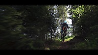
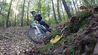
Popular Elbląg Mountain Biking Trails
• 100 ★ 5.0 • 2,851 ft • 25 ft • 28 •
Popular green difficulty singletrack. This multi-use trail can be used both directions and has a easy overall physical rating with a 25 ft green climb. Trail visibility is always easy to follow. On average it takes 3 minutes to complete this trail.
• 65 ★ 4.5 • 1,368 ft • 0 ft • 25 •
Zjazd z Góry Chrobrego, szybki, z pięknym widokiem na miasto i w miarę prosty, dobry dla początkującego. Na samym końcu trzeba uważać żeby nie wpaść w dziurę (czasami zakryta deską).
• 60 ★ 4.5 • 1,362 ft • 12 ft • 24 •
Na trasie są dropy, hopy i gapy, ale można je ominąć. To miejsce jest również znane jako 2137.
• 45 ★ 5.0 • 2,454 ft • 0 ft • 22 •
Moderately popular blue difficulty family friendly singletrack. This mountain bike primary trail and has a easy overall physical rating. It features berm. Trail visibility is always easy to follow. On average it takes 1 minutes to complete this trail.
• 45 ★ 5.0 • 3,071 ft • 20 ft • 20 •
Moderately popular blue difficulty singletrack. This mountain bike primary trail and has a easy overall physical rating with a 20 ft blue climb. Trail visibility is always easy to follow. On average it takes 1 minutes to complete this trail.
Elbląg Mountain Bike Routes
★ 5.0 • 50 miles • 1,412 ft • 0 • Point to Point •
Szlak pomarańczowy o długości 85 km. Szlak prowadzi nieopodal trasy wodnej Kanału Elbląskiego, co...
★ 4.0 • 3 miles • 369 ft • 0 • Loop •
Naturalna pętla będąca również szlakiem żółtym parku Bazantarnia
13 miles • 1,417 ft • 0 • Loop •
Elbląski etap wyścigu Garmin MTB Series 2020, który odbędzie się 26 września 2020
13 miles • 1,426 ft • 0 • Loop •
Trasa jednego z trzech etapów Garmin MTB Series w 2021 roku.
★ 5.0 • 14 miles • 1,574 ft • 25 • Loop • Race •
Zmieniona na parę dni przed imprezą, trasa pierwszego, elbląskiego etapu wyścigu Garmin MTB Series...
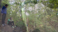
Photos of Elbląg Mountain Bike
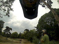
Videos of Elbląg Mountain Bike
trail: Bartek
0:54 |
58 |
Jun 18, 2019
trail: Bartek
9:05 |
216 |
May 22, 2018

trail: Maria
17:17 |
5 |
Apr 10, 2015

trail: Noga
0:13 |
62 |
Feb 4, 2015
trail: Bartek
4:23 |
594 |
Oct 20, 2014
trail: Bartek
0:46 |
368 |
Oct 20, 2014
trail: Wiktor
0:50 |
103 |
Oct 12, 2014
trail: Bartek
0:56 |
203 |
Sep 1, 2014
Recent Trail Reports
| status | trail | date | condition | info | user |
|---|---|---|---|---|---|
| Wrona | Oct 12, 2025 @ 11:17am (Europe/Kaliningrad) Oct 12, 2025 | Wet | kajetan1 TRAILFORKS | ||
| Gawron | Oct 12, 2025 @ 11:17am (Europe/Kaliningrad) Oct 12, 2025 | Wet | kajetan1 TRAILFORKS | ||
| Truso | Oct 12, 2025 @ 11:17am (Europe/Kaliningrad) Oct 12, 2025 | Wet | kajetan1 TRAILFORKS | ||
| Kuropatwa | Oct 12, 2025 @ 11:17am (Europe/Kaliningrad) Oct 12, 2025 | Wet | kajetan1 TRAILFORKS | ||
| Bażant | Oct 12, 2025 @ 11:17am (Europe/Kaliningrad) Oct 12, 2025 | Wet | kajetan1 TRAILFORKS | ||
| Mewa | Oct 12, 2025 @ 3:38pm (Europe/Warsaw) Oct 12, 2025 | Wet | kajetan1 TRAILFORKS | ||
| Dąbrowa | Jul 3, 2025 @ 11:26am Jul 3, 2025 | Ideal | R62 | ||
| Kopernik | Jul 3, 2025 @ 11:26am Jul 3, 2025 | Ideal | R62 | ||
| Dumanie | Jul 3, 2025 @ 11:26am Jul 3, 2025 | Ideal | R62 | ||
| Ania | Jul 3, 2025 @ 11:26am Jul 3, 2025 | Ideal | R62 |
Activity Feed
| username | action | type | title | date |
|---|---|---|---|---|
| saikhoong | add | video | activity #97086084 | Jun 15, 2026 @ 9:00pm Jun 15, 2026 |
| Zuziaslubowska | checkin | trail | activity #92111665 | Apr 7, 2026 @ 5:44am Apr 7, 2026 |
| Zuziaslubowska | ridden | trail | activity #92111664 | Apr 7, 2026 @ 5:44am Apr 7, 2026 |
| borysla | ridden | trail | activity #86260305 | Dec 29, 2025 @ 3:12am Dec 29, 2025 |
| MTBMarcin | comment | report | activity #82204442 | Oct 12, 2025 @ 6:54am Oct 12, 2025 |
Recent Comments
| username | type | title | comment | date |
|---|---|---|---|---|
| report | Dzieki za info! | Oct 12, 2025 @ 6:54am Oct 12, 2025 | ||
| trail | Flowowe fragmenty i ciekawe zakręty na końcu. | Oct 12, 2025 @ 6:46am Oct 12, 2025 | ||
| trail | Zjazdy i podjazdy, w tym jeden trudny podjazd.... | Oct 12, 2025 @ 6:45am Oct 12, 2025 | ||
| trail | Krótko, ale treściwie. Bandy a na końcu... | Oct 12, 2025 @ 6:43am Oct 12, 2025 | ||
| trail | Fajna, różnorodna ścieżka z ciekawymi... | Oct 12, 2025 @ 6:42am Oct 12, 2025 |
Local Badges
-

Epic Mountain Bike Climb 2k1 awarded -

Climbing 10k Badge5 awarded -

Mountain Biking 100k Badge0 awarded -

Completionist0 awarded -

Epic Ride Descent 2k1 awarded -

Descent 10k Badge4 awarded
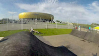
Bike & Skill Parks
| name | type | city | rating |
|---|---|---|---|
| BIS - Dirt Jumping | skill park | Elbląg | |
| Pumptrack - Nad Jarem | skill park | Elbląg | |
| Jelenia Dolina Motocross / Enduro | skill park | Elbląg | |
| Pumptrack - Oliwska | skill park | Elbląg | |
| Motocross Modrzewina | skill park | Elbląg |
Activity Type Stats
| activitytype | trails | distance | descent | descent distance | total vertical | rating | global rank | state rank | photos | reports | routes | ridelogs |
|---|---|---|---|---|---|---|---|---|---|---|---|---|
| Mountain Bike | 90 | 34 miles | 4,839 ft | 20 miles | 600 ft | #1,992 | #33 | 94 | 167 | 6 | 1,257 | |
| E-Bike | 32 | 12 miles | 1,808 ft | 7 miles | 427 ft | #2,757 | #301 | 154 | 1 | 31 | ||
| Horse | 5 | 2 miles | 39 ft | 2,224 ft | 197 ft | #653 | #262 | 4 | ||||
| Hike | 67 | 32 miles | 4,134 ft | 17 miles | 600 ft | #904 | #35 | 1 | 159 | 1 | 124 | |
| Trail Running | 64 | 32 miles | 3,930 ft | 17 miles | 600 ft | #2,900 | #49 | 160 | 1 | 161 | ||
| Dirtbike/Moto | 3 | 2 miles | 262 ft | 2 miles | 246 ft | #16 | 3 |
Frequently Asked Questions About Elbląg
▼
What are the best places to ride in Elbląg?
Elbląg has 3 areas to explore for mountain biking. The top rated areas are:
▼
What are the highest rated mountain biking trails in Elbląg?
The highest rated mountain biking trails in Elbląg are:
- Belweder (4.3/5)
- Górski Wąwóz (4.2/5)
- Ania (4.2/5)
- Ścieżka Jaszczurek (4.2/5)
- Łąka w Dolinie (4.2/5)
▼
What is the best time of the year to ride in Elbląg?
Based on ride log data, the most popular months to ride in Elbląg are:
- October (4 activities)
- July (4 activities)
- September (3 activities)
▼
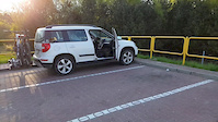
Where can I park to ride in Elbląg?
Activities
Trails
- By Remas94 & contributors
- Admins: MTBMarcin
- #27323 - 2,745 views
- elbląg activity log | embed map of Elbląg mountain bike trails | elbląg mountain biking points of interest polygons
Downloading of trail gps tracks in kml & gpx formats is enabled for Elbląg.
You must login to download files.