close
-
Layers w
- Weather Layers
- Pro
- Pro
- Pro
- Pro
- Pro
- Pro
- More Layers
- Pro
- Pro
- Pro
- Pro
-
Upgrade to

3D
Trail Conditions
- Unknown
- Snow Groomed
- Snow Packed
- Snow Covered
- Snow Cover Partial
- Freeze/thaw Cycle
- Icy
- Prevalent Mud
- Wet
- Variable
- Ideal
- Dry
- Very Dry
Trail Flow (Ridden Direction)
Trailforks scans users ridelogs to determine the most popular direction each trail is ridden. A good flowing trail network will have most trails flowing in a single direction according to their intension.
The colour categories are based on what percentage of riders are riding a trail in its intended direction.
The colour categories are based on what percentage of riders are riding a trail in its intended direction.
- > 96%
- > 90%
- > 80%
- > 70%
- > 50%
- < 50%
- bi-directional trail
- no data
Trail Last Ridden
Trailforks scans ridelogs to determine the last time a trail was ridden.
- < 2 days
- < 1 week
- < 2 weeks
- < 1 month
- < 6 months
- > 6 months
Trail Ridden Direction
The intended direction a trail should be ridden.
- Downhill Only
- Downhill Primary
- Both Directions
- Uphill Primary
- Uphill Only
- One Direction
Contribute Details
Colors indicate trail is missing specified detail.
- Description
- Photos
- Description & Photos
- Videos
Trail Popularity ?
Trailforks scans ridelogs to determine which trails are ridden the most in the last 9 months.
Trails are compared with nearby trails in the same city region with a possible 25 colour shades.
Think of this as a heatmap, more rides = more kinetic energy = warmer colors.
- most popular
- popular
- less popular
- not popular
ATV/ORV/OHV Filter
Max Vehicle Width
inches
US Cell Coverage
Legend

Radar Time
Activity Recordings
Trailforks uses anonymized public activity data.
?
Activity Recordings
Trailforks uses anonymized public activity data.
?
Personal Heatmap
▶
Activity Types
all
/
none
▶
Options
2
Date range
month
–
Winter Trails
Warning
A routing network for winter maps does not exist. Selecting trails using the winter trails layer has been disabled.
Missing Trails
Most Popular
Least Popular
Trails are colored based on popularity. The more popular a trail is, the more red. Less popular trails trend towards green.
Jump Magnitude Heatmap
Heatmap of where riders jump on trails. Zoom in to see individual jumps, click circles to view jump details.
BC Backroad Status
![map legend]()
Service Road Atlas is a free to use, community-driven service for viewing and creating reports on the numerous back-country service roads around B.C. and Alberta.

Slope Aspect
Direction the slope faces
Trails Deemphasized
Trails are shown in grey.
Only show trails with no bike usage.
Suggested Layers
Based on selected activity type
Save the current map location and zoom level as your default home location whenever this page is loaded.
SaveThis region encompasses the trail networks in the Elbow Valley, primarily on the north side of Hwy 66.
Activities Click to view
- Mountain Bike
209 trails
- E-Bike
189 trails
- Horse
104 trails
- Hike
248 trails
- Trail Running
247 trails
- Dirtbike/Moto
236 trails
- ATV/ORV/OHV
75 trails
- Snowmobile
6 trails
- Snowshoe
58 trails
- Nordic Ski
27 trails
Region Details
- 20
- 6
- 47
- 72
- 21
- 7
Stats
- Avg Trail Rating
- Trails (view details)
- 424
- Trails Mountain Bike
- 210
- Trails E-Bike
- 189
- Trails Gravel Bike
- 1
- Trails Winter Fat Bike
- 2
- Trails Horse
- 105
- Trails Hike
- 248
- Trails Trail Running
- 247
- Trails Dirtbike/Moto
- 245
- Trails ATV/ORV/OHV
- 75
- Trails Snowmobile
- 6
- Trails Snowshoe
- 58
- Trails Backcountry Ski
- 2
- Trails Nordic Ski
- 27
- Total Distance
- 546 miles
- Total Descent
- 104,278 ft
- Total Vertical
- 3,774 ft
- Highest Trailhead
- 7,715 ft
- Reports
- 10,598
- Photos
- 3,073
- Ridden Counter
- 139,208
Articles
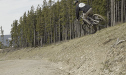
Video: Self-Shot Hot Laps on Some Of Alberta's Finest in 'Moosen'
May 28, 2026 from pinkbike.com
Bow Cycle's media creator takes a tripod and a custom Giant Reign Advanced E+2 out to Alberta's premium network to stack high-speed solo clips.
Race Report: Dust, Taquitos & A Whole Lot of Heart at MooseDuro 2025
Sep 15, 2025 from pinkbike.com
Rocky trails, great vibes, and a whole lot of two-wheel fun capped off another epic event.

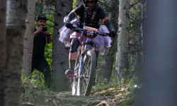
Video: Hannah Gillcrist Shreds Puma Grande in Alberta, Canada
Sep 18, 2024 from pinkbike.com
The future is bright for this U21 racer.

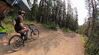
Video: Park-Like Flow On A Community Funded Jump Trail in Alberta
Feb 25, 2024 from pinkbike.com
Local ripper Aiden Greanya finds flow at the otherwise notoriously janky Moose Mountain.
Popular Trail Networks
view all areas »Sub Regions
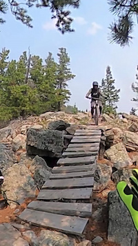
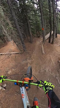
Popular Elbow Valley Mountain Biking Trails
• 100 ★ 4.4 • 2 miles • 532 ft • 4,601 •
is a fun bit of singletrack that leads out to connections with the south end of , and , , . It's a full bench cut that twists and turns all the way out to the junction with Merlin. The climbs and descents are very much like all the...
• 100 ★ 4.5 • 4 miles • 628 ft • 4,453 •
Built in 2014, followed the successful build of the previous year and it shares the same trademark features: consistent grades for easier climbing and flowing descents, sweeping bermed corners, rollers, bumps & table-tops. It has...
• 100 ★ 4.0 • 3 miles • 948 ft • 3,470 •
Starts from the WBC South Bridge trailhead and climbs all the way up to the / junction. Along the way, you cross , and trails and the junction. At the 3.6km mark, there is a short spur to a great viewpoint. At the start of the trail...
• 100 ★ 4.4 • 2 miles • 0 ft • 3,323 •
The name is pronounced “7 of 27 Descent” and is inspired by the unique well identifier for the Shell 7 of 27 well site. The well is located in Legal Sub-Division 7 of Section 27 Township 22 Range 6 west of the 5th Meridian. (near...
• 100 ★ 4.2 • 2 miles • 65 ft • 3,281 •
Continues along the ridge top to the popular viewpoint shown on the map. It then descends and climbs up to another summit and the junction. It then continues down to the junction, crosses and ski trails and ends at the junction. - - is...
• 95 ★ 3.5 • 1 mile • 278 ft • 2,611 •
This trail connects and , crossing . Year round it is often used as part of a - - loop. In Winter it can be a nice way of finishing a trip round Telephone by heading down .
• 90 ★ 4.4 • 3 miles • 541 ft • 2,260 •
This trail connects from the West Bragg side to on the Station Flats side. Half way up/down the west side (between R3 and Ranger Creek), the trail runs along the temporary logging road for about 100m. Turn right when you hit the dirt...
Elbow Valley Mountain Bike Routes
★ 4.0 • 12 miles • 2,353 ft • 2 •
and two loops of Merlin, back on Merlin
★ 4.7 • 8 miles • 1,342 ft • 3 • Loop •
to Merlin moderate trail ride Merlin counter clock wise
★ 3.8 • 6 miles • 1,006 ft • 3 • Loop •
A classic loop in West Bragg with a nice viewpoint half way up the climb and a fun downhill. Most people...
8 miles • 1,342 ft • 4 • Loop •
Braggin Rights to Merlin View. Short loop. Classic intermediate mtn biker loop and heavily frequented.
★ 4.8 • 13 miles • 2,246 ft • 7 • Loop •
A fun easy loop. I recommend riding counter clockwise. This is also the route for the 2016 Provincial XC...
Photos of Elbow Valley Mountain Bike
Videos of Elbow Valley Mountain Bike
trail: 1 Mo' Hill
0:26 |
48 |
Aug 8, 2024
trail: T-Dub
7:12 |
156 |
Aug 7, 2024
trail: SHAFT
0:44 |
54 |
Jul 9, 2024
trail: Moose Mountain Trail
0:47 |
229 |
Mar 6, 2024
trail: Flight 66 - Upper Section
0:15 |
231 |
Jan 30, 2024
trail: Race of Spades
0:16 |
|
Jul 21, 2023
trail: T-Dub
0:07 |
92 |
May 26, 2023
trail: T-Dub
0:39 |
145 |
May 25, 2023
Current Trail Warnings
| status | trail | date | condition | user | info |
|---|---|---|---|---|---|
| Moose Mountain Trail Moose Mountain | Jun 10, 2026 @ 11:55am (America/Edmonton) Jun 10, 2026 | Unknown | Parabellum | Numerous trees down across the main... | |
| Family Guy Moose Mountain | Jun 6, 2026 @ 9:35am (America/Edmonton) Jun 6, 2026 | Ideal | ChossSW5dcZ | The trail itself is ideal but the river... | |
| Special Spades Moose Mountain | Jun 6, 2026 @ 8:53am (America/Edmonton) Jun 6, 2026 | Dry | sofakingdom | Numerous trees down near the top. I... |
Recent Trail Reports
Activity Feed
| username | action | type | title | date |
|---|---|---|---|---|
| Emzee78 | ridden | trail | activity #97174596 | Jun 17, 2026 @ 4:53am 11 hours |
| guywhobikessometimes | wishlist | region | activity #97164392 | Jun 16, 2026 @ 11:05pm 16 hours |
| guywhobikessometimes | wishlist | trail | activity #97164054 | Jun 16, 2026 @ 10:54pm 17 hours |
| cinemod13 | add | report | activity #97158828 and 2 more | Jun 16, 2026 @ 8:04pm 19 hours |
| djgaff | wishlist | trail | activity #97139119 and 1 more | Jun 16, 2026 @ 2:49pm 1 day |
Recent Comments
| username | type | title | comment | date |
|---|---|---|---|---|
| trail | Bunch of trees down 5 minutes above Race of... | Jun 6, 2026 @ 5:27pm Jun 6, 2026 | ||
| report | Upper flight is in good condition, lower... | Jun 6, 2026 @ 1:39pm Jun 6, 2026 | ||
| trail | I’d describe this trail as (violin music... | Jun 6, 2026 @ 8:00am Jun 6, 2026 | ||
| trail | Blue trail at best, and a pretty boring one.... | Jun 5, 2026 @ 2:18pm Jun 5, 2026 | ||
| trail | Another brilliant effort by MMBTS and the... | May 28, 2026 @ 9:03pm May 28, 2026 |
Local Badges
-

10 Green Trails638 awarded -

Top 10 Trails214 awarded -

Completionist2 awarded -
Completionist13 awarded -
Completionist0 awarded -
Completionist0 awarded
Upcoming Local Events
Local Products
Local Products
Activity Type Stats
| activitytype | trails | distance | descent | descent distance | total vertical | rating | global rank | state rank | photos | reports | routes | ridelogs |
|---|---|---|---|---|---|---|---|---|---|---|---|---|
| Mountain Bike | 209 | 311 miles | 63,579 ft | 139 miles | 3,576 ft | 2,893 | 10,444 | 294 | 152,779 | |||
| E-Bike | 189 | 281 miles | 55,246 ft | 121 miles | 3,576 ft | 41 | 9,989 | 61 | 7,911 | |||
| Gravel Bike | 1 | 50 | 3 | 85 | ||||||||
| Winter Fat Bike | 2 | 7 | 139 | 6 | 177 | |||||||
| Horse | 104 | 210 miles | 25,607 ft | 84 miles | 3,110 ft | 13 | 2,979 | 7 | 135 | |||
| Hike | 248 | 299 miles | 46,066 ft | 121 miles | 3,576 ft | 59 | 9,978 | 25 | 8,982 | |||
| Trail Running | 247 | 298 miles | 46,037 ft | 121 miles | 3,576 ft | 1 | 9,980 | 30 | 3,388 | |||
| Dirtbike/Moto | 236 | 222 miles | 39,495 ft | 104 miles | 2,438 ft | 73 | 4,270 | 3,630 | ||||
| ATV/ORV/OHV | 75 | 98 miles | 12,352 ft | 47 miles | 2,438 ft | 1 | 4,020 | 131 | ||||
| Snowmobile | 6 | 1 mile | 177 ft | 3,501 ft | 1,621 ft | 2,185 | 9 | |||||
| Snowshoe | 58 | 77 miles | 8,560 ft | 29 miles | 1,857 ft | 1 | 2,547 | 4 | 251 | |||
| Backcountry Ski | 2 | 106 | 1 | 204 | ||||||||
| Nordic Ski | 27 | 37 miles | 2,841 ft | 13 miles | 869 ft | 7 | 175 | 4,066 |
Frequently Asked Questions About Elbow Valley
▼
What are the best places to ride in Elbow Valley?
Elbow Valley has 10 areas to explore for mountain biking. The top rated areas are:
▼
What are the highest rated mountain biking trails in Elbow Valley?
The highest rated mountain biking trails in Elbow Valley are:
- T-Dub (4.6/5)
- Jean Guy on The Rocks (4.6/5)
- Merlin View (4.4/5)
- Shattered (4.4/5)
- Sidetrax (4.4/5)
▼
What is the best time of the year to ride in Elbow Valley?
Based on ride log data, the most popular months to ride in Elbow Valley are:
- July (2,826 activities)
- August (2,400 activities)
- June (2,157 activities)
▼
What is the longest trail in Elbow Valley?
The longest trail in Elbow Valley is Ford Creek Trail at 9.5 miles. View all trails sorted by distance.
Activities
- Elbow Valley Mountain Biking Trails
- Elbow Valley E-Biking Trails
- Elbow Valley Horseback Trails
- Elbow Valley Hiking Trails
- Elbow Valley Trail Running Trails
- Elbow Valley Dirtbiking Trails
- Elbow Valley ATVing/Offroading Trails
- Elbow Valley Snowmobiling Trails
- Elbow Valley Snowshoeing Trails
- Elbow Valley Nordic Skiing Trails
Trails
Points of Interest
- By pinkrobe & contributors
- Admins: AEF, Canadmos, warrenmacdonald, AlbertaParks
- #17890 - 15,362 views
- elbow valley activity log | embed map of Elbow Valley mountain bike trails | elbow valley mountain biking points of interest
Downloading of trail gps tracks in kml & gpx formats is enabled for Elbow Valley.
You must login to download files.