close
-
Layers w
- Weather Layers
- Pro
- Pro
- Pro
- Pro
- Pro
- Pro
- More Layers
- Pro
- Pro
- Pro
- Pro
-
Upgrade to

3D
Trail Conditions
- Unknown
- Snow Groomed
- Snow Packed
- Snow Covered
- Snow Cover Partial
- Freeze/thaw Cycle
- Icy
- Prevalent Mud
- Wet
- Variable
- Ideal
- Dry
- Very Dry
Trail Flow (Ridden Direction)
Trailforks scans users ridelogs to determine the most popular direction each trail is ridden. A good flowing trail network will have most trails flowing in a single direction according to their intension.
The colour categories are based on what percentage of riders are riding a trail in its intended direction.
The colour categories are based on what percentage of riders are riding a trail in its intended direction.
- > 96%
- > 90%
- > 80%
- > 70%
- > 50%
- < 50%
- bi-directional trail
- no data
Trail Last Ridden
Trailforks scans ridelogs to determine the last time a trail was ridden.
- < 2 days
- < 1 week
- < 2 weeks
- < 1 month
- < 6 months
- > 6 months
Trail Ridden Direction
The intended direction a trail should be ridden.
- Downhill Only
- Downhill Primary
- Both Directions
- Uphill Primary
- Uphill Only
- One Direction
Contribute Details
Colors indicate trail is missing specified detail.
- Description
- Photos
- Description & Photos
- Videos
Trail Popularity ?
Trailforks scans ridelogs to determine which trails are ridden the most in the last 9 months.
Trails are compared with nearby trails in the same city region with a possible 25 colour shades.
Think of this as a heatmap, more rides = more kinetic energy = warmer colors.
- most popular
- popular
- less popular
- not popular
ATV/ORV/OHV Filter
Max Vehicle Width
inches
US Cell Coverage
Legend

Radar Time
Activity Recordings
Trailforks uses anonymized public activity data.
?
Activity Recordings
Trailforks uses anonymized public activity data.
?
Personal Heatmap
▶
Activity Types
all
/
none
▶
Options
2
Date range
month
–
Winter Trails
Warning
A routing network for winter maps does not exist. Selecting trails using the winter trails layer has been disabled.
Missing Trails
Most Popular
Least Popular
Trails are colored based on popularity. The more popular a trail is, the more red. Less popular trails trend towards green.
Jump Magnitude Heatmap
Heatmap of where riders jump on trails. Zoom in to see individual jumps, click circles to view jump details.
BC Backroad Status
![map legend]()
Service Road Atlas is a free to use, community-driven service for viewing and creating reports on the numerous back-country service roads around B.C. and Alberta.

Slope Aspect
Direction the slope faces
Trails Deemphasized
Trails are shown in grey.
Only show trails with no bike usage.
Suggested Layers
Based on selected activity type
Save the current map location and zoom level as your default home location whenever this page is loaded.
Save
No description for Elizabethtown has been added yet!
Login or register to submit one.
AKA: E' town
Region Supporters & Maintainers
trail builderSponsor![]() Builder
Builder
Activities Click to view
- Mountain Bike
88 trails
- E-Bike
96 trails
- Adaptive Bike
0 trails
- Winter Fat Bike
0 trails
- Hike
86 trails
- Trail Running
84 trails
- Snowmobile
10 trails
- Snowshoe
91 trails
- Backcountry Ski
5 trails
- Nordic Ski
10 trails
Region Details
- 6
- 1
- 25
- 33
- 19
- 4
Region Status
Open as of May 28, 2026Stats
- Avg Trail Rating
- Trails (view details)
- 97
- Trails Mountain Bike
- 89
- Trails E-Bike
- 96
- Trails Horse
- 1
- Trails Hike
- 86
- Trails Trail Running
- 84
- Trails Dirtbike/Moto
- 1
- Trails ATV/ORV/OHV
- 1
- Trails Snowmobile
- 10
- Trails Snowshoe
- 91
- Trails Backcountry Ski
- 5
- Trails Nordic Ski
- 10
- Total Distance
- 51 miles
- Total Descent
- 8,094 ft
- Total Vertical
- 1,622 ft
- Highest Trailhead
- 2,023 ft
- Reports
- 981
- Photos
- 208
- Ridden Counter
- 8,924
Sub Regions
-
Blueberry Hill Trails
- 13
- 24
- 11
- 1
-
Cobble Hill
- 1
- 5
- 1
-
Cobble Hill
-
Otis Mountain
- 4
- 5
- 8
- 2
-
Thrall Dam
- 1
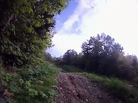
Popular Elizabethtown Mountain Biking Trails
• 85 ★ 4.2 • 1 mile • 73 ft • 317 •
Popular blue difficulty singletrack. This mountain bike primary trail can be used both directions. On average it takes 9 minutes to complete this trail.
• 85 ★ 3.5 • 1,398 ft • 82 ft • 288 •
Popular blue difficulty singletrack. This mountain bike primary trail can be used both directions. On average it takes 3 minutes to complete this trail.
• 65 ★ 2.7 • 3,028 ft • 31 ft • 263 •
Moderately popular blue difficulty singletrack. This multi-use trail can be used both directions and has a moderate overall physical rating with a 31 ft blue climb. Winter use: Backcountry snow grooming. On average it takes 5 minutes to complete this trail.
• 90 ★ 4.7 • 1 mile • 440 ft • 245 •
"Great Blue Heron" The primary climbing trail at Otis with direct access to the heroin rookery. Take you to the top of the ski hill and then traverses towards overlook. Pairs well with climbing to Otis Summit or access to Summit
• 100 ★ 4.2 • 1 mile • 528 ft • 242 •
, named after Elizabethtown local Joel Harwood, who passed at an early age. Friends and family made a lasting tribute with the creation of this trail, and memorial benches adorn both the beginning of the trail, and the end at the...
• 80 ★ 4.3 • 2,329 ft • 84 ft • 240 •
leads to one of the best overlooks in the park. After enjoying the view, hop back on the trail and hit a series of quick successive drops (all with go-arounds) and then loop back to the intersection with . Highly recommended.
• 100 ★ 4.8 • 2,054 ft • 244 ft • 236 •
Used primarily as a climbing route from the top of ski hill to Otis Summit. Challenging climb but a very rewarding clean to the top
Elizabethtown Mountain Bike Routes
★ 5.0 • 8 miles • 1,447 ft • 14 •
Follow this route for the best trails and the most amazing views. Your eyes will thank you, though your...
2 miles • 398 ft • 3 •
Smoothest loop in E-Town! Machine cut climb to the top followed by flowy single track decent Hand shaped...
4 miles • 728 ft • 4 •
Thank you to the owners, builders, maintainers. We had a great ride. Took some searching at times,...
7 miles • 1,105 ft • 12 •
This route takes you up the trail system all the way to the top of Joel’s the long way. Enjoy the view...
3 miles • 677 ft • 5 • Loop •
This route is a loop in the higher elevations of the Trails network. It begins at the junction with...
6 miles • 1,064 ft • 17 •
Planned route for the Otis section (afternoon ride) of the 4th Annual ETown BeatDown on Saturday October...
Photos of Elizabethtown Mountain Bike
Videos of Elizabethtown Mountain Bike
0:16 |
13 |
Dec 4, 2025
0:04 |
|
Apr 23, 2025
0:12 |
|
Apr 23, 2025

trail: Cabin
4:12 |
653 |
Jan 22, 2014
trail: Cabin (continued)
0:19 |
646 |
Jun 25, 2013
trail: Cabin (continued)
0:13 |
396 |
Sep 5, 2011
trail: Cabin (continued)
0:09 |
250 |
Jul 5, 2011
youtuber
![Are These The Best Trails In New York?...]()
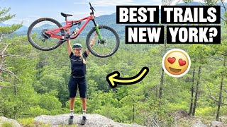
13:47 |
216 |
Jul 27, 2022
Recent Trail Reports
| status | trail | date | condition | info | user |
|---|---|---|---|---|---|
| Wookie Loop | May 28, 2026 @ 4:39pm (America/New_York) May 28, 2026 | Variable | edge-of-the-wild | ||
| Widowmaker | May 28, 2026 @ 4:39pm (America/New_York) May 28, 2026 | Variable | edge-of-the-wild | ||
| Waterfall | May 28, 2026 @ 4:39pm (America/New_York) May 28, 2026 | Variable | edge-of-the-wild | ||
| Walk of Shame | May 28, 2026 @ 4:39pm (America/New_York) May 28, 2026 | Variable | edge-of-the-wild | ||
| Upper Currey | May 28, 2026 @ 4:39pm (America/New_York) May 28, 2026 | Variable | edge-of-the-wild | ||
| The Glades | May 28, 2026 @ 4:39pm (America/New_York) May 28, 2026 | Variable | edge-of-the-wild | ||
| Pucker | May 28, 2026 @ 4:39pm (America/New_York) May 28, 2026 | Variable | edge-of-the-wild | ||
| Otis Access Road | May 28, 2026 @ 4:39pm (America/New_York) May 28, 2026 | Variable | edge-of-the-wild | ||
| Lower FlowBeast | May 28, 2026 @ 4:39pm (America/New_York) May 28, 2026 | Variable | edge-of-the-wild | ||
| Lower Currey | May 28, 2026 @ 4:39pm (America/New_York) May 28, 2026 | Variable | edge-of-the-wild |
Activity Feed
| username | action | type | title | date |
|---|---|---|---|---|
| 000bdr | wishlist | region | activity #97177006 | Jun 17, 2026 @ 5:50am 3 days |
| cjwoodall | wishlist | route | activity #96174656 | Jun 3, 2026 @ 12:38pm Jun 3, 2026 |
| cjwoodall | wishlist | route | activity #96174582 | Jun 3, 2026 @ 12:37pm Jun 3, 2026 |
| Ghodges | wishlist | region | activity #95850193 | May 30, 2026 @ 7:33am May 30, 2026 |
| edge-of-the-wild | add | report | activity #95730646 and 19 more | May 28, 2026 @ 1:39pm May 28, 2026 |
Recent Comments
| username | type | title | comment | date |
|---|---|---|---|---|
| trail | Happy to see new trails like this being added... | Oct 6, 2025 @ 3:43pm Oct 6, 2025 | ||
| trail | what a stupid name.. this trail is already... | Jun 2, 2025 @ 4:00pm Jun 2, 2025 | ||
| report | **just the top connection to GBX | May 28, 2025 @ 3:44pm May 28, 2025 | ||
| trail | Locally called "Drop" | Aug 3, 2024 @ 6:29am Aug 3, 2024 | ||
| trail | Just getting started | Mar 21, 2024 @ 10:27am Mar 21, 2024 |
Local Badges
-

10 Green Trails36 awarded -

10 Blue Trails84 awarded -

10 Black Trails42 awarded -

Epic Ride Climb 2k24 awarded -

Climbing 10k Badge7 awarded -

Climbing 100k Badge1 awarded
Bike & Skill Parks
| name | type | city | rating |
|---|---|---|---|
| Solace Cycles Skills Park | skill park | Elizabethtown |
Upcoming Local Events
Activity Type Stats
| activitytype | trails | distance | descent | descent distance | total vertical | rating | global rank | state rank | photos | reports | routes | ridelogs |
|---|---|---|---|---|---|---|---|---|---|---|---|---|
| Mountain Bike | 88 | 36 miles | 6,772 ft | 13 miles | 1,503 ft | #2,036 | #739 | 207 | 992 | 7 | 3,027 | |
| E-Bike | 96 | 51 miles | 8,094 ft | 20 miles | 1,624 ft | #2,522 | #1,014 | 827 | 4 | 53 | ||
| Horse | 1 | 2,497 ft | 102 ft | 1,932 ft | 98 ft | 66 | ||||||
| Hike | 86 | 36 miles | 6,772 ft | 13 miles | 1,503 ft | #4,767 | #1,678 | 1 | 990 | 521 | ||
| Trail Running | 84 | 35 miles | 6,650 ft | 13 miles | 1,503 ft | #4,243 | #1,297 | 990 | 29 | |||
| Dirtbike/Moto | 1 | 2,497 ft | 102 ft | 1,932 ft | 98 ft | 66 | ||||||
| ATV/ORV/OHV | 1 | 2,497 ft | 102 ft | 1,932 ft | 98 ft | 66 | 2 | |||||
| Snowmobile | 10 | 16 miles | 1,424 ft | 8 miles | 666 ft | #260 | #134 | 46 | ||||
| Snowshoe | 91 | 51 miles | 7,864 ft | 20 miles | 1,624 ft | #405 | #126 | 416 | 18 | |||
| Backcountry Ski | 5 | 3 miles | 597 ft | 1 mile | 1,070 ft | #588 | #191 | 258 | 83 | |||
| Nordic Ski | 10 | 6 miles | 994 ft | 3 miles | 443 ft | #1,264 | #566 | 260 | 140 |
Frequently Asked Questions About Elizabethtown
▼
What are the best places to ride in Elizabethtown?
Elizabethtown has 5 areas to explore for mountain biking. The top rated areas are:
▼
What are the highest rated mountain biking trails in Elizabethtown?
The highest rated mountain biking trails in Elizabethtown are:
- Flowbeast (4.4/5)
- BTW (4.4/5)
- Upper Currey (4.4/5)
- The Glades (4.2/5)
- GBH (4.2/5)
▼
What is the best time of the year to ride in Elizabethtown?
Based on ride log data, the most popular months to ride in Elizabethtown are:
- July (109 activities)
- September (86 activities)
- June (80 activities)
▼
Where can I park to ride in Elizabethtown?
There are 8 parking locations listed in Elizabethtown. The most popular parking spots are: View all parking and trailhead locations on the map to plan your visit.
Activities
Trails
Points of Interest
- By Benoi100 & contributors
- Admins: BETA, edge-of-the-wild, littlemazz
- #19017 - 6,594 views
- elizabethtown activity log | embed map of Elizabethtown mountain bike trails | elizabethtown mountain biking points of interest
Downloading of trail gps tracks in kml & gpx formats is enabled for Elizabethtown.
You must login to download files.