close
-
Layers w
- Weather Layers
- Pro
- Pro
- Pro
- Pro
- Pro
- Pro
- More Layers
- Pro
- Pro
- Pro
- Pro
-
Upgrade to

3D
Trail Conditions
- Unknown
- Snow Groomed
- Snow Packed
- Snow Covered
- Snow Cover Partial
- Freeze/thaw Cycle
- Icy
- Prevalent Mud
- Wet
- Variable
- Ideal
- Dry
- Very Dry
Trail Flow (Ridden Direction)
Trailforks scans users ridelogs to determine the most popular direction each trail is ridden. A good flowing trail network will have most trails flowing in a single direction according to their intension.
The colour categories are based on what percentage of riders are riding a trail in its intended direction.
The colour categories are based on what percentage of riders are riding a trail in its intended direction.
- > 96%
- > 90%
- > 80%
- > 70%
- > 50%
- < 50%
- bi-directional trail
- no data
Trail Last Ridden
Trailforks scans ridelogs to determine the last time a trail was ridden.
- < 2 days
- < 1 week
- < 2 weeks
- < 1 month
- < 6 months
- > 6 months
Trail Ridden Direction
The intended direction a trail should be ridden.
- Downhill Only
- Downhill Primary
- Both Directions
- Uphill Primary
- Uphill Only
- One Direction
Contribute Details
Colors indicate trail is missing specified detail.
- Description
- Photos
- Description & Photos
- Videos
Trail Popularity ?
Trailforks scans ridelogs to determine which trails are ridden the most in the last 9 months.
Trails are compared with nearby trails in the same city region with a possible 25 colour shades.
Think of this as a heatmap, more rides = more kinetic energy = warmer colors.
- most popular
- popular
- less popular
- not popular
ATV/ORV/OHV Filter
Max Vehicle Width
inches
US Cell Coverage
Legend

Radar Time
Activity Recordings
Trailforks uses anonymized public activity data.
?
Activity Recordings
Trailforks uses anonymized public activity data.
?
Personal Heatmap
▶
Activity Types
all
/
none
▶
Options
2
Date range
month
–
Winter Trails
Warning
A routing network for winter maps does not exist. Selecting trails using the winter trails layer has been disabled.
Missing Trails
Most Popular
Least Popular
Trails are colored based on popularity. The more popular a trail is, the more red. Less popular trails trend towards green.
Jump Magnitude Heatmap
Heatmap of where riders jump on trails. Zoom in to see individual jumps, click circles to view jump details.
BC Backroad Status
![map legend]()
Service Road Atlas is a free to use, community-driven service for viewing and creating reports on the numerous back-country service roads around B.C. and Alberta.

Slope Aspect
Direction the slope faces
Trails Deemphasized
Trails are shown in grey.
Only show trails with no bike usage.
Suggested Layers
Based on selected activity type
Save the current map location and zoom level as your default home location whenever this page is loaded.
Save
No description for Elkridge has been added yet!
Login or register to submit one.
Activities Click to view
- Mountain Bike
23 trails
- Gravel Bike
0 trails
- Adaptive Bike
0 trails
- Winter Fat Bike
0 trails
- Hike
26 trails
- Trail Running
26 trails
Stats
- Avg Trail Rating
- Trails (view details)
- 21
- Trails Mountain Bike
- 23
- Trails Hike
- 26
- Trails Trail Running
- 26
- Total Distance
- 14 miles
- Total Descent
- 1,112 ft
- Total Vertical
- 191 ft
- Highest Trailhead
- 385 ft
- Reports
- 363
- Photos
- 51
- Ridden Counter
- 7,423
Sub Regions
-
Rockburn Branch Park
- 10
Popular Elkridge Mountain Biking Trails
• 100 ★ 3.0 • 988 ft • 8 ft • 1,345 •
Easy singletrack connecting Branch Park with Patapsco Valley State Park.
• 100 ★ 3.0 • 666 ft • 25 ft • 1,120 •
Popular green difficulty singletrack. This mountain bike primary trail. Adaptive MTB rating: amtb green. On average it takes minutes to complete this trail.
• 90 ★ 3.0 • 1,709 ft • 29 ft • 998 •
Popular green difficulty singletrack. This mountain bike primary trail. On average it takes 4 minutes to complete this trail.
• 85 ★ 4.4 • 4,469 ft • 42 ft • 748 •
Popular green difficulty singletrack. This mountain bike primary trail and has a easy overall physical rating with a 42 ft green climb. Adaptive MTB rating: amtb green. Trail visibility is always easy to follow. On average it takes 5 minutes to complete this trail.
• 75 ★ 3.4 • 5,200 ft • 38 ft • 432 •
Popular green difficulty singletrack. This mountain bike primary trail. On average it takes 8 minutes to complete this trail.
• 95 ★ 4.0 • 1,608 ft • 19 ft • 407 •
Popular green difficulty family friendly doubletrack. This mountain bike primary trail can be used both directions and has a easy overall physical rating. Adaptive MTB rating: amtb green. On average it takes 1 minutes to complete this trail.
• 75 ★ 5.0 • 4,012 ft • 73 ft • 406 •
Popular green difficulty singletrack. This mountain bike primary trail and has a easy overall physical rating with a 73 ft green climb. On average it takes 8 minutes to complete this trail.
• 80 ★ 5.0 • 823 ft • 5 ft • 334 •
Popular green difficulty singletrack. This mountain bike primary trail can be used both directions. On average it takes 1 minutes to complete this trail.
Elkridge Mountain Bike Routes
★ 5.0 • 12 miles • 1,618 ft • 14 • Loop •
This is just a basic MTB loop of 12 miles that leaves from Field 8 parking. Not too crazy.
★ 2.4 • 14 miles • 1,526 ft • 11 • Loop •
Good 14 mile loop starting at Park riding through the Howard County section of the Avalon of Patapsco.
14 miles • 1,522 ft • 11 • Loop •
Good 14 mile loop starting at Park riding through the Howard County section of the Avalon of Patapsco.
14 miles • 1,522 ft • 11 • Loop •
Good 14 mile loop starting at Park riding through the Howard County section of the Avalon of Patapsco.
★ 3.0 • 9 miles • 635 ft • 5 • Out & Back •
This is a route from BWI Business District/BWI trail to Skills Park through Patapsco Valley State Park.
20 miles • 1,943 ft • 12 •
During the 2020 Patapsco Trail Fest held by Friends of Patapsco and MORE, there was a 5 day ride series...
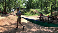
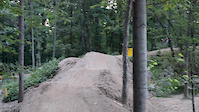
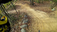
Photos of Elkridge Mountain Bike
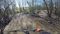
Videos of Elkridge Mountain Bike

trail: Rockburn
0:40 |
|
Aug 8, 2024
trail: Rockburn
0:43 |
99 |
Jul 20, 2021
trail: Rockburn
0:12 |
245 |
Aug 30, 2020
trail: Rockburn
0:33 |
234 |
Nov 5, 2019
trail: Pain Cave
0:07 |
70 |
Jun 24, 2017
trail: Pain Cave
0:50 |
351 |
Aug 9, 2015

trail: Pain Cave
3:00 |
170 |
Jan 31, 2015
4:03 |
338 |
Nov 18, 2014
Recent Trail Reports
| status | trail | date | condition | info | user |
|---|---|---|---|---|---|
| Rockburn Connector | Jun 4, 2026 @ 4:58pm (America/New_York) Jun 4, 2026 | Dry | gman0502 | ||
| Twisties | Jun 4, 2026 @ 4:58pm (America/New_York) Jun 4, 2026 | Dry | gman0502 | ||
| Nu Trail | Jun 4, 2026 @ 4:58pm (America/New_York) Jun 4, 2026 | Dry | gman0502 | ||
| Skills Park Trail | Jun 4, 2026 @ 4:58pm (America/New_York) Jun 4, 2026 | Dry | gman0502 | ||
| Quarry Trail | Apr 21, 2026 @ 8:08am (America/New_York) Apr 21, 2026 | Ideal | JamesAQyNbm | ||
| Frisbee Golf Drag Strip | Apr 18, 2026 @ 8:16am (America/New_York) Apr 18, 2026 | Ideal | shinny13 | ||
| Can't Take the Pain | Apr 18, 2026 @ 8:16am (America/New_York) Apr 18, 2026 | Ideal | shinny13 | ||
| Rockburn | Jan 4, 2026 @ 2:14pm (America/New_York) Jan 4, 2026 | Variable | willio10244 | ||
| Pain Cave | Jan 4, 2026 @ 2:14pm (America/New_York) Jan 4, 2026 | Dry | willio10244 | ||
| Patuxent Branch Trail | Aug 23, 2025 @ 2:08pm Aug 23, 2025 | Ideal | BoxRacing |
Activity Feed
| username | action | type | title | date |
|---|---|---|---|---|
| Lucas0gKuzm | wishlist | trail | activity #97699729 | Jun 24, 2026 @ 8:30am Jun 24, 2026 |
| dan99gpgt | wishlist | badge | activity #97151819 | Jun 16, 2026 @ 5:56pm Jun 16, 2026 |
| dan99gpgt | wishlist | region | activity #96419992 | Jun 6, 2026 @ 5:54pm Jun 6, 2026 |
| dan99gpgt | wishlist | skillpark | activity #96419978 | Jun 6, 2026 @ 5:54pm Jun 6, 2026 |
| ConnorigQiOH | wishlist | route | activity #96359120 | Jun 6, 2026 @ 5:22am Jun 6, 2026 |
Recent Comments
| username | type | title | comment | date |
|---|---|---|---|---|
| trail | Aside from being REALLY steep at the end, this... | Oct 10, 2024 @ 8:57am Oct 10, 2024 | ||
| trail | Mmm we a a m | Jun 11, 2024 @ 6:52am Jun 11, 2024 | ||
| trail | Fun to go down | Aug 14, 2022 @ 7:09am Aug 14, 2022 | ||
| report | Yeah. Saw that yesterday as well. Crazy how... | Jul 24, 2020 @ 6:51am Jul 24, 2020 |
Local Badges
-

Epic Ride Climb 2k4 awarded -

Climbing 10k Badge16 awarded -

Climbing 100k Badge0 awarded -

Epic Ride Descent 2k4 awarded -

Descent 10k Badge16 awarded -

Descent 100k Badge0 awarded
Bike & Skill Parks
| name | type | city | rating |
|---|---|---|---|
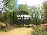
| Rockburn Branch Skills Park | skill park | Elkridge |
Activity Type Stats
| activitytype | trails | distance | descent | descent distance | total vertical | rating | global rank | state rank | photos | reports | routes | ridelogs |
|---|---|---|---|---|---|---|---|---|---|---|---|---|
| Mountain Bike | 23 | 14 miles | 1,112 ft | 6 miles | 190 ft | #3,209 | #1,100 | 51 | 363 | 16 | 6,510 | |
| Hike | 26 | 14 miles | 1,112 ft | 6 miles | 190 ft | #7,967 | #2,811 | 362 | 1 | 500 | ||
| Trail Running | 26 | 14 miles | 1,112 ft | 6 miles | 190 ft | #7,026 | #2,312 | 362 | 2 | 728 |
Frequently Asked Questions About Elkridge
▼
What are the best places to ride in Elkridge?
Elkridge has 1 areas to explore for mountain biking. The top rated areas are:
▼
What are the highest rated mountain biking trails in Elkridge?
The highest rated mountain biking trails in Elkridge are:
- Nu Trail (4.3/5)
- Orange Trail (4.1/5)
- Can't Take the Pain (4.1/5)
- Pain Cave (4.1/5)
- Rockburn Connector (4.1/5)
▼
What is the best time of the year to ride in Elkridge?
Based on ride log data, the most popular months to ride in Elkridge are:
- June (87 activities)
- May (87 activities)
- September (80 activities)
▼
Where can I park to ride in Elkridge?
There are 9 parking locations listed in Elkridge. The most popular parking spots are: View all parking and trailhead locations on the map to plan your visit.
- By Facingtraffic & contributors
- Admins: MORE-MD LDRSH, kmihm100
- #5380 - 3,140 views
- elkridge activity log | embed map of Elkridge mountain bike trails | elkridge mountain biking points of interest
Downloading of trail gps tracks in kml & gpx formats is enabled for Elkridge.
You must login to download files.