close
-
Layers w
- Weather Layers
- Pro
- Pro
- Pro
- Pro
- Pro
- Pro
- More Layers
- Pro
- Pro
- Pro
- Pro
-
Upgrade to

3D
Trail Conditions
- Unknown
- Snow Groomed
- Snow Packed
- Snow Covered
- Snow Cover Partial
- Freeze/thaw Cycle
- Icy
- Prevalent Mud
- Wet
- Variable
- Ideal
- Dry
- Very Dry
Trail Flow (Ridden Direction)
Trailforks scans users ridelogs to determine the most popular direction each trail is ridden. A good flowing trail network will have most trails flowing in a single direction according to their intension.
The colour categories are based on what percentage of riders are riding a trail in its intended direction.
The colour categories are based on what percentage of riders are riding a trail in its intended direction.
- > 96%
- > 90%
- > 80%
- > 70%
- > 50%
- < 50%
- bi-directional trail
- no data
Trail Last Ridden
Trailforks scans ridelogs to determine the last time a trail was ridden.
- < 2 days
- < 1 week
- < 2 weeks
- < 1 month
- < 6 months
- > 6 months
Trail Ridden Direction
The intended direction a trail should be ridden.
- Downhill Only
- Downhill Primary
- Both Directions
- Uphill Primary
- Uphill Only
- One Direction
Contribute Details
Colors indicate trail is missing specified detail.
- Description
- Photos
- Description & Photos
- Videos
Trail Popularity ?
Trailforks scans ridelogs to determine which trails are ridden the most in the last 9 months.
Trails are compared with nearby trails in the same city region with a possible 25 colour shades.
Think of this as a heatmap, more rides = more kinetic energy = warmer colors.
- most popular
- popular
- less popular
- not popular
ATV/ORV/OHV Filter
Max Vehicle Width
inches
US Cell Coverage
Legend

Radar Time
Activity Recordings
Trailforks uses anonymized public activity data.
?
Activity Recordings
Trailforks uses anonymized public activity data.
?
Personal Heatmap
▶
Activity Types
all
/
none
▶
Options
2
Date range
month
–
Winter Trails
Warning
A routing network for winter maps does not exist. Selecting trails using the winter trails layer has been disabled.
Missing Trails
Most Popular
Least Popular
Trails are colored based on popularity. The more popular a trail is, the more red. Less popular trails trend towards green.
Jump Magnitude Heatmap
Heatmap of where riders jump on trails. Zoom in to see individual jumps, click circles to view jump details.
BC Backroad Status
![map legend]()
Service Road Atlas is a free to use, community-driven service for viewing and creating reports on the numerous back-country service roads around B.C. and Alberta.

Slope Aspect
Direction the slope faces
Trails Deemphasized
Trails are shown in grey.
Only show trails with no bike usage.
Suggested Layers
Based on selected activity type
Save the current map location and zoom level as your default home location whenever this page is loaded.
Save
No description for Elorrio has been added yet!
Login or register to submit one.
This region uses the Uk/Euro style trail grading system.
Activities Click to view
- Mountain Bike
51 trails
- E-Bike
53 trails
- Adaptive Bike
0 trails
- Horse
12 trails
- Hike
51 trails
- Trail Running
50 trails
Region Details
- 24
- 5
- 14
- 4
Region Status
Caution as of 1 dayStats
- Avg Trail Rating
- Trails (view details)
- 49
- Trails Mountain Bike
- 53
- Trails E-Bike
- 53
- Trails Horse
- 12
- Trails Hike
- 51
- Trails Trail Running
- 50
- Total Distance
- 40 miles
- Total Descent Distance
- 19 miles
- Total Descent
- 11,058 ft
- Total Vertical
- 2,191 ft
- Highest Trailhead
- 2,680 ft
- Reports
- 271
- Photos
- 20
- Ridden Counter
- 1,096
Articles
Video: The Origins of the Trails in the Basque Country in 'Trail Tales - From Oak To Anchor'
Oct 29, 2021 from pinkbike.com
An industrial history leaves traces on the land and today you can still ride the old trails which start high in the mountains around the coast.
Sub Regions
-
Besaide - Memaia
- 1
- 14
- 4
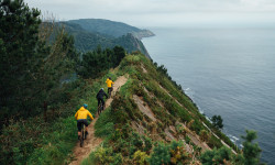
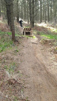
Popular Elorrio Mountain Biking Trails
• 90 ★ 4.8 • 4,518 ft • 18 ft • 55 •
Divertida bajada con un par de tramos de pedaleo al inicio. Muy noble, tan solo un paso puntual de roca donde hay que ir con un poco de cuidado. En el resto, puro flow donde se va rápido incluso a vista.
• 100 ★ 3.5 • 509 ft • 0 ft • 36 •
Pequeña senda que alternativa a la pista principal. En el sentido prpuesto tiene un pequeño salto en la bajada
• 80 ★ 5.0 • 2 miles • 344 ft • 33 •
Comenzaremos por una pista , que luego acabara siendo un precioso sendero. Nos llevara a la hasta Besaide. Un monumento que es donde están las tres provincias . También nos podremos ir a las bajadas de la zona de Elorrio.
• 70 ★ 0.0 • 1,273 ft • 186 ft • 32 •
Complicado remonte desde el final de las 3 bajadas de para recuperar cota sin tener que bajar a las obras del TAV. Es un sendero muy húmedo con tramos de piedra en el que solo los ebikers más habilidosos podrán llegar arriba sin...
• 70 ★ 4.8 • 3,799 ft • 32 ft • 31 •
Divertida bajada a través de pinar que va de menos a más. Empieza suave, con curveo con flow, poca pendiente y con saltos a los que se puede dar a vista, pero en la última parte la pendiente aumenta considerablemente y hay que hilar...
• 35 ★ 0.0 • 2,126 ft • 20 ft • 28 •
Single track corto y divertido que bordea la cima de Besaide
Elorrio Mountain Bike Routes
★ 5.0 • 18 miles • 4,457 ft • 10 • Loop •
Ruta all-mountain con impresionantes senderos de subida y bajada que atraviesa las zonas de Udala, Besaide...
★ 5.0 • 20 miles • 5,291 ft • 4 • Loop •
Las principales bajadas endureras del monte enlazadas
Photos of Elorrio Mountain Bike
Videos of Elorrio Mountain Bike
trail: Amurdi
0:07 |
265 |
Mar 15, 2021
0:23 |
26 |
Apr 13, 2025
Recent Trail Reports
| status | trail | date | condition | info | user |
|---|---|---|---|---|---|
| Otalorea | Jun 16, 2026 @ 5:27pm (Europe/Madrid) 1 day | Dry | etxanizmtb | ||
| Atxondoko Bariantea | May 28, 2026 @ 3:09pm (Europe/Madrid) May 28, 2026 | Dry | IvanbasurdeYT | ||
| Salida Arantzeta | May 28, 2026 @ 3:09pm (Europe/Madrid) May 28, 2026 | Dry | IvanbasurdeYT | ||
| Arantzeta | May 28, 2026 @ 3:09pm (Europe/Madrid) May 28, 2026 | Dry | IvanbasurdeYT | ||
| Larragain | May 28, 2026 @ 3:09pm (Europe/Madrid) May 28, 2026 | Dry | IvanbasurdeYT | ||
| Besaiderarte | May 10, 2026 @ 9:09am (Europe/Madrid) May 10, 2026 | Ideal | IBE1985 | ||
| Acceso Memaia | May 10, 2026 @ 9:09am (Europe/Madrid) May 10, 2026 | Ideal | IBE1985 | ||
| Atxondo - Cruce Axpe/Tope | May 10, 2026 @ 9:09am (Europe/Madrid) May 10, 2026 | Ideal | IBE1985 | ||
| Besaide monumentu zaharra | Feb 14, 2026 @ 8:58am (Europe/Madrid) Feb 13, 2026 | Wet | IBE1985 | ||
| Besaisbide | Feb 7, 2026 @ 3:48pm (Europe/Madrid) Feb 7, 2026 | Variable | Echaniz BASAMTB |
Activity Feed
| username | action | type | title | date |
|---|---|---|---|---|
| etxanizmtb | add | report | activity #97112489 | Jun 16, 2026 @ 8:28am 1 day |
| IvanbasurdeYT | add | report | activity #95838111 | May 30, 2026 @ 4:30am May 30, 2026 |
| IvanbasurdeYT | add | report | activity #95838108 and 3 more | May 30, 2026 @ 4:30am May 30, 2026 |
| ioritz | wishlist | route | activity #95031723 | May 19, 2026 @ 4:37am May 19, 2026 |
| IBE1985 | add | report | activity #94479660 and 2 more | May 10, 2026 @ 11:06pm May 10, 2026 |
Recent Comments
| username | type | title | comment | date |
|---|---|---|---|---|
| trail | Gracias por el comentario, pero para la... | Aug 18, 2025 @ 1:20pm Aug 18, 2025 | ||
| trail | Ha desaparecido por la entresaca | Aug 18, 2025 @ 4:42am Aug 18, 2025 | ||
| trail | Ultimo tramo imbajanle por la vegetacion | Aug 17, 2025 @ 2:29am Aug 17, 2025 | ||
| trail | Superior ha desaparecido por entresaca | Aug 17, 2025 @ 1:53am Aug 17, 2025 | ||
| report | Modificado | Feb 22, 2025 @ 12:23pm Feb 22, 2025 |
Local Badges
-

Epic Mountain Bike Climb 2k25 awarded -

Climbing 10k Badge13 awarded -

Mountain Biking 100k Badge0 awarded -

Epic Ride Descent 2k25 awarded -

Descent 10k Badge13 awarded -

Descent 100k Badge0 awarded
Bike & Skill Parks
| name | type | city | rating |
|---|---|---|---|
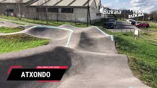
| PumpTrack Atxondo | skill park | Elorrio |
Activity Type Stats
| activitytype | trails | distance | descent | descent distance | total vertical | rating | global rank | state rank | photos | reports | routes | ridelogs |
|---|---|---|---|---|---|---|---|---|---|---|---|---|
| Mountain Bike | 51 | 39 miles | 10,476 ft | 18 miles | 1,709 ft | #4,405 | #275 | 20 | 271 | 2 | 1,552 | |
| E-Bike | 53 | 39 miles | 10,476 ft | 18 miles | 1,709 ft | #3,194 | #357 | 267 | 2 | 224 | ||
| Horse | 12 | 5 miles | 955 ft | 2 miles | 909 ft | #2,473 | #205 | 6 | ||||
| Hike | 51 | 39 miles | 10,394 ft | 18 miles | 2,192 ft | #5,152 | #334 | 261 | 67 | |||
| Trail Running | 50 | 38 miles | 10,390 ft | 18 miles | 2,192 ft | #4,688 | #332 | 261 | 21 |
Frequently Asked Questions About Elorrio
▼
What are the best places to ride in Elorrio?
Elorrio has 1 areas to explore for mountain biking. The top rated areas are:
▼
What are the highest rated mountain biking trails in Elorrio?
The highest rated mountain biking trails in Elorrio are:
- Amurdi (4.3/5)
- Otalorea (4.3/5)
- Arantzeta (4.2/5)
- Errekazabaleta Inferior (4.2/5)
- Besaisbide (4.1/5)
▼
What is the best time of the year to ride in Elorrio?
Based on ride log data, the most popular months to ride in Elorrio are:
- October (11 activities)
- September (10 activities)
- November (9 activities)
▼
Where can I park to ride in Elorrio?
Check the Elorrio trail map for trailhead and parking information. Community members regularly update access and parking details for trails in the area.
Activities
Trails
Points of Interest
- By olasolo & contributors
- Admins: Altavoz, krasty1002, Altavoz, krasty1002
- #38535 - 1,292 views
- elorrio activity log | embed map of Elorrio mountain bike trails | elorrio mountain biking points of interest
Downloading of trail gps tracks in kml & gpx formats is enabled for Elorrio.
You must login to download files.