close
-
Layers w
- Weather Layers
- Pro
- Pro
- Pro
- Pro
- Pro
- Pro
- More Layers
- Pro
- Pro
- Pro
- Pro
-
Upgrade to

3D
Trail Conditions
- Unknown
- Snow Groomed
- Snow Packed
- Snow Covered
- Snow Cover Partial
- Freeze/thaw Cycle
- Icy
- Prevalent Mud
- Wet
- Variable
- Ideal
- Dry
- Very Dry
Trail Flow (Ridden Direction)
Trailforks scans users ridelogs to determine the most popular direction each trail is ridden. A good flowing trail network will have most trails flowing in a single direction according to their intension.
The colour categories are based on what percentage of riders are riding a trail in its intended direction.
The colour categories are based on what percentage of riders are riding a trail in its intended direction.
- > 96%
- > 90%
- > 80%
- > 70%
- > 50%
- < 50%
- bi-directional trail
- no data
Trail Last Ridden
Trailforks scans ridelogs to determine the last time a trail was ridden.
- < 2 days
- < 1 week
- < 2 weeks
- < 1 month
- < 6 months
- > 6 months
Trail Ridden Direction
The intended direction a trail should be ridden.
- Downhill Only
- Downhill Primary
- Both Directions
- Uphill Primary
- Uphill Only
- One Direction
Contribute Details
Colors indicate trail is missing specified detail.
- Description
- Photos
- Description & Photos
- Videos
Trail Popularity ?
Trailforks scans ridelogs to determine which trails are ridden the most in the last 9 months.
Trails are compared with nearby trails in the same city region with a possible 25 colour shades.
Think of this as a heatmap, more rides = more kinetic energy = warmer colors.
- most popular
- popular
- less popular
- not popular
ATV/ORV/OHV Filter
Max Vehicle Width
inches
US Cell Coverage
Legend

Radar Time
Activity Recordings
Trailforks uses anonymized public activity data.
?
Activity Recordings
Trailforks uses anonymized public activity data.
?
Personal Heatmap
▶
Activity Types
all
/
none
▶
Options
2
Date range
month
–
Winter Trails
Warning
A routing network for winter maps does not exist. Selecting trails using the winter trails layer has been disabled.
Missing Trails
Most Popular
Least Popular
Trails are colored based on popularity. The more popular a trail is, the more red. Less popular trails trend towards green.
Jump Magnitude Heatmap
Heatmap of where riders jump on trails. Zoom in to see individual jumps, click circles to view jump details.
BC Backroad Status
![map legend]()
Service Road Atlas is a free to use, community-driven service for viewing and creating reports on the numerous back-country service roads around B.C. and Alberta.

Slope Aspect
Direction the slope faces
Trails Deemphasized
Trails are shown in grey.
Only show trails with no bike usage.
Suggested Layers
Based on selected activity type
Save the current map location and zoom level as your default home location whenever this page is loaded.
SaveThese trails are separate from Beech Mountain and there is No Lift Access.
The Emerald Outback @ Beech Mountain is a 7-mile trail park open to the public year round. The trails are maintained by the Town of Beech Mountain and criss-cross the mountaintop. These trails are separate from Beech Mountain and there is No Lift Access.
USA Cycling hosted its 2013 and 2014 collegiate national championships at the Emerald Outback, which is fast becoming one of the premier mountain biking locations in the Southeast. It's also a great destination for hiking and trail running.
The Emerald Outback is comprised of double track, single track, grassy areas and dirt/gravel roads, ranging from 4,700 to 5,400 feet in elevation, which makes the Outback one of the highest mountain biking trail systems on the East Coast.
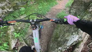
Several miles are single track, described as “typical rocky, rooty, East Coast mountain biking single track.”
Trails are free and open to the public seven days a week. Riders and hikers must register at the Beech Mountain Visitor Center before proceeding to the trails.
The Emerald Outback @ Beech Mountain is a 7-mile trail park open to the public year round. The trails are maintained by the Town of Beech Mountain and criss-cross the mountaintop. These trails are separate from Beech Mountain and there is No Lift Access.
USA Cycling hosted its 2013 and 2014 collegiate national championships at the Emerald Outback, which is fast becoming one of the premier mountain biking locations in the Southeast. It's also a great destination for hiking and trail running.
The Emerald Outback is comprised of double track, single track, grassy areas and dirt/gravel roads, ranging from 4,700 to 5,400 feet in elevation, which makes the Outback one of the highest mountain biking trail systems on the East Coast.
Several miles are single track, described as “typical rocky, rooty, East Coast mountain biking single track.”
Trails are free and open to the public seven days a week. Riders and hikers must register at the Beech Mountain Visitor Center before proceeding to the trails.
source: Beech Mountain-Emerald Outback
Primary Trail Type: Cross-Country
AKA: EMO
Land Manager: Beech Mountain
 google parking directions
Links
Region Supporters & Maintainers
![Beech Mountain]()
Beech MountainMaintainer
Activities Click to view
- Mountain Bike
17 trails
- E-Bike
5 trails
- Hike
15 trails
- Trail Running
15 trails
Region Details
- 3
- 2
- 7
- 4
- 1
Region Status
Open as of Jun 4, 2026Stats
- Avg Trail Rating
- Trails (view details)
- 17
- Trails Mountain Bike
- 17
- Trails E-Bike
- 5
- Trails Hike
- 15
- Trails Trail Running
- 15
- Trails Snowshoe
- 2
- Total Distance
- 9 miles
- Total Descent
- 2,124 ft
- Total Vertical
- 783 ft
- Highest Trailhead
- 5,325 ft
- Reports
- 119
- Photos
- 71
- Ridden Counter
- 2,053
Popular Emerald Outback Mountain Biking Trails
• 95 ★ 3.5 • 1 mile • 95 ft • 302 •
Popular blue difficulty singletrack. This multi-use trail can be used downhill primary and has a moderate overall physical rating. It features jump. On average it takes 12 minutes to complete this trail.
• 90 ★ 2.8 • 2,313 ft • 29 ft • 222 •
Popular blue difficulty singletrack. This multi-use trail. On average it takes 6 minutes to complete this trail.
• 100 ★ 4.2 • 2,257 ft • 31 ft • 210 •
Highly rated popular black diamond difficulty singletrack. This mountain bike primary trail can be used downhill only and has a easy overall physical rating with a 31 ft green climb. It features berm, drop, jump, gap jump, rock face and rock garden. Trail visibility is always easy to follow. On average it takes 3 minutes to complete this trail.
• 85 ★ 2.9 • 1 mile • 187 ft • 198 •
Popular black diamond difficulty singletrack. This multi-use trail. On average it takes 14 minutes to complete this trail.
• 80 ★ 3.5 • 4,806 ft • 67 ft • 190 •
Popular black diamond difficulty singletrack. This multi-use trail. On average it takes 16 minutes to complete this trail.
• 65 ★ 2.7 • 1,467 ft • 67 ft • 179 •
From the intersection of and . Gradual downhill single track, there is quite a bit of rain on Beech Mountain; it is not too treacherous but be on your toes.
• 100 ★ 4.4 • 1,886 ft • 51 ft • 150 •
This trail is short but fun, super fast and flowy with some decent sized jumps. Mainly clay based so avoid riding after large rains.
• 80 ★ 4.0 • 1,650 ft • 5 ft • 70 •
Popular black diamond difficulty singletrack. This mountain bike primary trail can be used downhill only. It features drop. Trail visibility is always easy to follow. On average it takes 5 minutes to complete this trail.
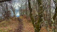
Photos of Emerald Outback Mountain Bike
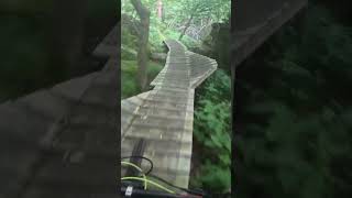
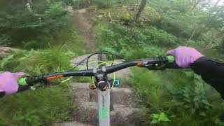
Videos of Emerald Outback Mountain Bike
trail: Ruby Slippers
0:59 |
123 |
Apr 28, 2023
youtuber
![Emerald Outback | Beech Mountain | MTB POV]()
7:44 |
85 |
Feb 15, 2026
trail: Ruby Slippers
0:47 |
89 |
Dec 23, 2024 , Beech Mountain
trail: Ruby Slippers
3:49 |
120 |
Oct 17, 2024 , Beech Mountain

trail: Witches Tail
0:06 |
214 |
Sep 3, 2024 , Beech Mountain
trail: Southern Ridge
8:01 |
134 |
Aug 19, 2024 , Beech Mountain

trail: Witches Backbone
4:08 |
135 |
Jul 1, 2024 , Beech Mountain

trail: OZ Forest Run
7:49 |
227 |
Jun 24, 2024 , Beech Mountain
Recent Trail Reports
| status | trail | date | condition | info | user |
|---|---|---|---|---|---|
| OZ Forest Run | Jun 4, 2026 @ 6:09pm (America/New_York) Jun 4, 2026 | Ideal | DZig | ||
| Jackalope's Trail | May 15, 2026 @ 2:56pm (America/New_York) May 15, 2026 | Ideal | caleb93 | ||
| Northview | May 15, 2026 @ 2:56pm (America/New_York) May 15, 2026 | Ideal | caleb93 | ||
| Witches Backbone | May 15, 2026 @ 2:56pm (America/New_York) May 15, 2026 | Ideal | caleb93 | ||
| Ruby Slippers | May 15, 2026 @ 2:56pm (America/New_York) May 15, 2026 | Ideal | caleb93 | ||
| Southern Ridge | May 15, 2026 @ 2:56pm (America/New_York) May 15, 2026 | Ideal | caleb93 | ||
| Wizard's Way | May 15, 2026 @ 2:56pm (America/New_York) May 15, 2026 | Ideal | caleb93 | ||
| Totos Trot | May 15, 2026 @ 2:56pm (America/New_York) May 15, 2026 | Ideal | caleb93 | ||
| Jackalope Connector | Jun 4, 2025 @ 10:54am Jun 4, 2025 | Ideal | ThomasMcComb | ||
| Witches Tail | May 24, 2025 @ 1:01pm May 24, 2025 | Ideal | caleb93 |
Activity Feed
| username | action | type | title | date |
|---|---|---|---|---|
| DZig | add | karma | activity #96255801 | Jun 4, 2026 @ 3:31pm Jun 4, 2026 |
| DZig | add | report | activity #96254583 | Jun 4, 2026 @ 3:09pm Jun 4, 2026 |
| DZig | ridden | trail | activity #96254283 and 1 more | Jun 4, 2026 @ 3:05pm Jun 4, 2026 |
| caleb93 | add | report | activity #94943818 and 7 more | May 17, 2026 @ 3:09pm May 17, 2026 |
| JeffVUFrEz | wishlist | trail | activity #94241511 and 1 more | May 7, 2026 @ 2:29pm May 7, 2026 |
Recent Comments
| username | type | title | comment | date |
|---|---|---|---|---|
| trail | If you are riding this up from the Oz Run... | Jun 13, 2025 @ 2:03pm Jun 13, 2025 | ||
| report | My bad commented through my pocket | Jun 8, 2025 @ 11:19am Jun 8, 2025 | ||
| report | wxha a. K deaa we s saws s so as e e z Ac... | Jun 8, 2025 @ 11:19am Jun 8, 2025 | ||
| trail | I think it might have been perfect dirt. | Apr 24, 2024 @ 12:54pm Apr 24, 2024 | ||
| trail | trail is running super! | Oct 5, 2023 @ 8:22am Oct 5, 2023 |
Nearby Areas
| name | distance | ||||
|---|---|---|---|---|---|
| Beech Mountain Bike Park | 3 | 8 | 2 | 1 | 0.6 km |
| Lees–McRae College | 1 | 2 | 2 | 2.8 km | |
| Sugar Mountain Resort | 1 | 3 | 1 | 2 | 4.5 km |
| Moses H. Cone Memorial Park | 1 | 11.4 km | |||
| Roan Mountain State Park | 5 | 11.7 km |
Bike & Skill Parks
| name | type | city | rating |
|---|---|---|---|
| Emerald Outback Skillpark | skill park | Beech Mountain |
Activity Type Stats
| activitytype | trails | distance | descent | descent distance | total vertical | rating | global rank | state rank | photos | reports | routes | ridelogs |
|---|---|---|---|---|---|---|---|---|---|---|---|---|
| Mountain Bike | 17 | 9 miles | 2,123 ft | 5 miles | 784 ft | #7,199 | #2,756 | 71 | 119 | 1,160 | ||
| E-Bike | 5 | 2 miles | 154 ft | 2,943 ft | 207 ft | #7,967 | #2,424 | 112 | 32 | |||
| Hike | 15 | 8 miles | 1,932 ft | 4 miles | 784 ft | #10,810 | #4,306 | 117 | 101 | |||
| Trail Running | 15 | 8 miles | 1,932 ft | 4 miles | 784 ft | #9,903 | #3,641 | 117 | 53 | |||
| Snowshoe | 2 | 1 mile | 230 ft | 3,776 ft | 157 ft | 1 |
Frequently Asked Questions About Emerald Outback
▼
What are the highest rated mountain biking trails in Emerald Outback?
The highest rated mountain biking trails in Emerald Outback are:
- Witches Tail (4.1/5)
- Witches Backbone (4.1/5)
- Ruby Slippers (4/5)
- Southern Ridge (3.7/5)
- OZ Forest Run (3.7/5)
▼
What is the best time of the year to ride in Emerald Outback?
Based on ride log data, the most popular months to ride in Emerald Outback are:
- July (25 activities)
- June (21 activities)
- August (19 activities)
▼
Where can I park to ride in Emerald Outback?
There are 1 parking locations listed in Emerald Outback. The most popular parking spots are:
▼
What is the longest trail in Emerald Outback?
The longest trail in Emerald Outback is Jackalope's Trail at 1.1 miles. View all trails sorted by distance.
Activities
- By caleb93
 & contributors
 - Admins: apply
- #4140 - 9,430 views
- emerald outback activity log | embed map of Emerald Outback mountain bike trails | emerald outback mountain biking points of interest
Downloading of trail gps tracks in kml & gpx formats is enabled for Emerald Outback.
You must login to download files.