close
-
Layers w
- Weather Layers
- Pro
- Pro
- Pro
- Pro
- Pro
- Pro
- More Layers
- Pro
- Pro
- Pro
- Pro
-
Upgrade to

3D
Trail Conditions
- Unknown
- Snow Groomed
- Snow Packed
- Snow Covered
- Snow Cover Partial
- Freeze/thaw Cycle
- Icy
- Prevalent Mud
- Wet
- Variable
- Ideal
- Dry
- Very Dry
Trail Flow (Ridden Direction)
Trailforks scans users ridelogs to determine the most popular direction each trail is ridden. A good flowing trail network will have most trails flowing in a single direction according to their intension.
The colour categories are based on what percentage of riders are riding a trail in its intended direction.
The colour categories are based on what percentage of riders are riding a trail in its intended direction.
- > 96%
- > 90%
- > 80%
- > 70%
- > 50%
- < 50%
- bi-directional trail
- no data
Trail Last Ridden
Trailforks scans ridelogs to determine the last time a trail was ridden.
- < 2 days
- < 1 week
- < 2 weeks
- < 1 month
- < 6 months
- > 6 months
Trail Ridden Direction
The intended direction a trail should be ridden.
- Downhill Only
- Downhill Primary
- Both Directions
- Uphill Primary
- Uphill Only
- One Direction
Contribute Details
Colors indicate trail is missing specified detail.
- Description
- Photos
- Description & Photos
- Videos
Trail Popularity ?
Trailforks scans ridelogs to determine which trails are ridden the most in the last 9 months.
Trails are compared with nearby trails in the same city region with a possible 25 colour shades.
Think of this as a heatmap, more rides = more kinetic energy = warmer colors.
- most popular
- popular
- less popular
- not popular
ATV/ORV/OHV Filter
Max Vehicle Width
inches
US Cell Coverage
Legend

Radar Time
Activity Recordings
Trailforks uses anonymized public activity data.
?
Activity Recordings
Trailforks uses anonymized public activity data.
?
Personal Heatmap
▶
Activity Types
all
/
none
▶
Options
2
Date range
month
–
Winter Trails
Warning
A routing network for winter maps does not exist. Selecting trails using the winter trails layer has been disabled.
Missing Trails
Most Popular
Least Popular
Trails are colored based on popularity. The more popular a trail is, the more red. Less popular trails trend towards green.
Jump Magnitude Heatmap
Heatmap of where riders jump on trails. Zoom in to see individual jumps, click circles to view jump details.
BC Backroad Status
![map legend]()
Service Road Atlas is a free to use, community-driven service for viewing and creating reports on the numerous back-country service roads around B.C. and Alberta.

Slope Aspect
Direction the slope faces
Trails Deemphasized
Trails are shown in grey.
Only show trails with no bike usage.
Suggested Layers
Based on selected activity type
Save the current map location and zoom level as your default home location whenever this page is loaded.
SaveThis riding area stretches from Bielsko-Biala to Wilkowice and Szczyrk, with two Gondola lifts and dozens of trails it is most likely the biggest Trail Park or Bike Park in this part of Europe. EnjoY
Primary Trail Type: All-Mountain & Downhill
eBikes Allowed:
Yes
 google parking directions
Links
This region uses the Uk/Euro style trail grading system.
Activities Click to view
- Mountain Bike
31 trails
- E-Bike
25 trails
- Hike
11 trails
- Trail Running
11 trails
- Backcountry Ski
0 trails
Bike Park Details
- 7
- 6
- 3
- 9
- 3
Region Status
Open as of Jun 9, 2026- Day Ticket
- zł59 PLN
- Uplift Type
- Gondola
- Season start
- Apr 3
- Season end
- Nov 3
Stats
- Avg Trail Rating
- Trails (view details)
- 28
- Trails Mountain Bike
- 31
- Trails E-Bike
- 25
- Trails Hike
- 11
- Trails Trail Running
- 11
- Total Distance
- 28 miles
- Total Descent
- 11,940 ft
- Total Vertical
- 2,216 ft
- Highest Trailhead
- 3,504 ft
- Reports
- 1,553
- Photos
- 486
- Ridden Counter
- 25,479
Popular Enduro Trails Bielsko-Biała Trails
• 100 ★ 4.7 • 3 miles • 180 ft • 1,596 •
Najdłuższa i najbardziej urozmaicona trasa w kompleksie. Zaczyna się przy górnej stacji kolei gondolowej na Szyndzielni i zjeżdża na Przełęcz Sipa (Kozia) i dalej prowadzi krótkim podjazdem do schroniska na Koziej Górze (stąd...
• 100 ★ 4.5 • 2 miles • 41 ft • 1,592 •
Niezbyt stroma, ale bardzo zakręcona ścieżka. Zaczyna się na wschodnim wierzchołku Koziej Góry, dojazd w to miejsce trwa około 45min od centrum ścieżek. Kończy się na Ul. Modrej (5 min od centrum). Poradzi sobie na niej...
• 95 ★ 4.5 • 738 ft • 40 ft • 1,276 •
Highly rated popular green difficulty singletrack. This mountain bike primary trail can be used uphill only and has a easy overall physical rating with a 40 ft green climb. On average it takes 1 minutes to complete this trail.
• 90 ★ 4.6 • 2 miles • 0 ft • 1,057 •
Naturalna, kręta i raczej niezbyt szybka ścieżka z dużą ilością śliskich korzeni i innych przeszkód – mimo to dosyć płynna. W dolnej części jest sporo muld tworzących naturalny „pumptrack”. Zaczyna się na szczycie...
• 80 ★ 4.6 • 1 mile • 10 ft • 1,010 •
Ścieżka posiada sporo naturalnych i sztucznych elementów, np. słynna sekcja korzeni, muldy, bandy i niewielkie wybicia („hopki”). Zaczyna się niedaleko od schroniska, przy starym torze saneczkowym (około 45min od centrum...
• 85 ★ 4.8 • 3 miles • 930 ft • 956 •
Łagodnie wijąca się ścieżka podjazdowa, która znacznie przyjemniej i ciekawiej pozwoli wjechać na szczyt Koziej Góry niż nudna droga szutrowa. W dolnej części ułożonych jest z kamieni parę technicznych skrótów dla...
• 90 ★ 4.5 • 1 mile • 21 ft • 915 •
The Trail was opened in 2019. It starts after about 600m of the trail, at first it is machine groomed, A-line type of a trail (quite big tables,berms and doubles, but nothing extreme), then it transforms into a natural but flowy...
Mountain Bike Routes
18 miles • 4,213 ft • 5 • Loop •
All Mountain e-bike one day trip. I used several local trails. I'd rate it as a little above average...
27 miles • 5,536 ft • 0 • Loop •
This starts basically from top of the cablecar. It has two climbing sections; first one is about 1.9 km in...
22 miles • 5,994 ft • 6 • Race •
UCI Enduro World Cup athletes will be in Bielsko-Biała, Poland on the 16-18 May, for the second round of...
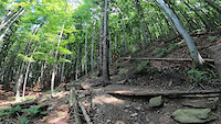
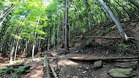
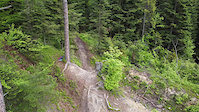
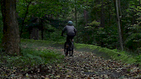
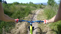
Photos of Enduro Trails Bielsko-Biała Mountain Bike
Videos of Enduro Trails Bielsko-Biała Mountain Bike
trail: Dziabar
0:11 |
160 |
Jun 26, 2021
trail: Dziabar
0:11 |
|
Jun 26, 2021

trail: Dziabar
0:11 |
|
Jun 26, 2021

trail: Twister
2:49 |
81 |
Jun 15, 2021
trail: Borówa
0:09 |
237 |
May 25, 2021
trail: Stary Zielony
0:55 |
110 |
May 25, 2020
trail: Cygan
2:10 |
68 |
Oct 16, 2019
trail: Stary Zielony
6:37 |
98 |
Jul 2, 2019
Current Trail Warnings
| status | trail | date | condition | user | info |
|---|---|---|---|---|---|
| ROCKnRolla | Jun 9, 2026 @ 9:57am (Europe/Warsaw) Jun 9, 2026 | Dry | RadoslawMsbxd6 | Trasa już nie jest flow. Ostatni remont... |
Recent Trail Reports
| status | trail | date | condition | info | user |
|---|---|---|---|---|---|
| Przez Cygana | Jun 6, 2026 @ 10:45am (Europe/Warsaw) Jun 6, 2026 | Wet | PiotrJaniak | ||
| Czarownica aka The Witch | May 17, 2026 @ 3:54pm (Europe/Warsaw) May 17, 2026 | Unknown | marcinxdpl | ||
| Borówa | May 17, 2026 @ 3:54pm (Europe/Warsaw) May 17, 2026 | Unknown | marcinxdpl | ||
| Szarpi | Apr 26, 2026 @ 3:58pm (Europe/Bratislava) Apr 26, 2026 | Ideal | papelz | ||
| Cyganka | Apr 25, 2026 @ 3:19pm (Europe/Warsaw) Apr 25, 2026 | Ideal | MichalxC1XkC | ||
| Dębowiec | Nov 29, 2025 @ 11:55am (Europe/Warsaw) Nov 29, 2025 | Snow Cover Partial | Spaff | ||
| Cygan | Oct 26, 2025 @ 10:26am (Europe/Warsaw) Oct 26, 2025 | Wet | rybard | ||
| Twister | Oct 15, 2025 @ 5:58pm (Europe/Bratislava) Oct 15, 2025 | Wet | JurajKEYrhI | ||
| Przez Cygański Las | Sep 30, 2025 @ 1:48pm (Europe/Warsaw) Sep 30, 2025 | Ideal | r85 | ||
| Stefanka | Sep 30, 2025 @ 1:48pm (Europe/Warsaw) Sep 30, 2025 | Ideal | r85 |
Activity Feed
| username | action | type | title | date |
|---|---|---|---|---|
| jakobjs | wishlist | trail | activity #97203481 | Jun 17, 2026 @ 12:35pm 15 hours |
| kactek | ridden | trail | activity #97192248 and 1 more | Jun 17, 2026 @ 10:03am 17 hours |
| kactek | ridden | trail | activity #96852801 | Jun 13, 2026 @ 12:53am Jun 13, 2026 |
| SebChoski | ridden | trail | activity #96755666 and 4 more | Jun 11, 2026 @ 12:33pm Jun 11, 2026 |
| RadoslawMsbxd6 | add | report | activity #96590479 | Jun 9, 2026 @ 12:57am Jun 9, 2026 |
Recent Comments
| username | type | title | comment | date |
|---|---|---|---|---|
| trail | Fajna szybka i przyjemna trasa. | Apr 25, 2026 @ 6:18am Apr 25, 2026 | ||
| trail | To jest trasa dla grzybiarzy, nie dla... | Oct 26, 2025 @ 10:57am Oct 26, 2025 | ||
| trail | Niesamowicie fajna trasa. Dla początkujących... | Sep 26, 2025 @ 10:52am Sep 26, 2025 | ||
| trail | Niesamowicie fajna trasa. Dla początkujących... | Sep 26, 2025 @ 10:51am Sep 26, 2025 | ||
| trail | Trochę odgruzowałem dzisiaj gałęzi z... | Mar 9, 2025 @ 4:04am Mar 9, 2025 |
Nearby Areas
| name | distance | ||||
|---|---|---|---|---|---|
| Magurka Wilkowicka | 2.7 km | ||||
| Straconka Elduro | 5 | 3 | 3.3 km | ||
| Międzybrodzie Bialskie | 4 | 6.2 km | |||
| Enduro Trails Szczyrk | 1 | 2 | 6.3 km | ||
| PKL Bike Park Góra Żar | 1 | 1 | 7.5 km |
Local Badges
-

Completionist8 awarded
Activity Type Stats
| activitytype | trails | distance | descent | descent distance | total vertical | rating | global rank | state rank | photos | reports | routes | ridelogs |
|---|---|---|---|---|---|---|---|---|---|---|---|---|
| Mountain Bike | 31 | 28 miles | 11,939 ft | 18 miles | 2,218 ft | #315 | #4 | 482 | 1,547 | 3 | 26,748 | |
| E-Bike | 25 | 26 miles | 11,007 ft | 16 miles | 1,847 ft | #142 | #16 | 4 | 1,398 | 1 | 4,492 | |
| Hike | 11 | 9 miles | 2,372 ft | 4 miles | 2,195 ft | #1,639 | #25 | 1,218 | 943 | |||
| Trail Running | 11 | 9 miles | 2,372 ft | 4 miles | 2,195 ft | #1,064 | #14 | 1,218 | 373 |
Frequently Asked Questions About Enduro Trails Bielsko-Biała
▼
What are the highest rated mountain biking trails in Enduro Trails Bielsko-Biała?
The highest rated mountain biking trails in Enduro Trails Bielsko-Biała are:
- Dziabar (4.7/5)
- TW+ (4.7/5)
- Borówa (4.6/5)
- Daglezjowy (4.6/5)
- Cyganka (4.6/5)
▼
What is the best time of the year to ride in Enduro Trails Bielsko-Biała?
Based on ride log data, the most popular months to ride in Enduro Trails Bielsko-Biała are:
- July (226 activities)
- August (192 activities)
- June (169 activities)
▼
Where can I park to ride in Enduro Trails Bielsko-Biała?
There are 1 parking locations listed in Enduro Trails Bielsko-Biała. The most popular parking spots are:
▼
What is the longest trail in Enduro Trails Bielsko-Biała?
The longest trail in Enduro Trails Bielsko-Biała is ROCKnRolla at 2.7 miles. View all trails sorted by distance.
Activities
Trails
- Hard trails in Enduro Trails Bielsko-Biała
- Easy trails in Enduro Trails Bielsko-Biała
- Favorite trails in Enduro Trails Bielsko-Biała
- Most ridden trails in Enduro Trails Bielsko-Biała
- Singletrack in Enduro Trails Bielsko-Biała
- Viewpoint trails in Enduro Trails Bielsko-Biała
- Trails with technical features in Enduro Trails Bielsko-Biała
- Race routes in Enduro Trails Bielsko-Biała
- By micolai
 TRAILFORKS Poland & contributors
 - Admins: Ecoriders, WŚ
- #25271 - 32,550 views
- enduro trails bielsko-biała activity log | embed map of Enduro Trails Bielsko-Biała mountain bike trails | enduro trails bielsko-biała mountain biking points of interest
Downloading of trail gps tracks in kml & gpx formats is enabled for Enduro Trails Bielsko-Biała.
You must login to download files.