close
-
Layers w
- Weather Layers
- Pro
- Pro
- Pro
- Pro
- Pro
- Pro
- More Layers
- Pro
- Pro
- Pro
- Pro
-
Upgrade to

3D
Trail Conditions
- Unknown
- Snow Groomed
- Snow Packed
- Snow Covered
- Snow Cover Partial
- Freeze/thaw Cycle
- Icy
- Prevalent Mud
- Wet
- Variable
- Ideal
- Dry
- Very Dry
Trail Flow (Ridden Direction)
Trailforks scans users ridelogs to determine the most popular direction each trail is ridden. A good flowing trail network will have most trails flowing in a single direction according to their intension.
The colour categories are based on what percentage of riders are riding a trail in its intended direction.
The colour categories are based on what percentage of riders are riding a trail in its intended direction.
- > 96%
- > 90%
- > 80%
- > 70%
- > 50%
- < 50%
- bi-directional trail
- no data
Trail Last Ridden
Trailforks scans ridelogs to determine the last time a trail was ridden.
- < 2 days
- < 1 week
- < 2 weeks
- < 1 month
- < 6 months
- > 6 months
Trail Ridden Direction
The intended direction a trail should be ridden.
- Downhill Only
- Downhill Primary
- Both Directions
- Uphill Primary
- Uphill Only
- One Direction
Contribute Details
Colors indicate trail is missing specified detail.
- Description
- Photos
- Description & Photos
- Videos
Trail Popularity ?
Trailforks scans ridelogs to determine which trails are ridden the most in the last 9 months.
Trails are compared with nearby trails in the same city region with a possible 25 colour shades.
Think of this as a heatmap, more rides = more kinetic energy = warmer colors.
- most popular
- popular
- less popular
- not popular
ATV/ORV/OHV Filter
Max Vehicle Width
inches
US Cell Coverage
Legend

Radar Time
Activity Recordings
Trailforks uses anonymized public activity data.
?
Activity Recordings
Trailforks uses anonymized public activity data.
?
Personal Heatmap
▶
Activity Types
all
/
none
▶
Options
2
Date range
month
–
Winter Trails
Warning
A routing network for winter maps does not exist. Selecting trails using the winter trails layer has been disabled.
Missing Trails
Most Popular
Least Popular
Trails are colored based on popularity. The more popular a trail is, the more red. Less popular trails trend towards green.
Jump Magnitude Heatmap
Heatmap of where riders jump on trails. Zoom in to see individual jumps, click circles to view jump details.
BC Backroad Status
![map legend]()
Service Road Atlas is a free to use, community-driven service for viewing and creating reports on the numerous back-country service roads around B.C. and Alberta.

Slope Aspect
Direction the slope faces
Trails Deemphasized
Trails are shown in grey.
Only show trails with no bike usage.
Suggested Layers
Based on selected activity type
Save the current map location and zoom level as your default home location whenever this page is loaded.
SavePopular Trail Networks
view all areas »
No description for England has been added yet!
Login or register to submit one.
This region uses the Uk/Euro style trail grading system.
Stats
- Avg Trail Rating
- Trails (view details)
- 8,113
- Trails Mountain Bike
- 7,312
- Trails E-Bike
- 4,571
- Trails Gravel Bike
- 836
- Trails Adaptive Bike
- 1,127
- Trails Winter Fat Bike
- 1,181
- Trails Horse
- 1,402
- Trails Hike
- 6,487
- Trails Trail Running
- 6,508
- Trails Dirtbike/Moto
- 63
- Trails Observed Trials
- 20
- Trails ATV/ORV/OHV
- 43
- Trails Snowmobile
- 3
- Trails Snowshoe
- 5
- Trails Downhill Ski
- 5
- Trails Backcountry Ski
- 5
- Trails Nordic Ski
- 8
- Total Distance
- 4,808 miles
- Total Descent
- 784,173 ft
- Total Vertical
- 3,089 ft
- Highest Trailhead
- 3,090 ft
- Reports
- 51,677
- Photos
- 23,774
- Ridden Counter
- 1,344,218
Articles

Connor Hudson & Jake Hart Split Wins at British 4X Series Rounds 3 & 4
Jun 10, 2026 from pinkbike.com
The Schwalbe British 4X Series headed to Falmouth Bike Park in Cornwall, where Connor Hudson continued his winning form before Jake Hart claimed...
Video: Tom Isted and Tom Caldwell Team Up for a Masterclass in British Freeride
Jun 9, 2026 from pinkbike.com
In "Working From Home," Giant freeride star Tom Isted takes a break from the global stage to unleash total chaos on his custom-spec Reign SX at...
Event Report: Immaculate Jumps Deliver Historic Turnout at Dirt Wars Round 2
Jun 8, 2026 from pinkbike.com
Despite heavy crashes under the Suffolk canopy, the Open and Pro categories push UK progression to new heights.
Saracen, Shimano & Madison Partner with Aston Hill Bike Park to Revive a Legendary Trail Destination
Dec 3, 2025 from pinkbike.com
The group are joining forces to restore what was once the South’s premier downhill bike park.
Sub Regions
- Bedfordshire (County) (10)
- Berkshire (County) (75)
- Bracknell (75)
- Crowthorne Woods (0)
- Swinley Forest (69)
- Newbury (1)
- Marlston (0)
- Reading (9)
- Chazey Woods (6)
- Bracknell (75)
- Brighton & Hove (1)
- Bristol (County) (51)
- Bristol (60)
- Ashton Court (3)
- Belmont Hill (11)
- Leigh Woods (13)
- Bristol (60)
- Buckinghamshire (County) (44)
- Amersham (1)
- Wendover (1)
- Aston Hill Bike Park (12)
- Cambridge & Isle of Ely (27)
- Cambridge (27)
- Cambridge (27)
- Cambridgeshire (0)
- Peterborough (0)
- Bourne Woods (0)
- Peterborough (0)
- Central Bedfordshire (58)
- Aspley Heath (44)
- Woburn Bike Park (5)
- Woburn Bike Trails (39)
- Leighton Buzzard (15)
- Rushmere Trails (15)
- Woburn (1)
- Aspley Heath (44)
- Channel Islands (26)
- Guernsey (17)
- Jersey (9)
- Rozel Woods (8)
- Guernsey (17)
- Cheshire (37)
- Chester (3)
- Macclesfield (14)
- Goyt Valley (4)
- Kerridge (0)
- Macclesfield Forest (9)
- Poynton (5)
- Lyme Park (4)
- Delamere Forest (14)
- Chester (3)
- Cheshire East (12)
- Congleton (8)
- Bosley Cloud (3)
- Glossop (2)
- Pott Shrigley (0)
- Styperson Hill (0)
- Rowarth (2)
- Congleton (8)
- Cornwall (266)
- Bodmin (66)
- "GBH" (15)
- Cardinham Woods (3)
- Lanhydrock Woods (6)
- Falmouth (5)
- Hayle (2)
- Helston (17)
- Penzance (1)
- Portreath (26)
- Redruth (91)
- Carn Brea (70)
- Poldice Valley (4)
- St Agnes (14)
- Wadebridge (1)
- Idless Woods (1)
- Pendeen (3)
- St Mary's (17)
- Steeple Woods (1)
- Woody's Bike Park (7)
- Bodmin (66)
- County Durham (126)
- Bishop Auckland (118)
- Descend Bike Park (12)
- Hamsterley Forest (103)
- Durham (1)
- Waldridge (1)
- Bishop Auckland (118)
- Cumbria (322)
- Ambleside (3)
- Armathwaite (28)
- Carlisle (0)
- Cleator Moor (71)
- Dent (71)
- Cockermouth (54)
- Setmurthy Woods (47)
- Egremont (7)
- Ennerdale Bridge (1)
- Grizedale (1)
- Hawkshead (55)
- Grizedale Forest (36)
- Kendal (14)
- Farleton (6)
- Keswick (77)
- Whinlatter (56)
- Mill Side (3)
- Penrith (2)
- Ennerdale Valley (0)
- GNAR Bike Park (4)
- Lake District National Park (0)
- Staveley (6)
- Ambleside (3)
- Derbyshire (81)
- Burton (2)
- Hicks Lodge (2)
- Castleton (5)
- Chesterfield (13)
- Hayfield (4)
- swadlincote (8)
- Black Rock (31)
- Shining Cliff Woods (10)
- Burton (2)
- Devon (178)
- Axminster (9)
- Trinity Hill Woods (10)
- Barnstaple (2)
- Fremington Woods (0)
- Exeter (22)
- Cafe Side Haldon (6)
- Stoke Woods (8)
- Exmouth (33)
- Cafe Side Haldon (5)
- Woodbury (0)
- Woodbury Common (29)
- Newton Abbot (7)
- Lustleigh Cleave (4)
- Okehampton (3)
- Ottery St Mary (23)
- East Hill (23)
- Plymouth (15)
- Cann Woods (14)
- Sidmouth (6)
- Harpford Woods (3)
- Tavistock (23)
- Gawton Gravity Hub (7)
- Tavi Woodlands (12)
- Torquay (12)
- Canonteign (0)
- Cove Woods (0)
- Dartmoor (2)
- Haldon Forest Park (22)
- Axminster (9)
- Dorset (120)
- Blandford Forum (13)
- Ashmore woods (9)
- Blandford (1)
- Bournemouth (1)
- Dorchester (32)
- Puddletown Forest (32)
- Highcliffe (1)
- Poole (9)
- Shaftesbury (1)
- Studland (3)
- Wareham (29)
- Lulworth Ranges (0)
- Wimborne Minster (7)
- Okeford Hill Bike Park (17)
- Whatcombe Wood (3)
- Blandford Forum (13)
- East Sussex (168)
- Brighton (77)
- Stanmer Park (69)
- Wild Park (7)
- Crowborough (34)
- Eastbourne (37)
- Friston Forest (25)
- Paradise Woods (3)
- Heathfield (12)
- Robertsbridge (8)
- Blackcap (2)
- Brighton (77)
- Essex (375)
- Brentwood (3)
- Colchester (3)
- Danbury (29)
- Danbury Common (1)
- Great Dunmow (25)
- Harlow (37)
- Saffron Walden (35)
- Southend-on-Sea (12)
- Benfleet Downs (0)
- Hadleigh Park (9)
- Epping Forest (227)
- Brentwood (3)
- Gloucestershire (197)
- Cheltenham (37)
- Leckhampton Hill (34)
- Churchill (1)
- Coleford (4)
- Gloucester (154)
- Ellwood (17)
- Flyup 417 Bike Park (20)
- Forest of Dean (117)
- North Nibley (1)
- Westonbirt Arboretum (0)
- Cheltenham (37)
- Greater London (196)
- Bexleyheath (4)
- Abbey woods (3)
- Croydon (0)
- Oxted Dirt Jumps (0)
- Dartford, Kent (1)
- Epping (7)
- Farningham (1)
- feltham (0)
- London (324)
- Potters Bar (85)
- Grovelands Park (12)
- Trent Park (73)
- Bexleyheath (4)
- Greater Manchester (50)
- Hale (0)
- littleborough (3)
- Manchester (32)
- Clayton Vale (16)
- Philips Park (11)
- Marple (10)
- Roman Lakes (9)
- Stockport (6)
- Hale (0)
- Hampshire (239)
- Aldershot (27)
- Andover (8)
- Basingstoke (11)
- Bransgore (1)
- Avon Tyrrell (0)
- Brockenhurst (0)
- Fleet (2)
- Headley (0)
- Liphook (9)
- Liss (11)
- Petersfield (122)
- Ringwood (27)
- Southampton (11)
- Winchester (2)
- Loosehanger (0)
- Baddesley Bike Park (0)
- Aldershot (27)
- Herefordshire (17)
- Wigmore (13)
- Wigmore Rolls (13)
- Wigmore (13)
- Hertfordshire (270)
- Bishops Stortford (115)
- Braughing (1)
- Broxbourne (53)
- Broxbourne Woods (43)
- Hemel Hempstead (5)
- Royston (8)
- St Albans (28)
- Stevenage (7)
- Thundridge (10)
- Tring (3)
- Ashridge Estate (2)
- Ware (4)
- Ware (Herts) (1)
- Welwyn Garden City (7)
- Whippendell Woods (0)
- Wippendale woods (0)
- Bishops Stortford (115)
- Isle of Wight (22)
- Brighstone (3)
- East Wight (0)
- Shorwell (8)
- Brighstone (3)
- Kent (249)
- Ashford (14)
- Covert Woods (11)
- Aylesford (4)
- Canterbury (14)
- Claygate (4)
- Arbrook Common (0)
- Cobham (6)
- cuxton (8)
- Cobham Woods (5)
- Deal (17)
- Betteshanger Park (17)
- Dover (53)
- Park Hill (7)
- Western Heights (2)
- Whitfield (17)
- Esher (8)
- Esher Common (6)
- Littleworth Common (2)
- Folkestone (10)
- Gillingham Kent (6)
- Gravesend (1)
- Maidstone (25)
- Little Monk Wood (0)
- Meopham (11)
- Pembury (10)
- Penhurst (4)
- Penshurst (1)
- Rochester (9)
- BBH (3)
- Great Chattenden Wood (1)
- Sittingbourne (1)
- Tunbridge Wells (45)
- Bedgebury Forest (42)
- Ashford (14)
- Leicestershire (9)
- Leicester (4)
- Loughborough (4)
- Leicester (4)
- Merseyside (3)
- Norfolk (64)
- Kings Lynn (1)
- Shouldham Warren (0)
- Sheringham (11)
- Weybourne Trails (9)
- Thetford (49)
- Kings Lynn (1)
- North Lincolnshire (4)
- North Yorkshire (1,243)
- Bridlington (1)
- Filey (7)
- Great Ayton (3)
- Guisborough (159)
- Guisborough Forest (159)
- Harrogate (48)
- Ingleby Greenhow (10)
- Ingleton (2)
- Kilburn (45)
- Kilburn Woods (45)
- Knaresborough (2)
- Middlesbrough (16)
- Osmotherley (18)
- Silton Forest (13)
- Pately Bridge (3)
- Pickering (99)
- Dalby Forest (174)
- Newbridge Park (3)
- Rosedale (30)
- Reeth (11)
- Swaledale (11)
- Scarborough (321)
- Bluebell Woods (2)
- Broxa Forest (47)
- Langdale Forest (33)
- Oliver's Mount (7)
- Raincliffe Woods (29)
- Staxton Woods (9)
- Wykeham Forest (42)
- Selby (109)
- Stokesley (6)
- Whitby (14)
- York (358)
- Sutton Bank National Park (48)
- Yearsley Woods (99)
- Bilsdale (21)
- Bridlington (1)
- Northamptonshire (15)
- Corby (3)
- Wakerley Woods (3)
- Northampton (10)
- Corby (3)
- Northumberland (81)
- Hexham (2)
- Prudhoe (0)
- Washington (4)
- Beamish Woodland (4)
- Kidland Forest (19)
- Kielder Water and Forest Park (36)
- Thrunton Wood (19)
- Hexham (2)
- Nottinghamshire (166)
- Mansfield (98)
- Sherwood Pines (80)
- Nottingham (65)
- Worksop (1)
- Annesley Forest (1)
- Felley (4)
- Mansfield (98)
- Oxford (12)
- Oxfordshire (33)
- Faringdon (16)
- Badbury Clump (10)
- Henley on Thames (3)
- Woodlands (0)
- Oxford (12)
- Duck Jumps (0)
- Shotover Country Park (12)
- Watlington (1)
- Faringdon (16)
- Redcar and Cleveland (30)
- Redcar (26)
- Errington Wood (22)
- Redcar (26)
- Shropshire (496)
- Bridgnorth (1)
- Comer Woods (1)
- Ludlow (45)
- Oswestry (0)
- Oswestry (0)
- Shrewsbury (361)
- Eastridge Woods (55)
- Grinshill (0)
- Haughmond Hill (93)
- Long Mynd (148)
- Nesscliffe (0)
- Shelve (11)
- Shrewsbury Urban (3)
- Stiperstones (33)
- Weston (18)
- Shropshire (11)
- Telford (80)
- Ercall Park (26)
- Oakengates (8)
- The Wrekin (46)
- Bridgnorth (1)
- Somerset (343)
- Bath (18)
- Brean (4)
- Bridgewater (4)
- Bridgwater (7)
- Cheddar (47)
- Kenn (34)
- Minehead (96)
- Taunton (166)
- Blackdown Hills (9)
- Kings Cliff (10)
- Quantock Hills (138)
- Wych Lodge (9)
- Watchet (1)
- Wells (1)
- Mendip Hills (1)
- Yeovil (1)
- Ham Hill (1)
- Bath (18)
- South Yorkshire (303)
- Barnsley (2)
- Doncaster (4)
- Nearcliffe Woods (2)
- Sheffield (260)
- Beeley Wood (26)
- Greno Woods (11)
- Lady Cannings Plantation (6)
- Parkwood Springs (43)
- Rother Valley Country Park (6)
- Wharncliffe Woods (107)
- Wakefield (0)
- Kinder Scout National Nature Preserve (0)
- Peak District (84)
- Barnsley (2)
- Staffordshire (276)
- Crewe (1)
- Hednesford (3)
- Kinver (2)
- Kinver (1)
- Leek (0)
- Newcastle-under-Lyme (5)
- Rendlesham (1)
- Rugeley (156)
- Cannock Chase (110)
- Stile Cop (30)
- Stoke on Trent (79)
- Downs Banks (4)
- Hanchurch (69)
- Oakamoor (1)
- Tamworth (21)
- Hopwas Woods (3)
- Pooley Country Park (16)
- Tunstall (10)
- Tunstall Forrest (1)
- Blithfield Reservoir (0)
- Crewe (1)
- Suffolk (64)
- Brandon (39)
- Brandon Country Park (39)
- Bury St Edmunds (3)
- Ipswich (5)
- Newmarket (1)
- Norwich (14)
- Bacton Woods (7)
- Brandon (39)
- Surrey (405)
- Camberley (15)
- Deepcut woods (3)
- Thibet (2)
- Dorking (216)
- North Downs (15)
- Surrey Hills (196)
- The Hurtwood (74)
- Egham (1)
- Epsom (8)
- Farnham (2)
- Guildford (8)
- Holmbury (2)
- Leatherhead (7)
- Leith Hill (1)
- Redlands Woods (3)
- Oxshott (1)
- Oxshott Heath (0)
- Prince's Covert (1)
- Reigate (7)
- Richmond upon Thames (71)
- East Sheen Common (7)
- Ham (21)
- Ham Avenues/The Copse (3)
- Ham Lands (22)
- Latchmere Recreational Area (2)
- Petersham Common Woods (1)
- Petersham Lodge Woods (0)
- Richmond Park (12)
- Woking (51)
- Chobham Common (0)
- Camberley (15)
- Swindon (4)
- Marlborough (1)
- Swindon (2)
- Wiltshire (1)
- West Woods (1)
- Marlborough (1)
- Tyne and Wear (12)
- Warwickshire (1)
- Leamington (1)
- Leamington (1)
- West Midlands (16)
- Clent (5)
- Clent Hills (5)
- Coventry (5)
- Rugby (4)
- Stourbridge (2)
- Sandwell Valley (0)
- Clent (5)
- West Sussex (360)
- Arundel (149)
- Angmering Park Estate (83)
- Highdown Hill (9)
- Houghton Forest (26)
- Slindon (31)
- Chichester (6)
- Crawley (43)
- Buchan Country Park (6)
- Tilgate Forest (13)
- Horsham (43)
- St Leonards Forest (37)
- Hurstpierpoint (2)
- Portsmouth (32)
- Stoughton Downhill (20)
- Pulborough (13)
- Steyning (75)
- Worthing (1)
- Deers Leap Bike Park (Closed) (16)
- Selhurst Park (5)
- Arundel (149)
- West Yorkshire (176)
- Bingley (4)
- Bradford (27)
- Esholt Woods (7)
- Castleford (12)
- Queens Park Trails (12)
- Halifax (1)
- Elland Woods (0)
- Hebden Bridge (8)
- Holmfirth (1)
- Huddersfield (4)
- Ilkley (5)
- Ilkley Moor (5)
- Leeds (53)
- Adel Woods (0)
- Harewood Estate (0)
- Leeds bike park (0)
- Leeds Urban Bike Park (25)
- Micklefield (5)
- Oakwell Hall County Park (1)
- Meltham (3)
- Otley (45)
- Otley Chevin Forest Park (44)
- Stainburn Forest (35)
- Shipley (0)
- Todmorden (8)
- Havok Bike Park (6)
- Wetherby (5)
- Clayton Wood (0)
- Scammonden Reservoir (0)
- Bingley (4)
- Wigan (163)
- Blackburn (8)
- Chorley (11)
- Healey Nab (7)
- West Pennine Moors (2)
- Clitheroe (43)
- Gisburn Forest (42)
- Darwen (1)
- Rawtenstall (29)
- Rochdale (8)
- Rochdale (1)
- Rossendale (1)
- Sabden (2)
- Whalley (50)
- Blackburn (8)
- Wiltshire (30)
- Box (0)
- Box Woods (0)
- Devizes (2)
- Salisbury (15)
- Warminster (11)
- Roundway Downhill Bikepark (1)
- Box (0)
- Worcestershire (23)
- Beverley (6)
- Milton Keynes (26)
- Back Wood (0)
- Campbell Park (19)
- Salcey Forest (0)
- Canford Heath (7)
- Rutland Water (1)
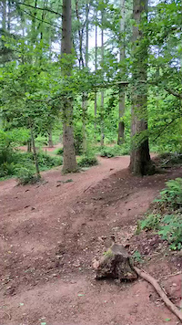
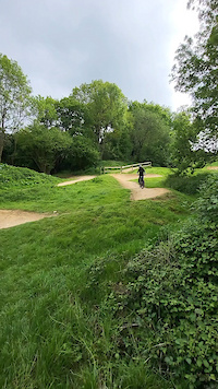
Popular England Mountain Biking Trails
• 100 ★ 3.3 • 843 ft • 17 ft • 2,722 •
Popular blue difficulty singletrack. This mountain bike primary trail can be used one direction. On average it takes 2 minutes to complete this trail.
• 100 ★ 4.3 • 3,665 ft • 17 ft • 2,649 •
A popular trail for the Stravista's as it has a couple of bomb holes, some decent Berms and requires some hard pedalling to get a decent time. Not the most technically challenging but puts a smile on your face (careful of the very bumpy...
• 85 ★ 3.6 • 2,516 ft • 6 ft • 2,589 •
Popular blue difficulty singletrack. This mountain bike primary trail can be used one direction. On average it takes minutes to complete this trail.
• 90 ★ 3.5 • 1,293 ft • 32 ft • 2,555 •
Popular blue difficulty singletrack. This mountain bike primary trail can be used one direction. On average it takes 2 minutes to complete this trail.
• 75 ★ 3.4 • 1,506 ft • 20 ft • 2,549 •
Popular blue difficulty singletrack. This mountain bike primary trail can be used one direction. On average it takes 1 minutes to complete this trail.
• 80 ★ 3.4 • 1,440 ft • 46 ft • 2,520 •
Popular blue difficulty singletrack. This mountain bike primary trail can be used one direction with a 46 ft blue climb. On average it takes 2 minutes to complete this trail.
• 70 ★ 3.3 • 1,102 ft • 6 ft • 2,498 •
Popular blue difficulty singletrack. This mountain bike primary trail can be used one direction. On average it takes 1 minutes to complete this trail.
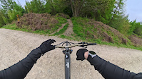
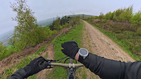
England Mountain Bike Routes
Follow the Dog Featured
★ 3.6 • 6 miles • 709 ft • 19 • Loop •
The Midlands' first dedicated mountain bike trail. Follow the Dog is a red graded 6.7 mile intermediate...
★ 3.9 • 12 miles • 1,760 ft • 40 • Loop •
This is the full 14.1 mile red route which includes both Follow the Dog and The Monkey Trail. Opened in...
Dalby Blue Cycling Trail Featured
★ 5.0 • 7 miles • 579 ft • 18 • Loop •
Start the Blue Cycle Trail from Dalby Visitor Centre trail start in Low Dalby. After a challenging but...
★ 4.7 • 5 miles • 462 ft • 18 • Loop •
This is the official diversion route for the Red Longslade Trail We are stoked to announce that Merlin,...
Hamsterley Red Route Featured
★ 3.5 • 14 miles • 1,802 ft • 42 • Loop •
The full red look at Hamsterley forest. Starts with a long section of fire road, climbing and some short...
Jerry Noddle Featured
★ 4.0 • 10 miles • 676 ft • 31 • Loop •
"Take in fantastic views on the fast flowing route." Offical Dalby Forest route.
Photos of England Mountain Bike
Videos of England Mountain Bike
featured
![www.yorkshirebikeguides.co.uk GoPro helmet cam...]()
trail: Dalby Forest Drive
3:30 |
691 |
Jan 23, 2015

trail: H.I.P.S.
0:31 |
2 |
Jun 15, 2026
0:07 |
6 |
Jun 8, 2026
trail: Blue Raccoon
0:04 |
15 |
May 5, 2026
trail: Arfur Stone
0:37 |
15 |
Apr 26, 2026
trail: John Storey's Trail
2:19 |
18 |
Apr 26, 2026
trail: The SuperChute
3:13 |
13 |
Apr 26, 2026
trail: Nomad
4:09 |
19 |
Apr 25, 2026
Current Trail Warnings
| status | trail | date | condition | user | info |
|---|---|---|---|---|---|
| Golden Nugget Surrey Hills | Jun 21, 2026 @ 1:47pm (Europe/London) 10 hours | Very Dry | eqsound | Tree down after last Right hand berm.... | |
| River Run St Leonards Forest | Jun 14, 2026 @ 7:26pm (Europe/London) Jun 14, 2026 | Unknown | pedallingplumber | So many trees down, almost impossible to... | |
| Whitegate Way Delamere Forest | Jun 14, 2026 @ 10:02am (Europe/Isle_of_Man) Jun 14, 2026 | Dry | AndyRoss | Gravel Bike Bridge is closed. You need to drop down... |
Recent Trail Reports
| status | trail | date | condition | info | user |
|---|---|---|---|---|---|
| Wood Farm Trail Hicks Lodge | Jun 21, 2026 @ 5:51pm (Europe/London) 6 hours | Ideal | Dartman67 | ||
| Red, Black, Red Descent Healey Nab | Jun 20, 2026 @ 10:03am (Europe/London) 2 days | Ideal | Vimto-North | ||
| Red Trail Descent Healey Nab | Jun 20, 2026 @ 10:03am (Europe/London) 2 days | Ideal | Vimto-North | ||
| Black Descent Healey Nab | Jun 20, 2026 @ 10:03am (Europe/London) 2 days | Ideal | Vimto-North | ||
| Trail Head Access West Pennine Moors | Jun 20, 2026 @ 10:03am (Europe/London) 2 days | Ideal | Vimto-North | ||
| Verderers To Black Ride Forest of Dean | Jun 19, 2026 @ 6:07pm (Europe/London) 2 days | Ideal | EmtbAdz | ||
| The Badgers Camborne | Jun 19, 2026 @ 4:55pm (Europe/London) 2 days | Variable | ripsilver Cornwall | ||
| Ring Bash Rampage Carn Brea | Jun 19, 2026 @ 4:54pm (Europe/London) 2 days | Variable | ripsilver Cornwall | ||
| Monument to Tregajorran rock Carn Brea | Jun 19, 2026 @ 4:53pm (Europe/London) 2 days | Variable | ripsilver Cornwall | ||
| Shell Brook Hicks Lodge | Jun 19, 2026 @ 11:31am (Europe/London) 3 days | Ideal | DAZ1925 |
Activity Feed
| username | action | type | title | date |
|---|---|---|---|---|
| Dartman67 | add | report | activity #97517528 | Jun 21, 2026 @ 1:45pm 2 hours |
| JonathanSherlockopIWKQKl | ridden | trail | activity #97508845 | Jun 21, 2026 @ 12:10pm 4 hours |
| EDavies10 | ridden | trail | activity #97505596 | Jun 21, 2026 @ 11:35am 4 hours |
| trailforks | add | video | activity #97480566 | Jun 21, 2026 @ 7:00am 9 hours |
| Dukeinlondon | ridden | trail | activity #97477399 | Jun 21, 2026 @ 6:16am 10 hours |
Recent Comments
| username | type | title | comment | date |
|---|---|---|---|---|
| report | Has been cut back. | Jun 18, 2026 @ 7:30am Jun 18, 2026 | ||
| trail | a good descent, a tree is down near the top... | Jun 16, 2026 @ 1:25pm Jun 16, 2026 | ||
| trail | Still rideable not bad in the dry | Jun 15, 2026 @ 10:36pm Jun 15, 2026 | ||
| trail | Not open for bicycles. | Jun 4, 2026 @ 12:34pm Jun 4, 2026 | ||
| trail | few trees down to the east of mainline. its... | Jun 1, 2026 @ 12:52pm Jun 1, 2026 |
Local Badges
-

10 Green Trails1,007 awarded -

Top 10 Trails0 awarded -

10 Blue Trails7 awarded -
10 Blue Trails1 awarded -

Epic Ride Climb 2k209 awarded -
Epic Ride Climb 2k42 awarded
Bike & Skill Parks
| name | type | city | rating |
|---|---|---|---|
| Flyup 417 Bike Park | bike park | Gloucester | |
| Tidworth Freeride Park | bike park | Salisbury | |
| GNAR Bike Park | bike park | Carlisle | |
| Gawton Gravity Hub | bike park | Tavistock | |
| Descend Bike Park | bike park | Bishop Auckland |
Upcoming Local Events
Local Trail Supporters
- North Face
- Bristol Trails Group
- Sustrans
- Lee Carter
![]()
- Charlie Waller
![]()
- Danbury Dig crew
- Woburn Bike Trail
- Woburn Bike Trails
- Steve Jones
![]()
![]()
- stanley jeram
![]()
![]()
Local Trail Supporters
- North Face
- Bristol Trails Group
- Sustrans
- Lee Carter
![]()
- Charlie Waller
![]()
- Danbury Dig crew
- Woburn Bike Trail
- Woburn Bike Trails
- Steve Jones
![]()
![]()
- stanley jeram
![]()
![]()
Activity Type Stats
| activitytype | trails | distance | descent | descent distance | total vertical | rating | global rank | state rank | photos | reports | routes | ridelogs |
|---|---|---|---|---|---|---|---|---|---|---|---|---|
| Mountain Bike | 7,312 | 4,352 miles | 738,297 ft | 2,178 miles | 3,091 ft | 23,649 | 51,556 | 554 | 2,111,355 | |||
| E-Bike | 4,571 | 2,703 miles | 429,167 ft | 1,327 miles | 3,084 ft | 40 | 46,255 | 184 | 230,819 | |||
| Gravel Bike | 836 | 721 miles | 71,102 ft | 281 miles | 2,769 ft | 1 | 6,910 | 73 | 9,202 | |||
| Adaptive Bike | 1,127 | 908 miles | 92,224 ft | 373 miles | 1,841 ft | 1 | 6,802 | 24 | 20 | |||
| Winter Fat Bike | 1,181 | 721 miles | 86,644 ft | 349 miles | 1,821 ft | 8,037 | 6 | |||||
| Horse | 1,402 | 1,233 miles | 117,579 ft | 546 miles | 1,749 ft | 4 | 10,101 | 12 | 54 | |||
| Hike | 6,487 | 4,285 miles | 607,717 ft | 2,044 miles | 3,087 ft | 53 | 48,389 | 75 | 85,363 | |||
| Trail Running | 6,508 | 4,291 miles | 610,666 ft | 2,048 miles | 3,087 ft | 3 | 48,442 | 62 | 57,101 | |||
| Dirtbike/Moto | 63 | 74 miles | 5,456 ft | 35 miles | 1,371 ft | 1 | 9,596 | 2 | 69 | |||
| Observed Trials | 20 | 27 miles | 3,045 ft | 14 miles | 1,696 ft | 2 | 413 | 2 | 22 | |||
| ATV/ORV/OHV | 43 | 61 miles | 5,049 ft | 30 miles | 1,348 ft | 2 | 9,594 | 10 | ||||
| Snowmobile | 3 | 3 miles | 148 ft | 1 mile | 112 ft | 1 | 6 | |||||
| Snowshoe | 5 | 8 miles | 1,309 ft | 5 miles | 719 ft | 7 | 23 | |||||
| Downhill Ski | 5 | 8 miles | 1,309 ft | 5 miles | 719 ft | 8 | 3 | 249 | ||||
| Backcountry Ski | 5 | 8 miles | 1,309 ft | 5 miles | 719 ft | 3 | 59 | |||||
| Nordic Ski | 8 | 10 miles | 1,637 ft | 7 miles | 787 ft | 7 | 160 |
Activities
- England Mountain Biking Trails
- England E-Biking Trails
- England Gravel Biking Trails
- England Adaptive Biking Trails
- England Winter Fat Biking Trails
- England Horseback Trails
- England Hiking Trails
- England Trail Running Trails
- England Dirtbiking Trails
- England Observed Trials Trails
- England ATVing/Offroading Trails
- England Snowshoeing Trails
- England Skiing Trails
- England Backcountry Skiing Trails
- England Nordic Skiing Trails
Trails
Points of Interest
- Descent Information
- Information Boards - Aspley Heath
- Information board for Aspley Woods
- Information Board
- Information Board
- Information board for Aspley Woods
- Information board for Aspley Woods
- Information Board for Woburn Estates
- Information Board for Woburn Estates
- Jinlye Rock Drop TTF
- Scafell Pike (971 m)
- Sca Fell (953 m)
- Symonds Knott (949 m)
- By brenthillier
 NSMBA TRAILFORKS & contributors
 - Admins: UKTP, 20twenty-p, wisey, MathieuC, cemoorelife
- #3367 - 60,163 views
- england activity log | embed map of England mountain bike trails | england mountain biking points of interest polygons
Downloading of trail gps tracks in kml & gpx formats is enabled for England.
You must login to download files.