close
-
Layers w
- Weather Layers
- Pro
- Pro
- Pro
- Pro
- Pro
- Pro
- More Layers
- Pro
- Pro
- Pro
- Pro
-
Upgrade to

3D
Trail Conditions
- Unknown
- Snow Groomed
- Snow Packed
- Snow Covered
- Snow Cover Partial
- Freeze/thaw Cycle
- Icy
- Prevalent Mud
- Wet
- Variable
- Ideal
- Dry
- Very Dry
Trail Flow (Ridden Direction)
Trailforks scans users ridelogs to determine the most popular direction each trail is ridden. A good flowing trail network will have most trails flowing in a single direction according to their intension.
The colour categories are based on what percentage of riders are riding a trail in its intended direction.
The colour categories are based on what percentage of riders are riding a trail in its intended direction.
- > 96%
- > 90%
- > 80%
- > 70%
- > 50%
- < 50%
- bi-directional trail
- no data
Trail Last Ridden
Trailforks scans ridelogs to determine the last time a trail was ridden.
- < 2 days
- < 1 week
- < 2 weeks
- < 1 month
- < 6 months
- > 6 months
Trail Ridden Direction
The intended direction a trail should be ridden.
- Downhill Only
- Downhill Primary
- Both Directions
- Uphill Primary
- Uphill Only
- One Direction
Contribute Details
Colors indicate trail is missing specified detail.
- Description
- Photos
- Description & Photos
- Videos
Trail Popularity ?
Trailforks scans ridelogs to determine which trails are ridden the most in the last 9 months.
Trails are compared with nearby trails in the same city region with a possible 25 colour shades.
Think of this as a heatmap, more rides = more kinetic energy = warmer colors.
- most popular
- popular
- less popular
- not popular
ATV/ORV/OHV Filter
Max Vehicle Width
inches
US Cell Coverage
Legend

Radar Time
Activity Recordings
Trailforks uses anonymized public activity data.
?
Activity Recordings
Trailforks uses anonymized public activity data.
?
Personal Heatmap
▶
Activity Types
all
/
none
▶
Options
2
Date range
month
–
Winter Trails
Warning
A routing network for winter maps does not exist. Selecting trails using the winter trails layer has been disabled.
Missing Trails
Most Popular
Least Popular
Trails are colored based on popularity. The more popular a trail is, the more red. Less popular trails trend towards green.
Jump Magnitude Heatmap
Heatmap of where riders jump on trails. Zoom in to see individual jumps, click circles to view jump details.
BC Backroad Status
![map legend]()
Service Road Atlas is a free to use, community-driven service for viewing and creating reports on the numerous back-country service roads around B.C. and Alberta.

Slope Aspect
Direction the slope faces
Trails Deemphasized
Trails are shown in grey.
Only show trails with no bike usage.
Suggested Layers
Based on selected activity type
Save the current map location and zoom level as your default home location whenever this page is loaded.
Save
No description for Ephraim has been added yet!
Login or register to submit one.
Activities Click to view
- Mountain Bike
62 trails
- E-Bike
39 trails
- Gravel Bike
0 trails
- Adaptive Bike
0 trails
- Winter Fat Bike
0 trails
- Horse
29 trails
- Hike
85 trails
- Trail Running
85 trails
- Dirtbike/Moto
34 trails
- Observed Trials
1 trails
- ATV/ORV/OHV
20 trails
- Snowshoe
4 trails
Region Details
- 27
- 14
- 1
- 8
- 1
Region Status
Caution as of Apr 10, 2026Stats
- Avg Trail Rating
- Trails (view details)
- 56
- Trails Mountain Bike
- 83
- Trails E-Bike
- 39
- Trails Horse
- 29
- Trails Hike
- 85
- Trails Trail Running
- 85
- Trails Dirtbike/Moto
- 34
- Trails Observed Trials
- 1
- Trails ATV/ORV/OHV
- 20
- Trails Snowshoe
- 4
- Total Distance
- 201 miles
- Total Descent
- 33,598 ft
- Total Vertical
- 5,837 ft
- Highest Trailhead
- 11,228 ft
- Reports
- 490
- Photos
- 229
- Ridden Counter
- 2,732
Sub Regions
-
Bald Mountain Ephraim
- 9
- 3
- 4
- 1
-
Black Hill Ephraim
- 2
- 4
Popular Ephraim Mountain Biking Trails
• 90 ★ 4.7 • 2 miles • 34 ft • 151 •
offers a unique blend of easy cruising and technical challenge. The trail starts off fairly flat and easy, making for a relaxed and enjoyable beginning. Early on, you'll encounter a wooden boardwalk that guides you safely around a...
• 95 ★ 4.5 • 3,701 ft • 0 ft • 138 •
offers a versatile ride that winds primarily through Gambel Oak, which bursts into vibrant colors during the autumn months, making it especially scenic in the fall. This trail is enjoyable in either direction — providing a smooth,...
• 95 ★ 3.0 • 4,495 ft • 12 ft • 129 •
is a scenic single-track trail that begins at the first kiosk pullout along the Ephraim Canyon Heritage Tour. This trail offers a unique opportunity to experience one of the few areas in the canyon where Pines thrive. As you ride,...
• 95 ★ 3.7 • 1 mile • 21 ft • 117 •
is a versatile and enjoyable trail, perfect for both mountain biking and trail running. With a fun switchback section through a beautiful grove, the trail offers an exciting challenge as you navigate the turns. Along the way, you'll...
• 100 ★ 3.0 • 1 mile • 28 ft • 110 •
offers a relatively easy ride, perfect for those seeking a smooth and enjoyable mountain biking experience. This scenic trail runs about 300 feet into the forest, paralleling the Willow Creek Road and providing a peaceful ride beneath...
• 80 ★ 4.7 • 2 miles • 0 ft • 107 •
It’s not super rocky, but there are a lot of roots, there are 3 bridges but one is mostly broken but you can bunny hop it(tried fixing it but some dirt bikers went through and destroyed it), non are big. There’s a lot of loose...
• 100 ★ 3.0 • 1 mile • 132 ft • 97 •
is a one-mile trail that links the and the , making it a key route for creating a looped mountain bike ride. This trail is very flat, offering a smooth and easy ride as it winds through a diverse landscape of oak, juniper, and pinion...
• 100 ★ 4.0 • 1 mile • 50 ft • 91 •
offers a fun and winding ride that starts off Willow Creek Road. Near the bottom, you’ll cross a cool wood bridge that adds a unique touch to this trail’s scenic charm. At the end, the trail connects to a double-track mountain road...
Ephraim Mountain Bike Routes
10 miles • 375 ft • 5 • Shuttled •
Hit all the best routes in one drop. Trails are easy with everything from aspens to junipers.
★ 4.0 • 10 miles • 1,001 ft • 25 • Loop •
This loops goes around 2 hills known as Little Hill, and Black Hill. Typical trails for this region.
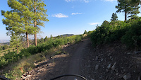
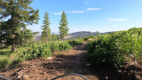
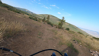
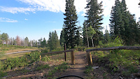
Photos of Ephraim Mountain Bike
Videos of Ephraim Mountain Bike
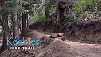
trail: Keebler Trail
0:04 |
44 |
Mar 5, 2025
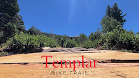
trail: Templar Trail
0:02 |
41 |
Mar 5, 2025
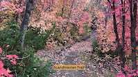
trail: Scandinavian Trail
0:27 |
15 |
Mar 4, 2025
trail: Mirkwood Trail
0:26 |
27 |
Mar 4, 2025
trail: Stopwatch Trail
0:29 |
34 |
Aug 6, 2022
trail: Stopwatch Trail
0:39 |
15 |
Aug 6, 2022
trail: Stopwatch Trail
0:41 |
13 |
Aug 6, 2022
trail: Scandinavian Trail
0:26 |
25 |
Aug 6, 2022
Recent Trail Reports
| status | trail | date | condition | info | user |
|---|---|---|---|---|---|
| White Pine | Apr 10, 2026 @ 11:06pm (America/Denver) Apr 10, 2026 | Variable | wheeledwanderer | ||
| Scandinavian Trail | Aug 21, 2025 @ 6:05pm Aug 21, 2025 | Ideal | Captainpirate | ||
| Skyline Drive | Aug 8, 2025 @ 8:56pm Aug 8, 2025 | Dry | falcon013 | ||
| Deer Run | Aug 7, 2025 @ 5:52pm Aug 7, 2025 | Dry | Captainpirate | ||
| Gravity Trail | Aug 7, 2025 @ 5:52pm Aug 7, 2025 | Dry | Captainpirate | ||
| Ponderosa Trail | Aug 7, 2025 @ 5:52pm Aug 7, 2025 | Dry | Captainpirate | ||
| Stopwatch Trail | Aug 7, 2025 @ 5:52pm Aug 7, 2025 | Dry | Captainpirate | ||
| Access Trail | Aug 7, 2025 @ 5:52pm Aug 7, 2025 | Dry | Captainpirate | ||
| Keebler Trail | Aug 7, 2025 @ 5:52pm Aug 7, 2025 | Dry | Captainpirate | ||
| Hydroplant | Jul 26, 2025 @ 10:06pm Jul 26, 2025 | Dry | Rapp82 |
National Scenic Trails & Official Routes
-
Great Western Trail
- Mountain Bike
- E-Bike
- Horse
- Hike
- Trail Running
- Dirtbike/Moto
- ATV/ORV/OHV

Activity Feed
| username | action | type | title | date |
|---|---|---|---|---|
| MountainMan1387 | wishlist | trail | activity #96586405 | Jun 8, 2026 @ 10:51pm Jun 8, 2026 |
| razz66 | ridden | trail | activity #94857894 | May 16, 2026 @ 3:47pm May 16, 2026 |
| thaddeusmt | wishlist | region | activity #93062795 | Apr 20, 2026 @ 11:05pm Apr 20, 2026 |
| wheeledwanderer | add | report | activity #92365032 | Apr 10, 2026 @ 10:06pm Apr 10, 2026 |
| markholloway | add | poi | activity #90857639 | Mar 19, 2026 @ 7:53am Mar 19, 2026 |
Recent Comments
| username | type | title | comment | date |
|---|---|---|---|---|
| trail | Felt a bit more like a blue for the climb.... | Jul 26, 2025 @ 10:02pm Jul 26, 2025 | ||
| trail | Loved it. Much more technical and steep than I... | Jul 26, 2025 @ 9:59pm Jul 26, 2025 | ||
| trail | It says it's both directions but it's not... | Jul 13, 2025 @ 12:07pm Jul 13, 2025 | ||
| trail | Fun trail, but beware that it’s not well... | Jun 1, 2025 @ 10:43am Jun 1, 2025 | ||
| trail | Awesome beginner trails that all look like... | May 12, 2024 @ 12:17pm May 12, 2024 |
Local Badges
-

10 Blue Trails17 awarded -

Epic Ride Climb 2k14 awarded -

Climbing 10k Badge9 awarded -

Climbing 100k Badge1 awarded -

Epic Ride Descent 2k19 awarded -

Descent 10k Badge16 awarded
Bike & Skill Parks
| name | type | city | rating |
|---|---|---|---|
| Canyon View Pump | skill park | Ephraim |
Local Trail Supporters
- The Community Mtb Riders
Activity Type Stats
| activitytype | trails | distance | descent | descent distance | total vertical | rating | global rank | state rank | photos | reports | routes | ridelogs |
|---|---|---|---|---|---|---|---|---|---|---|---|---|
| Mountain Bike | 62 | 197 miles | 32,641 ft | 97 miles | 5,591 ft | #1,290 | #492 | 169 | 583 | 2 | 3,608 | |
| E-Bike | 39 | 123 miles | 17,100 ft | 58 miles | 5,377 ft | #1,341 | #855 | 514 | 2 | 237 | ||
| Horse | 29 | 36 miles | 4,921 ft | 15 miles | 3,068 ft | #666 | #536 | 67 | 114 | 1 | 1 | |
| Hike | 85 | 194 miles | 32,142 ft | 95 miles | 5,837 ft | #1,153 | #532 | 1 | 580 | 1 | 285 | |
| Trail Running | 85 | 194 miles | 32,142 ft | 95 miles | 5,837 ft | #861 | #328 | 580 | 1 | 34 | ||
| Dirtbike/Moto | 34 | 119 miles | 15,853 ft | 56 miles | 5,377 ft | #258 | #131 | 84 | 1 | 3 | ||
| Observed Trials | 1 | 417 ft | 69 ft | 3 ft | #237 | #54 | 1 | |||||
| ATV/ORV/OHV | 20 | 100 miles | 12,418 ft | 47 miles | 5,377 ft | #262 | #85 | 66 | 9 | |||
| Snowshoe | 4 | 2 miles | 433 ft | 4,134 ft | 1,040 ft | #1,272 | #686 | 1 | 34 |
Frequently Asked Questions About Ephraim
▼
What are the best places to ride in Ephraim?
Ephraim has 2 areas to explore for mountain biking. The top rated areas are:
▼
What are the highest rated mountain biking trails in Ephraim?
The highest rated mountain biking trails in Ephraim are:
- Pioneer Trail (4.4/5)
- Flume (4.4/5)
- Pinecone (4.2/5)
- Deer Trail-Flume Connector (4.1/5)
- Gravity Trail (4.1/5)
▼
What is the best time of the year to ride in Ephraim?
Based on ride log data, the most popular months to ride in Ephraim are:
- July (70 activities)
- June (46 activities)
- September (40 activities)
▼
Where can I park to ride in Ephraim?
There are 17 parking locations listed in Ephraim. The most popular parking spots are: View all parking and trailhead locations on the map to plan your visit.
Activities
Trails
- By canadaka
 Trailforks & contributors
 - Admins: jkwilliamz, UtahJohn, jpmcghee, jasonmalczyk, UDWRHabitat, HatchesBattened, Sanpete
- #4826 - 8,721 views
- ephraim activity log | embed map of Ephraim mountain bike trails | ephraim mountain biking points of interest
Downloading of trail gps tracks in kml & gpx formats is enabled for Ephraim.
You must login to download files.