close
-
Layers w
- Weather Layers
- Pro
- Pro
- Pro
- Pro
- Pro
- Pro
- More Layers
- Pro
- Pro
- Pro
- Pro
-
Upgrade to

3D
Trail Conditions
- Unknown
- Snow Groomed
- Snow Packed
- Snow Covered
- Snow Cover Partial
- Freeze/thaw Cycle
- Icy
- Prevalent Mud
- Wet
- Variable
- Ideal
- Dry
- Very Dry
Trail Flow (Ridden Direction)
Trailforks scans users ridelogs to determine the most popular direction each trail is ridden. A good flowing trail network will have most trails flowing in a single direction according to their intension.
The colour categories are based on what percentage of riders are riding a trail in its intended direction.
The colour categories are based on what percentage of riders are riding a trail in its intended direction.
- > 96%
- > 90%
- > 80%
- > 70%
- > 50%
- < 50%
- bi-directional trail
- no data
Trail Last Ridden
Trailforks scans ridelogs to determine the last time a trail was ridden.
- < 2 days
- < 1 week
- < 2 weeks
- < 1 month
- < 6 months
- > 6 months
Trail Ridden Direction
The intended direction a trail should be ridden.
- Downhill Only
- Downhill Primary
- Both Directions
- Uphill Primary
- Uphill Only
- One Direction
Contribute Details
Colors indicate trail is missing specified detail.
- Description
- Photos
- Description & Photos
- Videos
Trail Popularity ?
Trailforks scans ridelogs to determine which trails are ridden the most in the last 9 months.
Trails are compared with nearby trails in the same city region with a possible 25 colour shades.
Think of this as a heatmap, more rides = more kinetic energy = warmer colors.
- most popular
- popular
- less popular
- not popular
ATV/ORV/OHV Filter
Max Vehicle Width
inches
US Cell Coverage
Legend

Radar Time
Activity Recordings
Trailforks uses anonymized public activity data.
?
Activity Recordings
Trailforks uses anonymized public activity data.
?
Personal Heatmap
▶
Activity Types
all
/
none
▶
Options
2
Date range
month
–
Winter Trails
Warning
A routing network for winter maps does not exist. Selecting trails using the winter trails layer has been disabled.
Missing Trails
Most Popular
Least Popular
Trails are colored based on popularity. The more popular a trail is, the more red. Less popular trails trend towards green.
Jump Magnitude Heatmap
Heatmap of where riders jump on trails. Zoom in to see individual jumps, click circles to view jump details.
BC Backroad Status
![map legend]()
Service Road Atlas is a free to use, community-driven service for viewing and creating reports on the numerous back-country service roads around B.C. and Alberta.

Slope Aspect
Direction the slope faces
Trails Deemphasized
Trails are shown in grey.
Only show trails with no bike usage.
Suggested Layers
Based on selected activity type
Save the current map location and zoom level as your default home location whenever this page is loaded.
SaveArea a est e a nord-est del Monte Generoso molto interessante sia per i bellissimi paesaggi in un ambiente di media montagna, sia per gli interessanti sentieri generalmente ben frequentati e con un sufficiente livello di pulizia.
This region uses the Uk/Euro style trail grading system.
Activities Click to view
- Mountain Bike
29 trails
- E-Bike
27 trails
- Adaptive Bike
0 trails
- Hike
29 trails
- Trail Running
29 trails
Region Details
- 3
- 2
- 6
- 10
- 2
Region Status
Open as of May 23, 2026Stats
- Avg Trail Rating
- Trails (view details)
- 23
- Trails Mountain Bike
- 29
- Trails E-Bike
- 27
- Trails Winter Fat Bike
- 1
- Trails Hike
- 29
- Trails Trail Running
- 29
- Total Distance
- 20 miles
- Total Descent Distance
- 14 miles
- Total Descent
- 7,683 ft
- Total Vertical
- 2,280 ft
- Highest Trailhead
- 5,332 ft
- Reports
- 239
- Photos
- 44
- Ridden Counter
- 1,155
Popular Erbonne Mountain Biking Trails
• 95 ★ 3.4 • 1 mile • 27 ft • 147 •
Da come si evince nei commenti il sentiero molto tecnico e roccioso non esiste più. Adesso abbiamo un sentiero in buona parte allargato e addolcito con l'escavatore. Nel link qui sotto leggerete i motivi dell'intervento. Però non va...
• 90 ★ 4.1 • 3 miles • 6 ft • 146 •
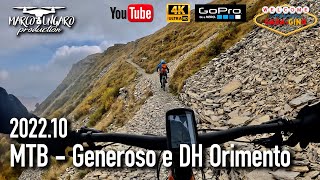
Single track from Monte Generoso Vetta to Orimento area. Quite exposed forst part, than open meadows and blueberry bush. Access trail to " "
• 100 ★ 3.5 • 2,480 ft • 46 ft • 96 •
Stradina di veloce collegamento tra il del Generoso e Orimento.
• 80 ★ 4.4 • 3 miles • 334 ft • 71 •
Dapprima singletrack su buon fondo generalmente di terra compatta. Dopo il Mater, evidente croce e bellissimo punto panoramico, diviene un bel doubletrack con un buon fondo spesso acciotolato.
• 55 ★ 4.2 • 2 miles • 124 ft • 64 •
First part need some hike and bike and it's quite exposed, than it becomes more flowy. Near the last open part you can go right (easier but used as hiking path) or left to reach the grassy picnic area.
• 60 ★ 0.0 • 3,953 ft • 449 ft • 54 •
Salita a spinta e successiva discesa con qualche radice.
• 65 ★ 4.2 • 2,575 ft • 0 ft • 50 •
Flowy single trail with a couple of technical section; use as connection between Monte Generoso, Valle di Muggio and Valle Intelvi
• 45 ★ 4.0 • 2,746 ft • 183 ft • 45 •
Quite exposed and narrow trail, some hike and bike section, that can be pedaled only with good technique. Used to reach trail.
Erbonne Mountain Bike Routes
1 mile • 89 ft • 0 •
collegamento dall'Alpe Grane alla partenza della DH Pedro
Photos of Erbonne Mountain Bike
Videos of Erbonne Mountain Bike
trail: Poncione di Cabbio
2:51 |
149 |
Mar 31, 2023 , Erbonne
trail: Sentiero Basso
14:49 |
238 |
Dec 12, 2022 , Erbonne
trail: Pizzo della Croce
11:10 |
97 |
Dec 12, 2022 , Erbonne
trail: Pizzo della Croce
2:00 |
184 |
Sep 25, 2022 , Erbonne
Current Trail Warnings
| status | trail | date | condition | user | info |
|---|---|---|---|---|---|
| Torrioni Traversa | May 23, 2026 @ 10:13am (Europe/Vaduz) May 23, 2026 | Ideal | Quattrod |
Recent Trail Reports
| status | trail | date | condition | info | user |
|---|---|---|---|---|---|
| Piancaccia | May 23, 2026 @ 7:04pm (Europe/Rome) May 23, 2026 | Unknown | VolpeGiuseppe | ||
| Access B to Corno | May 23, 2026 @ 3:13pm (Europe/Rome) May 23, 2026 | Ideal | euvanet | ||
| Traverso Sasso Gordona | May 23, 2026 @ 3:09pm (Europe/Rome) May 23, 2026 | Ideal | euvanet | ||
| Pizzo Della Croce - Mater | Apr 4, 2026 @ 11:30am (Europe/Vaduz) Apr 4, 2026 | Variable | tosiroberto | ||
| Pizzo della Croce | Apr 4, 2026 @ 11:30am (Europe/Vaduz) Apr 4, 2026 | Snow Packed | tosiroberto | ||
| Collegamento per Orimento | Apr 4, 2026 @ 11:30am (Europe/Vaduz) Apr 4, 2026 | Variable | tosiroberto | ||
| Orimento - Capanna Bruno | Mar 9, 2026 @ 4:06pm (Europe/Vaduz) Mar 9, 2026 | Ideal | Guret NORTHNLINE | ||
| Piano delle Alpi - Passo Bonello | Mar 9, 2026 @ 4:06pm (Europe/Vaduz) Mar 9, 2026 | Ideal | Guret NORTHNLINE | ||
| Poncione di Cabbio | Jan 31, 2026 @ 8:17pm (Europe/Rome) Jan 31, 2026 | Snow Covered | ilKasa | ||
| Monte Generoso Summit | Jan 3, 2026 @ 6:41pm (Europe/Rome) Jan 3, 2026 | Freeze/thaw Cycle | MontesiDani |
Activity Feed
| username | action | type | title | date |
|---|---|---|---|---|
| Quattrod | difficultyvote | trail | activity #96556161 and 1 more | Jun 8, 2026 @ 12:07pm Jun 8, 2026 |
| marcoangeletti | comment | report | activity #95382503 | May 24, 2026 @ 12:29am May 24, 2026 |
| Quattrod | add | report | activity #95365509 | May 23, 2026 @ 4:43pm May 23, 2026 |
| VolpeGiuseppe | add | report | activity #95330976 | May 23, 2026 @ 10:04am May 23, 2026 |
| euvanet | vote | trail | activity #95310437 and 1 more | May 23, 2026 @ 6:14am May 23, 2026 |
Recent Comments
| username | type | title | comment | date |
|---|---|---|---|---|
| report | @quattrod qual’è il problema rilevante... | May 24, 2026 @ 12:29am May 24, 2026 | ||
| trail | Se si percorre in discesa dalla vetta del... | May 1, 2026 @ 7:32am May 1, 2026 | ||
| trail | Dopo due anni le foto non rappresentano più... | Oct 25, 2025 @ 10:35am Oct 25, 2025 | ||
| trail | there are two short sections which are double... | Aug 17, 2024 @ 12:55pm Aug 17, 2024 | ||
| report | Se lo ritieni opportuno puoi dare il grado di... | Jul 20, 2024 @ 10:33am Jul 20, 2024 |
Local Badges
-

Epic Mountain Bike Climb 2k0 awarded -

Climbing 10k Badge0 awarded -

Mountain Biking 100k Badge0 awarded -

Epic Ride Descent 2k0 awarded -

Descent 10k Badge0 awarded -

Descent 100k Badge0 awarded
Activity Type Stats
| activitytype | trails | distance | descent | descent distance | total vertical | rating | global rank | state rank | photos | reports | routes | ridelogs |
|---|---|---|---|---|---|---|---|---|---|---|---|---|
| Mountain Bike | 29 | 20 miles | 7,684 ft | 14 miles | 2,280 ft | #6,023 | #469 | 45 | 239 | 1 | 193 | |
| E-Bike | 27 | 19 miles | 7,500 ft | 14 miles | 2,280 ft | #4,692 | #452 | 200 | 75 | |||
| Winter Fat Bike | 1 | #2,659 | #133 | |||||||||
| Hike | 29 | 20 miles | 7,684 ft | 14 miles | 2,280 ft | #7,311 | #409 | 239 | 94 | |||
| Trail Running | 29 | 20 miles | 7,684 ft | 14 miles | 2,280 ft | #6,900 | #395 | 237 | 9 |
Frequently Asked Questions About Erbonne
▼
What are the highest rated mountain biking trails in Erbonne?
The highest rated mountain biking trails in Erbonne are:
- Orimento - Capanna Bruno (4.1/5)
- Sentiero della Transumanza (4.1/5)
- Sentiero Alto (4.1/5)
- Sentiero Basso (4.1/5)
- Traverso Sasso Gordona (4/5)
▼
What is the best time of the year to ride in Erbonne?
Based on ride log data, the most popular months to ride in Erbonne are:
- August (6 activities)
- May (3 activities)
- October (1 activities)
▼
Where can I park to ride in Erbonne?
Check the Erbonne trail map for trailhead and parking information. Community members regularly update access and parking details for trails in the area.
▼
What is the longest trail in Erbonne?
The longest trail in Erbonne is Panchinona di Bolla - Piano delle Alpi at 2.8 miles. View all trails sorted by distance.
Activities
Trails
- By barc74 & contributors
- Admins: marcoangeletti, adessoomaipiu, micheletraversi, NORTHNLINE, adessoomaipiu
- #23227 - 1,592 views
- erbonne activity log | embed map of Erbonne mountain bike trails | erbonne mountain biking points of interest
Downloading of trail gps tracks in kml & gpx formats is enabled for Erbonne.
You must login to download files.