close
-
Layers w
- Weather Layers
- Pro
- Pro
- Pro
- Pro
- Pro
- Pro
- More Layers
- Pro
- Pro
- Pro
- Pro
-
Upgrade to

3D
Trail Conditions
- Unknown
- Snow Groomed
- Snow Packed
- Snow Covered
- Snow Cover Partial
- Freeze/thaw Cycle
- Icy
- Prevalent Mud
- Wet
- Variable
- Ideal
- Dry
- Very Dry
Trail Flow (Ridden Direction)
Trailforks scans users ridelogs to determine the most popular direction each trail is ridden. A good flowing trail network will have most trails flowing in a single direction according to their intension.
The colour categories are based on what percentage of riders are riding a trail in its intended direction.
The colour categories are based on what percentage of riders are riding a trail in its intended direction.
- > 96%
- > 90%
- > 80%
- > 70%
- > 50%
- < 50%
- bi-directional trail
- no data
Trail Last Ridden
Trailforks scans ridelogs to determine the last time a trail was ridden.
- < 2 days
- < 1 week
- < 2 weeks
- < 1 month
- < 6 months
- > 6 months
Trail Ridden Direction
The intended direction a trail should be ridden.
- Downhill Only
- Downhill Primary
- Both Directions
- Uphill Primary
- Uphill Only
- One Direction
Contribute Details
Colors indicate trail is missing specified detail.
- Description
- Photos
- Description & Photos
- Videos
Trail Popularity ?
Trailforks scans ridelogs to determine which trails are ridden the most in the last 9 months.
Trails are compared with nearby trails in the same city region with a possible 25 colour shades.
Think of this as a heatmap, more rides = more kinetic energy = warmer colors.
- most popular
- popular
- less popular
- not popular
ATV/ORV/OHV Filter
Max Vehicle Width
inches
US Cell Coverage
Legend

Radar Time
Activity Recordings
Trailforks uses anonymized public activity data.
?
Activity Recordings
Trailforks uses anonymized public activity data.
?
Personal Heatmap
▶
Activity Types
all
/
none
▶
Options
2
Date range
month
–
Winter Trails
Warning
A routing network for winter maps does not exist. Selecting trails using the winter trails layer has been disabled.
Missing Trails
Most Popular
Least Popular
Trails are colored based on popularity. The more popular a trail is, the more red. Less popular trails trend towards green.
Jump Magnitude Heatmap
Heatmap of where riders jump on trails. Zoom in to see individual jumps, click circles to view jump details.
BC Backroad Status
![map legend]()
Service Road Atlas is a free to use, community-driven service for viewing and creating reports on the numerous back-country service roads around B.C. and Alberta.

Slope Aspect
Direction the slope faces
Trails Deemphasized
Trails are shown in grey.
Only show trails with no bike usage.
Suggested Layers
Based on selected activity type
Save the current map location and zoom level as your default home location whenever this page is loaded.
Save
No description for Ermua has been added yet!
Login or register to submit one.
This region uses the Uk/Euro style trail grading system.
Activities Click to view
- Mountain Bike
33 trails
- E-Bike
33 trails
- Horse
7 trails
- Hike
33 trails
- Trail Running
33 trails
- Observed Trials
7 trails
Region Details
- 12
- 2
- 12
- 6
- 1
Region Status
Caution as of Jun 21, 2026Stats
- Avg Trail Rating
- Trails (view details)
- 33
- Trails Mountain Bike
- 33
- Trails E-Bike
- 33
- Trails Horse
- 7
- Trails Hike
- 33
- Trails Trail Running
- 33
- Trails Observed Trials
- 7
- Total Distance
- 22 miles
- Total Descent Distance
- 11 miles
- Total Descent
- 8,338 ft
- Total Vertical
- 1,599 ft
- Highest Trailhead
- 2,187 ft
- Reports
- 179
- Photos
- 32
- Ridden Counter
- 863
Sub Regions
-
Ermua
- 2
- 12
- 6
- 1
Popular Ermua Mountain Biking Trails
• 85 ★ 3.8 • 3,960 ft • 0 ft • 34 •
La pendiente es la protagonista de este singletrack que además es revirado, hay que jugar con apoyos en los peraltes para meter la bici y seguir dándole cera.
• 80 ★ 4.4 • 2,402 ft • 0 ft • 32 •
Sendero con tramos verticales y curvas donde retorcer la bici
• 75 ★ 3.0 • 1 mile • 384 ft • 28 •
Precioso sendero que sube serpenteando a través del bosque, con curvas de herradura donde sufrir al meter la bici
• 55 ★ 3.7 • 1,991 ft • 0 ft • 26 •
Trail parcialmente afectado por las talas que obliga a bajar algún tramo por pista.Está viejito en general, parece que no tiene mucho uso, pero e deja bajar.
• 5 ★ 4.0 • 1,496 ft • 0 ft • 25 •
Bajada trabajada con tramos con bastante pendiente y curvas de horquilla con apoyos.
• 70 ★ 3.0 • 1,991 ft • 0 ft • 24 •
Popular blue difficulty singletrack. This multi-use trail can be used downhill primary.
Ermua Mountain Bike Routes
24 miles • 6,170 ft • 17 • Loop •
El triángulo formado por los pueblos de Ermua, Elgeta y Eibar esconde algunos de las bajadas más...
20 miles • 3,167 ft • 1 • Loop •
Recorrido largo de la martxa de Zaldibar 2025 celebraba el 2025-11-16
15 miles • 3,677 ft • 7 • Loop • Race •
Recorrido de la martxa mtb de Zaldibar de 2024
Videos of Ermua Mountain Bike
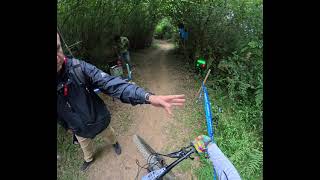
trail: Artaluz DH
3:35 |
72 |
Apr 7, 2026 , Ermua
Recent Trail Reports
| status | trail | date | condition | info | user |
|---|---|---|---|---|---|
| Tc4 | Jun 21, 2026 @ 9:11am (Europe/Madrid) Jun 21, 2026 | Dry | IBE1985 | ||
| Conector TC4 a Fénix | Jun 21, 2026 @ 9:11am (Europe/Madrid) Jun 21, 2026 | Dry | IBE1985 | ||
| Obelix | Jun 21, 2026 @ 9:11am (Europe/Madrid) Jun 21, 2026 | Dry | IBE1985 | ||
| Acceso Galia | Jun 21, 2026 @ 9:11am (Europe/Madrid) Jun 21, 2026 | Dry | IBE1985 | ||
| El Filtro | Jun 21, 2026 @ 9:11am (Europe/Madrid) Jun 21, 2026 | Very Dry | IBE1985 | ||
| Pagokua / El Haya | Jun 21, 2026 @ 9:11am (Europe/Madrid) Jun 21, 2026 | Dry | IBE1985 | ||
| Gurutzea | Jun 21, 2026 @ 9:11am (Europe/Madrid) Jun 21, 2026 | Dry | IBE1985 | ||
| Santamariñazar | Jun 21, 2026 @ 9:11am (Europe/Madrid) Jun 21, 2026 | Dry | IBE1985 | ||
| Txula | Jun 21, 2026 @ 9:11am (Europe/Madrid) Jun 21, 2026 | Dry | IBE1985 | ||
| Astérix | Jun 7, 2026 @ 8:42am (Europe/Madrid) Jun 6, 2026 | Ideal | krasty1002 TMD |
Activity Feed
| username | action | type | title | date |
|---|---|---|---|---|
| IBE1985 | vote | trail | activity #97576837 and 1 more | Jun 22, 2026 @ 11:57am 2 days |
| IBE1985 | vote | trail | activity #97544742 | Jun 21, 2026 @ 11:09pm 3 days |
| IBE1985 | add | report | activity #97543435 and 8 more | Jun 21, 2026 @ 10:22pm 3 days |
| Theju84 | comment | trail | activity #96656707 | Jun 10, 2026 @ 12:11am Jun 10, 2026 |
| IBE1985 | update | event | activity #96527750 | Jun 8, 2026 @ 2:54am Jun 8, 2026 |
Recent Comments
| username | type | title | comment | date |
|---|---|---|---|---|
| trail | Se ha vuelto abrir y se puede hacer, pero hay... | Jun 10, 2026 @ 12:11am Jun 10, 2026 | ||
| trail | En buenas condiciones algo de hojas y ramas | Sep 2, 2025 @ 12:59pm Sep 2, 2025 | ||
| trail | En buenas condiciones algo de hojas y ramas | Sep 2, 2025 @ 12:55pm Sep 2, 2025 | ||
| trail | Si, por eso es mejor desviarse hacia la subida... | Jun 19, 2025 @ 1:01am Jun 19, 2025 | ||
| trail | Cuidado donde acaba la la flow en la pista... | Jun 18, 2025 @ 11:54pm Jun 18, 2025 |
Local Badges
-

Epic Mountain Bike Climb 2k58 awarded -

Climbing 10k Badge23 awarded -

Mountain Biking 100k Badge1 awarded -

Epic Ride Descent 2k58 awarded -

Descent 10k Badge23 awarded -

Descent 100k Badge1 awarded
Activity Type Stats
| activitytype | trails | distance | descent | descent distance | total vertical | rating | global rank | state rank | photos | reports | routes | ridelogs |
|---|---|---|---|---|---|---|---|---|---|---|---|---|
| Mountain Bike | 33 | 22 miles | 8,340 ft | 11 miles | 1,598 ft | #6,247 | #336 | 32 | 179 | 3 | 1,845 | |
| E-Bike | 33 | 22 miles | 8,340 ft | 11 miles | 1,598 ft | #4,263 | #408 | 179 | 3 | 460 | ||
| Horse | 7 | 3 miles | 1,847 ft | 2 miles | 925 ft | #2,648 | #220 | 1 | ||||
| Hike | 33 | 22 miles | 8,340 ft | 11 miles | 1,598 ft | #6,928 | #395 | 177 | 61 | |||
| Trail Running | 33 | 22 miles | 8,340 ft | 11 miles | 1,598 ft | #6,382 | #390 | 178 | 52 | |||
| Observed Trials | 7 | 3 miles | 1,847 ft | 2 miles | 925 ft | #132 | #10 |
Frequently Asked Questions About Ermua
▼
What are the best places to ride in Ermua?
Ermua has 1 areas to explore for mountain biking. The top rated areas are:
▼
What are the highest rated mountain biking trails in Ermua?
▼
What is the best time of the year to ride in Ermua?
Based on ride log data, the most popular months to ride in Ermua are:
- September (4 activities)
- June (3 activities)
- November (2 activities)
▼
Where can I park to ride in Ermua?
There are 1 parking locations listed in Ermua. The most popular parking spots are:
Activities
Trails
Points of Interest
- By Pablo-W & contributors
- Admins: Altavoz, krasty1002, Altavoz, krasty1002
- #40779 - 1,398 views
- ermua activity log | embed map of Ermua mountain bike trails | ermua mountain biking points of interest
Downloading of trail gps tracks in kml & gpx formats is enabled for Ermua.
You must login to download files.