close
-
Layers w
- Weather Layers
- Pro
- Pro
- Pro
- Pro
- Pro
- Pro
- More Layers
- Pro
- Pro
- Pro
- Pro
-
Upgrade to

3D
Trail Conditions
- Unknown
- Snow Groomed
- Snow Packed
- Snow Covered
- Snow Cover Partial
- Freeze/thaw Cycle
- Icy
- Prevalent Mud
- Wet
- Variable
- Ideal
- Dry
- Very Dry
Trail Flow (Ridden Direction)
Trailforks scans users ridelogs to determine the most popular direction each trail is ridden. A good flowing trail network will have most trails flowing in a single direction according to their intension.
The colour categories are based on what percentage of riders are riding a trail in its intended direction.
The colour categories are based on what percentage of riders are riding a trail in its intended direction.
- > 96%
- > 90%
- > 80%
- > 70%
- > 50%
- < 50%
- bi-directional trail
- no data
Trail Last Ridden
Trailforks scans ridelogs to determine the last time a trail was ridden.
- < 2 days
- < 1 week
- < 2 weeks
- < 1 month
- < 6 months
- > 6 months
Trail Ridden Direction
The intended direction a trail should be ridden.
- Downhill Only
- Downhill Primary
- Both Directions
- Uphill Primary
- Uphill Only
- One Direction
Contribute Details
Colors indicate trail is missing specified detail.
- Description
- Photos
- Description & Photos
- Videos
Trail Popularity ?
Trailforks scans ridelogs to determine which trails are ridden the most in the last 9 months.
Trails are compared with nearby trails in the same city region with a possible 25 colour shades.
Think of this as a heatmap, more rides = more kinetic energy = warmer colors.
- most popular
- popular
- less popular
- not popular
ATV/ORV/OHV Filter
Max Vehicle Width
inches
US Cell Coverage
Legend

Radar Time
Activity Recordings
Trailforks uses anonymized public activity data.
?
Activity Recordings
Trailforks uses anonymized public activity data.
?
Personal Heatmap
▶
Activity Types
all
/
none
▶
Options
2
Date range
month
–
Winter Trails
Warning
A routing network for winter maps does not exist. Selecting trails using the winter trails layer has been disabled.
Missing Trails
Most Popular
Least Popular
Trails are colored based on popularity. The more popular a trail is, the more red. Less popular trails trend towards green.
Jump Magnitude Heatmap
Heatmap of where riders jump on trails. Zoom in to see individual jumps, click circles to view jump details.
BC Backroad Status
![map legend]()
Service Road Atlas is a free to use, community-driven service for viewing and creating reports on the numerous back-country service roads around B.C. and Alberta.

Slope Aspect
Direction the slope faces
Trails Deemphasized
Trails are shown in grey.
Only show trails with no bike usage.
Suggested Layers
Based on selected activity type
Save the current map location and zoom level as your default home location whenever this page is loaded.
Save
No description for Escaldes has been added yet!
Login or register to submit one.
This region uses the Uk/Euro style trail grading system.
Activities Click to view
- Mountain Bike
19 trails
- E-Bike
19 trails
- Adaptive Bike
- Hike
19 trails
- Trail Running
19 trails
Region Details
- 3
- 10
- 4
- 2
Region Status
Caution as of Jun 12, 2026Stats
- Avg Trail Rating
- Trails (view details)
- 19
- Trails Mountain Bike
- 19
- Trails E-Bike
- 19
- Trails Hike
- 19
- Trails Trail Running
- 19
- Total Distance
- 16 miles
- Total Descent Distance
- 12 miles
- Total Descent
- 8,906 ft
- Total Vertical
- 4,519 ft
- Highest Trailhead
- 8,154 ft
- Reports
- 11
- Photos
- 19
- Ridden Counter
- 387
Popular Escaldes Mountain Biking Trails
• 30 ★ 4.0 • 4,738 ft • 75 ft • 7 •
Less popular black difficulty singletrack. This mountain bike primary trail. On average it takes 17 minutes to complete this trail.
• 55 ★ 0.0 • 3,005 ft • 33 ft • 6 • • hike
En gran parte es singletrack, pero en algún punto es posible que se tengan que subir losas o bajarse de la bici si se hace de subida.
• 85 ★ 0.0 • 1,421 ft • 0 ft • 5 •
Popular blue difficulty singletrack. This multi-use trail can be used both directions and has a moderate overall physical rating with a 0 ft blue climb. Trail visibility is always easy to follow.
• 40 ★ 1.0 • 4,921 ft • 3 ft • 4 •
Moderately popular blue difficulty singletrack. This multi-use trail can be used both directions and has a moderate overall physical rating with a 3 ft blue climb. Trail visibility is always easy to follow.
• 55 ★ 0.0 • 1 mile • 578 ft • 3 •
Moderately popular blue difficulty singletrack. This multi-use trail can be used both directions and has a moderate overall physical rating with a 578 ft blue climb. Trail visibility is sometimes hard to follow.
• 75 ★ 0.0 • 3,504 ft • 667 ft • 3 •
Popular blue difficulty singletrack. This multi-use trail can be used both directions and has a moderate overall physical rating with a 667 ft blue climb. Trail visibility is always easy to follow.
• 5 ★ 1.0 • 3,258 ft • 3 ft • 1 •
Less popular blue difficulty singletrack. This multi-use trail can be used both directions and has a moderate overall physical rating with a 3 ft blue climb. Trail visibility is sometimes hard to follow.
Photos of Escaldes Mountain Bike
Videos of Escaldes Mountain Bike
2:10 |
163 |
Jan 5, 2022 , Escaldes
3:30 |
163 |
Jan 5, 2022 , Escaldes

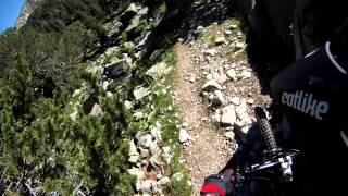
trail: Camí De La Muntanya Superior
0:25 |
119 |
Jan 5, 2022 , Escaldes

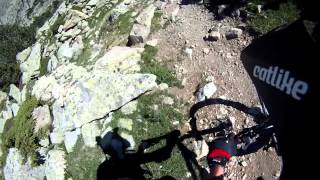
trail: Camí De La Muntanya
0:00 |
226 |
Jan 5, 2022 , Escaldes
Current Trail Warnings
| status | trail | date | condition | user | info |
|---|---|---|---|---|---|
| GR-11-La Dama del Llac | Jun 12, 2026 @ 9:51am (Europe/Andorra) Jun 12, 2026 | Variable | 1stamenov | The trail is for hiking only. Doesn't... |
Recent Trail Reports
| status | trail | date | condition | info | user |
|---|---|---|---|---|---|
| Llac d'Engolasters | Jun 12, 2026 @ 9:51am (Europe/Andorra) Jun 12, 2026 | Ideal | 1stamenov | ||
| Camí de les Molleres | May 4, 2026 @ 7:03am (Europe/Andorra) May 3, 2026 | Wet | CARLESv44VDR | ||
| Vall Del Madriu La Barracota-Orris | Aug 22, 2022 @ 12:20am Aug 22, 2022 | Ideal | Kaltag TFSPAIN |
Activity Feed
| username | action | type | title | date |
|---|---|---|---|---|
| 1stamenov | add | report | activity #96819072 and 1 more | Jun 12, 2026 @ 11:45am Jun 12, 2026 |
| Alexand7 | add | report | activity #94513870 | May 11, 2026 @ 1:23pm May 11, 2026 |
| CARLESv44VDR | ridden | trail | activity #94511047 | May 11, 2026 @ 12:30pm May 11, 2026 |
| CARLESv44VDR | vote | trail | activity #94511044 and 1 more | May 11, 2026 @ 12:30pm May 11, 2026 |
| CARLESv44VDR | comment | trail | activity #94511033 and 1 more | May 11, 2026 @ 12:30pm May 11, 2026 |
Recent Comments
| username | type | title | comment | date |
|---|---|---|---|---|
| trail | Esta también es por lo menos NEGRA 100% | May 11, 2026 @ 12:30pm May 11, 2026 | ||
| trail | Es Negra por lo menos 100% | May 11, 2026 @ 12:30pm May 11, 2026 | ||
| trail | No es azul ni negra... este camino no es para... | Aug 25, 2025 @ 10:27am Aug 25, 2025 | ||
| trail | Si això és blava no m'imagino una negra.... | Jun 12, 2025 @ 10:37pm Jun 12, 2025 | ||
| trail | Ni de coña es azul y ni de coña ambas... | May 17, 2025 @ 7:12am May 17, 2025 |
Activity Type Stats
| activitytype | trails | distance | descent | descent distance | total vertical | rating | global rank | state rank | photos | reports | routes | ridelogs |
|---|---|---|---|---|---|---|---|---|---|---|---|---|
| Mountain Bike | 19 | 16 miles | 8,904 ft | 12 miles | 4,521 ft | #7,525 | #2 | 4 | 11 | 381 | ||
| E-Bike | 19 | 16 miles | 8,904 ft | 12 miles | 4,521 ft | #876 | #3 | 15 | 12 | 50 | ||
| Hike | 19 | 16 miles | 8,901 ft | 12 miles | 4,521 ft | #2,083 | #2 | 12 | 126 | |||
| Trail Running | 19 | 16 miles | 8,901 ft | 12 miles | 4,521 ft | #1,722 | #2 | 12 | 73 |
Frequently Asked Questions About Escaldes
▼
What are the highest rated mountain biking trails in Escaldes?
The highest rated mountain biking trails in Escaldes are:
- Camí De La Muntanya (3.6/5)
- Sortida Tamarro a Ctra (0/5)
- Camp del Serrat (0/5)
- Tamarro-Coll de Jovell-Cabanya (0/5)
- Camí de les Molleres (0/5)
▼
Where can I park to ride in Escaldes?
There are 1 parking locations listed in Escaldes. The most popular parking spots are:
▼
What is the longest trail in Escaldes?
The longest trail in Escaldes is Tamarro-Coll de Jovell-Cabanya at 1.4 miles. View all trails sorted by distance.
▼
What are the best & highest rated hiking trails in Escaldes?
Activities
Trails
Points of Interest
- By JordiEstefanell & contributors
- Admins: tomzaniroli, elyari, snaker4, AMG, kai-bcn
- #32379 - 703 views
- escaldes activity log | embed map of Escaldes mountain bike trails | escaldes mountain biking points of interest
Downloading of trail gps tracks in kml & gpx formats is enabled for Escaldes.
You must login to download files.