close
-
Layers w
- Weather Layers
- Pro
- Pro
- Pro
- Pro
- Pro
- Pro
- More Layers
- Pro
- Pro
- Pro
- Pro
-
Upgrade to

3D
Trail Conditions
- Unknown
- Snow Groomed
- Snow Packed
- Snow Covered
- Snow Cover Partial
- Freeze/thaw Cycle
- Icy
- Prevalent Mud
- Wet
- Variable
- Ideal
- Dry
- Very Dry
Trail Flow (Ridden Direction)
Trailforks scans users ridelogs to determine the most popular direction each trail is ridden. A good flowing trail network will have most trails flowing in a single direction according to their intension.
The colour categories are based on what percentage of riders are riding a trail in its intended direction.
The colour categories are based on what percentage of riders are riding a trail in its intended direction.
- > 96%
- > 90%
- > 80%
- > 70%
- > 50%
- < 50%
- bi-directional trail
- no data
Trail Last Ridden
Trailforks scans ridelogs to determine the last time a trail was ridden.
- < 2 days
- < 1 week
- < 2 weeks
- < 1 month
- < 6 months
- > 6 months
Trail Ridden Direction
The intended direction a trail should be ridden.
- Downhill Only
- Downhill Primary
- Both Directions
- Uphill Primary
- Uphill Only
- One Direction
Contribute Details
Colors indicate trail is missing specified detail.
- Description
- Photos
- Description & Photos
- Videos
Trail Popularity ?
Trailforks scans ridelogs to determine which trails are ridden the most in the last 9 months.
Trails are compared with nearby trails in the same city region with a possible 25 colour shades.
Think of this as a heatmap, more rides = more kinetic energy = warmer colors.
- most popular
- popular
- less popular
- not popular
ATV/ORV/OHV Filter
Max Vehicle Width
inches
US Cell Coverage
Legend

Radar Time
Activity Recordings
Trailforks uses anonymized public activity data.
?
Activity Recordings
Trailforks uses anonymized public activity data.
?
Personal Heatmap
▶
Activity Types
all
/
none
▶
Options
2
Date range
month
–
Winter Trails
Warning
A routing network for winter maps does not exist. Selecting trails using the winter trails layer has been disabled.
Missing Trails
Most Popular
Least Popular
Trails are colored based on popularity. The more popular a trail is, the more red. Less popular trails trend towards green.
Jump Magnitude Heatmap
Heatmap of where riders jump on trails. Zoom in to see individual jumps, click circles to view jump details.
BC Backroad Status
![map legend]()
Service Road Atlas is a free to use, community-driven service for viewing and creating reports on the numerous back-country service roads around B.C. and Alberta.

Slope Aspect
Direction the slope faces
Trails Deemphasized
Trails are shown in grey.
Only show trails with no bike usage.
Suggested Layers
Based on selected activity type
Save the current map location and zoom level as your default home location whenever this page is loaded.
Save
No description for Český Krumlov has been added yet!
Login or register to submit one.
This region uses the Uk/Euro style trail grading system.
Activities Click to view
- Mountain Bike
16 trails
- E-Bike
10 trails
- Adaptive Bike
0 trails
- Winter Fat Bike
0 trails
- Hike
2 trails
- Trail Running
2 trails
Region Details
- 2
- 1
- 3
- 5
- 1
Region Status
Open as of May 15, 2026Stats
- Avg Trail Rating
- Trails (view details)
- 13
- Trails Mountain Bike
- 16
- Trails E-Bike
- 10
- Trails Horse
- 1
- Trails Hike
- 2
- Trails Trail Running
- 2
- Trails Dirtbike/Moto
- 2
- Trails Observed Trials
- 1
- Trails ATV/ORV/OHV
- 1
- Total Distance
- 12 miles
- Total Descent
- 3,061 ft
- Total Vertical
- 1,604 ft
- Highest Trailhead
- 2,990 ft
- Reports
- 70
- Photos
- 173
- Ridden Counter
- 712
Sub Regions
-
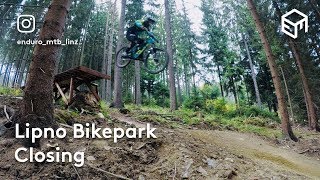
Bikepark Lipno
- 2
- 4
- 1
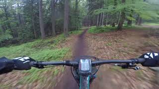
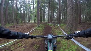
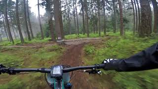
Popular Český Krumlov Mountain Biking Trails
• 60 ★ 3.9 • 4,724 ft • 0 ft • 108 •
Blue line with moderate jumps, but you can find in first forest big double "canyon" gap, where is also chicken line. This line is for beginners and expert riders.
• 90 ★ 4.0 • 2,451 ft • 0 ft • 105 •
Red line is steeper with bigger jumps with table than blue one on opposite side. You can find there a lot of transfer jumps, drops and also one wall ride. Is for expert riders only!
• 80 ★ 4.7 • 4,131 ft • 8 ft • 95 •
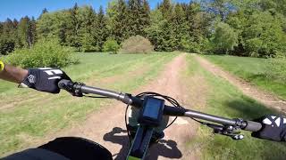
graveled flowtrail to Frymburk easy with lots of curves and some easy jumps
• 70 ★ 2.8 • 3 miles • 57 ft • 78 •
Flow trail for all riders including small children, gravel riders, beginner, etc.
• 40 ★ 2.8 • 3,415 ft • 0 ft • 63 •
Please use this trail as trail only if you want to ride at Lipno Bikepark. This trail is not primary for all day riding.
• 10 ★ 3.6 • 2,992 ft • 10 ft • 37 •
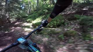
Natural forest-trail. Very easy and flowy, which end at start next singletrack with amazing view to Lipno lake and Frymburk city.
• 5 ★ 4.0 • 888 ft • 3 ft • 3 •
Dirt jump location, good for beginner and experienced riders too. A lot of lines.
Photos of Český Krumlov Mountain Bike
Videos of Český Krumlov Mountain Bike
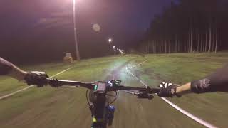
5:05 |
1033 |
Sep 7, 2018
3:28 |
357 |
Sep 7, 2018
5:04 |
492 |
Sep 7, 2018

5:29 |
322 |
Sep 7, 2018
2:54 |
240 |
Sep 7, 2018
5:01 |
265 |
Sep 7, 2018
3:23 |
288 |
Sep 7, 2018
2:04 |
305 |
Sep 7, 2018
Recent Trail Reports
| status | trail | date | condition | info | user |
|---|---|---|---|---|---|
| Marta Flowtrail | May 15, 2026 @ 12:02pm (Europe/Prague) May 15, 2026 | Ideal | ktm-boy-69 TRAILFORKS | ||
| Cihelna Loop | Aug 31, 2025 @ 8:58am Aug 31, 2025 | Ideal | ktm-boy-69 TRAILFORKS | ||
| Lipno Kramolin Uphill 2 | Aug 31, 2025 @ 8:58am Aug 31, 2025 | Ideal | ktm-boy-69 TRAILFORKS | ||
| Natural | Aug 2, 2025 @ 9:41am Aug 2, 2025 | Variable | ktm-boy-69 TRAILFORKS | ||
| Červená | Aug 3, 2024 @ 12:37am Aug 3, 2024 | Ideal | paulkleefman | ||
| Promenádní | Aug 3, 2024 @ 12:37am Aug 3, 2024 | Ideal | paulkleefman | ||
| Modrá | Aug 3, 2024 @ 12:37am Aug 3, 2024 | Ideal | paulkleefman | ||
| Čakovský Doubletrack | May 29, 2024 @ 11:16am May 29, 2024 | Ideal | marek69 | ||
| Floutrejl | Jul 5, 2023 @ 3:00am Jul 5, 2023 | Ideal | marekraska | ||
| Lipno - Frymburk | Jun 25, 2023 @ 4:05am Jun 25, 2023 | Ideal | ktm-boy-69 TRAILFORKS |
Activity Feed
| username | action | type | title | date |
|---|---|---|---|---|
| ThwoshKibWeg2Qui | wishlist | trail | activity #95627639 | May 27, 2026 @ 5:38am May 27, 2026 |
| muerte | ridden | trail | activity #95415340 and 3 more | May 24, 2026 @ 8:55am May 24, 2026 |
| ktm-boy-69 | add | report | activity #94802856 | May 16, 2026 @ 4:44am May 16, 2026 |
| gerison | wishlist | skillpark | activity #94230246 | May 7, 2026 @ 11:19am May 7, 2026 |
| sxn2vb | ridden | trail | activity #82117728 | Oct 11, 2025 @ 4:46am Oct 11, 2025 |
Recent Comments
| username | type | title | comment | date |
|---|---|---|---|---|
| trail | really boring | Apr 11, 2024 @ 4:06am Apr 11, 2024 | ||
| trail | Zumindest schneller als der Jezerni auf der... | Apr 16, 2023 @ 1:52pm Apr 16, 2023 | ||
| trail | hawara.... oida voda... des ding killt...... | Oct 31, 2022 @ 11:50am Oct 31, 2022 | ||
| trail | hawara.... oida voda... des ding killt...... | Oct 31, 2022 @ 11:48am Oct 31, 2022 | ||
| trail | Sadly the trail doesn't exist any more. It has... | May 28, 2022 @ 5:06am May 28, 2022 |
Local Badges
-

Epic Mountain Bike Climb 2k40 awarded -

Climbing 10k Badge11 awarded -

Mountain Biking 100k Badge0 awarded -

Epic Ride Descent 2k40 awarded -

Descent 10k Badge11 awarded -

Descent 100k Badge0 awarded
Bike & Skill Parks
| name | type | city | rating |
|---|---|---|---|
| Bikepark Lipno | bike park | Český Krumlov | |
| Pumptrack Lipno | skill park | Český Krumlov | |
| Kaplice | skill park | Český Krumlov | |
| Pumptrack Skillpark Frymburk | skill park | Český Krumlov |
Activity Type Stats
| activitytype | trails | distance | descent | descent distance | total vertical | rating | global rank | state rank | photos | reports | routes | ridelogs |
|---|---|---|---|---|---|---|---|---|---|---|---|---|
| Mountain Bike | 16 | 12 miles | 3,061 ft | 7 miles | 1,604 ft | #2,155 | #16 | 167 | 70 | 2,345 | ||
| E-Bike | 10 | 7 miles | 873 ft | 3 miles | 1,604 ft | #1,293 | #5 | 65 | 136 | |||
| Horse | 1 | 5,213 ft | 26 ft | 1,670 ft | 39 ft | |||||||
| Hike | 2 | 1 mile | 85 ft | 2,861 ft | 151 ft | #2,392 | #16 | 58 | 174 | |||
| Trail Running | 2 | 1 mile | 85 ft | 2,861 ft | 151 ft | #1,944 | #16 | 58 | 31 | |||
| Dirtbike/Moto | 2 | 1 mile | 85 ft | 2,861 ft | 151 ft | 2 | ||||||
| Observed Trials | 1 | 5,213 ft | 26 ft | 1,670 ft | 39 ft | |||||||
| ATV/ORV/OHV | 1 | 5,213 ft | 26 ft | 1,670 ft | 39 ft |
Frequently Asked Questions About Český Krumlov
▼
What are the best places to ride in Český Krumlov?
Český Krumlov has 1 areas to explore for mountain biking. The top rated areas are:
▼
What are the highest rated mountain biking trails in Český Krumlov?
The highest rated mountain biking trails in Český Krumlov are:
- Marta Flowtrail (4.3/5)
- Cihelna Loop (4.3/5)
- Červená (4/5)
- Krumlov Bikroska - Dirt Jump (4/5)
- Modrá (3.9/5)
▼
What is the best time of the year to ride in Český Krumlov?
Based on ride log data, the most popular months to ride in Český Krumlov are:
- June (9 activities)
- August (8 activities)
- May (8 activities)
▼
Where can I park to ride in Český Krumlov?
There are 5 parking locations listed in Český Krumlov. The most popular parking spots are: View all parking and trailhead locations on the map to plan your visit.
Trails
- By NebsterC-3PO & contributors
- Admins: ČeMBA, ČeMBA, ČeMBA, ČeMBA, ČeMBA, ČeMBA, ČeMBA, ČeMBA, ČeMBA, ČeMBA
- #11741 - 6,046 views
- Český krumlov activity log | embed map of Český Krumlov mountain bike trails | Český krumlov mountain biking points of interest
Downloading of trail gps tracks in kml & gpx formats is enabled for Český Krumlov.
You must login to download files.