close
-
Layers w
- Weather Layers
- Pro
- Pro
- Pro
- Pro
- Pro
- Pro
- More Layers
- Pro
- Pro
- Pro
- Pro
-
Upgrade to

3D
Trail Conditions
- Unknown
- Snow Groomed
- Snow Packed
- Snow Covered
- Snow Cover Partial
- Freeze/thaw Cycle
- Icy
- Prevalent Mud
- Wet
- Variable
- Ideal
- Dry
- Very Dry
Trail Flow (Ridden Direction)
Trailforks scans users ridelogs to determine the most popular direction each trail is ridden. A good flowing trail network will have most trails flowing in a single direction according to their intension.
The colour categories are based on what percentage of riders are riding a trail in its intended direction.
The colour categories are based on what percentage of riders are riding a trail in its intended direction.
- > 96%
- > 90%
- > 80%
- > 70%
- > 50%
- < 50%
- bi-directional trail
- no data
Trail Last Ridden
Trailforks scans ridelogs to determine the last time a trail was ridden.
- < 2 days
- < 1 week
- < 2 weeks
- < 1 month
- < 6 months
- > 6 months
Trail Ridden Direction
The intended direction a trail should be ridden.
- Downhill Only
- Downhill Primary
- Both Directions
- Uphill Primary
- Uphill Only
- One Direction
Contribute Details
Colors indicate trail is missing specified detail.
- Description
- Photos
- Description & Photos
- Videos
Trail Popularity ?
Trailforks scans ridelogs to determine which trails are ridden the most in the last 9 months.
Trails are compared with nearby trails in the same city region with a possible 25 colour shades.
Think of this as a heatmap, more rides = more kinetic energy = warmer colors.
- most popular
- popular
- less popular
- not popular
ATV/ORV/OHV Filter
Max Vehicle Width
inches
US Cell Coverage
Legend

Radar Time
Activity Recordings
Trailforks uses anonymized public activity data.
?
Activity Recordings
Trailforks uses anonymized public activity data.
?
Personal Heatmap
▶
Activity Types
all
/
none
▶
Options
2
Date range
month
–
Winter Trails
Warning
A routing network for winter maps does not exist. Selecting trails using the winter trails layer has been disabled.
Missing Trails
Most Popular
Least Popular
Trails are colored based on popularity. The more popular a trail is, the more red. Less popular trails trend towards green.
Jump Magnitude Heatmap
Heatmap of where riders jump on trails. Zoom in to see individual jumps, click circles to view jump details.
BC Backroad Status
![map legend]()
Service Road Atlas is a free to use, community-driven service for viewing and creating reports on the numerous back-country service roads around B.C. and Alberta.

Slope Aspect
Direction the slope faces
Trails Deemphasized
Trails are shown in grey.
Only show trails with no bike usage.
Suggested Layers
Based on selected activity type
Save the current map location and zoom level as your default home location whenever this page is loaded.
Save
No description for Essex has been added yet!
Login or register to submit one.
This region uses the Uk/Euro style trail grading system.
Activities Click to view
- Mountain Bike
375 trails
- E-Bike
368 trails
- Horse
114 trails
- Hike
392 trails
- Trail Running
392 trails
- Dirtbike/Moto
9 trails
- ATV/ORV/OHV
6 trails
- Nordic Ski
0 trails
Region Details
- 101
- 159
- 106
- 9
Stats
- Avg Trail Rating
- Trails (view details)
- 415
- Trails Mountain Bike
- 375
- Trails E-Bike
- 368
- Trails Horse
- 114
- Trails Hike
- 392
- Trails Trail Running
- 392
- Trails Dirtbike/Moto
- 9
- Trails Observed Trials
- 1
- Trails ATV/ORV/OHV
- 6
- Trails Snowmobile
- 3
- Total Distance
- 216 miles
- Total Descent
- 18,298 ft
- Total Vertical
- 460 ft
- Highest Trailhead
- 465 ft
- Reports
- 2,238
- Photos
- 836
- Ridden Counter
- 20,969
Articles
Video & Event Report: Celebrating 10 Years of Radfest in 2019 - Essex, UK
Aug 8, 2019 from pinkbike.com
A weekend for trials riders, BMXers and dirt jumpers to get together to ride bikes at Radical Bikes bike park in Essex, UK.
Sub Regions
- Brentwood (3)
- Colchester (3)
- Danbury (29)
- Danbury Common (1)
- Grain (1)
- Great Dunmow (25)
- Harlow (37)
- Saffron Walden (35)
- Southend-on-Sea (12)
- Benfleet Downs (0)
- Hadleigh Park (9)
- Epping Forest (227)
Popular Essex Mountain Biking Trails
• 100 ★ 0.0 • 669 ft • 0 ft • 389 •
Popular green difficulty family friendly doubletrack. This multi-use trail can be used both directions and has a easy overall physical rating. On average it takes 1 minutes to complete this trail.
• 95 ★ 0.0 • 732 ft • 5 ft • 342 •
Popular green difficulty singletrack. This multi-use trail can be used both directions and has a easy overall physical rating. On average it takes 1 minutes to complete this trail.
• 90 ★ 3.0 • 920 ft • 0 ft • 268 •
A short undulating run that follows runs along the side of the road. s cave is rumoured to be located near the end of this trail in the front garden of Turpin House on Rats Lane.
• 85 ★ 4.4 • 1 mile • 125 ft • 249 •
Popular red difficulty singletrack. This mountain bike primary trail can be used downhill primary. On average it takes 8 minutes to complete this trail.
• 95 ★ 2.0 • 2,734 ft • 87 ft • 244 •
Popular green difficulty doubletrack. This multi-use trail can be used both directions and has a easy overall physical rating. On average it takes 2 minutes to complete this trail.
Essex Mountain Bike Routes
32 miles • 2,086 ft • 35 • Loop •
Roughly 50K loop from Buckhurst Hill taking in the River Roding (can get overgrown in places), Wanstead...
★ 3.0 • 17 miles • 1,174 ft • 9 • Loop •
Larger 28K/17M Loop than smaller Loop 1
27 miles • 2,364 ft • 127 • Loop •
Decent length route from Epping taking in most decent trails down through Theydon, Loughton, Chingford,...
10 miles • 903 ft • 13 •
Nice Epping route, starting at Pole Hill, ending on the road back to Walthamstow
67 miles • 2,398 ft • 15 • Loop •
A mixture of byways, bridleways and country lanes. Taking in Wylde Skye Brewery Tap Room in Linton for a pint.
29 miles • 801 ft • 2 • Loop •
Local lanes out to Lindsel,and Great Bardfield. Returning through Thaxsted.
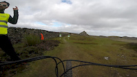
Photos of Essex Mountain Bike
Videos of Essex Mountain Bike

trail: Hadleigh XC - Part 1
6:01 |
458 |
Oct 26, 2019
trail: Blue Bell
0:59 |
245 |
Sep 24, 2019
trail: Blue Bell
0:53 |
350 |
Mar 15, 2017

trail: Warren
0:23 |
364 |
Dec 23, 2016

trail: Blue Bell
3:02 |
46 |
Nov 28, 2016
trail: Footpath
6:25 |
154 |
Aug 22, 2016
trail: Footpath
5:23 |
60 |
Aug 9, 2016

trail: Collarbone
0:13 |
713 |
Aug 4, 2016
Recent Trail Reports
Activity Feed
| username | action | type | title | date |
|---|---|---|---|---|
| trailforks | add | video | activity #96432052 | Jun 6, 2026 @ 11:00pm Jun 6, 2026 |
| Jxroussel | wishlist | region | activity #96249309 | Jun 4, 2026 @ 1:32pm Jun 4, 2026 |
| janftr | add | report | activity #95969528 and 20 more | May 31, 2026 @ 12:45pm May 31, 2026 |
| koleaby4 | wishlist | region | activity #95162200 | May 21, 2026 @ 2:12am May 21, 2026 |
| Olegfiglin | wishlist | route | activity #94170618 | May 6, 2026 @ 12:04pm May 6, 2026 |
Recent Comments
| username | type | title | comment | date |
|---|---|---|---|---|
| trail | Good | Sep 16, 2025 @ 12:52pm Sep 16, 2025 | ||
| trail | No sign of a trail at all. Barely passable... | Sep 21, 2024 @ 5:23am Sep 21, 2024 | ||
| trail | The High Road end of this trail has been... | Aug 24, 2024 @ 2:55pm Aug 24, 2024 | ||
| trail | Great trail with lots of cool bumps and turns. | Aug 15, 2024 @ 3:51am Aug 15, 2024 | ||
| trail | All okay when ridden 2nd April 2024. Just a... | Apr 4, 2024 @ 9:13am Apr 4, 2024 |
Local Badges
-

Epic Ride Descent 2k0 awarded -

Descent 10k Badge0 awarded -
Descent 10k Badge17 awarded -
Epic Ride Descent 2k0 awarded -

Descent 100k Badge0 awarded -

Mountain Biking 100k Badge0 awarded
Bike & Skill Parks
| name | type | city | rating |
|---|---|---|---|
| Braintree BMX Track | skill park | Chelmsford | |
| Baddow Pumptrack | skill park | Chelmsford | |
| Tiptree Pumptrack | skill park | Danbury | |
| Rayne Village Hall Pumptrack | skill park | Chelmsford | |
| Promenade Park Pumptrack | skill park | Danbury |
Local Trail Supporters
- Danbury Dig crew
Activity Type Stats
| activitytype | trails | distance | descent | descent distance | total vertical | rating | global rank | state rank | photos | reports | routes | ridelogs |
|---|---|---|---|---|---|---|---|---|---|---|---|---|
| Mountain Bike | 375 | 200 miles | 17,073 ft | 90 miles | 459 ft | 834 | 2,238 | 14 | 53,720 | |||
| E-Bike | 368 | 191 miles | 16,814 ft | 87 miles | 459 ft | 2,195 | 4 | 2,984 | ||||
| Horse | 114 | 86 miles | 5,538 ft | 38 miles | 436 ft | 479 | 4 | |||||
| Hike | 392 | 211 miles | 18,028 ft | 94 miles | 459 ft | 2,226 | 2 | 1,499 | ||||
| Trail Running | 392 | 211 miles | 17,992 ft | 94 miles | 459 ft | 2,225 | 3 | 4,489 | ||||
| Dirtbike/Moto | 9 | 8 miles | 341 ft | 4 miles | 207 ft | 442 | 2 | |||||
| Observed Trials | 1 | 3,264 ft | 39 ft | |||||||||
| ATV/ORV/OHV | 6 | 6 miles | 295 ft | 3 miles | 207 ft | 2 | 442 | |||||
| Snowmobile | 3 | 3 miles | 148 ft | 1 mile | 112 ft |
Frequently Asked Questions About Essex
▼
What are the best places to ride in Essex?
Essex has 4 areas to explore for mountain biking. The top rated areas are:
▼
What are the highest rated mountain biking trails in Essex?
The highest rated mountain biking trails in Essex are:
- High Beach to Claypit Hill (4.2/5)
- Return of the Jedi (4.2/5)
- Collarbone (4.2/5)
- Earl's Round & Down (4.1/5)
- Fairmead Single Track (4.1/5)
▼
What is the best time of the year to ride in Essex?
Based on ride log data, the most popular months to ride in Essex are:
- July (269 activities)
- June (246 activities)
- August (228 activities)
▼
What is the longest trail in Essex?
The longest trail in Essex is The Flitch Way at 9.9 km. View all trails sorted by distance.
Activities
Trails
Points of Interest
- Debden House Campsite Camping
- Pole Hill Obelisk Viewpoint
- Viewpoint - Honey Lane Quarters
- Viewpoint - Gardeners Arms Pub (views over London)
- Ambresbury Banks Iron Age Earthworks Sight
- Loughton Camp Iron Age Earthworks Sight
- Viewpoint over the forest, reservoirs and London. Worth a look.
- Viewpoints overlooking the Deer Sanctuary and the Forest
- The Glade Viewpoint
- Connaught Water Viewpoint
- By brenthillier
 NSMBA TRAILFORKS & contributors
 - Admins: UKTP, 20twenty-p, wisey, MathieuC, cemoorelife
- #6777 - 28,006 views
- essex activity log | embed map of Essex mountain bike trails | essex mountain biking points of interest polygons
Downloading of trail gps tracks in kml & gpx formats is enabled for Essex.
You must login to download files.