close
-
Layers w
- Weather Layers
- Pro
- Pro
- Pro
- Pro
- Pro
- Pro
- More Layers
- Pro
- Pro
- Pro
- Pro
-
Upgrade to

3D
Trail Conditions
- Unknown
- Snow Groomed
- Snow Packed
- Snow Covered
- Snow Cover Partial
- Freeze/thaw Cycle
- Icy
- Prevalent Mud
- Wet
- Variable
- Ideal
- Dry
- Very Dry
Trail Flow (Ridden Direction)
Trailforks scans users ridelogs to determine the most popular direction each trail is ridden. A good flowing trail network will have most trails flowing in a single direction according to their intension.
The colour categories are based on what percentage of riders are riding a trail in its intended direction.
The colour categories are based on what percentage of riders are riding a trail in its intended direction.
- > 96%
- > 90%
- > 80%
- > 70%
- > 50%
- < 50%
- bi-directional trail
- no data
Trail Last Ridden
Trailforks scans ridelogs to determine the last time a trail was ridden.
- < 2 days
- < 1 week
- < 2 weeks
- < 1 month
- < 6 months
- > 6 months
Trail Ridden Direction
The intended direction a trail should be ridden.
- Downhill Only
- Downhill Primary
- Both Directions
- Uphill Primary
- Uphill Only
- One Direction
Contribute Details
Colors indicate trail is missing specified detail.
- Description
- Photos
- Description & Photos
- Videos
Trail Popularity ?
Trailforks scans ridelogs to determine which trails are ridden the most in the last 9 months.
Trails are compared with nearby trails in the same city region with a possible 25 colour shades.
Think of this as a heatmap, more rides = more kinetic energy = warmer colors.
- most popular
- popular
- less popular
- not popular
ATV/ORV/OHV Filter
Max Vehicle Width
inches
US Cell Coverage
Legend

Radar Time
Activity Recordings
Trailforks uses anonymized public activity data.
?
Activity Recordings
Trailforks uses anonymized public activity data.
?
Personal Heatmap
▶
Activity Types
all
/
none
▶
Options
2
Date range
month
–
Winter Trails
Warning
A routing network for winter maps does not exist. Selecting trails using the winter trails layer has been disabled.
Missing Trails
Most Popular
Least Popular
Trails are colored based on popularity. The more popular a trail is, the more red. Less popular trails trend towards green.
Jump Magnitude Heatmap
Heatmap of where riders jump on trails. Zoom in to see individual jumps, click circles to view jump details.
BC Backroad Status
![map legend]()
Service Road Atlas is a free to use, community-driven service for viewing and creating reports on the numerous back-country service roads around B.C. and Alberta.

Slope Aspect
Direction the slope faces
Trails Deemphasized
Trails are shown in grey.
Only show trails with no bike usage.
Suggested Layers
Based on selected activity type
Save the current map location and zoom level as your default home location whenever this page is loaded.
Save
No description for Ethiopia has been added yet!
Login or register to submit one.
Region Details
- 1
- 8
- 2
- 1
Stats
- Avg Trail Rating
- Trails (view details)
- 12
- Trails Mountain Bike
- 12
- Trails E-Bike
- 1
- Trails Hike
- 12
- Trails Trail Running
- 12
- Total Distance
- 36 miles
- Total Descent
- 16,130 ft
- Total Vertical
- 2,673 ft
- Highest Trailhead
- 9,663 ft
- Reports
- 64
- Ridden Counter
- 29
Sub Regions
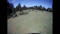
Popular Ethiopia Mountain Biking Trails
• 5 ★ 5.0 • 3 miles • 13 ft • 5 •
This is one of the best runs in the park. All of it is forested singletrack with a bit of everything present from steeps to twisties to a few rock gardens. The first third is a technical, narrow, steep expert DH style track with some...
• 5 ★ 5.0 • 2,494 ft • 10 ft • 3 •
Old school DH track. Natural berms. Delicious. Finishes on the just above the park HQ. Can connect from the opposite downhill side of the park HQ to other trails to get back on to , Ziza, other tracks that may or may not be mapped.
• ★ 4.0 • 1 mile • 0 ft • 3 •
This is tough. Steep rock love fest. Loose but not too fast.
• 5 ★ 5.0 • 4 miles • 3 ft • 3 •
This is Menagesha's best DH singletrack descent with some drops and small jumps for creative line-finders, but mostly it is just fast forest tracks with perfect natural flow. The top third is very technical and steep. There is a...
• ★ 5.0 • 2 miles • 3 ft • 1 •
This is a fast forest track with perfect natural flow and shallow angle of descent. The 15-20-minute descent is great for intermediate/advanced trail riders. There are lots of options, so don't worry too much about going the wrong way....
• 5 ★ 5.0 • 5 miles • 54 ft • 1 •
is one of the iconic Menagesha singletrack descents that includes all land use types in the area, from native juniper forest to pine to eucalyptus forest to agricultural land. The trail quality is superb and has a bit of everything. It...
• ★ 5.0 • 6 miles • 40 ft • 1 •
One of the iconic Menagesha singletrack descents that includes all land use types in the area from native juniper forest to pine to eucalyptus forest to lush agricultural land to degraded agricultural land. Trail quality is superb and...
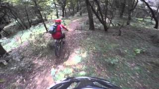
Videos of Ethiopia Mountain Bike
trail: Speedo
3:35 |
158 |
Jan 29, 2015

trail: Boomshakalaka
938 |
Nov 19, 2015 , adisababba
trail: 11
1182 |
Nov 19, 2015 , Addis Ababa

trail: Monkey Machete Mayhem
1734 |
Nov 19, 2015 , Addis Ababa
Recent Comments
| username | type | title | comment | date |
|---|---|---|---|---|
| report | Parts of the the trail is wet | Oct 1, 2023 @ 11:08am Oct 1, 2023 | ||
| trail | Warning March 2017: There are young kids near... | Mar 10, 2017 @ 4:26am Mar 10, 2017 |
Activity Type Stats
| activitytype | trails | distance | descent | descent distance | total vertical | rating | global rank | state rank | photos | reports | routes | ridelogs |
|---|---|---|---|---|---|---|---|---|---|---|---|---|
| Mountain Bike | 12 | 36 miles | 16,129 ft | 30 miles | 2,674 ft | #123 | 64 | 865 | ||||
| E-Bike | 1 | 4 miles | 154 ft | 1,601 ft | 2,018 ft | #109 | 60 | |||||
| Hike | 12 | 36 miles | 16,129 ft | 30 miles | 2,674 ft | #101 | 61 | 51 | ||||
| Trail Running | 12 | 36 miles | 16,129 ft | 30 miles | 2,674 ft | #99 | 61 |
Trails
Points of Interest
- By stifford
 & contributors
 - Admins: apply
- #6326 - 5,030 views
- ethiopia activity log | embed map of Ethiopia mountain bike trails |
Downloading of trail gps tracks in kml & gpx formats is enabled for Ethiopia.
You must login to download files.