close
-
Layers w
- Weather Layers
- Pro
- Pro
- Pro
- Pro
- Pro
- Pro
- More Layers
- Pro
- Pro
- Pro
- Pro
-
Upgrade to

3D
Trail Conditions
- Unknown
- Snow Groomed
- Snow Packed
- Snow Covered
- Snow Cover Partial
- Freeze/thaw Cycle
- Icy
- Prevalent Mud
- Wet
- Variable
- Ideal
- Dry
- Very Dry
Trail Flow (Ridden Direction)
Trailforks scans users ridelogs to determine the most popular direction each trail is ridden. A good flowing trail network will have most trails flowing in a single direction according to their intension.
The colour categories are based on what percentage of riders are riding a trail in its intended direction.
The colour categories are based on what percentage of riders are riding a trail in its intended direction.
- > 96%
- > 90%
- > 80%
- > 70%
- > 50%
- < 50%
- bi-directional trail
- no data
Trail Last Ridden
Trailforks scans ridelogs to determine the last time a trail was ridden.
- < 2 days
- < 1 week
- < 2 weeks
- < 1 month
- < 6 months
- > 6 months
Trail Ridden Direction
The intended direction a trail should be ridden.
- Downhill Only
- Downhill Primary
- Both Directions
- Uphill Primary
- Uphill Only
- One Direction
Contribute Details
Colors indicate trail is missing specified detail.
- Description
- Photos
- Description & Photos
- Videos
Trail Popularity ?
Trailforks scans ridelogs to determine which trails are ridden the most in the last 9 months.
Trails are compared with nearby trails in the same city region with a possible 25 colour shades.
Think of this as a heatmap, more rides = more kinetic energy = warmer colors.
- most popular
- popular
- less popular
- not popular
ATV/ORV/OHV Filter
Max Vehicle Width
inches
US Cell Coverage
Legend

Radar Time
Activity Recordings
Trailforks uses anonymized public activity data.
?
Activity Recordings
Trailforks uses anonymized public activity data.
?
Personal Heatmap
▶
Activity Types
all
/
none
▶
Options
2
Date range
month
–
Winter Trails
Warning
A routing network for winter maps does not exist. Selecting trails using the winter trails layer has been disabled.
Missing Trails
Most Popular
Least Popular
Trails are colored based on popularity. The more popular a trail is, the more red. Less popular trails trend towards green.
Jump Magnitude Heatmap
Heatmap of where riders jump on trails. Zoom in to see individual jumps, click circles to view jump details.
BC Backroad Status
![map legend]()
Service Road Atlas is a free to use, community-driven service for viewing and creating reports on the numerous back-country service roads around B.C. and Alberta.

Slope Aspect
Direction the slope faces
Trails Deemphasized
Trails are shown in grey.
Only show trails with no bike usage.
Suggested Layers
Based on selected activity type
Save the current map location and zoom level as your default home location whenever this page is loaded.
Save
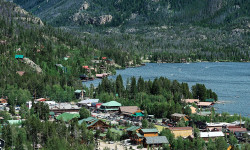
No description for Eugene has been added yet!
Login or register to submit one.
Activities Click to view
- Mountain Bike
243 trails
- E-Bike
101 trails
- Gravel Bike
0 trails
- Adaptive Bike
0 trails
- Winter Fat Bike
0 trails
- Horse
5 trails
- Hike
330 trails
- Trail Running
330 trails
Region Details
- 30
- 107
- 20
- 5
- 1
Region Status
Caution as of 20 hoursLocal Trail Association
Stats
- Avg Trail Rating
- Trails (view details)
- 181
- Trails Mountain Bike
- 257
- Trails E-Bike
- 101
- Trails Horse
- 5
- Trails Hike
- 330
- Trails Trail Running
- 330
- Total Distance
- 169 miles
- Total Descent
- 25,591 ft
- Total Vertical
- 5,217 ft
- Highest Trailhead
- 5,596 ft
- Reports
- 1,976
- Photos
- 778
- Ridden Counter
- 31,899
Articles
Lesser-Known Lake Escapes in the U.S.
May 22, 2025 from outsideonline.com
From turquoise gems in the Rockies to forest-fringed glacial lakes in New England, escape the crowds at these nine lakes in the U.S. where...
Sub Regions
-
Alton Baker Park
- 16
- 4
-
Carpenter Bypass
- 52
- 14
- 1
- 1
-
Hendricks Park
-
McKenzie River
- 5
- 2
-
Ridgeline Park
- 24
- 4
- 2
-
Wild Iris Ridge
- 8
Popular Eugene Mountain Biking Trails
• 75 ★ 4.2 • 25 miles • 604 ft • 1,285 •
Whether biking, walking or running - this is one of the most spectacular trails to travel. Through lush 300 year old old growth forests and lava fields, along side lakes so clean you can see over 100 feet to the bottom! Most hikers and...
• 75 ★ 5.0 • 3 miles • 79 ft • 738 •
This is a optional, and easier, line to the more difficult that follows the east side of . The trail offers views of and follows a well constructed trail through old growth forest.
• 70 ★ 4.2 • 4 miles • 1,644 ft • 543 •
Natural tread multiuse singletrack climbing or descending trail in the Willamette National Forest. Narrow bench cut singletrack at the top until the first road crossing at about the 1 mile point. Below that a newly-built section (as of...
• 95 ★ 4.6 • 1,558 ft • 0 ft • 505 •
Beginner to intermediate level flow trail. Many rollers and berms, some tabletop jumps and some poppy short jumps at the bottom. Last two big jumps are intimidating lips but have ridearounds if you're not ready for them. Everything is...
• 100 ★ 2.7 • 1,529 ft • 0 ft • 488 •
Popular green difficulty singletrack. This mountain bike primary trail and has a moderate overall physical rating with a 0 ft green climb. On average it takes 2 minutes to complete this trail.
• 95 ★ 4.4 • 2,297 ft • 0 ft • 472 •
Old-school cross-country downhill trail that has gotten recently modified with insloped (bermed) corners and catch basins and a few jumps. Very fast ride.
• 100 ★ 3.0 • 1,437 ft • 0 ft • 445 •
Relatively straight and level cross-country connector trail between two gravel s. Provides access to the top of as well as the end of and short connector descents down to the south . A good alternative to riding the paved road back and...
• 100 ★ 4.0 • 2,457 ft • 115 ft • 439 •
Popular green difficulty singletrack. This mountain bike primary trail and has a easy overall physical rating with a 115 ft green climb. On average it takes 6 minutes to complete this trail.
Eugene Mountain Bike Routes
★ 4.0 • 16 miles • 2,416 ft • 31 •
Ben's suggested 3 hour Whypass ride.
★ 4.0 • 17 miles • 2,114 ft • 4 • Shuttled •
This is an alternate start to the North put-in and South put-in (Pat Saddle) for , to get you to O'Leary...
★ 5.0 • 26 miles • 6,191 ft • 4 • Loop •
This ride is the burly, backcountry loop with a short road connection to start. The O'Leary Trail Loop...
5 miles • 838 ft • 8 •
North area route. Shuttling , or making your ebike buddy put it in turbo mode to fetch the car at the...
10 miles • 1,579 ft • 2 • Loop •
This route is intended for adaptive riders, but anyone can do it. It skips the first section of trail...
★ 3.0 • 3 miles • 616 ft • 5 • Loop •
Sampler route for beginners at Whypass, focusing on as the primary descent.
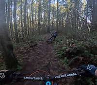
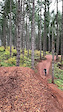
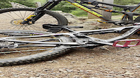
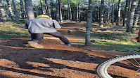
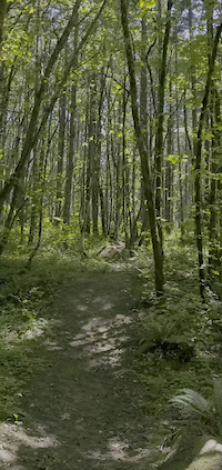
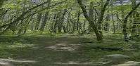
Photos of Eugene Mountain Bike
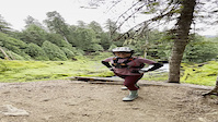
Videos of Eugene Mountain Bike
trail: Pipedream
0:14 |
143 |
Dec 22, 2023
trail: The Gift
0:20 |
187 |
Oct 22, 2023
trail: McKenzie River Trail
0:11 |
|
May 1, 2023
trail: McKenzie River Trail
0:09 |
|
May 1, 2023
trail: The Gift
0:06 |
|
Nov 30, 2022
trail: Death Therapy
0:08 |
384 |
Jul 1, 2022

trail: Death Therapy
0:06 |
|
Jul 1, 2022
trail: Death Therapy
0:06 |
|
Jun 30, 2022
Recent Trail Reports
| status | trail | date | condition | info | user |
|---|---|---|---|---|---|
| Y2K | Jun 19, 2026 @ 3:03pm (America/Los_Angeles) 20 hours | Ideal | tRailzs | ||
| Mama Tried | Jun 19, 2026 @ 2:54pm (America/Los_Angeles) 20 hours | Dry | tRailzs | ||
| Ode to Joy | Jun 19, 2026 @ 1:56pm (America/Los_Angeles) 21 hours | Dry | tRailzs | ||
| The Gift | Jun 19, 2026 @ 12:32pm (America/Los_Angeles) 22 hours | Dry | tRailzs | ||
| Can't Be Done | Jun 7, 2026 @ 2:25pm (America/Boise) Jun 7, 2026 | Dry | ninjabraap | ||
| Boneyard | Jun 7, 2026 @ 2:25pm (America/Boise) Jun 7, 2026 | Dry | ninjabraap | ||
| Burial Ground (Alternate) | Jun 7, 2026 @ 2:25pm (America/Boise) Jun 7, 2026 | Dry | ninjabraap | ||
| Hit Parade Climb | Jun 7, 2026 @ 2:25pm (America/Boise) Jun 7, 2026 | Dry | ninjabraap | ||
| Hit Parade | Jun 7, 2026 @ 2:25pm (America/Boise) Jun 7, 2026 | Dry | ninjabraap | ||
| SST | Jun 7, 2026 @ 2:25pm (America/Boise) Jun 7, 2026 | Dry | ninjabraap |
Activity Feed
| username | action | type | title | date |
|---|---|---|---|---|
| Strattoa | wishlist | route | activity #97389320 | Jun 20, 2026 @ 6:43am 4 hours |
| Strattoa | wishlist | trail | activity #97388409 | Jun 20, 2026 @ 6:30am 4 hours |
| amy9999 | wishlist | trail | activity #97347720 | Jun 19, 2026 @ 3:12pm 19 hours |
| tRailzs | comment | trail | activity #97346982 | Jun 19, 2026 @ 3:01pm 20 hours |
| Markz99jo4 | add | photo | activity #97342840 | Jun 19, 2026 @ 1:54pm 21 hours |
Recent Comments
| username | type | title | comment | date |
|---|---|---|---|---|
| trail | Pretty fun and fast but the drops are... | Jun 19, 2026 @ 3:01pm 20 hours | ||
| trail | That's because they aren't bikers and don't... | Jun 5, 2026 @ 8:35am Jun 5, 2026 | ||
| trail | Loose chunky rocks to the first switchback.... | Jun 4, 2026 @ 8:25pm Jun 4, 2026 | ||
| report | Thanks for the update! | Feb 15, 2026 @ 1:47pm Feb 15, 2026 | ||
| report | Thanks for the update, such a bummer | Jan 8, 2026 @ 10:32am Jan 8, 2026 |
Local Badges
-

Completionist0 awarded -

Big Ride 30k3,484 awarded -

Epic Ride 50k1,270 awarded -

Top 10 Trails2 awarded -

Descent 100k Badge8 awarded -
Completionist0 awarded
Bike & Skill Parks
| name | type | city | rating |
|---|---|---|---|
| Alton Baker BMX Track | skill park | Eugene |
Local Trail Supporters
- Eugene Parks Foundation
Activity Type Stats
| activitytype | trails | distance | descent | descent distance | total vertical | rating | global rank | state rank | photos | reports | routes | ridelogs |
|---|---|---|---|---|---|---|---|---|---|---|---|---|
| Mountain Bike | 243 | 138 miles | 22,785 ft | 61 miles | 5,217 ft | #454 | #168 | 764 | 1,969 | 16 | 29,928 | |
| E-Bike | 101 | 6 miles | 935 ft | 2 miles | 856 ft | #3,179 | #1,147 | 9 | 1,148 | 2 | 1,504 | |
| Horse | 5 | 24 miles | 1,227 ft | 4 miles | 4,364 ft | #1,403 | #836 | 156 | ||||
| Hike | 330 | 163 miles | 23,747 ft | 66 miles | 5,217 ft | #271 | #135 | 3 | 1,853 | 2,752 | ||
| Trail Running | 330 | 163 miles | 23,747 ft | 66 miles | 5,217 ft | #546 | #210 | 3 | 1,853 | 2,506 |
Frequently Asked Questions About Eugene
▼
What are the best places to ride in Eugene?
Eugene has 6 areas to explore for mountain biking. The top rated areas are:
▼
What are the highest rated mountain biking trails in Eugene?
The highest rated mountain biking trails in Eugene are:
- Hit Parade (4.6/5)
- Fun Times (4.4/5)
- Uno Mas (4.4/5)
- Mama Tried (4.4/5)
- Can't Be Done (4.4/5)
▼
What is the best time of the year to ride in Eugene?
Based on ride log data, the most popular months to ride in Eugene are:
- July (358 activities)
- August (253 activities)
- June (212 activities)
▼
Where can I park to ride in Eugene?
Activities
Trails
Points of Interest
- Paradise Campground Camping
- Tamolitch (Blue) Pool Sight
- Sahalie Falls Sight
- Great Springs (Blue Pool) Sight
- Koosah Falls Sight
- Ice Cap Creek Campground Camping
- Cold Water Cove Campground Camping
- Spencer Butte Summit
- Shelter Cabin
- [dog park] Alton Baker Dog Park Other
- Burnt Top (6,276 ft)
- Groundhog Mountain (6,135 ft)
- Little Groundhog Mountain (6,010 ft)
- By ACree
 & contributors
 - Admins: DOD, OTA
- #6117 - 28,067 views
- eugene activity log | embed map of Eugene mountain bike trails | eugene mountain biking points of interest polygons
Downloading of trail gps tracks in kml & gpx formats is enabled for Eugene.
You must login to download files.