close
-
Layers w
- Weather Layers
- Pro
- Pro
- Pro
- Pro
- Pro
- Pro
- More Layers
- Pro
- Pro
- Pro
- Pro
-
Upgrade to

3D
Trail Conditions
- Unknown
- Snow Groomed
- Snow Packed
- Snow Covered
- Snow Cover Partial
- Freeze/thaw Cycle
- Icy
- Prevalent Mud
- Wet
- Variable
- Ideal
- Dry
- Very Dry
Trail Flow (Ridden Direction)
Trailforks scans users ridelogs to determine the most popular direction each trail is ridden. A good flowing trail network will have most trails flowing in a single direction according to their intension.
The colour categories are based on what percentage of riders are riding a trail in its intended direction.
The colour categories are based on what percentage of riders are riding a trail in its intended direction.
- > 96%
- > 90%
- > 80%
- > 70%
- > 50%
- < 50%
- bi-directional trail
- no data
Trail Last Ridden
Trailforks scans ridelogs to determine the last time a trail was ridden.
- < 2 days
- < 1 week
- < 2 weeks
- < 1 month
- < 6 months
- > 6 months
Trail Ridden Direction
The intended direction a trail should be ridden.
- Downhill Only
- Downhill Primary
- Both Directions
- Uphill Primary
- Uphill Only
- One Direction
Contribute Details
Colors indicate trail is missing specified detail.
- Description
- Photos
- Description & Photos
- Videos
Trail Popularity ?
Trailforks scans ridelogs to determine which trails are ridden the most in the last 9 months.
Trails are compared with nearby trails in the same city region with a possible 25 colour shades.
Think of this as a heatmap, more rides = more kinetic energy = warmer colors.
- most popular
- popular
- less popular
- not popular
ATV/ORV/OHV Filter
Max Vehicle Width
inches
US Cell Coverage
Legend

Radar Time
Activity Recordings
Trailforks uses anonymized public activity data.
?
Activity Recordings
Trailforks uses anonymized public activity data.
?
Personal Heatmap
▶
Activity Types
all
/
none
▶
Options
2
Date range
month
–
Winter Trails
Warning
A routing network for winter maps does not exist. Selecting trails using the winter trails layer has been disabled.
Missing Trails
Most Popular
Least Popular
Trails are colored based on popularity. The more popular a trail is, the more red. Less popular trails trend towards green.
Jump Magnitude Heatmap
Heatmap of where riders jump on trails. Zoom in to see individual jumps, click circles to view jump details.
BC Backroad Status
![map legend]()
Service Road Atlas is a free to use, community-driven service for viewing and creating reports on the numerous back-country service roads around B.C. and Alberta.

Slope Aspect
Direction the slope faces
Trails Deemphasized
Trails are shown in grey.
Only show trails with no bike usage.
Suggested Layers
Based on selected activity type
Save the current map location and zoom level as your default home location whenever this page is loaded.
Save
No description for Eureka has been added yet!
Login or register to submit one.
Activities Click to view
- Mountain Bike
46 trails
- Adaptive Bike
0 trails
- Winter Fat Bike
0 trails
- Hike
52 trails
- Trail Running
55 trails
Region Details
- 3
- 4
- 9
- 23
- 3
Region Status
Caution as of Jul 16, 2025Local Trail Association
Stats
- Avg Trail Rating
- Trails (view details)
- 44
- Trails Mountain Bike
- 46
- Trails E-Bike
- 2
- Trails Horse
- 3
- Trails Hike
- 55
- Trails Trail Running
- 55
- Trails Dirtbike/Moto
- 2
- Trails ATV/ORV/OHV
- 2
- Total Distance
- 149 miles
- Total Descent
- 50,989 ft
- Total Vertical
- 5,110 ft
- Highest Trailhead
- 7,745 ft
- Reports
- 89
- Photos
- 196
- Ridden Counter
- 948
Sub Regions
-
Ten Lakes Scenic Recreation Area
- 5
- 18
- 3
Popular Eureka Mountain Biking Trails
• 90 ★ 2.5 • 1 mile • 250 ft • 66 •
This section of the /#339 runs between trail #341and trail #87(Therriault Pass). Pretty ridable in either direction.
• 85 ★ 3.5 • 2 miles • 1,601 ft • 63 •
Main access trail from the west side to the Ten Lakes Scenic Recreation Area/Therriault Pass/Therriault Lakes/Woverine Basin and . Trails in the Ten Lakes Scenic Recreation Area are shown on the Kootenai National Forest/Rexford and...
• 90 ★ 4.0 • 1 mile • 368 ft • 63 •
This Section of the /FS #339 runs between trails #88 #341. Some pushing if riding from south to north.
• 95 ★ 4.0 • 1,886 ft • 71 ft • 47 •
/FS Trail #339. This section runs through Therriault Pass Trail #87, continuing eastwards it intersects the Trail #335 and then intersects the Big therriault trail #190.
• 95 ★ 4.0 • 1 mile • 140 ft • 43 •
This section of trail 339 runs between Paradise/ /#83 and the Sinclair Peak Trail/#88. You can ride it either way. Traveling from south to north there is a bit of hike-a-biking. The 339 is part of the loop.
• 75 ★ 0.0 • 4 miles • 440 ft • 41 •
Popular black diamond difficulty singletrack. This mountain bike primary trail can be used both directions and has a moderate overall physical rating with a 440 ft blue climb. On average it takes 35 minutes to complete this trail.
• 70 ★ 4.0 • 2 miles • 577 ft • 38 •
This section of the #339 runs between Trail #83 and Trail #84. this is part of the loop.
• 80 ★ 3.0 • 2 miles • 1,095 ft • 35 •
Intermittent feeder trail creating longer or shorter loops in the Wolverine Lakes Basin. Strong riders should be able to clean the ride going up. Map source: Kootenai Nat Forest Map/Rexford and Forting Ranger Districts.
Eureka Mountain Bike Routes
10 miles • 2,078 ft • 11 •
sdfasdfasdgasdgfdfgfdghfdghrtyertgdfsgsadfasdfasdfasdfasdfasdfasdf
19 miles • 4,348 ft • 9 • Loop •
10 Lakes Loop. Starting and finishing at Big Terriault Campground.
79 miles • 16,508 ft • 1 •
The Pacific Northwest Trail is a 1,200-mile continuous path from the Continental Divide to the Pacific...
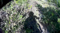
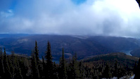
Photos of Eureka Mountain Bike
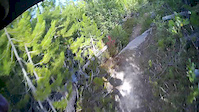
Videos of Eureka Mountain Bike
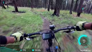
trail: Webb Lookout
3:01 |
272 |
Jul 21, 2015
trail: Webb Lookout
3:01 |
177 |
Jul 20, 2015
trail: Webb Lookout
3:01 |
413 |
Oct 21, 2014
885 |
Aug 15, 2017 , Eureka
Recent Trail Reports
| status | trail | date | condition | info | user |
|---|---|---|---|---|---|
| Sinclair Creek | Jul 16, 2025 @ 9:48am Jul 16, 2025 | Dry | Hobbs | ||
| Highline Trail | Jul 16, 2025 @ 9:48am Jul 16, 2025 | Dry | Hobbs | ||
| Highline Trail | Jul 16, 2025 @ 9:48am Jul 16, 2025 | Dry | Hobbs | ||
| Highline Trail | Jul 16, 2025 @ 9:48am Jul 16, 2025 | Ideal | Hobbs | ||
| Therriault Pass/Trail #87 | Jul 16, 2025 @ 9:48am Jul 16, 2025 | Variable | Hobbs | ||
| South Side of Therriault Lake | Oct 10, 2024 @ 1:30pm Oct 10, 2024 | Ideal | phess907 | ||
| Highline Trail | Oct 10, 2024 @ 1:30pm Oct 10, 2024 | Ideal | phess907 | ||
| Bluebird Lakes Trail | Oct 10, 2024 @ 1:30pm Oct 10, 2024 | Ideal | phess907 | ||
| Poorman Mountain | Oct 2, 2024 @ 11:40pm Oct 2, 2024 | Dry | bigdawggjcrossover | ||
| Tuchuck Creek | Aug 18, 2024 @ 10:03am Aug 18, 2024 | Unknown | b-man2u |
National Scenic Trails & Official Routes
-
Pacific Northwest Trail
- Mountain Bike
- Horse
- Hike
- Trail Running
Activity Feed
| username | action | type | title | date |
|---|---|---|---|---|
| 2WheeledGaper | wishlist | route | activity #97602716 | Jun 22, 2026 @ 8:40pm 3 days |
| zacharystephenmiller | ridden | trail | activity #93662368 | Apr 29, 2026 @ 11:37am Apr 29, 2026 |
| zacharystephenmiller | ridden | trail | activity #93661907 | Apr 29, 2026 @ 11:31am Apr 29, 2026 |
| otterpop86 | wishlist | trail | activity #93519042 | Apr 27, 2026 @ 8:32am Apr 27, 2026 |
| JeffVonKiper | update | trail | activity #93125263 and 1 more | Apr 21, 2026 @ 7:35pm Apr 21, 2026 |
Recent Comments
| username | type | title | comment | date |
|---|---|---|---|---|
| trail | This would be an epic trail, if there... | Aug 24, 2025 @ 8:50am Aug 24, 2025 | ||
| trail | Trail is overgrown for the first three miles... | Aug 6, 2023 @ 5:20pm Aug 6, 2023 | ||
| trail | O | Jul 28, 2023 @ 5:08am Jul 28, 2023 | ||
| trail | Rideable, lots of trees down and slightly... | Sep 11, 2022 @ 8:24pm Sep 11, 2022 | ||
| trail | Snowy and cold!! | Oct 11, 2021 @ 12:39pm Oct 11, 2021 |
Local Badges
-

10 Black Trails7 awarded -

Epic Ride Climb 2k66 awarded -

Climbing 10k Badge9 awarded -

Climbing 100k Badge0 awarded -

Epic Ride Descent 2k70 awarded -

Descent 10k Badge9 awarded
Activity Type Stats
| activitytype | trails | distance | descent | descent distance | total vertical | rating | global rank | state rank | photos | reports | routes | ridelogs |
|---|---|---|---|---|---|---|---|---|---|---|---|---|
| Mountain Bike | 46 | 140 miles | 46,388 ft | 66 miles | 5,112 ft | #1,862 | #682 | 195 | 89 | 3 | 971 | |
| E-Bike | 2 | 56 | 15 | |||||||||
| Horse | 3 | 31 | 4 | |||||||||
| Hike | 52 | 149 miles | 50,991 ft | 74 miles | 5,112 ft | #1,643 | #731 | 1 | 89 | 1 | 254 | |
| Trail Running | 55 | 149 miles | 50,991 ft | 74 miles | 5,112 ft | #1,269 | #462 | 89 | 14 | |||
| Dirtbike/Moto | 2 | 31 | 9 | |||||||||
| ATV/ORV/OHV | 2 | 31 | 3 |
Frequently Asked Questions About Eureka
▼
What are the best places to ride in Eureka?
Eureka has 1 areas to explore for mountain biking.
▼
What are the highest rated mountain biking trails in Eureka?
The highest rated mountain biking trails in Eureka are:
- Webb Lookout (4.4/5)
- Thoma-Tuchuck Peak (4.2/5)
- Tuchuck Creek (4.2/5)
- Review Mountain (4.1/5)
- Laughing Water (4.1/5)
▼
What is the best time of the year to ride in Eureka?
Based on ride log data, the most popular months to ride in Eureka are:
- July (31 activities)
- August (27 activities)
- September (13 activities)
▼
Where can I park to ride in Eureka?
Trails
- By b-man2u
 & contributors
 - Admins: FAMB, JeffVonKiper
- #5687 - 10,072 views
- eureka activity log | embed map of Eureka mountain bike trails | eureka mountain biking points of interest
Downloading of trail gps tracks in kml & gpx formats is enabled for Eureka.
You must login to download files.