close
-
Layers w
- Weather Layers
- Pro
- Pro
- Pro
- Pro
- Pro
- Pro
- More Layers
- Pro
- Pro
- Pro
- Pro
-
Upgrade to

3D
Trail Conditions
- Unknown
- Snow Groomed
- Snow Packed
- Snow Covered
- Snow Cover Partial
- Freeze/thaw Cycle
- Icy
- Prevalent Mud
- Wet
- Variable
- Ideal
- Dry
- Very Dry
Trail Flow (Ridden Direction)
Trailforks scans users ridelogs to determine the most popular direction each trail is ridden. A good flowing trail network will have most trails flowing in a single direction according to their intension.
The colour categories are based on what percentage of riders are riding a trail in its intended direction.
The colour categories are based on what percentage of riders are riding a trail in its intended direction.
- > 96%
- > 90%
- > 80%
- > 70%
- > 50%
- < 50%
- bi-directional trail
- no data
Trail Last Ridden
Trailforks scans ridelogs to determine the last time a trail was ridden.
- < 2 days
- < 1 week
- < 2 weeks
- < 1 month
- < 6 months
- > 6 months
Trail Ridden Direction
The intended direction a trail should be ridden.
- Downhill Only
- Downhill Primary
- Both Directions
- Uphill Primary
- Uphill Only
- One Direction
Contribute Details
Colors indicate trail is missing specified detail.
- Description
- Photos
- Description & Photos
- Videos
Trail Popularity ?
Trailforks scans ridelogs to determine which trails are ridden the most in the last 9 months.
Trails are compared with nearby trails in the same city region with a possible 25 colour shades.
Think of this as a heatmap, more rides = more kinetic energy = warmer colors.
- most popular
- popular
- less popular
- not popular
ATV/ORV/OHV Filter
Max Vehicle Width
inches
US Cell Coverage
Legend

Radar Time
Activity Recordings
Trailforks uses anonymized public activity data.
?
Activity Recordings
Trailforks uses anonymized public activity data.
?
Personal Heatmap
▶
Activity Types
all
/
none
▶
Options
2
Date range
month
–
Winter Trails
Warning
A routing network for winter maps does not exist. Selecting trails using the winter trails layer has been disabled.
Missing Trails
Most Popular
Least Popular
Trails are colored based on popularity. The more popular a trail is, the more red. Less popular trails trend towards green.
Jump Magnitude Heatmap
Heatmap of where riders jump on trails. Zoom in to see individual jumps, click circles to view jump details.
BC Backroad Status
![map legend]()
Service Road Atlas is a free to use, community-driven service for viewing and creating reports on the numerous back-country service roads around B.C. and Alberta.

Slope Aspect
Direction the slope faces
Trails Deemphasized
Trails are shown in grey.
Only show trails with no bike usage.
Suggested Layers
Based on selected activity type
Save the current map location and zoom level as your default home location whenever this page is loaded.
Save
No description for Evanston has been added yet!
Login or register to submit one.
Activities Click to view
- Mountain Bike
31 trails
- E-Bike
12 trails
- Adaptive Bike
0 trails
- Winter Fat Bike
0 trails
- Hike
39 trails
- Trail Running
40 trails
Region Details
- 3
- 10
- 12
- 5
- 1
Region Status
Open as of May 9, 2026Stats
- Avg Trail Rating
- Trails (view details)
- 36
- Trails Mountain Bike
- 31
- Trails E-Bike
- 12
- Trails Hike
- 40
- Trails Trail Running
- 40
- Total Distance
- 23 miles
- Total Descent
- 2,985 ft
- Total Vertical
- 874 ft
- Highest Trailhead
- 7,551 ft
- Reports
- 77
- Photos
- 39
- Ridden Counter
- 1,180
Sub Regions
-
Bear River State Park
- 10
- 2
-
Rio Oso
- 10
- 5
- 1
Popular Evanston Mountain Biking Trails
• 85 ★ 4.0 • 4,593 ft • 173 ft • 80 •
Popular green difficulty singletrack. This mountain bike primary trail can be used both directions and has a moderate overall physical rating with a 173 ft blue climb. On average it takes 10 minutes to complete this trail.
• 75 ★ 4.0 • 1,535 ft • 0 ft • 65 •
Downhill flow with good berms and several little jumps. This trail has some good speed and the berms aren't huge, but just enough to keep up your speed before and after the kickers
• 65 ★ 4.4 • 1,022 ft • 10 ft • 63 •
One way trail down over three drops and with multiple jump opportunities. The trail starts with a rock drop, but if you go slow you can roll it like all the other 2 drops. One of the drops in the middle is more of a fast rock slab roll....
• 95 ★ 4.5 • 3,855 ft • 37 ft • 60 •
Flowey connector to the Anthill loop with berms and tabletop jumps.
• 100 ★ 4.0 • 1,637 ft • 65 ft • 57 •
Popular green difficulty singletrack. This mountain bike primary trail. On average it takes 3 minutes to complete this trail.
• 75 ★ 4.0 • 1,457 ft • 152 ft • 56 •
Fairly difficult climb but very doable, fun down from the top to the trail head area of the system.
• 100 ★ 4.0 • 646 ft • 21 ft • 54 •
Popular green difficulty singletrack. This mountain bike primary trail can be used both directions. On average it takes 1 minutes to complete this trail.
• 65 ★ 3.0 • 5,180 ft • 40 ft • 51 •
Trail that follows the river edge to an uphill section connecting with upper trail system. There is a technical area that slopes to the river.
Evanston Mountain Bike Routes
612 miles • 26,166 ft • 0 • Point to Point •
A challenging, rugged trek across Wyoming. The route dips to within a mile of the Colorado state line near...
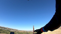
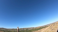
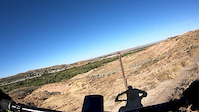
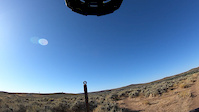
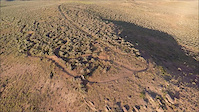
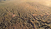
Photos of Evanston Mountain Bike
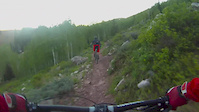
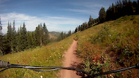
Videos of Evanston Mountain Bike
trail: Drop In
0:13 |
157 |
Sep 18, 2019
trail: Snake
0:26 |
71 |
Sep 18, 2019
trail: Huff & Puff
0:22 |
54 |
Sep 18, 2019
trail: EZPZ
0:49 |
31 |
Sep 18, 2019
trail: Horney Toad
0:47 |
39 |
Aug 4, 2019
trail: Horney Toad
0:02 |
37 |
Aug 4, 2019
trail: Cottonwood
6:41 |
419 |
Jun 16, 2016
trail: Cottonwood
0:12 |
314 |
Apr 9, 2012
Recent Trail Reports
| status | trail | date | condition | info | user |
|---|---|---|---|---|---|
| Snake | Aug 7, 2025 @ 10:01am Aug 7, 2025 | Dry | padrefan1982 | ||
| Dead Goat | Aug 7, 2025 @ 10:01am Aug 7, 2025 | Dry | padrefan1982 | ||
| Side Betty | Aug 7, 2025 @ 10:01am Aug 7, 2025 | Dry | padrefan1982 | ||
| Dry Hole Cut | Aug 7, 2025 @ 10:01am Aug 7, 2025 | Dry | padrefan1982 | ||
| Dry Hole Loop | Aug 7, 2025 @ 10:01am Aug 7, 2025 | Dry | padrefan1982 | ||
| Owls Roost | Aug 7, 2025 @ 10:01am Aug 7, 2025 | Very Dry | padrefan1982 | ||
| Dead Goat | Aug 7, 2025 @ 10:01am Aug 7, 2025 | Dry | padrefan1982 | ||
| Rivers Edge | Oct 18, 2023 @ 7:20am Oct 18, 2023 | Dry | kb7rsk | ||
| E.T. Hwy | Oct 18, 2023 @ 7:20am Oct 18, 2023 | Dry | kb7rsk | ||
| Area 36 | Oct 18, 2023 @ 7:20am Oct 18, 2023 | Dry | kb7rsk |
Activity Feed
| username | action | type | title | date |
|---|---|---|---|---|
| Tealstr | wishlist | region | activity #83652895 | Nov 5, 2025 @ 8:35pm Nov 5, 2025 |
| padrefan1982 | add | report | activity #77642082 and 6 more | Aug 7, 2025 @ 7:39pm Aug 7, 2025 |
| SamcrzPO4 | ridden | trail | activity #73238968 | Jun 6, 2025 @ 10:21pm Jun 6, 2025 |
| SamcrzPO4 | ridden | trail | activity #73204070 | Jun 6, 2025 @ 10:09am Jun 6, 2025 |
| PaulOloXe | vote | trail | activity #72858955 | Jun 1, 2025 @ 8:13am Jun 1, 2025 |
Recent Comments
| username | type | title | comment | date |
|---|---|---|---|---|
| trail | Just ride it down. | May 21, 2025 @ 3:13pm May 21, 2025 | ||
| trail | Rough condition 6/1/24. Super loose, Four... | Jun 1, 2024 @ 5:24pm Jun 1, 2024 | ||
| trail | Pretty easy, smooth way to spin up to the... | Jul 3, 2021 @ 10:48am Jul 3, 2021 | ||
| report | You guys should be proud of this one. Needs a... | May 31, 2021 @ 11:14am May 31, 2021 | ||
| trail | These trails are very short but well built and... | Feb 22, 2021 @ 9:04am Feb 22, 2021 |
Local Badges
-

10 Green Trails17 awarded -

Epic Ride Climb 2k3 awarded -

Climbing 10k Badge2 awarded -

Climbing 100k Badge0 awarded -

Epic Ride Descent 2k4 awarded -

Descent 10k Badge2 awarded
Activity Type Stats
| activitytype | trails | distance | descent | descent distance | total vertical | rating | global rank | state rank | photos | reports | routes | ridelogs |
|---|---|---|---|---|---|---|---|---|---|---|---|---|
| Mountain Bike | 31 | 19 miles | 2,264 ft | 7 miles | 614 ft | #5,055 | #1,702 | 39 | 77 | 1 | 532 | |
| E-Bike | 12 | 6 miles | 157 ft | 2 miles | 79 ft | #8,230 | #2,499 | 72 | 16 | |||
| Hike | 39 | 23 miles | 2,986 ft | 9 miles | 876 ft | #6,761 | #2,389 | 77 | 1 | 156 | ||
| Trail Running | 40 | 23 miles | 2,986 ft | 9 miles | 876 ft | #6,766 | #2,215 | 77 | 1 | 31 |
Frequently Asked Questions About Evanston
▼
What are the best places to ride in Evanston?
Evanston has 3 areas to explore for mountain biking. The top rated areas are:
▼
What are the highest rated mountain biking trails in Evanston?
The highest rated mountain biking trails in Evanston are:
- Horney Toad (4.1/5)
- Drop In (4.1/5)
- Snake (4/5)
- Dry Hole Loop Access (4/5)
- Dead Goat (4/5)
▼
What is the best time of the year to ride in Evanston?
Based on ride log data, the most popular months to ride in Evanston are:
- July (15 activities)
- June (13 activities)
- September (9 activities)
▼
Where can I park to ride in Evanston?
There are 4 parking locations listed in Evanston. The most popular parking spots are: View all parking and trailhead locations on the map to plan your visit.
Activities
Trails
- By brenthillier
 NSMBA TRAILFORKS & contributors
 - Admins: WP, chuktA, BRORA
- #9397 - 5,774 views
- evanston activity log | embed map of Evanston mountain bike trails | evanston mountain biking points of interest
Downloading of trail gps tracks in kml & gpx formats is enabled for Evanston.
You must login to download files.