close
-
Layers w
- Weather Layers
- Pro
- Pro
- Pro
- Pro
- Pro
- Pro
- More Layers
- Pro
- Pro
- Pro
- Pro
-
Upgrade to

3D
Trail Conditions
- Unknown
- Snow Groomed
- Snow Packed
- Snow Covered
- Snow Cover Partial
- Freeze/thaw Cycle
- Icy
- Prevalent Mud
- Wet
- Variable
- Ideal
- Dry
- Very Dry
Trail Flow (Ridden Direction)
Trailforks scans users ridelogs to determine the most popular direction each trail is ridden. A good flowing trail network will have most trails flowing in a single direction according to their intension.
The colour categories are based on what percentage of riders are riding a trail in its intended direction.
The colour categories are based on what percentage of riders are riding a trail in its intended direction.
- > 96%
- > 90%
- > 80%
- > 70%
- > 50%
- < 50%
- bi-directional trail
- no data
Trail Last Ridden
Trailforks scans ridelogs to determine the last time a trail was ridden.
- < 2 days
- < 1 week
- < 2 weeks
- < 1 month
- < 6 months
- > 6 months
Trail Ridden Direction
The intended direction a trail should be ridden.
- Downhill Only
- Downhill Primary
- Both Directions
- Uphill Primary
- Uphill Only
- One Direction
Contribute Details
Colors indicate trail is missing specified detail.
- Description
- Photos
- Description & Photos
- Videos
Trail Popularity ?
Trailforks scans ridelogs to determine which trails are ridden the most in the last 9 months.
Trails are compared with nearby trails in the same city region with a possible 25 colour shades.
Think of this as a heatmap, more rides = more kinetic energy = warmer colors.
- most popular
- popular
- less popular
- not popular
ATV/ORV/OHV Filter
Max Vehicle Width
inches
US Cell Coverage
Legend

Radar Time
Activity Recordings
Trailforks uses anonymized public activity data.
?
Activity Recordings
Trailforks uses anonymized public activity data.
?
Personal Heatmap
▶
Activity Types
all
/
none
▶
Options
2
Date range
month
–
Winter Trails
Warning
A routing network for winter maps does not exist. Selecting trails using the winter trails layer has been disabled.
Missing Trails
Most Popular
Least Popular
Trails are colored based on popularity. The more popular a trail is, the more red. Less popular trails trend towards green.
Jump Magnitude Heatmap
Heatmap of where riders jump on trails. Zoom in to see individual jumps, click circles to view jump details.
BC Backroad Status
![map legend]()
Service Road Atlas is a free to use, community-driven service for viewing and creating reports on the numerous back-country service roads around B.C. and Alberta.

Slope Aspect
Direction the slope faces
Trails Deemphasized
Trails are shown in grey.
Only show trails with no bike usage.
Suggested Layers
Based on selected activity type
Save the current map location and zoom level as your default home location whenever this page is loaded.
Save
No description for Exeter has been added yet!
Login or register to submit one.
Activities Click to view
- Mountain Bike
176 trails
- E-Bike
25 trails
- Adaptive Bike
0 trails
- Winter Fat Bike
0 trails
- Hike
167 trails
- Trail Running
165 trails
- Snowmobile
12 trails
- Snowshoe
160 trails
- Backcountry Ski
5 trails
- Nordic Ski
28 trails
Region Details
- 19
- 26
- 107
- 14
- 3
- 2
Region Status
Open as of Jun 1, 2026Stats
- Avg Trail Rating
- Trails (view details)
- 172
- Trails Mountain Bike
- 177
- Trails E-Bike
- 25
- Trails Hike
- 167
- Trails Trail Running
- 165
- Trails Snowmobile
- 12
- Trails Snowshoe
- 160
- Trails Downhill Ski
- 1
- Trails Backcountry Ski
- 5
- Trails Nordic Ski
- 28
- Total Distance
- 51 miles
- Total Descent Distance
- 17 miles
- Total Descent
- 3,412 ft
- Total Vertical
- 205 ft
- Highest Trailhead
- 225 ft
- Reports
- 1,590
- Photos
- 80
- Ridden Counter
- 80,572
Sub Regions
-
Fort Rock
- 11
- 107
- 14
- 3
- 1
-
Kimball Preserve
- 6
-
Phillips Exeter Academy Woodlands Trail Network
- 8
Popular Exeter Mountain Biking Trails
• 100 ★ 4.7 • 2,116 ft • 40 ft • 1,300 •
Popular blue difficulty singletrack. This mountain bike primary trail. On average it takes 4 minutes to complete this trail.
• 95 ★ 4.4 • 1,453 ft • 53 ft • 1,188 •
Popular blue difficulty singletrack. This mountain bike primary trail can be used both directions. On average it takes 3 minutes to complete this trail.
• 85 ★ 4.5 • 1 mile • 152 ft • 1,152 •
Technical, flow-y trail with many features and side hits. Several jumps and gaps, with an offshoot drop trail for something bigger. Definitely some challenging tech sections. Finishes off with a short bridge before rejoining .
• 100 ★ 0.0 • 499 ft • 0 ft • 1,062 •
Popular blue difficulty singletrack. This mountain bike primary trail. On average it takes 1 minutes to complete this trail.
• 100 ★ 5.0 • 1 mile • 67 ft • 1,060 •
Popular blue difficulty singletrack. This mountain bike primary trail can be used both directions and has a moderate overall physical rating with a 67 ft blue climb. Trail visibility is sometimes hard to follow. On average it takes 10 minutes to complete this trail.
• 90 ★ 4.0 • 1,184 ft • 22 ft • 1,037 •
Popular blue difficulty singletrack. This mountain bike primary trail can be used both directions and has a moderate overall physical rating with a 22 ft blue climb. It features rock garden. Trail visibility is always easy to follow. On average it takes 2 minutes to complete this trail.
• 90 ★ 4.0 • 1,654 ft • 39 ft • 1,024 •
Popular blue difficulty singletrack. This mountain bike primary trail can be used both directions. On average it takes 4 minutes to complete this trail.
• 90 ★ 4.0 • 856 ft • 0 ft • 1,023 •
Popular blue difficulty singletrack. This mountain bike primary trail can be used both directions. On average it takes 1 minutes to complete this trail.
Exeter Mountain Bike Routes
★ 4.2 • 10 miles • 769 ft • 54 • Loop •
A challenging intermediate to expert 10+ mile tour of some of the gems of the northern part of Fort Rock.
★ 3.5 • 8 miles • 678 ft • 58 •
Fort Rock route to get to and then back to the parking lot.
16 miles • 1,360 ft • 48 •
Route to hit all the big features around fort rock
6 miles • 365 ft • 18 • Loop •
Nice moderate loop starting at the Watson lot. Good single track, includes new trails built in 2021.
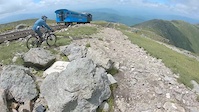
Photos of Exeter Mountain Bike
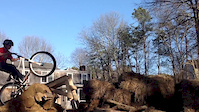
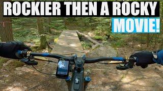
Videos of Exeter Mountain Bike

trail: Shadow's Skinny Log
0:06 |
415 |
Aug 25, 2022
trail: Summit
3:11 |
3121 |
Dec 19, 2019
trail: To Bog
0:12 |
276 |
Apr 1, 2014

trail: IPA
0:57 |
208 |
Oct 14, 2012

trail: Tunnel Down
1:15:15 |
312 |
Aug 23, 2022 , Exeter

trail: neB giB
1:15:15 |
235 |
Aug 23, 2022 , Exeter
trail: Lower Parliament
1:15:15 |
169 |
Aug 23, 2022 , Exeter

trail: Hamburger Hill
1:15:15 |
291 |
Aug 23, 2022 , Exeter
Recent Trail Reports
| status | trail | date | condition | info | user |
|---|---|---|---|---|---|
| Jolly Rand Trail | Jan 8, 2026 @ 2:06pm (America/New_York) Jan 8, 2026 | Freeze/thaw Cycle | TrakWalker | ||
| Mycelium | Nov 29, 2025 @ 2:00pm (America/New_York) Nov 29, 2025 | Variable | covc | ||
| Doghouse | Nov 29, 2025 @ 2:00pm (America/New_York) Nov 29, 2025 | Variable | covc | ||
| Colt 45 | Aug 11, 2025 @ 10:06am Aug 11, 2025 | Ideal | covc | ||
| XLR8 | Aug 11, 2025 @ 10:06am Aug 11, 2025 | Ideal | covc | ||
| Trestle to Gas | Aug 11, 2025 @ 10:06am Aug 11, 2025 | Ideal | covc | ||
| Watson Lot Trail | Jul 21, 2025 @ 12:06pm Jul 21, 2025 | Dry | TIMGARLAND | ||
| Green Loop | Jul 13, 2025 @ 12:09pm Jul 13, 2025 | Unknown | klieg | ||
| Yellowgreen Loop | Apr 16, 2025 @ 11:39am Apr 16, 2025 | Variable | Hubbles83 WMNEMBA | ||
| Yellow Loop | Apr 16, 2025 @ 11:39am Apr 16, 2025 | Variable | Hubbles83 WMNEMBA |
Activity Feed
| username | action | type | title | date |
|---|---|---|---|---|
| TourDivide18 | wishlist | trail | activity #97392255 | Jun 20, 2026 @ 7:21am Jun 20, 2026 |
| Mwv1987 | ridden | trail | activity #96951777 | Jun 14, 2026 @ 3:47am Jun 14, 2026 |
| Hubbles83 | update | trail | activity #96931908 | Jun 13, 2026 @ 6:31pm Jun 13, 2026 |
| gosurf1 | wishlist | route | activity #96871559 | Jun 13, 2026 @ 6:52am Jun 13, 2026 |
| RobinXPUUon | wishlist | route | activity #96871526 | Jun 13, 2026 @ 6:52am Jun 13, 2026 |
Recent Comments
| username | type | title | comment | date |
|---|---|---|---|---|
| trail | Very muddy in usual spots. Multiple trees down. | Jun 3, 2026 @ 6:04pm Jun 3, 2026 | ||
| trail | The crew did such a nice job with this trail.... | May 21, 2026 @ 6:03pm May 21, 2026 | ||
| trail | Awesome little trail! | Jul 28, 2025 @ 7:30pm Jul 28, 2025 | ||
| trail | Surprisingly fun! | Jul 28, 2025 @ 7:30pm Jul 28, 2025 | ||
| trail | No bueno, boring, double tracky | Jul 28, 2025 @ 7:29pm Jul 28, 2025 |
Local Badges
-

Mountain Biking 100k Badge2 awarded -

Descent 10k Badge86 awarded -

Epic Ride Descent 2k1 awarded -

Descent 100k Badge2 awarded -

Climbing 10k Badge86 awarded -

Epic Mountain Bike Climb 2k1 awarded
Activity Type Stats
| activitytype | trails | distance | descent | descent distance | total vertical | rating | global rank | state rank | photos | reports | routes | ridelogs |
|---|---|---|---|---|---|---|---|---|---|---|---|---|
| Mountain Bike | 176 | 51 miles | 3,402 ft | 17 miles | 207 ft | #174 | #67 | 79 | 1,587 | 6 | 38,117 | |
| E-Bike | 25 | 7 miles | 604 ft | 3 miles | 161 ft | #5,570 | #1,722 | 1,522 | 941 | |||
| Hike | 167 | 49 miles | 3,127 ft | 16 miles | 203 ft | #3,455 | #1,218 | 2 | 1,584 | 1 | 593 | |
| Trail Running | 165 | 49 miles | 3,091 ft | 16 miles | 203 ft | #2,935 | #853 | 1,584 | 1 | 579 | ||
| Snowmobile | 12 | 4 miles | 289 ft | 2 miles | 108 ft | #320 | #167 | 817 | 6 | |||
| Snowshoe | 160 | 47 miles | 3,209 ft | 15 miles | 203 ft | #248 | #67 | 875 | 1 | 105 | ||
| Downhill Ski | 1 | 246 ft | 69 ft | 7 ft | 12 | 7 | ||||||
| Backcountry Ski | 5 | 4,075 ft | 154 ft | 2,667 ft | 69 ft | #645 | #229 | 12 | 1 | 18 | ||
| Nordic Ski | 28 | 14 miles | 738 ft | 4 miles | 203 ft | #1,027 | #433 | 1 | 835 | 106 |
Frequently Asked Questions About Exeter
▼
What are the best places to ride in Exeter?
Exeter has 3 areas to explore for mountain biking. The top rated areas are:
▼
What are the highest rated mountain biking trails in Exeter?
The highest rated mountain biking trails in Exeter are:
- Crank On Down (4.5/5)
- Ground On Down (4.4/5)
- Sting Ring (4.4/5)
- Cattle Dog (4.4/5)
- Parker Way (4.4/5)
▼
What is the best time of the year to ride in Exeter?
Based on ride log data, the most popular months to ride in Exeter are:
- May (857 activities)
- July (780 activities)
- June (736 activities)
▼
Where can I park to ride in Exeter?
There are 6 parking locations listed in Exeter. The most popular parking spots are: View all parking and trailhead locations on the map to plan your visit.
Activities
Trails
- By WillieJacobsz
 Trailforks SBP SWW & contributors
 - Admins: SC NEMBA-NH
- #32348 - 8,997 views
- exeter activity log | embed map of Exeter mountain bike trails | exeter mountain biking points of interest
Downloading of trail gps tracks in kml & gpx formats is enabled for Exeter.
You must login to download files.