close
-
Layers w
- Weather Layers
- Pro
- Pro
- Pro
- Pro
- Pro
- Pro
- More Layers
- Pro
- Pro
- Pro
- Pro
-
Upgrade to

3D
Trail Conditions
- Unknown
- Snow Groomed
- Snow Packed
- Snow Covered
- Snow Cover Partial
- Freeze/thaw Cycle
- Icy
- Prevalent Mud
- Wet
- Variable
- Ideal
- Dry
- Very Dry
Trail Flow (Ridden Direction)
Trailforks scans users ridelogs to determine the most popular direction each trail is ridden. A good flowing trail network will have most trails flowing in a single direction according to their intension.
The colour categories are based on what percentage of riders are riding a trail in its intended direction.
The colour categories are based on what percentage of riders are riding a trail in its intended direction.
- > 96%
- > 90%
- > 80%
- > 70%
- > 50%
- < 50%
- bi-directional trail
- no data
Trail Last Ridden
Trailforks scans ridelogs to determine the last time a trail was ridden.
- < 2 days
- < 1 week
- < 2 weeks
- < 1 month
- < 6 months
- > 6 months
Trail Ridden Direction
The intended direction a trail should be ridden.
- Downhill Only
- Downhill Primary
- Both Directions
- Uphill Primary
- Uphill Only
- One Direction
Contribute Details
Colors indicate trail is missing specified detail.
- Description
- Photos
- Description & Photos
- Videos
Trail Popularity ?
Trailforks scans ridelogs to determine which trails are ridden the most in the last 9 months.
Trails are compared with nearby trails in the same city region with a possible 25 colour shades.
Think of this as a heatmap, more rides = more kinetic energy = warmer colors.
- most popular
- popular
- less popular
- not popular
ATV/ORV/OHV Filter
Max Vehicle Width
inches
US Cell Coverage
Legend

Radar Time
Activity Recordings
Trailforks uses anonymized public activity data.
?
Activity Recordings
Trailforks uses anonymized public activity data.
?
Personal Heatmap
▶
Activity Types
all
/
none
▶
Options
2
Date range
month
–
Winter Trails
Warning
A routing network for winter maps does not exist. Selecting trails using the winter trails layer has been disabled.
Missing Trails
Most Popular
Least Popular
Trails are colored based on popularity. The more popular a trail is, the more red. Less popular trails trend towards green.
Jump Magnitude Heatmap
Heatmap of where riders jump on trails. Zoom in to see individual jumps, click circles to view jump details.
BC Backroad Status
![map legend]()
Service Road Atlas is a free to use, community-driven service for viewing and creating reports on the numerous back-country service roads around B.C. and Alberta.

Slope Aspect
Direction the slope faces
Trails Deemphasized
Trails are shown in grey.
Only show trails with no bike usage.
Suggested Layers
Based on selected activity type
Save the current map location and zoom level as your default home location whenever this page is loaded.
Save
No description for Fairfield has been added yet!
Login or register to submit one.
Activities Click to view
- Mountain Bike
91 trails
- E-Bike
14 trails
- Gravel Bike
0 trails
- Adaptive Bike
0 trails
- Winter Fat Bike
0 trails
- Horse
20 trails
- Hike
94 trails
- Trail Running
94 trails
Region Details
- 20
- 2
- 23
- 17
- 18
- 3
- 1
Region Status
Open as of Jun 15, 2026Stats
- Avg Trail Rating
- Trails (view details)
- 87
- Trails Mountain Bike
- 91
- Trails E-Bike
- 14
- Trails Horse
- 20
- Trails Hike
- 94
- Trails Trail Running
- 94
- Total Distance
- 50 miles
- Total Descent
- 6,616 ft
- Total Vertical
- 905 ft
- Highest Trailhead
- 933 ft
- Reports
- 1,070
- Photos
- 128
- Ridden Counter
- 36,246
Sub Regions
-
Lynch Canyon Open Space
- 3
-
Patwino Worrtla Kodoi Dihi Open Space Park
- 9
-
Rockville Hills Regional Park
- 2
- 7
- 17
- 18
- 3
- 1
Popular Fairfield Mountain Biking Trails
• 100 ★ 4.2 • 2,683 ft • 177 ft • 1,341 •
There are other routes up, but this is the main trail used by everyone up and down. Used by all park users so watch out for hikers, runners, dogs and riders coming up from around blind corners when you're going down. Use that bell! Not...
• 75 ★ 0.0 • 276 ft • 0 ft • 1,023 •
Popular green difficulty singletrack. This mountain bike primary trail. On average it takes minutes to complete this trail.
• 100 ★ 3.5 • 879 ft • 0 ft • 988 •
Popular blue difficulty singletrack. This mountain bike primary trail. On average it takes 2 minutes to complete this trail.
• 100 ★ 3.5 • 1,438 ft • 84 ft • 975 •
Popular black diamond difficulty singletrack. This mountain bike primary trail can be used both directions. On average it takes 2 minutes to complete this trail.
• 75 ★ 4.0 • 3,048 ft • 48 ft • 926 •
Highly rated popular blue difficulty singletrack. This mountain bike primary trail and has a easy overall physical rating with a 48 ft green climb. On average it takes 6 minutes to complete this trail.
• 95 ★ 4.4 • 2,619 ft • 72 ft • 904 •
Highly rated popular green difficulty singletrack. This mountain bike primary trail can be used both directions. On average it takes 3 minutes to complete this trail.
• 100 ★ 4.0 • 425 ft • 20 ft • 893 •
Popular blue difficulty singletrack. This mountain bike primary trail can be used both directions. On average it takes minutes to complete this trail.
• 90 ★ 3.6 • 1,797 ft • 115 ft • 841 •
Popular blue difficulty singletrack. This mountain bike primary trail can be used both directions and has a moderate overall physical rating with a 115 ft black diamond climb. On average it takes 3 minutes to complete this trail.
Fairfield Mountain Bike Routes
★ 4.0 • 10 miles • 1,488 ft • 25 • Loop •
Moderate Route that hits some of the easier single black trails at
★ 3.5 • 7 miles • 1,354 ft • 41 • Point to Point •
Tour of some of the chunky black and double back descents in Rockville
6 miles • 1,015 ft • 10 •
Hit up Lower Tilly counter clockwise, make your way around the lake and up the , ride Outer Loop for the...
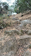
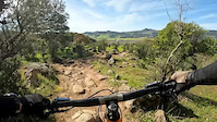
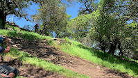
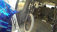
Photos of Fairfield Mountain Bike
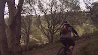
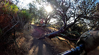
Videos of Fairfield Mountain Bike
trail: Cascade Trail
0:10 |
96 |
Nov 18, 2024

trail: Unknown
0:26 |
|
Mar 5, 2023

trail: Outside Loop
0:26 |
|
Mar 5, 2023
trail: Tower Trail
0:26 |
|
Mar 5, 2023
trail: Rockville Trail
0:16 |
105 |
Jan 28, 2022
trail: Manzanita Trail
0:48 |
124 |
Nov 15, 2020
trail: Rockville Trail
0:22 |
496 |
May 6, 2019
trail: Fire road
7:11 |
43 |
Aug 22, 2018
Recent Trail Reports
| status | trail | date | condition | info | user |
|---|---|---|---|---|---|
| Chemise Loop (Upper) | Jun 15, 2026 @ 8:20am (America/Los_Angeles) Jun 15, 2026 | Dry | hkgas | ||
| Devil's Backbone | Jun 7, 2026 @ 11:48am (America/Los_Angeles) Jun 7, 2026 | Dry | JoseyCNFHs | ||
| Upper Quarry | Jun 7, 2026 @ 11:48am (America/Los_Angeles) Jun 7, 2026 | Dry | JoseyCNFHs | ||
| Tilley Connector | Jun 7, 2026 @ 11:48am (America/Los_Angeles) Jun 7, 2026 | Dry | JoseyCNFHs | ||
| Wild Turkey Run | Jun 7, 2026 @ 11:48am (America/Los_Angeles) Jun 7, 2026 | Dry | JoseyCNFHs | ||
| May-December | Jun 7, 2026 @ 11:48am (America/Los_Angeles) Jun 7, 2026 | Dry | JoseyCNFHs | ||
| Jockey Junction | Jun 7, 2026 @ 11:48am (America/Los_Angeles) Jun 7, 2026 | Dry | JoseyCNFHs | ||
| Arch Trail | Jun 7, 2026 @ 11:48am (America/Los_Angeles) Jun 7, 2026 | Dry | JoseyCNFHs | ||
| Lakeside Trail | Jun 7, 2026 @ 11:48am (America/Los_Angeles) Jun 7, 2026 | Ideal | JoseyCNFHs | ||
| Mason Pond | Jun 7, 2026 @ 11:48am (America/Los_Angeles) Jun 7, 2026 | Very Dry | JoseyCNFHs |
Activity Feed
| username | action | type | title | date |
|---|---|---|---|---|
| Kaylaw7shJj | wishlist | trail | activity #97186232 and 1 more | Jun 17, 2026 @ 8:35am 1 day |
| hkgas | add | report | activity #97055605 | Jun 15, 2026 @ 11:33am Jun 15, 2026 |
| Mikeblankinship | wishlist | region | activity #96514725 | Jun 7, 2026 @ 6:49pm Jun 7, 2026 |
| JoseyCNFHs | add | report | activity #96512472 and 9 more | Jun 7, 2026 @ 6:04pm Jun 7, 2026 |
| xtal510 | wishlist | route | activity #96132933 | Jun 2, 2026 @ 8:25pm Jun 2, 2026 |
Recent Comments
| username | type | title | comment | date |
|---|---|---|---|---|
| trail | Rock Garden is an all time favorite. Next time... | Oct 11, 2025 @ 7:51am Oct 11, 2025 | ||
| trail | Definitely a must ride at Rockville. Not very... | Oct 8, 2025 @ 3:01pm Oct 8, 2025 | ||
| trail | I swear this trail was built as a prank 10/10 | Sep 3, 2025 @ 8:33pm Sep 3, 2025 | ||
| report | It seems like this wasn’t actually the... | Jun 8, 2025 @ 2:42pm Jun 8, 2025 | ||
| trail | This is a serious challenge to clear. I can... | Mar 1, 2025 @ 5:30pm Mar 1, 2025 |
Local Badges
-

Rockville: 20 Miles in One Ride372 awarded -

Rockville: Every Trail in One Ride0 awarded -

Rockville's Toughest Tech in One Ride0 awarded -

10 Black Trails259 awarded -

Rockville: Ride Every Trail6 awarded -

Top 10 Trails93 awarded
Activity Type Stats
| activitytype | trails | distance | descent | descent distance | total vertical | rating | global rank | state rank | photos | reports | routes | ridelogs |
|---|---|---|---|---|---|---|---|---|---|---|---|---|
| Mountain Bike | 91 | 49 miles | 6,575 ft | 20 miles | 906 ft | #590 | #218 | 114 | 1,070 | 14 | 15,168 | |
| E-Bike | 14 | 13 miles | 1,545 ft | 5 miles | 705 ft | #6,184 | #1,883 | 8 | 1,012 | 620 | ||
| Horse | 20 | 21 miles | 2,877 ft | 9 miles | 728 ft | #1,941 | #1,090 | 217 | ||||
| Hike | 94 | 50 miles | 6,617 ft | 20 miles | 906 ft | #4,064 | #1,434 | 6 | 1,070 | 2 | 339 | |
| Trail Running | 94 | 50 miles | 6,617 ft | 20 miles | 906 ft | #891 | #335 | 1,070 | 1 | 175 |
Frequently Asked Questions About Fairfield
▼
What are the best places to ride in Fairfield?
Fairfield has 3 areas to explore for mountain biking. The top rated areas are:
▼
What are the highest rated mountain biking trails in Fairfield?
The highest rated mountain biking trails in Fairfield are:
- Upper to Lower Tilley Technical Downhill (4.3/5)
- Rock Garden (4.3/5)
- Upper Tilley Trail (4.3/5)
- Cascade Trail (4.2/5)
- Lower Tilley Loop (4.2/5)
▼
What is the best time of the year to ride in Fairfield?
Based on ride log data, the most popular months to ride in Fairfield are:
- January (93 activities)
- February (84 activities)
- November (83 activities)
▼
Where can I park to ride in Fairfield?
There are 3 parking locations listed in Fairfield. The most popular parking spots are: View all parking and trailhead locations on the map to plan your visit.
Activities
Trails
Points of Interest
- By TheBikeNerd
 NWTA & contributors
 - Admins: BTCEB, bkxc
- #5773 - 5,862 views
- fairfield activity log | embed map of Fairfield mountain bike trails | fairfield mountain biking points of interest
Downloading of trail gps tracks in kml & gpx formats is enabled for Fairfield.
You must login to download files.