close
-
Layers w
- Weather Layers
- Pro
- Pro
- Pro
- Pro
- Pro
- Pro
- More Layers
- Pro
- Pro
- Pro
- Pro
-
Upgrade to

3D
Trail Conditions
- Unknown
- Snow Groomed
- Snow Packed
- Snow Covered
- Snow Cover Partial
- Freeze/thaw Cycle
- Icy
- Prevalent Mud
- Wet
- Variable
- Ideal
- Dry
- Very Dry
Trail Flow (Ridden Direction)
Trailforks scans users ridelogs to determine the most popular direction each trail is ridden. A good flowing trail network will have most trails flowing in a single direction according to their intension.
The colour categories are based on what percentage of riders are riding a trail in its intended direction.
The colour categories are based on what percentage of riders are riding a trail in its intended direction.
- > 96%
- > 90%
- > 80%
- > 70%
- > 50%
- < 50%
- bi-directional trail
- no data
Trail Last Ridden
Trailforks scans ridelogs to determine the last time a trail was ridden.
- < 2 days
- < 1 week
- < 2 weeks
- < 1 month
- < 6 months
- > 6 months
Trail Ridden Direction
The intended direction a trail should be ridden.
- Downhill Only
- Downhill Primary
- Both Directions
- Uphill Primary
- Uphill Only
- One Direction
Contribute Details
Colors indicate trail is missing specified detail.
- Description
- Photos
- Description & Photos
- Videos
Trail Popularity ?
Trailforks scans ridelogs to determine which trails are ridden the most in the last 9 months.
Trails are compared with nearby trails in the same city region with a possible 25 colour shades.
Think of this as a heatmap, more rides = more kinetic energy = warmer colors.
- most popular
- popular
- less popular
- not popular
ATV/ORV/OHV Filter
Max Vehicle Width
inches
US Cell Coverage
Legend

Radar Time
Activity Recordings
Trailforks uses anonymized public activity data.
?
Activity Recordings
Trailforks uses anonymized public activity data.
?
Personal Heatmap
▶
Activity Types
all
/
none
▶
Options
2
Date range
month
–
Winter Trails
Warning
A routing network for winter maps does not exist. Selecting trails using the winter trails layer has been disabled.
Missing Trails
Most Popular
Least Popular
Trails are colored based on popularity. The more popular a trail is, the more red. Less popular trails trend towards green.
Jump Magnitude Heatmap
Heatmap of where riders jump on trails. Zoom in to see individual jumps, click circles to view jump details.
BC Backroad Status
![map legend]()
Service Road Atlas is a free to use, community-driven service for viewing and creating reports on the numerous back-country service roads around B.C. and Alberta.

Slope Aspect
Direction the slope faces
Trails Deemphasized
Trails are shown in grey.
Only show trails with no bike usage.
Suggested Layers
Based on selected activity type
Save the current map location and zoom level as your default home location whenever this page is loaded.
Save
No description for Fairplay has been added yet!
Login or register to submit one.
Activities Click to view
- Mountain Bike
27 trails
- Gravel Bike
0 trails
- Adaptive Bike
0 trails
- Horse
5 trails
- Hike
40 trails
- Trail Running
40 trails
Region Details
- 8
- 3
- 12
- 4
Region Status
Open as of Sep 25, 2025Stats
- Avg Trail Rating
- Trails (view details)
- 35
- Trails Mountain Bike
- 27
- Trails E-Bike
- 1
- Trails Horse
- 5
- Trails Hike
- 40
- Trails Trail Running
- 40
- Trails Dirtbike/Moto
- 3
- Trails Snowshoe
- 3
- Trails Nordic Ski
- 1
- Total Distance
- 61 miles
- Total Descent
- 5,082 ft
- Total Vertical
- 6,898 ft
- Highest Trailhead
- 14,261 ft
- Reports
- 22
- Photos
- 18
- Ridden Counter
- 1,512
Sub Regions
-
PNF = South Park Ranger District
- 2
Popular Fairplay Mountain Biking Trails
• 100 ★ 0.0 • 2 miles • 99 ft • 68 •
Popular blue difficulty singletrack. This mountain bike primary trail can be used both directions. On average it takes 10 minutes to complete this trail.
• 100 ★ 3.0 • 2 miles • 788 ft • 62 •
Popular blue difficulty singletrack. This mountain bike primary trail can be used both directions. On average it takes 43 minutes to complete this trail.
• 75 ★ 0.0 • 2 miles • 1,710 ft • 15 • • hike
Popular blue difficulty singletrack. This hike primary trail can be used both directions. On average it takes 2 hours23 minutes to complete this trail.
• 95 ★ 0.0 • 5,266 ft • 224 ft • 13 • • hike
Popular green difficulty singletrack. This hike primary trail can be used both directions. On average it takes 13 minutes to complete this trail.
• 70 ★ 0.0 • 2 miles • 2,107 ft • 11 • • hike
Popular black diamond difficulty singletrack. This hike primary trail can be used both directions. On average it takes 1 hour58 minutes to complete this trail.
• 5 ★ 0.0 • 1 mile • 819 ft • 10 • • hike
Less popular black diamond difficulty singletrack. This hike primary trail can be used both directions and has a hard overall physical rating with a 819 ft black diamond climb. On average it takes 1 hour9 minutes to complete this trail.
• 5 ★ 0.0 • 2 miles • 2,128 ft • 9 • • hike
Less popular black diamond difficulty singletrack. This hike primary trail can be used both directions and has a extreme overall physical rating with a 2,128 ft black diamond climb. On average it takes 2 hours14 minutes to complete this trail.
Fairplay Mountain Bike Routes
5 miles • 1,910 ft • 1 • Out & Back •
4 miles • 1,208 ft • 1 • Loop •
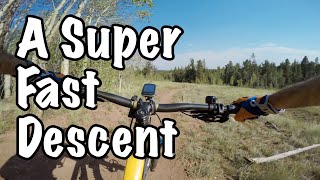
Photos of Fairplay Mountain Bike
Videos of Fairplay Mountain Bike

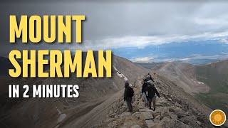
trail: Mount Sherman Trail
2:00 |
73 |
Dec 31, 2025 , Fairplay
Recent Trail Reports
| status | trail | date | condition | info | user |
|---|---|---|---|---|---|
| Horseshoe | Sep 25, 2025 @ 9:48am (America/Denver) Sep 25, 2025 | Variable | JCWarrick | ||
| Tie Hack | Sep 25, 2025 @ 9:48am (America/Denver) Sep 25, 2025 | Variable | JCWarrick | ||
| Tie Hack | Oct 12, 2024 @ 5:23pm Oct 12, 2024 | Ideal | giniek27 | ||
| Beaver Creek Trail | Oct 12, 2024 @ 12:30pm Oct 12, 2024 | Dry | giniek27 | ||
| County Road | Jul 18, 2024 @ 12:16pm Jul 18, 2024 | Ideal | Mathematicus | ||
| Sheep Creek Trail | Oct 4, 2023 @ 4:29pm Oct 4, 2023 | Ideal | jimwp | ||
| Louie's Loop Trail | Jun 26, 2023 @ 7:51pm Jun 26, 2023 | Ideal | the-rowdy-montanan | ||
| Limber Grove Trail | Jun 26, 2023 @ 7:49pm Jun 26, 2023 | Ideal | the-rowdy-montanan | ||
| West Jefferson | Sep 12, 2021 @ 8:33am Sep 12, 2021 | Dry | WYGreg |
Activity Feed
| username | action | type | title | date |
|---|---|---|---|---|
| dfritton | add | photo | activity #96338351 and 3 more | Jun 5, 2026 @ 7:33pm Jun 5, 2026 |
| jakevogel33 | wishlist | trail | activity #95221316 and 3 more | May 21, 2026 @ 8:54pm May 21, 2026 |
| markholloway | update | region | activity #88704122 | Feb 10, 2026 @ 5:17pm Feb 10, 2026 |
| fourcornersexplorer | add | video | activity #86400505 | Dec 31, 2025 @ 12:17pm Dec 31, 2025 |
| CarveTheClimb | ridden | trail | activity #81644030 | Oct 3, 2025 @ 6:48pm Oct 3, 2025 |
Recent Comments
| username | type | title | comment | date |
|---|---|---|---|---|
| trail | Unless you’re a star, there’s a fair bit... | Aug 15, 2025 @ 4:03pm Aug 15, 2025 | ||
| trail | Not super fun on an MTB but could be a lot... | Jun 21, 2025 @ 5:21pm Jun 21, 2025 | ||
| trail | Not super fun on an MTB but could be a lot... | Jun 21, 2025 @ 5:21pm Jun 21, 2025 | ||
| trail | This is a jeep road, not single track. | Aug 5, 2023 @ 2:04pm Aug 5, 2023 | ||
| trail | trail closed for rehab. would not recommend on... | Sep 21, 2022 @ 10:02am Sep 21, 2022 |
Local Badges
-

Epic Ride Descent 2k2 awarded -

Descent 10k Badge1 awarded -

Descent 100k Badge0 awarded -

Epic Mountain Bike Climb 2k0 awarded -

Climbing 10k Badge0 awarded -

Mountain Biking 100k Badge0 awarded
Activity Type Stats
| activitytype | trails | distance | descent | descent distance | total vertical | rating | global rank | state rank | photos | reports | routes | ridelogs |
|---|---|---|---|---|---|---|---|---|---|---|---|---|
| Mountain Bike | 27 | 51 miles | 4,400 ft | 12 miles | 4,324 ft | #5,860 | #1,983 | 15 | 22 | 8 | 920 | |
| E-Bike | 1 | 9 miles | 10 ft | 2,113 ft | 1,322 ft | 10 | 10 | |||||
| Horse | 5 | 11 miles | 1,411 ft | 3 miles | 3,684 ft | #2,325 | #1,285 | 2 | 4 | |||
| Hike | 40 | 61 miles | 5,082 ft | 14 miles | 6,896 ft | #3,534 | #1,240 | 2 | 22 | 19 | 1,012 | |
| Trail Running | 40 | 61 miles | 5,082 ft | 14 miles | 6,896 ft | #3,654 | #1,088 | 22 | 18 | 87 | ||
| Dirtbike/Moto | 3 | 8 miles | 1,165 ft | 3 miles | 2,208 ft | 3 | 2 | 5 | ||||
| Snowshoe | 3 | 12 miles | 1,414 ft | 3 miles | 3,209 ft | 9 | 17 | |||||
| Nordic Ski | 1 | 3 miles | 1,509 ft | 42 |
Frequently Asked Questions About Fairplay
▼
What are the best places to ride in Fairplay?
Fairplay has 1 areas to explore for mountain biking. The top rated areas are:
▼
What are the highest rated mountain biking trails in Fairplay?
The highest rated mountain biking trails in Fairplay are:
- Wheeler Lake Trail (3.9/5)
- Tie Hack (3.8/5)
- Tie Hack (0/5)
- Beaver Creek Trail (0/5)
- Sheep Creek Trail (0/5)
▼
What is the best time of the year to ride in Fairplay?
Based on ride log data, the most popular months to ride in Fairplay are:
- July (25 activities)
- August (19 activities)
- September (17 activities)
▼
Where can I park to ride in Fairplay?
There are 8 parking locations listed in Fairplay. The most popular parking spots are: View all parking and trailhead locations on the map to plan your visit.
Activities
Trails
- By canadaka
 Trailforks & contributors
 - Admins: apply
- #4915 - 5,338 views
- fairplay activity log | embed map of Fairplay mountain bike trails | fairplay mountain biking points of interest
Downloading of trail gps tracks in kml & gpx formats is enabled for Fairplay.
You must login to download files.