close
-
Layers w
- Weather Layers
- Pro
- Pro
- Pro
- Pro
- Pro
- Pro
- More Layers
- Pro
- Pro
- Pro
- Pro
-
Upgrade to

3D
Trail Conditions
- Unknown
- Snow Groomed
- Snow Packed
- Snow Covered
- Snow Cover Partial
- Freeze/thaw Cycle
- Icy
- Prevalent Mud
- Wet
- Variable
- Ideal
- Dry
- Very Dry
Trail Flow (Ridden Direction)
Trailforks scans users ridelogs to determine the most popular direction each trail is ridden. A good flowing trail network will have most trails flowing in a single direction according to their intension.
The colour categories are based on what percentage of riders are riding a trail in its intended direction.
The colour categories are based on what percentage of riders are riding a trail in its intended direction.
- > 96%
- > 90%
- > 80%
- > 70%
- > 50%
- < 50%
- bi-directional trail
- no data
Trail Last Ridden
Trailforks scans ridelogs to determine the last time a trail was ridden.
- < 2 days
- < 1 week
- < 2 weeks
- < 1 month
- < 6 months
- > 6 months
Trail Ridden Direction
The intended direction a trail should be ridden.
- Downhill Only
- Downhill Primary
- Both Directions
- Uphill Primary
- Uphill Only
- One Direction
Contribute Details
Colors indicate trail is missing specified detail.
- Description
- Photos
- Description & Photos
- Videos
Trail Popularity ?
Trailforks scans ridelogs to determine which trails are ridden the most in the last 9 months.
Trails are compared with nearby trails in the same city region with a possible 25 colour shades.
Think of this as a heatmap, more rides = more kinetic energy = warmer colors.
- most popular
- popular
- less popular
- not popular
ATV/ORV/OHV Filter
Max Vehicle Width
inches
US Cell Coverage
Legend

Radar Time
Activity Recordings
Trailforks uses anonymized public activity data.
?
Activity Recordings
Trailforks uses anonymized public activity data.
?
Personal Heatmap
▶
Activity Types
all
/
none
▶
Options
2
Date range
month
–
Winter Trails
Warning
A routing network for winter maps does not exist. Selecting trails using the winter trails layer has been disabled.
Missing Trails
Most Popular
Least Popular
Trails are colored based on popularity. The more popular a trail is, the more red. Less popular trails trend towards green.
Jump Magnitude Heatmap
Heatmap of where riders jump on trails. Zoom in to see individual jumps, click circles to view jump details.
BC Backroad Status
![map legend]()
Service Road Atlas is a free to use, community-driven service for viewing and creating reports on the numerous back-country service roads around B.C. and Alberta.

Slope Aspect
Direction the slope faces
Trails Deemphasized
Trails are shown in grey.
Only show trails with no bike usage.
Suggested Layers
Based on selected activity type
Save the current map location and zoom level as your default home location whenever this page is loaded.
SaveThe fully-approved and new trail network at the southern edge of Lake Cowichan is suitable for gravel, xc and downhillers. Given the new status of the network a lot of work is still needed and ongoing. Bring a bear spray, and enjoy the rugged trails, beautiful views, and don't forget to go for a jump in the lake to cool off afterwards.
Primary Trail Type: Cross-Country
eBikes Allowed:
Yes
Land Status: Private Managed Forest
Land Manager: Mosaic Forest Management
 google parking directions
Links
Region Supporters & Maintainers
Activities Click to view
- Mountain Bike
79 trails
- E-Bike
80 trails
- Hike
79 trails
- Trail Running
79 trails
- Snowshoe
75 trails
Region Details
- 32
- 13
- 19
- 8
- 1
Region Status
Open as of 2 daysStats
- Avg Trail Rating
- Trails (view details)
- 73
- Trails Mountain Bike
- 79
- Trails E-Bike
- 80
- Trails Hike
- 79
- Trails Trail Running
- 79
- Trails Snowshoe
- 75
- Total Distance
- 36 miles
- Total Descent Distance
- 15 miles
- Total Descent
- 4,168 ft
- Total Vertical
- 1,049 ft
- Highest Trailhead
- 1,593 ft
- Reports
- 1,027
- Photos
- 131
- Ridden Counter
- 2,997
Popular Fairservice Fun Mountain Biking Trails
• 100 ★ 4.5 • 2,700 ft • 31 ft • 74 •
Fast and flowy double track with little climb sections in either direction.
• 100 ★ 4.0 • 2,835 ft • 31 ft • 67 •
is a double track trail in dense forest that constantly goes up and down and winds around in the forest.
• 90 ★ 4.3 • 1,007 ft • 0 ft • 59 •
is a smooth, mostly constant climber singletrail or a fast, narrow, and fun downhill. Lower two thirds are in recently logged area, upper section is in the forest.
• 85 ★ 5.0 • 896 ft • 0 ft • 47 •
Drops off the road in very steep and loamy ruts. You choose to either shoot down a long straight section, or wind around the corner left from the top and connect half way down into the shoot. Continues on and winds up over roots...
• 100 ★ 3.4 • 2,799 ft • 22 ft • 43 •
is a narrow single trail with tight corners that winds up and down through the forest.
• 90 ★ 4.0 • 1,440 ft • 0 ft • 41 •
is a rutty, loamy downhill that cuts some rough corners over rocks and roots. I mostly runs out in the open away from trees but there are plenty of tight bushes and corners on this narrow singletrail to need your attention.
• 95 ★ 4.5 • 2,224 ft • 24 ft • 40 •
is a tight and technical downhill with corners, log crossings, creek bed crossing and more. At the lower section you can either turn right and go back up the creek side a bit and cross over to or you can go left and shoot all the way...
• 85 ★ 4.0 • 2,123 ft • 17 ft • 39 •
starts easy on a traverse but ends up shooting down in tight corners, and ruts for a bit until it hits the creek. Then rolls down flat to the FSR. The lower section can be used as a climber to get up and across the creek to . Lower...
Fairservice Fun Mountain Bike Routes
15 miles • 1,724 ft • 19 •
Larger route for the 2025 Vancouver Island Trail Running Series event in Lake Cowichan.
8 miles • 516 ft • 10 •
Smaller route for the 2025 Vancouver Island Trail Running Series event in Lake Cowichan.
6 miles • 435 ft • 10 •
The basic route for the open group ride of the Fairservice Fun Festival 2023.
10 miles • 590 ft • 8 • Point to Point • Race •
The Poker Run 2024 route is the selection of paths for the ride event as part of the Headwater Festival in...
Photos of Fairservice Fun Mountain Bike
Videos of Fairservice Fun Mountain Bike
trail: Three Amigos
0:49 |
152 |
Jul 27, 2025 , Lake Cowichan
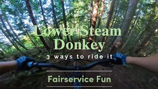
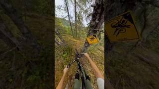
trail: Steam Donkey
3:08 |
136 |
Jan 20, 2025 , Lake Cowichan
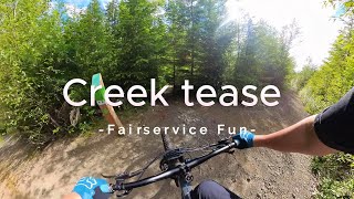
trail: Creek Tease
3:59 |
83 |
Jan 20, 2025 , Lake Cowichan
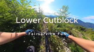
trail: Lower Cutblock
2:11 |
103 |
Jan 20, 2025 , Lake Cowichan
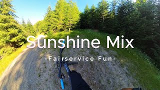
trail: Sunshine Mix
2:24 |
115 |
Jan 20, 2025 , Lake Cowichan

trail: Twa Dogs
3:14 |
75 |
Jan 20, 2025 , Lake Cowichan
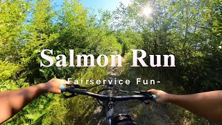
trail: Salmon Run
0:37 |
52 |
Jan 20, 2025 , Lake Cowichan
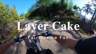
trail: Layer Cake
2:30 |
100 |
Nov 15, 2024 , Lake Cowichan
Recent Trail Reports
| status | trail | date | condition | info | user |
|---|---|---|---|---|---|
| Got Gravel | Jun 18, 2026 @ 10:05am (America/Vancouver) 2 days | Dry | Daniel66TOF | ||
| FSM17 | Jun 18, 2026 @ 10:05am (America/Vancouver) 2 days | Dry | Daniel66TOF | ||
| Gun Smoke | Jun 18, 2026 @ 10:05am (America/Vancouver) 2 days | Dry | Daniel66TOF | ||
| Twa Dogs | Jun 18, 2026 @ 10:05am (America/Vancouver) 2 days | Dry | Daniel66TOF | ||
| Chainsaw | Jun 18, 2026 @ 10:05am (America/Vancouver) 2 days | Dry | Daniel66TOF | ||
| Scotts Cruiser | Jun 18, 2026 @ 10:05am (America/Vancouver) 2 days | Dry | Daniel66TOF | ||
| Steam Donkey | Jun 18, 2026 @ 10:05am (America/Vancouver) 2 days | Dry | Daniel66TOF | ||
| Creek Tease | Jun 18, 2026 @ 10:05am (America/Vancouver) 2 days | Dry | Daniel66TOF | ||
| Game Trail | Jun 18, 2026 @ 10:05am (America/Vancouver) 2 days | Dry | Daniel66TOF | ||
| Beaver Creek Trail | Jun 18, 2026 @ 10:05am (America/Vancouver) 2 days | Dry | Daniel66TOF |
Activity Feed
| username | action | type | title | date |
|---|---|---|---|---|
| Daniel66TOF | add | report | activity #97268788 and 9 more | Jun 18, 2026 @ 12:15pm 2 days |
| rem17 | add | report | activity #96799687 and 3 more | Jun 12, 2026 @ 6:37am Jun 12, 2026 |
| Daniel66TOF | add | report | activity #96622547 and 6 more | Jun 9, 2026 @ 12:17pm Jun 9, 2026 |
| LBelton | add | photo | activity #96113363 and 1 more | Jun 2, 2026 @ 3:29pm Jun 2, 2026 |
| Daniel66TOF | add | report | activity #95941128 and 18 more | May 31, 2026 @ 8:06am May 31, 2026 |
Recent Comments
| username | type | title | comment | date |
|---|---|---|---|---|
| report | Thank you for reporting. We will put it on our... | May 3, 2026 @ 2:17pm May 3, 2026 | ||
| report | Nice work! | Dec 14, 2025 @ 8:25pm Dec 14, 2025 | ||
| report | I would assume Wet Stone Bed is in the same... | Dec 14, 2025 @ 4:45pm Dec 14, 2025 | ||
| report | I did today! It’s running great! | Nov 29, 2025 @ 12:37pm Nov 29, 2025 | ||
| report | Awesome work. I hope you got to ride if... | Nov 28, 2025 @ 9:02pm Nov 28, 2025 |
Nearby Areas
| name | distance | ||||
|---|---|---|---|---|---|
| Lakeview Park | 1 | 6 | 1 | 1 km | |
| Laketown Ranch | 4 | 3 | 2.2 km | ||
| Bald Mountain Park | 1 | 5 km | |||
| Cowichan River Provincal Park | 3 | 2 | 11.8 km | ||
| Mount Prevost | 1 | 11 | 11 | 14 km |
Local Badges
-

Completionist1 awarded
Local Trail Supporters
- lake cowichan trail blazers
Activity Type Stats
| activitytype | trails | distance | descent | descent distance | total vertical | rating | global rank | state rank | photos | reports | routes | ridelogs |
|---|---|---|---|---|---|---|---|---|---|---|---|---|
| Mountain Bike | 79 | 36 miles | 4,170 ft | 15 miles | 1,050 ft | #3,026 | #147 | 120 | 1,024 | 3 | 897 | |
| E-Bike | 80 | 36 miles | 4,170 ft | 15 miles | 1,050 ft | #2,849 | #95 | 1,022 | 2 | 57 | ||
| Hike | 79 | 31 miles | 3,209 ft | 12 miles | 1,043 ft | #5,085 | #213 | 1,020 | 2 | 105 | ||
| Trail Running | 79 | 31 miles | 3,209 ft | 12 miles | 1,043 ft | #1,422 | #49 | 12 | 1,020 | 3 | 542 | |
| Snowshoe | 75 | #710 | #62 | 35 | 1 |
Frequently Asked Questions About Fairservice Fun
▼
What are the highest rated mountain biking trails in Fairservice Fun?
The highest rated mountain biking trails in Fairservice Fun are:
- Try To Stay Dry (4.2/5)
- Steam Donkey (4.1/5)
- Salmon Run (4.1/5)
- Bobalicious (4.1/5)
- Beaver Creek Trail (4.1/5)
▼
What is the best time of the year to ride in Fairservice Fun?
Based on ride log data, the most popular months to ride in Fairservice Fun are:
- July (38 activities)
- August (25 activities)
- September (17 activities)
▼
Where can I park to ride in Fairservice Fun?
There are 8 parking locations listed in Fairservice Fun. The most popular parking spots are:
- Fairservice Main entrance
- Salmon Run Parking
- Western entrance
- Stone Avenue parking
- Hobson Avenue Parking
▼
What is the longest trail in Fairservice Fun?
The longest trail in Fairservice Fun is Beaver Creek Trail at 1.0 mile. View all trails sorted by distance.
Activities
- By Patchworx & contributors
- Admins: Dubnyk, CRD-Parks, CLTBS
- #23259 - 14,196 views
- fairservice fun activity log | embed map of Fairservice Fun mountain bike trails | fairservice fun mountain biking points of interest polygons
Downloading of trail gps tracks in kml & gpx formats is enabled for Fairservice Fun.
You must login to download files.