close
-
Layers w
- Weather Layers
- Pro
- Pro
- Pro
- Pro
- Pro
- Pro
- More Layers
- Pro
- Pro
- Pro
- Pro
-
Upgrade to

3D
Trail Conditions
- Unknown
- Snow Groomed
- Snow Packed
- Snow Covered
- Snow Cover Partial
- Freeze/thaw Cycle
- Icy
- Prevalent Mud
- Wet
- Variable
- Ideal
- Dry
- Very Dry
Trail Flow (Ridden Direction)
Trailforks scans users ridelogs to determine the most popular direction each trail is ridden. A good flowing trail network will have most trails flowing in a single direction according to their intension.
The colour categories are based on what percentage of riders are riding a trail in its intended direction.
The colour categories are based on what percentage of riders are riding a trail in its intended direction.
- > 96%
- > 90%
- > 80%
- > 70%
- > 50%
- < 50%
- bi-directional trail
- no data
Trail Last Ridden
Trailforks scans ridelogs to determine the last time a trail was ridden.
- < 2 days
- < 1 week
- < 2 weeks
- < 1 month
- < 6 months
- > 6 months
Trail Ridden Direction
The intended direction a trail should be ridden.
- Downhill Only
- Downhill Primary
- Both Directions
- Uphill Primary
- Uphill Only
- One Direction
Contribute Details
Colors indicate trail is missing specified detail.
- Description
- Photos
- Description & Photos
- Videos
Trail Popularity ?
Trailforks scans ridelogs to determine which trails are ridden the most in the last 9 months.
Trails are compared with nearby trails in the same city region with a possible 25 colour shades.
Think of this as a heatmap, more rides = more kinetic energy = warmer colors.
- most popular
- popular
- less popular
- not popular
ATV/ORV/OHV Filter
Max Vehicle Width
inches
US Cell Coverage
Legend

Radar Time
Activity Recordings
Trailforks uses anonymized public activity data.
?
Activity Recordings
Trailforks uses anonymized public activity data.
?
Personal Heatmap
▶
Activity Types
all
/
none
▶
Options
2
Date range
month
–
Winter Trails
Warning
A routing network for winter maps does not exist. Selecting trails using the winter trails layer has been disabled.
Missing Trails
Most Popular
Least Popular
Trails are colored based on popularity. The more popular a trail is, the more red. Less popular trails trend towards green.
Jump Magnitude Heatmap
Heatmap of where riders jump on trails. Zoom in to see individual jumps, click circles to view jump details.
BC Backroad Status
![map legend]()
Service Road Atlas is a free to use, community-driven service for viewing and creating reports on the numerous back-country service roads around B.C. and Alberta.

Slope Aspect
Direction the slope faces
Trails Deemphasized
Trails are shown in grey.
Only show trails with no bike usage.
Suggested Layers
Based on selected activity type
Save the current map location and zoom level as your default home location whenever this page is loaded.
SaveGreat write up @ http://www.falconridgeski.com/bike-trails
Activities Click to view
- Mountain Bike
62 trails
- E-Bike
47 trails
- Gravel Bike
1 trails
- Adaptive Bike
1 trails
- Winter Fat Bike
1 trails
- Horse
5 trails
- Hike
59 trails
- Trail Running
64 trails
- Snowmobile
4 trails
- Snowshoe
23 trails
- Backcountry Ski
5 trails
- Nordic Ski
29 trails
Region Details
- 3
- 2
- 26
- 29
- 2
Region Status
Caution as of Jun 5, 2026Stats
- Avg Trail Rating
- Trails (view details)
- 76
- Trails Mountain Bike
- 62
- Trails E-Bike
- 47
- Trails Gravel Bike
- 1
- Trails Adaptive Bike
- 1
- Trails Winter Fat Bike
- 1
- Trails Horse
- 5
- Trails Hike
- 59
- Trails Trail Running
- 64
- Trails Snowmobile
- 4
- Trails Snowshoe
- 23
- Trails Downhill Ski
- 1
- Trails Backcountry Ski
- 5
- Trails Nordic Ski
- 29
- Total Distance
- 69 miles
- Total Descent
- 3,083 ft
- Total Vertical
- 173 ft
- Highest Trailhead
- 1,228 ft
- Reports
- 1,409
- Photos
- 338
- Ridden Counter
- 6,999
Sub Regions
-
Falcon Lake Trans Canada Trail
- 13
- 3
-
Falcon Ridge
- 1
- 12
- 20
- 2
Popular Falcon Lake Mountain Biking Trails
• 50 ★ 5.0 • 2 miles • 155 ft • 266 •
Double track onnecting to Weclome Centre and chalet parking lot.
• 75 ★ 5.0 • 1 mile • 38 ft • 248 •
A local favorite that keeps rewarding you as you conquer the most challenging sections. It's the most continually technically challenging trail on the Five of Diamonds route with many 0.5 to 1m rocky outcrop undulations to test your...
• 100 ★ 0.0 • 1,424 ft • 47 ft • 223 •
Popular green difficulty ski run (off-piste). This multi-use trail can be used downhill primary. On average it takes 2 minutes to complete this trail.
• 70 ★ 5.0 • 1,834 ft • 11 ft • 212 •
One of our most popular trails. It starts with a series of 5 fun rocky Mcrock-face rollers, transitions to twisty and banked boardwalk, up a challenging open rock-face climb, and finishes fast. We'll be adding more boardwalk and wood...
• 75 ★ 4.0 • 1,027 ft • 32 ft • 212 •
A little bit of everything; double track descent entry, rocky - rooty climb, open rock-face features. Take in the Black Diamond loop near the start to spice up your ride.
• 75 ★ 5.0 • 679 ft • 0 ft • 209 •
Short fun descent section. Part of trail route and the Damp Conditions Route. Almost all open rock face trail surface. Two steep rock rolls. Two A-line - B-line options for where it gets a bit more steep. Continues on to Lower with dirt...
• 80 ★ 4.0 • 1,056 ft • 32 ft • 204 •
Uphill direction travel only. Switchback climb with mostly 5 to 8% slope. Two corners with rock face challenge. Presently clay surface which is great when dry, but closed when wet to prevent rutting. Quite often the Damp Conditions...
Falcon Lake Mountain Bike Routes
Five of Diamonds Featured
★ 4.2 • 4 miles • 347 ft • 14 •
The links together Falcon Trails Resort's best mountain bike trails. It winds through the boreal forest...
Tour de Falcon Featured
★ 5.0 • 24 miles • 1,457 ft • 8 • Loop •
Embark on the "Tour de Falcon," a scenic trail that circumnavigates the beautiful Falcon Lake. This route...
Onishkatoon Gwaykaadiziwin Featured
10 miles • 859 ft • 5 • Out & Back •
The route is wider than a single track trail but narrower than a double track trail and is marked but some...
8 miles • 371 ft • 1 • Point to Point •
from the causeway to Falcon Trails Resort
2 miles • 199 ft • 9 •
For 2024 we have made the course a little shorter, cutting off which allows for more laps and better flow.
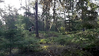
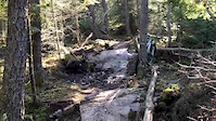
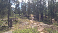
Photos of Falcon Lake Mountain Bike
Videos of Falcon Lake Mountain Bike
trail: Naurco Flats (1)
3:50 |
13 |
May 15, 2024
trail: Mogul climb
2:25 |
|
May 15, 2024
trail: Top of The World
0:03 |
91 |
Jul 5, 2022
trail: Roller Coaster
0:14 |
168 |
Aug 8, 2019
trail: Top of The World
0:14 |
260 |
Aug 8, 2019
trail: Roller Coaster
0:48 |
468 |
Nov 26, 2016

trail: Granite Pass
0:04 |
241 |
Jul 12, 2016
trail: Granite Pass
0:14 |
315 |
Jul 12, 2016
Recent Trail Reports
| status | trail | date | condition | info | user |
|---|---|---|---|---|---|
| Falcon South Shore Trail | Jun 5, 2026 @ 10:03pm (America/Winnipeg) Jun 5, 2026 | Dry | blightniak | ||
| Top of The World | May 2, 2026 @ 10:32am (America/Vancouver) May 2, 2026 | Dry | lrswan | ||
| Falcon to High Lake Portage | Oct 31, 2025 @ 9:52am (America/Winnipeg) Oct 31, 2025 | Ideal | dterniercycle BBTrails | ||
| Connect the Shores North Side | Oct 31, 2025 @ 9:52am (America/Winnipeg) Oct 31, 2025 | Ideal | dterniercycle BBTrails | ||
| Pierre's Poetry | Oct 31, 2025 @ 9:52am (America/Winnipeg) Oct 31, 2025 | Ideal | dterniercycle BBTrails | ||
| Falcon North Shore Trail | Oct 31, 2025 @ 9:52am (America/Winnipeg) Oct 31, 2025 | Ideal | dterniercycle BBTrails | ||
| High Bay to Laws Bay | Oct 31, 2025 @ 9:52am (America/Winnipeg) Oct 31, 2025 | Ideal | dterniercycle BBTrails | ||
| West Hawk to Faloma Trail | Sep 30, 2025 @ 7:08pm (America/Winnipeg) Sep 30, 2025 | Ideal | Darren445 | ||
| Warm-up shack trail | Sep 30, 2025 @ 7:08pm (America/Winnipeg) Sep 30, 2025 | Dry | Darren445 | ||
| Teagans Connector | Sep 30, 2025 @ 7:07pm (America/Winnipeg) Sep 30, 2025 | Dry | Darren445 |
Activity Feed
| username | action | type | title | date |
|---|---|---|---|---|
| KevinMillerTranscona | comment | route | activity #97230649 | Jun 17, 2026 @ 9:00pm 2 days |
| AlKing | add | poi | activity #96753793 | Jun 11, 2026 @ 12:04pm Jun 11, 2026 |
| AlKing | update | trail | activity #96753125 | Jun 11, 2026 @ 11:54am Jun 11, 2026 |
| blightniak | add | report | activity #96339542 | Jun 5, 2026 @ 8:06pm Jun 5, 2026 |
| markgray5 | wishlist | route | activity #96150466 | Jun 3, 2026 @ 6:22am Jun 3, 2026 |
Recent Comments
| username | type | title | comment | date |
|---|---|---|---|---|
| report | Awesome. Thank you! | May 2, 2026 @ 10:58am May 2, 2026 | ||
| report | I didn’t see any in the way of the path! | May 2, 2026 @ 10:53am May 2, 2026 | ||
| report | Hey Lisa, thanks for the report! Did you see... | May 2, 2026 @ 10:41am May 2, 2026 | ||
| report | We walked part of the section that runs... | Mar 22, 2025 @ 1:54pm Mar 22, 2025 | ||
| trail | This trail was upgraded by the South... | Aug 26, 2024 @ 12:51pm Aug 26, 2024 |
Local Badges
-

10 Green Trails50 awarded -

10 Blue Trails84 awarded -

Epic Ride Climb 2k0 awarded -

Climbing 10k Badge3 awarded -

Climbing 100k Badge0 awarded -

Epic Ride Descent 2k0 awarded
Activity Type Stats
| activitytype | trails | distance | descent | descent distance | total vertical | rating | global rank | state rank | photos | reports | routes | ridelogs |
|---|---|---|---|---|---|---|---|---|---|---|---|---|
| Mountain Bike | 62 | 43 miles | 2,661 ft | 15 miles | 161 ft | #2,878 | #7 | 253 | 1,383 | 21 | 2,567 | |
| E-Bike | 47 | 40 miles | 2,585 ft | 14 miles | 161 ft | #3,146 | #7 | 1,330 | 6 | 64 | ||
| Gravel Bike | 1 | #479 | #10 | 13 | 2 | 12 | ||||||
| Adaptive Bike | 1 | #397 | #11 | 1 | ||||||||
| Winter Fat Bike | 1 | #293 | #12 | 3 | 1 | 5 | 5 | |||||
| Horse | 5 | 17 miles | 673 ft | 5 miles | 154 ft | #1,721 | #4 | 959 | ||||
| Hike | 59 | 43 miles | 2,726 ft | 15 miles | 161 ft | #2,498 | #7 | 61 | 1,383 | 5 | 516 | |
| Trail Running | 64 | 44 miles | 2,766 ft | 15 miles | 161 ft | #3,836 | #5 | 1,383 | 6 | 226 | ||
| Snowmobile | 4 | 20 miles | 72 ft | 6 miles | 174 ft | #201 | #3 | 45 | 2 | |||
| Snowshoe | 23 | 35 miles | 2,083 ft | 12 miles | 161 ft | #614 | #5 | 110 | 5 | 18 | ||
| Downhill Ski | 1 | 502 ft | 16 ft | 289 ft | 16 ft | 20 | 4 | |||||
| Backcountry Ski | 5 | 4 miles | 243 ft | 2 miles | 121 ft | #552 | #1 | 21 | 1 | 3 | ||
| Nordic Ski | 29 | 31 miles | 1,499 ft | 10 miles | 154 ft | #316 | #4 | 21 | 90 | 8 | 180 |
Frequently Asked Questions About Falcon Lake
▼
What are the best places to ride in Falcon Lake?
Falcon Lake has 2 areas to explore for mountain biking. The top rated areas are:
▼
What are the highest rated mountain biking trails in Falcon Lake?
The highest rated mountain biking trails in Falcon Lake are:
- Top of The World (4.4/5)
- Trail B (4.1/5)
- High Lake Trail (4.1/5)
- Roller Coaster (4.1/5)
- Lower No Limits (4.1/5)
▼
What is the best time of the year to ride in Falcon Lake?
Based on ride log data, the most popular months to ride in Falcon Lake are:
- July (135 activities)
- August (111 activities)
- September (44 activities)
▼
Where can I park to ride in Falcon Lake?
There are 4 parking locations listed in Falcon Lake. The most popular parking spots are: View all parking and trailhead locations on the map to plan your visit.
Activities
Trails
Points of Interest
- Rock Face Roller Coaster (4 rollers) TTF
- Future site of the Onishkatoon Gwaykaadiziwin Trailhead Pavilion Information
- Another Bridge on Laws Bay
- Bridge on Laws Bay
- Soon to be Bridge
- First Bridge
- Trailhead Map Information
- Falcon Ridge Ski Slopes & Trail’s End Cafe Lodge
- Warm-up Shelter Cabin
- Easy Boulder Roll TTF
- By brenthillier
 NSMBA TRAILFORKS & contributors
 - Admins: SWTA
- #3328 - 20,147 views
- falcon lake activity log | embed map of Falcon Lake mountain bike trails | falcon lake mountain biking points of interest
Downloading of trail gps tracks in kml & gpx formats is enabled for Falcon Lake.
You must login to download files.