close
-
Layers w
- Weather Layers
- Pro
- Pro
- Pro
- Pro
- Pro
- Pro
- More Layers
- Pro
- Pro
- Pro
- Pro
-
Upgrade to

3D
Trail Conditions
- Unknown
- Snow Groomed
- Snow Packed
- Snow Covered
- Snow Cover Partial
- Freeze/thaw Cycle
- Icy
- Prevalent Mud
- Wet
- Variable
- Ideal
- Dry
- Very Dry
Trail Flow (Ridden Direction)
Trailforks scans users ridelogs to determine the most popular direction each trail is ridden. A good flowing trail network will have most trails flowing in a single direction according to their intension.
The colour categories are based on what percentage of riders are riding a trail in its intended direction.
The colour categories are based on what percentage of riders are riding a trail in its intended direction.
- > 96%
- > 90%
- > 80%
- > 70%
- > 50%
- < 50%
- bi-directional trail
- no data
Trail Last Ridden
Trailforks scans ridelogs to determine the last time a trail was ridden.
- < 2 days
- < 1 week
- < 2 weeks
- < 1 month
- < 6 months
- > 6 months
Trail Ridden Direction
The intended direction a trail should be ridden.
- Downhill Only
- Downhill Primary
- Both Directions
- Uphill Primary
- Uphill Only
- One Direction
Contribute Details
Colors indicate trail is missing specified detail.
- Description
- Photos
- Description & Photos
- Videos
Trail Popularity ?
Trailforks scans ridelogs to determine which trails are ridden the most in the last 9 months.
Trails are compared with nearby trails in the same city region with a possible 25 colour shades.
Think of this as a heatmap, more rides = more kinetic energy = warmer colors.
- most popular
- popular
- less popular
- not popular
ATV/ORV/OHV Filter
Max Vehicle Width
inches
US Cell Coverage
Legend

Radar Time
Activity Recordings
Trailforks uses anonymized public activity data.
?
Activity Recordings
Trailforks uses anonymized public activity data.
?
Personal Heatmap
▶
Activity Types
all
/
none
▶
Options
2
Date range
month
–
Winter Trails
Warning
A routing network for winter maps does not exist. Selecting trails using the winter trails layer has been disabled.
Missing Trails
Most Popular
Least Popular
Trails are colored based on popularity. The more popular a trail is, the more red. Less popular trails trend towards green.
Jump Magnitude Heatmap
Heatmap of where riders jump on trails. Zoom in to see individual jumps, click circles to view jump details.
BC Backroad Status
![map legend]()
Service Road Atlas is a free to use, community-driven service for viewing and creating reports on the numerous back-country service roads around B.C. and Alberta.

Slope Aspect
Direction the slope faces
Trails Deemphasized
Trails are shown in grey.
Only show trails with no bike usage.
Suggested Layers
Based on selected activity type
Save the current map location and zoom level as your default home location whenever this page is loaded.
Save
No description for Falkirk has been added yet!
Login or register to submit one.
This region uses the Uk/Euro style trail grading system.
Activities Click to view
- Mountain Bike
351 trails
- E-Bike
349 trails
- Gravel Bike
0 trails
- Adaptive Bike
0 trails
- Winter Fat Bike
0 trails
- Horse
64 trails
- Hike
304 trails
- Trail Running
304 trails
Region Details
- 59
- 228
- 35
- 18
- 5
- 1
Region Status
Open as of Jun 7, 2026Stats
- Avg Trail Rating
- Trails (view details)
- 351
- Trails Mountain Bike
- 352
- Trails E-Bike
- 349
- Trails Horse
- 64
- Trails Hike
- 304
- Trails Trail Running
- 304
- Trails Dirtbike/Moto
- 3
- Total Distance
- 122 miles
- Total Descent
- 8,432 ft
- Total Vertical
- 608 ft
- Highest Trailhead
- 609 ft
- Reports
- 6,020
- Photos
- 93
- Ridden Counter
- 38,228
Sub Regions
-
Bantaskin Estate
- 9
- 1
-
Callendar Estate
- 42
- 9
- 12
- 3
- 1
-
Callendar Park
- 30
- 8
- 2
-
Falkirk Wheel
- 15
- 4
- 1
-
Polmont Woods
-
The Helix
- 39
- 2
-
Torwood
- 6
- 5
- 1
- 2
-
Westquarter Glen
- 12
Popular Falkirk Mountain Biking Trails
• 100 ★ 2.4 • 568 ft • 25 ft • 624 •
Gravel that exits into the main car park with a tarmac road.
• 100 ★ 2.5 • 1,237 ft • 2 ft • 608 •
A nice gradual descent back to the Blue trails. The Undulations lend themselves to a No Pedal Challenge - pump your bike and see how far you get without pedalling!
• 100 ★ 2.8 • 2,989 ft • 37 ft • 573 •
Easy trail riding suitable for all abilities. Very scenic route through the woods.
• 100 ★ 2.2 • 692 ft • 56 ft • 555 •
Popular red difficulty gravel path. This mountain bike primary trail can be used one direction and has a easy overall physical rating with a 56 ft green climb. Trail visibility is always easy to follow. On average it takes 1 minutes to complete this trail.
• 95 ★ 2.0 • 1,890 ft • 42 ft • 552 •
Popular blue difficulty family friendly gravel path. This multi-use trail can be used both directions and has a easy overall physical rating with a 42 ft green climb. Trail visibility is always easy to follow. On average it takes 2 minutes to complete this trail.
• 100 ★ 3.5 • 830 ft • 0 ft • 535 •
This is the optional red line with a bit more of a challenge about halfway round - drops off the main trail into a drop and then a short rock garden.
• 100 ★ 4.4 • 820 ft • 3 ft • 516 •
Highly rated popular proline difficulty gravel path. This mountain bike primary trail can be used one direction and has a moderate overall physical rating with a 3 ft blue climb. It features berm, drop, gap jump and skinny. Trail visibility is always easy to follow. On average it takes 2 minutes to complete this trail.
• 100 ★ 1.8 • 456 ft • 2 ft • 509 •
Optional route with some narrow tree gaps, rooty sections and some rocky bits. Nice, twisty trail.
Falkirk Mountain Bike Routes
★ 4.5 • 2 miles • 151 ft • 5 • Loop •
"Canada Trail 4.1km 30 minutes An easy graded route suitable for most cyclists. There are no steep hills,...
★ 3.0 • 2 miles • 84 ft • 6 • Loop •
"Craigieburn Trail 3.4km 30 minutes A slightly more challenging route with a few gentle hills to work the...
10 miles • 1,100 ft • 39 • Loop •
Trying to cover every trail which means riding the same access trails a few times.
• 13 miles • 1,701 ft • 72 •
• 5 miles • 475 ft • 26 •
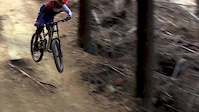
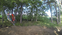
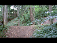
Photos of Falkirk Mountain Bike
Videos of Falkirk Mountain Bike
trail: Path
3:42 |
245 |
May 7, 2017
trail: Skyline
3:19 |
7065 |
May 24, 2016
trail: Jump
0:21 |
256 |
Oct 14, 2015
trail: Path
8:56 |
528 |
Jun 20, 2015
trail: Skyline
2:25 |
28012 |
Mar 9, 2015
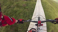
trail: Boardwalk
0:11 |
1962 |
Aug 6, 2013
trail: Jump
0:25 |
312 |
Aug 1, 2013
trail: Jump
0:10 |
327 |
Jul 2, 2013
Recent Trail Reports
| status | trail | date | condition | info | user |
|---|---|---|---|---|---|
| Is this the Start? | Jun 7, 2026 @ 2:30pm (Europe/London) Jun 7, 2026 | Wet | ntscots | ||
| Access Road | Jun 13, 2026 @ 10:17am (Europe/Isle_of_Man) Jun 13, 2026 | Dry | ShoodNoBetter BCDC | ||
| Canada Trail | Jun 13, 2026 @ 10:17am (Europe/Isle_of_Man) Jun 13, 2026 | Variable | ShoodNoBetter BCDC | ||
| Canada Trail | Jun 13, 2026 @ 10:17am (Europe/Isle_of_Man) Jun 13, 2026 | Variable | ShoodNoBetter BCDC | ||
| Canada Trail | Jun 13, 2026 @ 10:17am (Europe/Isle_of_Man) Jun 13, 2026 | Dry | ShoodNoBetter BCDC | ||
| Edge | Jun 13, 2026 @ 10:17am (Europe/Isle_of_Man) Jun 13, 2026 | Variable | ShoodNoBetter BCDC | ||
| Path | Jun 13, 2026 @ 10:17am (Europe/Isle_of_Man) Jun 13, 2026 | Dry | ShoodNoBetter BCDC | ||
| Path | Jun 13, 2026 @ 10:17am (Europe/Isle_of_Man) Jun 13, 2026 | Dry | ShoodNoBetter BCDC | ||
| Greenrig Entrance | Jun 6, 2026 @ 9:48am (Europe/Isle_of_Man) Jun 6, 2026 | Dry | ShoodNoBetter BCDC | ||
| Canada Trail | Jun 6, 2026 @ 9:48am (Europe/Isle_of_Man) Jun 6, 2026 | Dry | ShoodNoBetter BCDC |
Activity Feed
| username | action | type | title | date |
|---|---|---|---|---|
| ntscots | add | report | activity #97407950 | Jun 20, 2026 @ 10:01am 2 hours |
| ShoodNoBetter | add | report | activity #97132319 and 3 more | Jun 16, 2026 @ 12:46pm Jun 16, 2026 |
| ShoodNoBetter | add | report | activity #97132318 and 1 more | Jun 16, 2026 @ 12:46pm Jun 16, 2026 |
| ShoodNoBetter | add | report | activity #97132317 | Jun 16, 2026 @ 12:46pm Jun 16, 2026 |
| ShoodNoBetter | add | report | activity #96373370 and 25 more | Jun 6, 2026 @ 8:23am Jun 6, 2026 |
Recent Comments
| username | type | title | comment | date |
|---|---|---|---|---|
| trail | Nice wee addition, nice and steep! | Aug 11, 2025 @ 1:41am Aug 11, 2025 | ||
| report | Is that the bit to the side of Jack's Track?... | Feb 16, 2025 @ 7:12am Feb 16, 2025 | ||
| trail | Lots of trees down 26th Jan 2025, no loops... | Jan 26, 2025 @ 10:15am Jan 26, 2025 | ||
| trail | To whoever who has been working on this trail... | Oct 4, 2024 @ 11:47am Oct 4, 2024 | ||
| trail | Nice and dry up to Tappoch Broch. Top part of... | Jul 26, 2024 @ 10:20am Jul 26, 2024 |
Local Badges
-

Epic Ride Climb 2k18 awarded -

Climbing 10k Badge67 awarded -

Climbing 100k Badge3 awarded -

Epic Ride Descent 2k18 awarded -

Descent 10k Badge67 awarded -

Descent 100k Badge4 awarded
Bike & Skill Parks
| name | type | city | rating |
|---|---|---|---|
| Larbert Pump Track | skill park | Falkirk | |
| Skills Loop | skill park | Falkirk | |
| Callendar Park Cycling Hub | skill park | Falkirk |
Activity Type Stats
| activitytype | trails | distance | descent | descent distance | total vertical | rating | global rank | state rank | photos | reports | routes | ridelogs |
|---|---|---|---|---|---|---|---|---|---|---|---|---|
| Mountain Bike | 351 | 122 miles | 8,428 ft | 54 miles | 607 ft | #410 | #17 | 88 | 6,023 | 4 | 23,913 | |
| E-Bike | 349 | 122 miles | 8,363 ft | 54 miles | 607 ft | #450 | #30 | 5,930 | 4 | 1,477 | ||
| Horse | 64 | 29 miles | 2,283 ft | 16 miles | 607 ft | #640 | #25 | 734 | 1 | |||
| Hike | 304 | 112 miles | 6,827 ft | 49 miles | 607 ft | #671 | #22 | 5,818 | 358 | |||
| Trail Running | 304 | 112 miles | 6,827 ft | 49 miles | 607 ft | #699 | #24 | 5,818 | 3,567 | |||
| Dirtbike/Moto | 3 | 1 mile | 52 ft | 3,291 ft | 240 ft | 270 |
Frequently Asked Questions About Falkirk
▼
What are the best places to ride in Falkirk?
Falkirk has 8 areas to explore for mountain biking. The top rated areas are:
▼
What are the highest rated mountain biking trails in Falkirk?
The highest rated mountain biking trails in Falkirk are:
- Jack's Track (4.2/5)
- Path (4.1/5)
- The Fall (4.1/5)
- Path (4/5)
- Blue View (4/5)
▼
What is the best time of the year to ride in Falkirk?
Based on ride log data, the most popular months to ride in Falkirk are:
- September (147 activities)
- April (139 activities)
- August (119 activities)
▼
Where can I park to ride in Falkirk?
There are 18 parking locations listed in Falkirk. The most popular parking spots are: View all parking and trailhead locations on the map to plan your visit.
Activities
Trails
- By brenthillier
 NSMBA TRAILFORKS & contributors
 - Admins: DMBinS, FLS, OTA, BCDC
- #7211 - 10,260 views
- falkirk activity log | embed map of Falkirk mountain bike trails | falkirk mountain biking points of interest
Downloading of trail gps tracks in kml & gpx formats is enabled for Falkirk.
You must login to download files.