close
-
Layers w
- Weather Layers
- Pro
- Pro
- Pro
- Pro
- Pro
- Pro
- More Layers
- Pro
- Pro
- Pro
- Pro
-
Upgrade to

3D
Trail Conditions
- Unknown
- Snow Groomed
- Snow Packed
- Snow Covered
- Snow Cover Partial
- Freeze/thaw Cycle
- Icy
- Prevalent Mud
- Wet
- Variable
- Ideal
- Dry
- Very Dry
Trail Flow (Ridden Direction)
Trailforks scans users ridelogs to determine the most popular direction each trail is ridden. A good flowing trail network will have most trails flowing in a single direction according to their intension.
The colour categories are based on what percentage of riders are riding a trail in its intended direction.
The colour categories are based on what percentage of riders are riding a trail in its intended direction.
- > 96%
- > 90%
- > 80%
- > 70%
- > 50%
- < 50%
- bi-directional trail
- no data
Trail Last Ridden
Trailforks scans ridelogs to determine the last time a trail was ridden.
- < 2 days
- < 1 week
- < 2 weeks
- < 1 month
- < 6 months
- > 6 months
Trail Ridden Direction
The intended direction a trail should be ridden.
- Downhill Only
- Downhill Primary
- Both Directions
- Uphill Primary
- Uphill Only
- One Direction
Contribute Details
Colors indicate trail is missing specified detail.
- Description
- Photos
- Description & Photos
- Videos
Trail Popularity ?
Trailforks scans ridelogs to determine which trails are ridden the most in the last 9 months.
Trails are compared with nearby trails in the same city region with a possible 25 colour shades.
Think of this as a heatmap, more rides = more kinetic energy = warmer colors.
- most popular
- popular
- less popular
- not popular
ATV/ORV/OHV Filter
Max Vehicle Width
inches
US Cell Coverage
Legend

Radar Time
Activity Recordings
Trailforks uses anonymized public activity data.
?
Activity Recordings
Trailforks uses anonymized public activity data.
?
Personal Heatmap
▶
Activity Types
all
/
none
▶
Options
2
Date range
month
–
Winter Trails
Warning
A routing network for winter maps does not exist. Selecting trails using the winter trails layer has been disabled.
Missing Trails
Most Popular
Least Popular
Trails are colored based on popularity. The more popular a trail is, the more red. Less popular trails trend towards green.
Jump Magnitude Heatmap
Heatmap of where riders jump on trails. Zoom in to see individual jumps, click circles to view jump details.
BC Backroad Status
![map legend]()
Service Road Atlas is a free to use, community-driven service for viewing and creating reports on the numerous back-country service roads around B.C. and Alberta.

Slope Aspect
Direction the slope faces
Trails Deemphasized
Trails are shown in grey.
Only show trails with no bike usage.
Suggested Layers
Based on selected activity type
Save the current map location and zoom level as your default home location whenever this page is loaded.
SaveTokyo Drift
Activities Click to view
- Mountain Bike
123 trails
- Gravel Bike
0 trails
- Adaptive Bike
0 trails
- Winter Fat Bike
0 trails
- Horse
7 trails
- Hike
108 trails
- Trail Running
105 trails
Region Details
- 27
- 21
- 32
- 20
- 3
Region Status
Closed as of Jun 17, 2026Local Trail Association
Stats
- Avg Trail Rating
- Trails (view details)
- 104
- Trails Mountain Bike
- 128
- Trails E-Bike
- 1
- Trails Horse
- 8
- Trails Hike
- 108
- Trails Trail Running
- 105
- Total Distance
- 55 miles
- Total Descent
- 11,479 ft
- Total Vertical
- 960 ft
- Highest Trailhead
- 1,024 ft
- Reports
- 6,392
- Photos
- 471
- Ridden Counter
- 74,208
Sub Regions
-
Tokul East
- 8
- 19
- 9
- 2
-
Tokul West
- 13
- 13
- 11
- 1
Popular Fall City Mountain Biking Trails
• 100 ★ 3.3 • 1,312 ft • 85 ft • 1,512 •
Popular blue difficulty singletrack. This mountain bike primary trail can be used both directions and has a easy overall physical rating with a 85 ft blue climb. On average it takes 2 minutes to complete this trail.
• 100 ★ 4.2 • 2,503 ft • 230 ft • 1,508 •
Nice climb option to get up to "Tokul Central" trails (Ivan's, etc). Also fun coming down.
• 90 ★ 4.6 • 1,742 ft • 0 ft • 1,383 •
Lower Crazy Ivan is a super fun and fast flow trail. It includes an optional natural stump jump, several small optional jumps, one mandatory but rollable drop, a steep techie section, and nice berms. It is a must ride trail at Tokul East.
• 90 ★ 3.9 • 1,417 ft • 0 ft • 1,358 •
A fast-flowing descent. Features a few small jumps and good-size drops. This is a spicy blue: some of the drops require very good technique and are followed by turns and loose pebbles in classic Tokul fashion. This is a fabulous trail...
• 95 ★ 4.3 • 2,500 ft • 0 ft • 1,334 •
This is a great, and undeservedly under-ridden trail (best kept secret?). Along with Upper Ivan, is the steepest trail at Tokul East (at least one section of it is slightly steeper than the steepest part of Upper Ivan). Several nice...
• 100 ★ 3.6 • 846 ft • 23 ft • 1,324 •
A fun little trail that gets its namesake from the burger stand in Fall City that boasts of "GREASE, SALT, SUGAR & CAFFEINE!".
• 70 ★ 3.4 • 3,051 ft • 17 ft • 1,294 •
The iconic Tokul East trail. The trail was awesome before the logging. It is still very fun from late fall, thru Winter and early Spring. in Summer, due to the clear cut, it gets blown out and full of marbles. Also, blackberries and...
• 80 ★ 4.4 • 2,664 ft • 0 ft • 1,251 •
Starting with a roll in on the steep and fast chute, is a flowy rip over jumps and off some small drops down an iconic Tokul west ridge line. Originally a short jump line known as the s, which was extended down to the Snoqualmie Valley...
Fall City Mountain Bike Routes
★ 4.0 • 5 miles • 799 ft • 6 • Loop •
This route highlights the newest black trails at Tokul West; Dogwash and Log Jam Extention. Both trails...
6 miles • 1,350 ft • 10 • Out & Back •
A shorter-distance loop of East Tokul, hitting , (lower) and all of Midtown.
5 miles • 923 ft • 9 •
and then cross over to midtown. This ride avoids the super technical of Tokul but adds the fun and workout.
70 miles • 12,856 ft • 36 •
The Real McCoy loop 2024 edition. Now with Tokyo Drift!
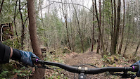
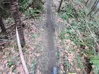
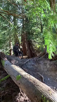
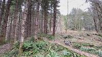
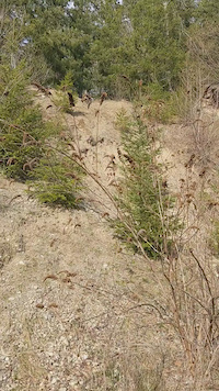
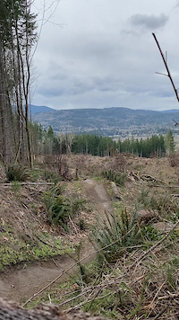
Photos of Fall City Mountain Bike
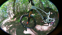
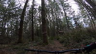
Videos of Fall City Mountain Bike
trail: PNWheel
0:07 |
|
Feb 28, 2023
trail: PNWheel
0:15 |
693 |
Feb 1, 2023
0:16 |
70 |
May 5, 2022
trail: Between Two Fernz (Upper)
0:11 |
109 |
Mar 26, 2022
trail: Ludicrous Speed
0:18 |
60 |
Feb 7, 2022
trail: Upper Crazy Ivan
0:44 |
198 |
Jun 20, 2021
trail: Tokyo Drift
0:25 |
212 |
Apr 23, 2021
trail: Rainier
2:48 |
152 |
Mar 27, 2021
Current Trail Warnings
| status | trail | date | condition | user | info |
|---|---|---|---|---|---|
| Curly Fries | Jun 17, 2026 @ 9:55pm (America/Los_Angeles) Jun 17, 2026 | Variable | srstout | Overgrown. Barely passable. Slow going. | |
| Flowtron 3000 | Jun 7, 2026 @ 4:54pm (America/Vancouver) Jun 7, 2026 | Ideal | joracine | Overgrown, barely rideable. | |
| Midtown XC | May 31, 2026 @ 9:22pm (America/Los_Angeles) May 31, 2026 | Dry | motosantiago | Very overgrown. Even if it wasn't, this... |
Recent Trail Reports
Activity Feed
| username | action | type | title | date |
|---|---|---|---|---|
| srstout | add | report | activity #97232202 and 8 more | Jun 17, 2026 @ 9:54pm Jun 17, 2026 |
| Jschwach | ridden | trail | activity #97076330 | Jun 15, 2026 @ 5:20pm Jun 15, 2026 |
| kent426 | comment | report | activity #96938683 and 1 more | Jun 13, 2026 @ 9:48pm Jun 13, 2026 |
| joracine | add | report | activity #96519387 and 5 more | Jun 7, 2026 @ 9:05pm Jun 7, 2026 |
| motosantiago | add | report | activity #95998215 | May 31, 2026 @ 9:22pm May 31, 2026 |
Recent Comments
| username | type | title | comment | date |
|---|---|---|---|---|
| report | I couldn’t even get 1000 ft in the trail it... | Jun 13, 2026 @ 9:49pm Jun 13, 2026 | ||
| report | Yup, I turned around, Tolko has really gone... | Jun 13, 2026 @ 9:48pm Jun 13, 2026 | ||
| trail | Sounds like this one used to be different in... | Apr 23, 2026 @ 3:40am Apr 23, 2026 | ||
| trail | Lower Fernz now routes (only) into High... | Mar 25, 2026 @ 2:14pm Mar 25, 2026 | ||
| report | Thanks for your work! | Mar 23, 2026 @ 11:10am Mar 23, 2026 |
Local Badges
-

Top 10 Trails62 awarded -

Descent 100k Badge4 awarded -

Big Ride 30k2,570 awarded -

Epic Ride 50k1,374 awarded -

Descent 10k Badge299 awarded -

Completionist0 awarded
Bike & Skill Parks
| name | type | city | rating |
|---|---|---|---|
| Ivan Pumptrack | skill park | Fall City |
Local Trail Supporters
- Bob Bournique
- Peter Sherill
Activity Type Stats
| activitytype | trails | distance | descent | descent distance | total vertical | rating | global rank | state rank | photos | reports | routes | ridelogs |
|---|---|---|---|---|---|---|---|---|---|---|---|---|
| Mountain Bike | 123 | 54 miles | 11,427 ft | 21 miles | 961 ft | #242 | #86 | 484 | 6,436 | 29 | 37,719 | |
| E-Bike | 1 | 2,640 | 1 | 749 | ||||||||
| Horse | 7 | 12 miles | 102 ft | 4,616 ft | 889 ft | #2,011 | #1,124 | 1,252 | 2 | |||
| Hike | 108 | 51 miles | 10,371 ft | 19 miles | 932 ft | #3,710 | #1,309 | 6,269 | 461 | |||
| Trail Running | 105 | 50 miles | 10,371 ft | 19 miles | 932 ft | #3,124 | #909 | 1 | 6,262 | 894 |
Frequently Asked Questions About Fall City
▼
What are the best places to ride in Fall City?
Fall City has 2 areas to explore for mountain biking. The top rated areas are:
▼
What are the highest rated mountain biking trails in Fall City?
The highest rated mountain biking trails in Fall City are:
- Between Two Fernz (Upper) (4.6/5)
- Crazy Ivan (4.5/5)
- Dog Wash (4.5/5)
- PNWheel (4.4/5)
- Chewy (4.3/5)
▼
What is the best time of the year to ride in Fall City?
Based on ride log data, the most popular months to ride in Fall City are:
- November (413 activities)
- May (409 activities)
- April (379 activities)
▼
Where can I park to ride in Fall City?
There are 4 parking locations listed in Fall City. The most popular parking spots are:
- Tokul East Parking
- Snoqualmie Valley Trail Parking
- Parking
- Tokul Roundabout Lot (aka Gravel Parking Lot at Fall City Community Park)
Activities
Trails
- By jebike
 & contributors
 - Admins: EMBA-C2S, EMBA-C2S
- #5462 - 16,058 views
- fall city activity log | embed map of Fall City mountain bike trails | fall city mountain biking points of interest polygons
Downloading of trail gps tracks in kml & gpx formats is enabled for Fall City.
You must login to download files.