close
-
Layers w
- Weather Layers
- Pro
- Pro
- Pro
- Pro
- Pro
- Pro
- More Layers
- Pro
- Pro
- Pro
- Pro
-
Upgrade to

3D
Trail Conditions
- Unknown
- Snow Groomed
- Snow Packed
- Snow Covered
- Snow Cover Partial
- Freeze/thaw Cycle
- Icy
- Prevalent Mud
- Wet
- Variable
- Ideal
- Dry
- Very Dry
Trail Flow (Ridden Direction)
Trailforks scans users ridelogs to determine the most popular direction each trail is ridden. A good flowing trail network will have most trails flowing in a single direction according to their intension.
The colour categories are based on what percentage of riders are riding a trail in its intended direction.
The colour categories are based on what percentage of riders are riding a trail in its intended direction.
- > 96%
- > 90%
- > 80%
- > 70%
- > 50%
- < 50%
- bi-directional trail
- no data
Trail Last Ridden
Trailforks scans ridelogs to determine the last time a trail was ridden.
- < 2 days
- < 1 week
- < 2 weeks
- < 1 month
- < 6 months
- > 6 months
Trail Ridden Direction
The intended direction a trail should be ridden.
- Downhill Only
- Downhill Primary
- Both Directions
- Uphill Primary
- Uphill Only
- One Direction
Contribute Details
Colors indicate trail is missing specified detail.
- Description
- Photos
- Description & Photos
- Videos
Trail Popularity ?
Trailforks scans ridelogs to determine which trails are ridden the most in the last 9 months.
Trails are compared with nearby trails in the same city region with a possible 25 colour shades.
Think of this as a heatmap, more rides = more kinetic energy = warmer colors.
- most popular
- popular
- less popular
- not popular
ATV/ORV/OHV Filter
Max Vehicle Width
inches
US Cell Coverage
Legend

Radar Time
Activity Recordings
Trailforks uses anonymized public activity data.
?
Activity Recordings
Trailforks uses anonymized public activity data.
?
Personal Heatmap
▶
Activity Types
all
/
none
▶
Options
2
Date range
month
–
Winter Trails
Warning
A routing network for winter maps does not exist. Selecting trails using the winter trails layer has been disabled.
Missing Trails
Most Popular
Least Popular
Trails are colored based on popularity. The more popular a trail is, the more red. Less popular trails trend towards green.
Jump Magnitude Heatmap
Heatmap of where riders jump on trails. Zoom in to see individual jumps, click circles to view jump details.
BC Backroad Status
![map legend]()
Service Road Atlas is a free to use, community-driven service for viewing and creating reports on the numerous back-country service roads around B.C. and Alberta.

Slope Aspect
Direction the slope faces
Trails Deemphasized
Trails are shown in grey.
Only show trails with no bike usage.
Suggested Layers
Based on selected activity type
Save the current map location and zoom level as your default home location whenever this page is loaded.
Save
No description for Fallen Leaf Park has been added yet!
Login or register to submit one.
 google parking directions
Primary Trail Type: Cross-Country
eBikes Allowed:
No
Land Status: Municipal Park
google parking directions Region Supporters & Maintainers
Activities Click to view
- Mountain Bike
19 trails
- Hike
18 trails
- Trail Running
18 trails
Region Details
- 3
- 2
- 14
Region Status
Caution as of May 17, 2026Stats
- Avg Trail Rating
- Trails (view details)
- 19
- Trails Mountain Bike
- 19
- Trails Hike
- 18
- Trails Trail Running
- 18
- Total Distance
- 4 miles
- Total Descent
- 777 ft
- Total Vertical
- 292 ft
- Highest Trailhead
- 476 ft
- Reports
- 221
- Photos
- 7
- Ridden Counter
- 2,494
Popular Fallen Leaf Park Mountain Biking Trails
• 65 ★ 3.5 • 3,632 ft • 143 ft • 164 •
Moderately popular blue difficulty singletrack. This mountain bike primary trail can be used both directions and has a moderate overall physical rating with a 143 ft blue climb. On average it takes 8 minutes to complete this trail.
• 60 ★ 3.0 • 1,424 ft • 46 ft • 141 •
Trail with a hidden black diamond connector at the baseball field.
• 55 ★ 2.0 • 666 ft • 6 ft • 135 •
Moderately popular blue difficulty singletrack. This mountain bike primary trail can be used both directions and has a moderate overall physical rating with a 6 ft blue climb. On average it takes 1 minutes to complete this trail.
• 45 ★ 4.0 • 925 ft • 12 ft • 134 •
Moderately popular blue difficulty singletrack. This mountain bike primary trail can be used both directions and has a moderate overall physical rating with a 12 ft blue climb. On average it takes 1 minutes to complete this trail.
• 40 ★ 3.0 • 712 ft • 9 ft • 131 •
Moderately popular blue difficulty singletrack. This mountain bike primary trail can be used both directions and has a moderate overall physical rating with a 9 ft blue climb. On average it takes 1 minutes to complete this trail.
• 50 ★ 0.0 • 1,768 ft • 221 ft • 122 •
Moderately popular blue difficulty singletrack. This mountain bike primary trail can be used both directions and has a hard overall physical rating with a 221 ft black diamond climb. On average it takes 6 minutes to complete this trail.
• 30 ★ 0.0 • 2,073 ft • 249 ft • 121 •
Less popular blue difficulty singletrack. This mountain bike primary trail can be used both directions and has a hard overall physical rating with a 249 ft black diamond climb. On average it takes 8 minutes to complete this trail.
• 60 ★ 0.0 • 328 ft • 0 ft • 120 •
Moderately popular blue difficulty singletrack. This mountain bike primary trail can be used both directions and has a easy overall physical rating with a 0 ft blue climb. On average it takes minutes to complete this trail.
Fallen Leaf Park Mountain Bike Routes
★ 1.7 • 5 miles • 466 ft • 8 • Loop •
Quick loop for a good training ride. Includes some technical sections and challenges to keep the ride...
4 miles • 637 ft • 26 •
A way to discover every ridable trail on the north side of round lake.
• 8 miles • 856 ft • 14 •
• 11 miles • 1,334 ft • 22 •
• 10 miles • 652 ft • 4 •
• 7 miles • 562 ft • 1 •
Videos of Fallen Leaf Park Mountain Bike
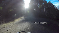
trail: Boneyard
8:09 |
380 |
Apr 1, 2015
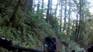
trail: Nasty Stench
1158 |
Sep 2, 2016 , Camas
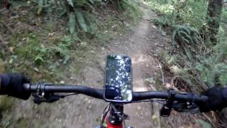
trail: Eavesdrop
763 |
Aug 29, 2016 , Camas
Recent Trail Reports
| status | trail | date | condition | info | user |
|---|---|---|---|---|---|
| Parking Lot Corner Entrance | May 2, 2026 @ 6:03pm (America/Vancouver) May 2, 2026 | Ideal | RichardDavies | ||
| Disgruntled | May 2, 2026 @ 6:03pm (America/Vancouver) May 2, 2026 | Ideal | RichardDavies | ||
| Short Cut | May 2, 2026 @ 6:03pm (America/Vancouver) May 2, 2026 | Ideal | RichardDavies | ||
| Nasty Stench | May 2, 2026 @ 6:03pm (America/Vancouver) May 2, 2026 | Ideal | RichardDavies | ||
| Eavesdrop | May 2, 2026 @ 6:03pm (America/Vancouver) May 2, 2026 | Ideal | RichardDavies | ||
| Skinny Man | May 2, 2026 @ 6:03pm (America/Vancouver) May 2, 2026 | Variable | RichardDavies | ||
| Baseball Field to Picnic Shelter | May 2, 2026 @ 6:03pm (America/Vancouver) May 2, 2026 | Wet | RichardDavies | ||
| Boneyard | Dec 21, 2024 @ 1:00pm Dec 21, 2024 | Variable | RichardDavies | ||
| Picnic Loop | Dec 21, 2024 @ 1:00pm Dec 21, 2024 | Wet | RichardDavies | ||
| Ridge Line | Dec 21, 2024 @ 1:00pm Dec 21, 2024 | Variable | RichardDavies |
Activity Feed
| username | action | type | title | date |
|---|---|---|---|---|
| Lostisle | wishlist | route | activity #97186660 | Jun 17, 2026 @ 8:41am 2 days |
| RichardDavies | add | report | activity #93917814 and 6 more | May 2, 2026 @ 9:08pm May 2, 2026 |
| LoamIsHome | wishlist | trail | activity #92616309 | Apr 14, 2026 @ 1:04pm Apr 14, 2026 |
| RestaurantFWgblw | wishlist | region | activity #88840282 | Feb 13, 2026 @ 10:58am Feb 13, 2026 |
| mooseindahouse | wishlist | trail | activity #85966892 and 1 more | Dec 23, 2025 @ 4:13pm Dec 23, 2025 |
Recent Comments
| username | type | title | comment | date |
|---|---|---|---|---|
| trail | The boardwalk that used to keep you out of the... | May 28, 2024 @ 3:49pm May 28, 2024 | ||
| trail | Very tight corners here. Notably, I broke a... | Mar 20, 2024 @ 12:11pm Mar 20, 2024 | ||
| trail | Definitely not a blue green at best! Flat... | May 11, 2022 @ 3:29pm May 11, 2022 | ||
| trail | For a blue, really challenging | Oct 18, 2020 @ 12:41pm Oct 18, 2020 | ||
| trail | Challenging, good ride when it’s been dry... | Oct 18, 2020 @ 12:40pm Oct 18, 2020 |
Nearby Areas
| name | distance | ||||
|---|---|---|---|---|---|
| 44N/Lower Leadbetter | 11 | 0.6 km | |||
| Lacamas Park | 24 | 24 | 1 | 0.9 km | |
| Sandy River Delta | 18 | 1 | 4.2 km | ||
| Green Mountain | 8 | 6 | 4.3 km | ||
| Steigerwald Lake | 2 | 1 | 5.4 km |
Local Products
Activity Type Stats
| activitytype | trails | distance | descent | descent distance | total vertical | rating | global rank | state rank | photos | reports | routes | ridelogs |
|---|---|---|---|---|---|---|---|---|---|---|---|---|
| Mountain Bike | 19 | 4 miles | 778 ft | 1 mile | 292 ft | #10,491 | #4,170 | 7 | 210 | 1 | 3,174 | |
| Hike | 18 | 4 miles | 620 ft | 1 mile | 292 ft | #14,623 | #6,447 | 210 | 2 | 114 | ||
| Trail Running | 18 | 4 miles | 620 ft | 1 mile | 292 ft | #12,464 | #5,004 | 210 | 490 |
Frequently Asked Questions About Fallen Leaf Park
▼
What are the highest rated mountain biking trails in Fallen Leaf Park?
The highest rated mountain biking trails in Fallen Leaf Park are:
- Late For Dinner (4.1/5)
- Disgruntled (4/5)
- Recovery Loop (4/5)
- Dead Lake Trail (3.9/5)
- Skinny Man (3.8/5)
▼
What is the best time of the year to ride in Fallen Leaf Park?
Based on ride log data, the most popular months to ride in Fallen Leaf Park are:
- July (60 activities)
- February (40 activities)
- August (33 activities)
▼
Where can I park to ride in Fallen Leaf Park?
There are 1 parking locations listed in Fallen Leaf Park. The most popular parking spots are:
▼
What is the longest trail in Fallen Leaf Park?
The longest trail in Fallen Leaf Park is Dead Lake Trail at 3,632 ft. View all trails sorted by distance.
Activities
- By SVergillo
 EMBA-SW & contributors
 - Admins: apply
- #10594 - 8,840 views
- fallen leaf park activity log | embed map of Fallen Leaf Park mountain bike trails | fallen leaf park mountain biking points of interest
Downloading of trail gps tracks in kml & gpx formats is enabled for Fallen Leaf Park.
You must login to download files.