close
-
Layers w
- Weather Layers
- Pro
- Pro
- Pro
- Pro
- Pro
- Pro
- More Layers
- Pro
- Pro
- Pro
- Pro
-
Upgrade to

3D
Trail Conditions
- Unknown
- Snow Groomed
- Snow Packed
- Snow Covered
- Snow Cover Partial
- Freeze/thaw Cycle
- Icy
- Prevalent Mud
- Wet
- Variable
- Ideal
- Dry
- Very Dry
Trail Flow (Ridden Direction)
Trailforks scans users ridelogs to determine the most popular direction each trail is ridden. A good flowing trail network will have most trails flowing in a single direction according to their intension.
The colour categories are based on what percentage of riders are riding a trail in its intended direction.
The colour categories are based on what percentage of riders are riding a trail in its intended direction.
- > 96%
- > 90%
- > 80%
- > 70%
- > 50%
- < 50%
- bi-directional trail
- no data
Trail Last Ridden
Trailforks scans ridelogs to determine the last time a trail was ridden.
- < 2 days
- < 1 week
- < 2 weeks
- < 1 month
- < 6 months
- > 6 months
Trail Ridden Direction
The intended direction a trail should be ridden.
- Downhill Only
- Downhill Primary
- Both Directions
- Uphill Primary
- Uphill Only
- One Direction
Contribute Details
Colors indicate trail is missing specified detail.
- Description
- Photos
- Description & Photos
- Videos
Trail Popularity ?
Trailforks scans ridelogs to determine which trails are ridden the most in the last 9 months.
Trails are compared with nearby trails in the same city region with a possible 25 colour shades.
Think of this as a heatmap, more rides = more kinetic energy = warmer colors.
- most popular
- popular
- less popular
- not popular
ATV/ORV/OHV Filter
Max Vehicle Width
inches
US Cell Coverage
Legend

Radar Time
Activity Recordings
Trailforks uses anonymized public activity data.
?
Activity Recordings
Trailforks uses anonymized public activity data.
?
Personal Heatmap
▶
Activity Types
all
/
none
▶
Options
2
Date range
month
–
Winter Trails
Warning
A routing network for winter maps does not exist. Selecting trails using the winter trails layer has been disabled.
Missing Trails
Most Popular
Least Popular
Trails are colored based on popularity. The more popular a trail is, the more red. Less popular trails trend towards green.
Jump Magnitude Heatmap
Heatmap of where riders jump on trails. Zoom in to see individual jumps, click circles to view jump details.
BC Backroad Status
![map legend]()
Service Road Atlas is a free to use, community-driven service for viewing and creating reports on the numerous back-country service roads around B.C. and Alberta.

Slope Aspect
Direction the slope faces
Trails Deemphasized
Trails are shown in grey.
Only show trails with no bike usage.
Suggested Layers
Based on selected activity type
Save the current map location and zoom level as your default home location whenever this page is loaded.
Save
No description for Falls City has been added yet!
Login or register to submit one.
Activities Click to view
- Mountain Bike
26 trails
- E-Bike
26 trails
- Gravel Bike
0 trails
- Adaptive Bike
0 trails
- Hike
12 trails
- Trail Running
12 trails
Region Details
- 4
- 4
- 3
- 8
- 6
Region Status
Open as of Jun 8, 2026Stats
- Avg Trail Rating
- Trails (view details)
- 25
- Trails Mountain Bike
- 26
- Trails E-Bike
- 26
- Trails Hike
- 12
- Trails Trail Running
- 12
- Total Distance
- 9 miles
- Total Descent
- 3,587 ft
- Total Vertical
- 1,259 ft
- Highest Trailhead
- 1,948 ft
- Reports
- 2,586
- Photos
- 576
- Ridden Counter
- 19,702
Articles
Video: Creative Lines & Jibs with 10x Motocross Trials National Champion
Jul 19, 2019 from pinkbike.com
Two-wheeled magic with Pat Smage.
Video: Jibs & Jumps with Kirt Voreis in Oregon
Jun 21, 2019 from pinkbike.com
Kirt Voreis jibbing some Black Rock, Oregon old school freeride in 'Time Flies'.
Sub Regions
-
Blackrock Mountain Bike Area
- 3
- 3
- 8
- 7
Popular Falls City Mountain Biking Trails
• 60 ★ 3.8 • 2,136 ft • 0 ft • 1,302 •
Bonzai Downhill (BD) can best be described as the “bread and butter” experience at Blackrock. It is the most versatile trail on the mountain, allowing each rider to challenge him or herself according to their skill set, so everyone,...
• 75 ★ 4.3 • 1,181 ft • 0 ft • 1,288 •
First of five sections of Banzai Downhill, one of three trails that provide a top-to-bottom descent of the system. Starts with a wood roll-in to a catch berm, then a hard left-hander into a series of three tabletop jumps. From there...
• 80 ★ 4.2 • 3,533 ft • 6 ft • 1,203 •
Fourth of five sections of Banzai Downhill, one of three trails that provide a top-to-bottom descent of the system. The last section that most riders will want to take, as it exits close to Basic Training and a good spot to restart...
• 55 ★ 4.6 • 1,381 ft • 0 ft • 1,182 •
Second of five sections of Banzai Downhill, one of three trails that provide a top-to-bottom descent of the system. Starts with a large wooden table-top. That leads directly into Plankenstein, an extended twisting bridge above the...
• 50 ★ 4.5 • 3,064 ft • 43 ft • 1,129 •
Third of five sections of Banzai Downhill, one of three trails that provide a top-to-bottom descent of the system. This segment is one of only three that are rated "green" by the trail managers; the other two being and . Starts with a...
• 90 ★ 4.9 • 771 ft • 0 ft • 1,119 •
is a high flying jump marathon that is characterized by mandatory doubles with few ride arounds. This trail requires expert skills and proper scouting of the jumps and features.
• 95 ★ 4.6 • 876 ft • 0 ft • 1,024 •
Third of six sections of Sickter Gnar, one of three trails that provide a top-to-bottom descent of the system. Starts immediately with an optional rock-armored drop off the main into a series of corners and small kickers. The end of the...
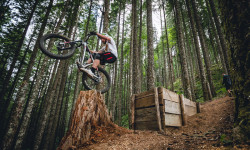
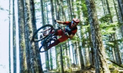
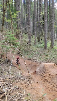
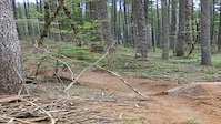
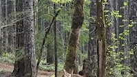
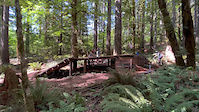
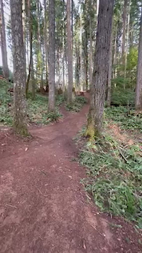
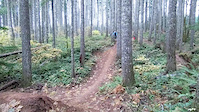
Photos of Falls City Mountain Bike
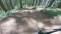
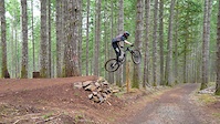
Videos of Falls City Mountain Bike
trail: Granny's Kitchen 2
0:09 |
|
Apr 20, 2024
trail: Granny's Kitchen 2
0:08 |
|
Apr 20, 2024
trail: Granny's Kitchen 2
0:04 |
224 |
Apr 20, 2024
0:05 |
125 |
Aug 19, 2023
trail: Sickter Gnar 1
0:14 |
94 |
Jul 26, 2023
trail: Sunday Stroll
2:22 |
1186 |
May 11, 2023
trail: Run Around
0:10 |
394 |
Feb 13, 2023
trail: Run Around
0:15 |
250 |
Dec 12, 2022
Recent Trail Reports
Activity Feed
| username | action | type | title | date |
|---|---|---|---|---|
| Golffreak001 | wishlist | region | activity #97621794 | Jun 23, 2026 @ 6:18am Jun 23, 2026 |
| jlejle | wishlist | region | activity #97516417 | Jun 21, 2026 @ 1:33pm Jun 21, 2026 |
| FscFHh | wishlist | region | activity #97344395 | Jun 19, 2026 @ 2:19pm Jun 19, 2026 |
| MrBrooks | add | photo | activity #97336133 and 1 more | Jun 19, 2026 @ 12:11pm Jun 19, 2026 |
| jskis | ridden | trail | activity #97233983 | Jun 17, 2026 @ 11:00pm Jun 17, 2026 |
Recent Comments
| username | type | title | comment | date |
|---|---|---|---|---|
| trail | Careful on this one, some jumps require lots... | May 21, 2026 @ 4:57pm May 21, 2026 | ||
| trail | I thought it used to be more fun. Bring back... | Feb 19, 2026 @ 3:18pm Feb 19, 2026 | ||
| trail | Trail has been rerouted in the second half,... | Oct 20, 2025 @ 1:00pm Oct 20, 2025 | ||
| trail | This is now Sunday Stroll 1. Maybe still a... | Sep 30, 2025 @ 10:32am Sep 30, 2025 | ||
| trail | The new Jumps are great! I wouldn't call this... | Sep 30, 2025 @ 10:30am Sep 30, 2025 |
Local Badges
-

Epic Ride Climb 2k34 awarded -

Climbing 10k Badge18 awarded -

Climbing 100k Badge0 awarded -

Epic Ride Descent 2k44 awarded -

Descent 10k Badge20 awarded -

Descent 100k Badge0 awarded
Bike & Skill Parks
| name | type | city | rating |
|---|---|---|---|
| Basic Training | skill park | Falls City |
Local Mountain Biking Directory
-
Blackrock Mountain Bike AssociationTrail Association
![Blackrock Mountain Bike Association]()
Activity Type Stats
| activitytype | trails | distance | descent | descent distance | total vertical | rating | global rank | state rank | photos | reports | routes | ridelogs |
|---|---|---|---|---|---|---|---|---|---|---|---|---|
| Mountain Bike | 26 | 9 miles | 3,586 ft | 6 miles | 1,260 ft | #1,849 | #679 | 574 | 2,586 | 3,908 | ||
| E-Bike | 26 | 9 miles | 3,586 ft | 6 miles | 1,260 ft | #4,041 | #1,349 | 2 | 1,390 | 390 | ||
| Hike | 12 | 5 miles | 1,509 ft | 3 miles | 1,070 ft | #10,298 | #3,659 | 2,506 | 75 | |||
| Trail Running | 12 | 5 miles | 1,509 ft | 3 miles | 1,070 ft | #9,825 | #3,351 | 2,506 | 2 |
Frequently Asked Questions About Falls City
▼
What are the best places to ride in Falls City?
Falls City has 1 areas to explore for mountain biking. The top rated areas are:
▼
What are the highest rated mountain biking trails in Falls City?
The highest rated mountain biking trails in Falls City are:
- Sunday Stroll (4.6/5)
- Brake Check (4.6/5)
- Run Around (4.5/5)
- Banzai Downhill 2 (4.5/5)
- Sickter Gnar 3 (4.4/5)
▼
What is the best time of the year to ride in Falls City?
Based on ride log data, the most popular months to ride in Falls City are:
- July (67 activities)
- August (64 activities)
- October (44 activities)
▼
Where can I park to ride in Falls City?
There are 2 parking locations listed in Falls City. The most popular parking spots are:
Activities
Trails
Points of Interest
- By grantprezence
 & contributors
 - Admins: BRMBA, NWTA, SATA
- #4239 - 6,297 views
- falls city activity log | embed map of Falls City mountain bike trails | falls city mountain biking points of interest
Downloading of trail gps tracks in kml & gpx formats is enabled for Falls City.
You must login to download files.