close
-
Layers w
- Weather Layers
- Pro
- Pro
- Pro
- Pro
- Pro
- Pro
- More Layers
- Pro
- Pro
- Pro
- Pro
-
Upgrade to

3D
Trail Conditions
- Unknown
- Snow Groomed
- Snow Packed
- Snow Covered
- Snow Cover Partial
- Freeze/thaw Cycle
- Icy
- Prevalent Mud
- Wet
- Variable
- Ideal
- Dry
- Very Dry
Trail Flow (Ridden Direction)
Trailforks scans users ridelogs to determine the most popular direction each trail is ridden. A good flowing trail network will have most trails flowing in a single direction according to their intension.
The colour categories are based on what percentage of riders are riding a trail in its intended direction.
The colour categories are based on what percentage of riders are riding a trail in its intended direction.
- > 96%
- > 90%
- > 80%
- > 70%
- > 50%
- < 50%
- bi-directional trail
- no data
Trail Last Ridden
Trailforks scans ridelogs to determine the last time a trail was ridden.
- < 2 days
- < 1 week
- < 2 weeks
- < 1 month
- < 6 months
- > 6 months
Trail Ridden Direction
The intended direction a trail should be ridden.
- Downhill Only
- Downhill Primary
- Both Directions
- Uphill Primary
- Uphill Only
- One Direction
Contribute Details
Colors indicate trail is missing specified detail.
- Description
- Photos
- Description & Photos
- Videos
Trail Popularity ?
Trailforks scans ridelogs to determine which trails are ridden the most in the last 9 months.
Trails are compared with nearby trails in the same city region with a possible 25 colour shades.
Think of this as a heatmap, more rides = more kinetic energy = warmer colors.
- most popular
- popular
- less popular
- not popular
ATV/ORV/OHV Filter
Max Vehicle Width
inches
US Cell Coverage
Legend

Radar Time
Activity Recordings
Trailforks uses anonymized public activity data.
?
Activity Recordings
Trailforks uses anonymized public activity data.
?
Personal Heatmap
▶
Activity Types
all
/
none
▶
Options
2
Date range
month
–
Winter Trails
Warning
A routing network for winter maps does not exist. Selecting trails using the winter trails layer has been disabled.
Missing Trails
Most Popular
Least Popular
Trails are colored based on popularity. The more popular a trail is, the more red. Less popular trails trend towards green.
Jump Magnitude Heatmap
Heatmap of where riders jump on trails. Zoom in to see individual jumps, click circles to view jump details.
BC Backroad Status
![map legend]()
Service Road Atlas is a free to use, community-driven service for viewing and creating reports on the numerous back-country service roads around B.C. and Alberta.

Slope Aspect
Direction the slope faces
Trails Deemphasized
Trails are shown in grey.
Only show trails with no bike usage.
Suggested Layers
Based on selected activity type
Save the current map location and zoom level as your default home location whenever this page is loaded.
Save
No description for Falmouth has been added yet!
Login or register to submit one.
Activities Click to view
- Mountain Bike
494 trails
- E-Bike
5 trails
- Gravel Bike
0 trails
- Adaptive Bike
0 trails
- Horse
67 trails
- Hike
494 trails
- Trail Running
494 trails
- Snowshoe
249 trails
Region Details
- 113
- 1
- 230
- 101
- 41
- 5
- 1
Region Status
Open as of 2 daysStats
- Avg Trail Rating
- Trails (view details)
- 492
- Trails Mountain Bike
- 494
- Trails E-Bike
- 5
- Trails Horse
- 67
- Trails Hike
- 494
- Trails Trail Running
- 494
- Trails Snowshoe
- 249
- Trails Nordic Ski
- 1
- Total Distance
- 153 miles
- Total Descent
- 9,648 ft
- Total Vertical
- 215 ft
- Highest Trailhead
- 219 ft
- Reports
- 1,122
- Photos
- 537
- Ridden Counter
- 38,536
Sub Regions
-
Beebe Woods
- 25
- 9
- 5
-
Collins Woodlot / Kettle Holes
- 19
- 15
- 9
-
Coonamessett Greenway
- 32
- 13
- 1
-
Crane Wildlife Management Area - North
- 10
- 1
-
Crane Wildlife Management Area - South
- 8
- 2
-
Devils Lane (MBL)
- 3
- 3
-
Long Pond
- 10
- 2
- 2
-
Mares Pond Reservation
- 5
- 4
-
Mock Moraine Conservation Area
- 9
- 3
- 2
-
Otis (Falmouth)
- 33
- 26
- 12
- 5
-
Oyster Pond Headwaters
- 8
- 1
-
Peterson Farm
- 13
- 3
-
SOO (South of Otis)
- 27
- 11
- 9
- 1
-
WHOI Campus Trails
- 4
- 3
Popular Falmouth Mountain Biking Trails
• 100 ★ 0.0 • 2,228 ft • 69 ft • 944 •
Park your car and get ready for a little climb, some nice roots and rock gardens and a crossing.
• 100 ★ 4.5 • 2,930 ft • 37 ft • 814 •
After you cross the powerlines, this trail starts and you'll come to a four-way cross path, follow the path to the right down a short hill and after a couple hundred yards you'll enter the . Bring momentum and try to clear the walls....
• 100 ★ 4.7 • 3,655 ft • 42 ft • 778 •
This trail runs along Route 28 in a north and south direction, you're either heading into the Otis network or ending your ride on this trail. This trail is buff, fast, and has some berms. It is a lot of fun to ride.
• 100 ★ 5.0 • 2,854 ft • 8 ft • 681 •
Look for the super fast section ahead, open it up and go as fast as your lungs and legs allow on one of the most fun sections of packed dirt on the Cape.
• 100 ★ 5.0 • 1,204 ft • 18 ft • 674 •
Popular blue difficulty family friendly singletrack. This multi-use trail can be used both directions and has a moderate overall physical rating with a 18 ft blue climb. Trail visibility is sometimes hard to follow. On average it takes 2 minutes to complete this trail.
• 100 ★ 4.0 • 3,209 ft • 74 ft • 552 •
Great trail, well ridden and heading south has a fun strava segment called Climb. To the north is the trail and to the south the .
• 100 ★ 0.0 • 387 ft • 0 ft • 524 •
Popular green difficulty singletrack. This multi-use trail can be used both directions. On average it takes minutes to complete this trail.
Falmouth Mountain Bike Routes
★ 5.0 • 16 miles • 1,057 ft • 1 • Out & Back •
Nice ride from 151 out to Monks Cove on Buzzards Bay and back again. Careful crossing 28, most of the ride...
★ 3.5 • 42 miles • 981 ft • 19 • Loop •
This route was designed with gravel bikes in mind, but a mountain bike is a viable option. It is a mix of...
35 miles • 2,483 ft • 32 • Point to Point •
Leg #1 – Woods Hole to Sandwich Your challenge begins in the scenic village of Woods Hole in Falmouth....
★ 4.0 • 9 miles • 540 ft • 11 •
Has a lot of fun rock features and some flow to finish it off.
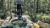
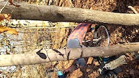
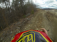
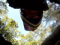
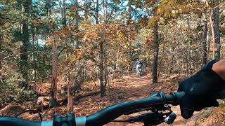
Photos of Falmouth Mountain Bike
Videos of Falmouth Mountain Bike
trail: Graveyard
0:37 |
357 |
Jul 19, 2020
trail: Backdoor
0:06 |
169 |
Jan 10, 2020
trail: Sand Pit
0:43 |
130 |
Apr 14, 2013

trail: Hike a Bike
0:42 |
379 |
Mar 4, 2012

trail: Moraine Trail North
0:56 |
171 |
Jan 8, 2012

trail: Landers Labor
4:28 |
9349 |
Jan 2, 2012
trail: H2O
0:36 |
91 |
Oct 9, 2011
trail: Otis Park and Ride
0:25 |
557 |
Oct 24, 2020 , Falmouth
Current Trail Warnings
| status | trail | date | condition | user | info |
|---|---|---|---|---|---|
| Slap 'n Tickle Trail | Jun 21, 2026 @ 4:37pm (America/New_York) 2 days | Unknown | jfamely | ||
| Moraine Trail - Long Pond to Brick Kiln | Jun 4, 2026 @ 7:36pm (America/New_York) Jun 4, 2026 | Unknown | ArdenKTH | Need a saw |
Recent Trail Reports
| status | trail | date | condition | info | user |
|---|---|---|---|---|---|
| Hayway Woods Loop | Jun 8, 2026 @ 7:23pm (America/New_York) Jun 8, 2026 | Variable | IsraelBzG8BL | ||
| Happy Trail | May 17, 2026 @ 3:26pm (America/New_York) May 17, 2026 | Unknown | jfamely | ||
| Lower Slap 'n Tickle Trail | May 17, 2026 @ 3:22pm (America/New_York) May 17, 2026 | Unknown | jfamely | ||
| The Esker | May 6, 2026 @ 2:10pm (America/New_York) May 6, 2026 | Unknown | dlafreniere CC NEMBA | ||
| Sunset Ridge Trail | May 5, 2026 @ 5:54pm (America/New_York) May 5, 2026 | Unknown | ArdenKTH | ||
| Deer Trail | May 5, 2026 @ 3:15pm (America/New_York) May 5, 2026 | Unknown | capedcod | ||
| Toward the Light | Apr 25, 2026 @ 2:18pm (America/New_York) Apr 25, 2026 | Unknown | ArdenKTH | ||
| Angel's Mirror | Apr 25, 2026 @ 2:06pm (America/New_York) Apr 25, 2026 | Unknown | ArdenKTH | ||
| Cape Cod Climb | Apr 18, 2026 @ 2:29pm (America/New_York) Apr 18, 2026 | Unknown | jfamely | ||
| Graveyard | Apr 18, 2026 @ 1:19pm (America/New_York) Apr 18, 2026 | Unknown | jfamely |
Activity Feed
| username | action | type | title | date |
|---|---|---|---|---|
| jfamely | add | report | activity #97516860 | Jun 21, 2026 @ 1:37pm 2 days |
| zqKRgS | ridden | route | activity #97390745 | Jun 20, 2026 @ 7:02am Jun 20, 2026 |
| zqKRgS | wishlist | route | activity #97382577 | Jun 20, 2026 @ 4:57am Jun 20, 2026 |
| terry-amtb | wishlist | route | activity #97136967 | Jun 16, 2026 @ 2:08pm Jun 16, 2026 |
| IsraelBzG8BL | add | report | activity #96577882 | Jun 8, 2026 @ 6:22pm Jun 8, 2026 |
Recent Comments
| username | type | title | comment | date |
|---|---|---|---|---|
| report | This has been cleared. | Mar 29, 2026 @ 11:21am Mar 29, 2026 | ||
| report | Glad to help, and my son enjoyed wielding the... | Jan 24, 2026 @ 6:57am Jan 24, 2026 | ||
| report | Thanks Arden! That was a show stopper | Jan 23, 2026 @ 1:56pm Jan 23, 2026 | ||
| trail | Downed logs cleared, | Jan 23, 2026 @ 1:46pm Jan 23, 2026 | ||
| report | All clear | Jan 23, 2026 @ 1:45pm Jan 23, 2026 |
Local Badges
-

Completionist - Long Pond - CC10008 awarded -

Completionist - Peterson Farm - CC100010 awarded -

Completionist - Otis (Falmouth) - CC10002 awarded -

Completionist0 awarded -
Completionist0 awarded -
Completionist8 awarded
Activity Type Stats
| activitytype | trails | distance | descent | descent distance | total vertical | rating | global rank | state rank | photos | reports | routes | ridelogs |
|---|---|---|---|---|---|---|---|---|---|---|---|---|
| Mountain Bike | 494 | 153 miles | 9,649 ft | 56 miles | 217 ft | #561 | #207 | 505 | 1,126 | 48 | 18,180 | |
| E-Bike | 5 | 11 miles | 135 ft | 5 miles | 43 ft | #7,150 | #2,161 | 575 | 1 | 192 | ||
| Horse | 67 | 31 miles | 810 ft | 10 miles | 164 ft | #1,330 | #804 | 1 | 120 | 4 | ||
| Hike | 494 | 153 miles | 9,649 ft | 56 miles | 217 ft | #577 | #268 | 38 | 1,140 | 3 | 463 | |
| Trail Running | 494 | 153 miles | 9,649 ft | 56 miles | 217 ft | #565 | #216 | 1 | 1,140 | 3 | 580 | |
| Snowshoe | 249 | 90 miles | 5,440 ft | 32 miles | 213 ft | #134 | #32 | 229 | 4 | |||
| Nordic Ski | 1 | 577 ft | 7 ft | 102 ft | 10 ft |
Frequently Asked Questions About Falmouth
▼
What are the best places to ride in Falmouth?
Falmouth has 14 areas to explore for mountain biking. The top rated areas are:
▼
What are the highest rated mountain biking trails in Falmouth?
The highest rated mountain biking trails in Falmouth are:
- Rockhopper (4.4/5)
- Spinnah (4.3/5)
- Slap 'n Tickle Trail (4.3/5)
- Sunset Ridge Trail (4.2/5)
- Half Pipe Trail (4.2/5)
▼
What is the best time of the year to ride in Falmouth?
Based on ride log data, the most popular months to ride in Falmouth are:
- July (613 activities)
- June (416 activities)
- August (383 activities)
▼
Where can I park to ride in Falmouth?
There are 31 parking locations listed in Falmouth. The most popular parking spots are: View all parking and trailhead locations on the map to plan your visit.
Activities
Trails
Points of Interest
- By WillieJacobsz
 Trailforks SBP SWW & contributors
 - Admins: CC NEMBA, capecolin
- #4467 - 11,184 views
- falmouth activity log | embed map of Falmouth mountain bike trails | falmouth mountain biking points of interest
Downloading of trail gps tracks in kml & gpx formats is enabled for Falmouth.
You must login to download files.