close
-
Layers w
- Weather Layers
- Pro
- Pro
- Pro
- Pro
- Pro
- Pro
- More Layers
- Pro
- Pro
- Pro
- Pro
-
Upgrade to

3D
Trail Conditions
- Unknown
- Snow Groomed
- Snow Packed
- Snow Covered
- Snow Cover Partial
- Freeze/thaw Cycle
- Icy
- Prevalent Mud
- Wet
- Variable
- Ideal
- Dry
- Very Dry
Trail Flow (Ridden Direction)
Trailforks scans users ridelogs to determine the most popular direction each trail is ridden. A good flowing trail network will have most trails flowing in a single direction according to their intension.
The colour categories are based on what percentage of riders are riding a trail in its intended direction.
The colour categories are based on what percentage of riders are riding a trail in its intended direction.
- > 96%
- > 90%
- > 80%
- > 70%
- > 50%
- < 50%
- bi-directional trail
- no data
Trail Last Ridden
Trailforks scans ridelogs to determine the last time a trail was ridden.
- < 2 days
- < 1 week
- < 2 weeks
- < 1 month
- < 6 months
- > 6 months
Trail Ridden Direction
The intended direction a trail should be ridden.
- Downhill Only
- Downhill Primary
- Both Directions
- Uphill Primary
- Uphill Only
- One Direction
Contribute Details
Colors indicate trail is missing specified detail.
- Description
- Photos
- Description & Photos
- Videos
Trail Popularity ?
Trailforks scans ridelogs to determine which trails are ridden the most in the last 9 months.
Trails are compared with nearby trails in the same city region with a possible 25 colour shades.
Think of this as a heatmap, more rides = more kinetic energy = warmer colors.
- most popular
- popular
- less popular
- not popular
ATV/ORV/OHV Filter
Max Vehicle Width
inches
US Cell Coverage
Legend

Radar Time
Activity Recordings
Trailforks uses anonymized public activity data.
?
Activity Recordings
Trailforks uses anonymized public activity data.
?
Personal Heatmap
▶
Activity Types
all
/
none
▶
Options
2
Date range
month
–
Winter Trails
Warning
A routing network for winter maps does not exist. Selecting trails using the winter trails layer has been disabled.
Missing Trails
Most Popular
Least Popular
Trails are colored based on popularity. The more popular a trail is, the more red. Less popular trails trend towards green.
Jump Magnitude Heatmap
Heatmap of where riders jump on trails. Zoom in to see individual jumps, click circles to view jump details.
BC Backroad Status
![map legend]()
Service Road Atlas is a free to use, community-driven service for viewing and creating reports on the numerous back-country service roads around B.C. and Alberta.

Slope Aspect
Direction the slope faces
Trails Deemphasized
Trails are shown in grey.
Only show trails with no bike usage.
Suggested Layers
Based on selected activity type
Save the current map location and zoom level as your default home location whenever this page is loaded.
Save
No description for Fargo has been added yet!
Login or register to submit one.
Activities Click to view
- Mountain Bike
26 trails
- E-Bike
4 trails
- Gravel Bike
0 trails
- Adaptive Bike
0 trails
- Horse
0 trails
- Hike
29 trails
- Trail Running
29 trails
- Dirtbike/Moto
0 trails
- Observed Trials
0 trails
- ATV/ORV/OHV
0 trails
- Snowmobile
0 trails
- Snowshoe
13 trails
- Downhill Ski
0 trails
- Backcountry Ski
12 trails
- Nordic Ski
14 trails
Region Details
- 3
- 4
- 15
- 1
Region Status
Caution as of May 11, 2025Stats
- Avg Trail Rating
- Trails (view details)
- 26
- Trails Mountain Bike
- 27
- Trails E-Bike
- 4
- Trails Hike
- 29
- Trails Trail Running
- 29
- Trails Snowshoe
- 13
- Trails Backcountry Ski
- 12
- Trails Nordic Ski
- 14
- Total Distance
- 16 miles
- Total Descent
- 312 ft
- Total Vertical
- 24 ft
- Highest Trailhead
- 906 ft
- Reports
- 420
- Photos
- 68
- Ridden Counter
- 1,296
Sub Regions
-
Lions Trail System
- 4
- 13
- 1
Popular Fargo Mountain Biking Trails
• 60 ★ 3.8 • 2 miles • 42 ft • 133 •
A short and fun twisty trail. Not many straight lines, but a great workout with off and on accelerations. Tight tree spots to work on narrow clearance with handlebars. Engineered rock garden for technical skills with a roll around...
• 90 ★ 4.3 • 1 mile • 51 ft • 106 •
This trail start at and heads South until concluding at the start of near the . It starts with twisting through evergreen trees before getting some high speed flow that leads to a 3-pack of gap jumps; or riders can take the right...
• 85 ★ 5.0 • 2,484 ft • 3 ft • 80 •
was added in October 2020 and can be used as a single 1 mile loop or as an extension of and for total of approximately 7 miles or approximately 35-60 minutes at a reasonable pace. starts just south of the Forum Communications Tower near...
• 35 ★ 0.0 • 1 mile • 9 ft • 60 •
Less popular white difficulty gravel path. This multi-use trail can be used both directions. On average it takes 3 minutes to complete this trail.
• 80 ★ 0.0 • 3,307 ft • 6 ft • 39 •
heads north and starts at the conclusion of at disc golf hole #11. The first half is tight and twisty through the woods along the Red River which also passes along several decades old cars that have been trapped year’s of flooding and...
• 5 ★ 0.0 • 722 ft • 0 ft • 37 •
is playful name to let you know and be cautious of photographers capturing everything from Sr pics to Family portraits - all of which is great! Just be aware and cautious. This trail starts if you choose the left option when ending ....
• 70 ★ 0.0 • 3,615 ft • 31 ft • 37 •
Red Rose Ramble is named after the winding trail that follows both the Red River and eventually Rose Creek. The trail heads north at the conclusion of and features some mild climbs before coming to a return option to Lions Lot. If...
• 50 ★ 0.0 • 3,222 ft • 11 ft • 37 •
starts at the and heads North along the Red River before concluding at the start of .
Fargo Mountain Bike Routes
2 miles • 51 ft • 2 • Loop •
Potential short course loop at Lions Trail System. Start on the , run 75% of , use gravel maintenance road...
4 miles • 127 ft • 7 • Loop •
Potential short course loop at Lions Trail System. Start on the , run 75% of , use gravel maintenance road...
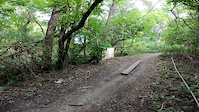
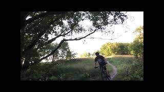
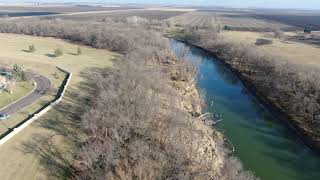
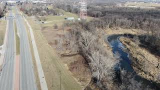
Photos of Fargo Mountain Bike
Videos of Fargo Mountain Bike
trail: Trees n' Jumps
0:07 |
208 |
Sep 6, 2020
trail: Trees n' Jumps
0:15 |
404 |
Oct 1, 2021 , Fargo
trail: Iwen South
14:25 |
591 |
Dec 19, 2020 , Fargo
trail: Forum Tower - Northbound
7:14 |
667 |
Nov 23, 2020 , Fargo
trail: Trees n' Jumps
19:25 |
1391 |
Jun 16, 2020 , Fargo

trail: Iwen South
11:59 |
887 |
May 19, 2018 , Fargo
Recent Trail Reports
| status | trail | date | condition | info | user |
|---|---|---|---|---|---|
| Trees n' Jumps | Mar 28, 2025 @ 6:38am Mar 28, 2025 | Unknown | ryerickson264 FMTB | ||
| Snowbird | Mar 28, 2025 @ 6:38am Mar 28, 2025 | Unknown | ryerickson264 FMTB | ||
| Red Rose Ramble | Mar 28, 2025 @ 6:38am Mar 28, 2025 | Unknown | ryerickson264 FMTB | ||
| Paparazzi | Mar 28, 2025 @ 6:38am Mar 28, 2025 | Unknown | ryerickson264 FMTB | ||
| Northbound | Mar 28, 2025 @ 6:38am Mar 28, 2025 | Unknown | ryerickson264 FMTB | ||
| Lions Lot Connector2 to Red Rose Ramble | Mar 28, 2025 @ 6:38am Mar 28, 2025 | Unknown | ryerickson264 FMTB | ||
| Lions Lot Connector1 to Red Rose Ramble | Mar 28, 2025 @ 6:38am Mar 28, 2025 | Unknown | ryerickson264 FMTB | ||
| Lions Lot | Mar 28, 2025 @ 6:38am Mar 28, 2025 | Unknown | ryerickson264 FMTB | ||
| Iwen South | Mar 28, 2025 @ 6:38am Mar 28, 2025 | Unknown | ryerickson264 FMTB | ||
| Forum Tower - Northbound | Mar 28, 2025 @ 6:38am Mar 28, 2025 | Unknown | ryerickson264 FMTB |
Activity Feed
| username | action | type | title | date |
|---|---|---|---|---|
| Woyen | add | poi | activity #95109074 | May 20, 2026 @ 8:15am May 20, 2026 |
| msmcfate | add | trail | activity #94519471 | May 11, 2026 @ 3:06pm May 11, 2026 |
| Woyen | add | trail | activity #94477320 | May 10, 2026 @ 9:11pm May 10, 2026 |
| MFraase | like | directory | activity #92052535 | Apr 6, 2026 @ 7:47am Apr 6, 2026 |
| BikeRegCom | add | event | activity #88814505 | Feb 12, 2026 @ 7:59pm Feb 12, 2026 |
Recent Comments
| username | type | title | comment | date |
|---|---|---|---|---|
| trail | Both north and south loop conditions are great... | Jun 10, 2023 @ 9:58am Jun 10, 2023 | ||
| trail | This trail makes you dizzy. Has zero flow and... | Jun 5, 2023 @ 12:11am Jun 5, 2023 | ||
| report | Recently mowed and cleared. | Aug 7, 2022 @ 2:29pm Aug 7, 2022 | ||
| trail | The high parts are mostly dry on Iwen North,... | May 7, 2022 @ 9:13am May 7, 2022 | ||
| report | Good conditions, a little sticky low spots,... | Sep 6, 2021 @ 11:06am Sep 6, 2021 |
Local Badges
-

Epic Mountain Bike Climb 2k0 awarded -

Climbing 10k Badge0 awarded -

Mountain Biking 100k Badge0 awarded -

Epic Ride Descent 2k0 awarded -

Descent 10k Badge0 awarded -

Descent 100k Badge0 awarded
Local Mountain Biking Directory
-
Fargo Moorhead Trailbuilders
![Fargo Moorhead Trailbuilders]()
-
Great Riders Club
-
Paramount SportsBike Shop
![Paramount Sports]()
-
Island Park CyclesBike Shop
-
Brents Bmx, LlcBike Shop
Activity Type Stats
| activitytype | trails | distance | descent | descent distance | total vertical | rating | global rank | state rank | photos | reports | routes | ridelogs |
|---|---|---|---|---|---|---|---|---|---|---|---|---|
| Mountain Bike | 26 | 13 miles | 279 ft | 3 miles | 23 ft | #6,456 | #2,181 | 77 | 423 | 2 | 5,091 | |
| E-Bike | 4 | 4,829 ft | 3 ft | 545 ft | 13 ft | #9,448 | #2,925 | 83 | 54 | |||
| Hike | 29 | 16 miles | 312 ft | 4 miles | 23 ft | #7,927 | #2,800 | 1 | 330 | 117 | ||
| Trail Running | 29 | 16 miles | 312 ft | 4 miles | 23 ft | #7,751 | #2,572 | 330 | 87 | |||
| Snowshoe | 13 | 2 miles | 69 ft | 3,173 ft | 20 ft | #1,263 | #679 | 92 | 52 | |||
| Backcountry Ski | 12 | 7 miles | 200 ft | 1 mile | 23 ft | #561 | #170 | 105 | 7 | |||
| Nordic Ski | 14 | 9 miles | 230 ft | 2 miles | 23 ft | #1,176 | #521 | 66 | 281 |
Frequently Asked Questions About Fargo
▼
What are the best places to ride in Fargo?
Fargo has 4 areas to explore for mountain biking. The top rated areas are:
▼
What are the highest rated mountain biking trails in Fargo?
The highest rated mountain biking trails in Fargo are:
- Forum Tower - Northbound (4.3/5)
- Trees n' Jumps (4.2/5)
- Iwen South (3.9/5)
- Masochist (3.6/5)
- Lemke Park Hiking Trail (3.4/5)
▼
What is the best time of the year to ride in Fargo?
Based on ride log data, the most popular months to ride in Fargo are:
- May (16 activities)
- July (16 activities)
- August (12 activities)
▼
Where can I park to ride in Fargo?
There are 8 parking locations listed in Fargo. The most popular parking spots are: View all parking and trailhead locations on the map to plan your visit.
Activities
Trails
Points of Interest
- By brenthillier
 NSMBA TRAILFORKS & contributors
 - Admins: FMTB
- #21264 - 12,853 views
- fargo activity log | embed map of Fargo mountain bike trails | fargo mountain biking points of interest
Downloading of trail gps tracks in kml & gpx formats is enabled for Fargo.
You must login to download files.