close
-
Layers w
- Weather Layers
- Pro
- Pro
- Pro
- Pro
- Pro
- Pro
- More Layers
- Pro
- Pro
- Pro
- Pro
-
Upgrade to

3D
Trail Conditions
- Unknown
- Snow Groomed
- Snow Packed
- Snow Covered
- Snow Cover Partial
- Freeze/thaw Cycle
- Icy
- Prevalent Mud
- Wet
- Variable
- Ideal
- Dry
- Very Dry
Trail Flow (Ridden Direction)
Trailforks scans users ridelogs to determine the most popular direction each trail is ridden. A good flowing trail network will have most trails flowing in a single direction according to their intension.
The colour categories are based on what percentage of riders are riding a trail in its intended direction.
The colour categories are based on what percentage of riders are riding a trail in its intended direction.
- > 96%
- > 90%
- > 80%
- > 70%
- > 50%
- < 50%
- bi-directional trail
- no data
Trail Last Ridden
Trailforks scans ridelogs to determine the last time a trail was ridden.
- < 2 days
- < 1 week
- < 2 weeks
- < 1 month
- < 6 months
- > 6 months
Trail Ridden Direction
The intended direction a trail should be ridden.
- Downhill Only
- Downhill Primary
- Both Directions
- Uphill Primary
- Uphill Only
- One Direction
Contribute Details
Colors indicate trail is missing specified detail.
- Description
- Photos
- Description & Photos
- Videos
Trail Popularity ?
Trailforks scans ridelogs to determine which trails are ridden the most in the last 9 months.
Trails are compared with nearby trails in the same city region with a possible 25 colour shades.
Think of this as a heatmap, more rides = more kinetic energy = warmer colors.
- most popular
- popular
- less popular
- not popular
ATV/ORV/OHV Filter
Max Vehicle Width
inches
US Cell Coverage
Legend

Radar Time
Activity Recordings
Trailforks uses anonymized public activity data.
?
Activity Recordings
Trailforks uses anonymized public activity data.
?
Personal Heatmap
▶
Activity Types
all
/
none
▶
Options
2
Date range
month
–
Winter Trails
Warning
A routing network for winter maps does not exist. Selecting trails using the winter trails layer has been disabled.
Missing Trails
Most Popular
Least Popular
Trails are colored based on popularity. The more popular a trail is, the more red. Less popular trails trend towards green.
Jump Magnitude Heatmap
Heatmap of where riders jump on trails. Zoom in to see individual jumps, click circles to view jump details.
BC Backroad Status
![map legend]()
Service Road Atlas is a free to use, community-driven service for viewing and creating reports on the numerous back-country service roads around B.C. and Alberta.

Slope Aspect
Direction the slope faces
Trails Deemphasized
Trails are shown in grey.
Only show trails with no bike usage.
Suggested Layers
Based on selected activity type
Save the current map location and zoom level as your default home location whenever this page is loaded.
Save
No description for Febbio has been added yet!
Login or register to submit one.
This region uses the Uk/Euro style trail grading system.
Region Supporters & Maintainers
![]()
Ride The Giant ASDMaintainer![]()
ALPE DI CUSNA A.S.D.Maintainer
Activities Click to view
- Mountain Bike
67 trails
- E-Bike
64 trails
- Adaptive Bike
0 trails
- Winter Fat Bike
0 trails
- Horse
8 trails
- Hike
51 trails
- Trail Running
50 trails
- Observed Trials
6 trails
- Downhill Ski
6 trails
- Backcountry Ski
7 trails
Region Details
- 11
- 7
- 19
- 14
- 7
Region Status
Open as of 12 hoursStats
- Avg Trail Rating
- Trails (view details)
- 62
- Trails Mountain Bike
- 70
- Trails E-Bike
- 64
- Trails Horse
- 8
- Trails Hike
- 51
- Trails Trail Running
- 50
- Trails Dirtbike/Moto
- 1
- Trails Observed Trials
- 6
- Trails Snowshoe
- 1
- Trails Downhill Ski
- 6
- Trails Backcountry Ski
- 7
- Trails Nordic Ski
- 1
- Total Distance
- 74 miles
- Total Descent
- 41,797 ft
- Total Vertical
- 4,564 ft
- Highest Trailhead
- 6,769 ft
- Reports
- 323
- Photos
- 224
- Ridden Counter
- 2,350
Sub Regions
-
Alpe di Cusna Bike Park
- 2
- 3
- 1
- 2
-
Monte Cusna
- 4
- 11
- 8
- 5
-
Torricella Trail Area
- 1
- 7
- 1
- 1
Popular Febbio Mountain Biking Trails
• 95 ★ 4.8 • 1 mile • 0 ft • 61 •
Trail flow nel bosco con corte sezioni tecniche. Flow trail with short tecnical sections.
• 70 ★ 5.0 • 3 miles • 65 ft • 60 •
Sentiero di crinale molto panoramico. Qualche sezione tecnica ed alcune brevi risalite. Ultimo tratto nel bosco flow bellissimo! Panoramic trail on the Ridge from . Some tecnical sections e schort uphill. the finish into the wood is...
• 100 ★ 5.0 • 1,414 ft • 16 ft • 50 •
Popular green difficulty singletrack. This mountain bike primary trail can be used both directions. Adaptive MTB rating: amtb green. Trail visibility is always easy to follow.
• 90 ★ 4.7 • 4,678 ft • 0 ft • 48 •
Popular red difficulty singletrack. This mountain bike primary trail can be used downhill only. It features drop, jump, rock garden and roller coaster. Adaptive MTB rating: amtb green. Trail visibility is always easy to follow.
• 100 ★ 5.0 • 820 ft • 0 ft • 43 •
Popular blue difficulty singletrack. This mountain bike primary trail can be used downhill only. It features drop. Adaptive MTB rating: amtb blue. Trail visibility is always easy to follow.
• 80 ★ 5.0 • 5,043 ft • 0 ft • 41 •
Popular red difficulty singletrack. This mountain bike primary trail can be used downhill only. It features drop, jump, gap jump, rock garden and roller coaster. Adaptive MTB rating: amtb green. Trail visibility is always easy to follow.
• 65 ★ 3.7 • 2 miles • 0 ft • 38 •
Qualche saliscendi iniziale, a seguire bel flow veloce, poi alcuni tratti dove il sentiero è più scassato. Saliscendi sul finire Up and Down in the beginning, then beatiful flow and in the end some loose rocks. Up and down in the end
Febbio Mountain Bike Routes
22 miles • 3,466 ft • 5 • Loop •
Tour di media difficoltà con partenza dall'arrivo della seggiovia Febbio 2000. Sentieri prevalentemente...
13 miles • 1,931 ft • 0 • Loop •
Anello all-mountain con partenza dal rifugio del crinale salendo in seggiovia da Rescadore (Febbio). Dal...
15 miles • 3,730 ft • 0 • Loop •
........................................................................
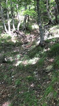
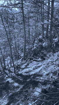
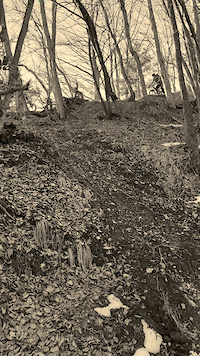
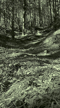
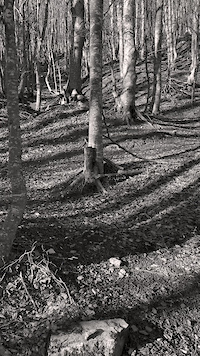
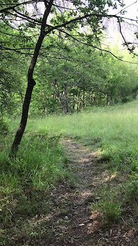
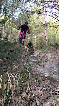
Photos of Febbio Mountain Bike
Videos of Febbio Mountain Bike
trail: Lucignolo
0:10 |
15 |
Feb 19, 2025
trail: Lucignolo
0:11 |
6 |
Feb 19, 2025
trail: Lucignolo
0:10 |
7 |
Feb 19, 2025
trail: Lucignolo
0:08 |
7 |
Feb 19, 2025
trail: Lucignolo
0:07 |
4 |
Feb 19, 2025
trail: Oompa Loompa
0:22 |
12 |
Feb 19, 2025

trail: Oompa Loompa
0:22 |
5 |
Feb 19, 2025
trail: Pineta
0:04 |
17 |
Feb 19, 2025
Current Trail Warnings
| status | trail | date | condition | user | info |
|---|---|---|---|---|---|
| Ciliegina | Jun 2, 2026 @ 2:43pm (Europe/Rome) Jun 2, 2026 | Wet | alpinemattiyt | traccia tutta imboscata. Trail ormai... |
Recent Trail Reports
| status | trail | date | condition | info | user |
|---|---|---|---|---|---|
| Beep Beep | Jun 19, 2026 @ 2:21pm (Europe/Rome) 12 hours | Ideal | Baluba64 GMTBL | ||
| Alta Tensione | Jun 19, 2026 @ 2:19pm (Europe/Rome) 12 hours | Ideal | Baluba64 GMTBL | ||
| Abetina Reale | Jun 19, 2026 @ 2:15pm (Europe/Rome) 12 hours | Ideal | Baluba64 GMTBL | ||
| Cerbiatto | Jun 19, 2026 @ 2:11pm (Europe/Rome) 12 hours | Ideal | Baluba64 GMTBL | ||
| Muschio | Jun 4, 2026 @ 6:13pm (Europe/Rome) Jun 4, 2026 | Variable | Stefanof2Io9R | ||
| Squalo | Jun 4, 2026 @ 6:13pm (Europe/Rome) Jun 4, 2026 | Unknown | Stefanof2Io9R | ||
| Rosso Bastardo | Jun 4, 2026 @ 6:12pm (Europe/Rome) Jun 4, 2026 | Wet | Stefanof2Io9R | ||
| Timone Olandese | Jun 4, 2026 @ 6:12pm (Europe/Rome) Jun 4, 2026 | Variable | Stefanof2Io9R | ||
| Febb-Re | Jun 4, 2026 @ 6:11pm (Europe/Rome) Jun 4, 2026 | Variable | Stefanof2Io9R | ||
| Contessa | Jun 3, 2026 @ 11:21pm (Europe/Rome) Jun 3, 2026 | Snow Covered | ArteBici |
Activity Feed
| username | action | type | title | date |
|---|---|---|---|---|
| Baluba64 | update | trail | activity #97309828 and 2 more | Jun 19, 2026 @ 5:30am 12 hours |
| Baluba64 | add | report | activity #97309491 | Jun 19, 2026 @ 5:21am 12 hours |
| Baluba64 | add | report | activity #97309062 and 2 more | Jun 19, 2026 @ 5:11am 12 hours |
| marcoscurano | wishlist | trail | activity #96724721 and 2 more | Jun 11, 2026 @ 2:18am Jun 11, 2026 |
| MaxDraeg | wishlist | trail | activity #96291915 | Jun 5, 2026 @ 6:45am Jun 5, 2026 |
Recent Comments
| username | type | title | comment | date |
|---|---|---|---|---|
| trail | Gran bel sentiero livello S3, un misto di... | Jun 3, 2026 @ 2:30pm Jun 3, 2026 | ||
| trail | Sentiero "multilinea" sul crinale della... | Jun 3, 2026 @ 2:21pm Jun 3, 2026 | ||
| trail | Parte iniziale su banale carrareccia senza... | Jun 3, 2026 @ 2:18pm Jun 3, 2026 | ||
| trail | Percorsa solo la parte alta,se è tutto così... | May 5, 2026 @ 5:33am May 5, 2026 | ||
| report | Rimovibili con motosega piccola? | Oct 15, 2025 @ 7:53am Oct 15, 2025 |
Local Badges
-

Epic Ride Climb 2k184 awarded -

Climbing 10k Badge24 awarded -

Climbing 100k Badge0 awarded -

Completionist0 awarded -

Epic Ride Descent 2k184 awarded -

Descent 10k Badge27 awarded
Activity Type Stats
| activitytype | trails | distance | descent | descent distance | total vertical | rating | global rank | state rank | photos | reports | routes | ridelogs |
|---|---|---|---|---|---|---|---|---|---|---|---|---|
| Mountain Bike | 67 | 74 miles | 41,798 ft | 48 miles | 4,564 ft | #1,665 | #62 | 222 | 334 | 4 | 856 | |
| E-Bike | 64 | 72 miles | 41,037 ft | 47 miles | 4,564 ft | #2,040 | #192 | 312 | 2 | 260 | ||
| Horse | 8 | 6 miles | 89 ft | 2,858 ft | 1,745 ft | #1,989 | #118 | 8 | ||||
| Hike | 51 | 57 miles | 29,341 ft | 34 miles | 4,423 ft | #4,084 | #156 | 311 | 320 | |||
| Trail Running | 50 | 54 miles | 29,285 ft | 33 miles | 4,409 ft | #3,649 | #141 | 311 | 22 | |||
| Dirtbike/Moto | 1 | 5 | ||||||||||
| Observed Trials | 6 | 3 miles | 30 ft | 1,214 ft | 748 ft | #144 | #10 | 6 | ||||
| Snowshoe | 1 | 5 | ||||||||||
| Downhill Ski | 6 | 3 miles | 30 ft | 1,214 ft | 748 ft | #505 | #43 | 3 | 5 | |||
| Backcountry Ski | 7 | 3 miles | 30 ft | 1,214 ft | 748 ft | #242 | #13 | 3 | 67 | |||
| Nordic Ski | 1 | 19 |
Frequently Asked Questions About Febbio
▼
What are the best places to ride in Febbio?
Febbio has 3 areas to explore for mountain biking. The top rated areas are:
▼
What are the highest rated mountain biking trails in Febbio?
The highest rated mountain biking trails in Febbio are:
- Border Line (4.3/5)
- Squalo (4.3/5)
- Monte Prado (4.2/5)
- Muschio (4.2/5)
- Beep Beep (4.2/5)
▼
What is the best time of the year to ride in Febbio?
Based on ride log data, the most popular months to ride in Febbio are:
- July (11 activities)
- August (7 activities)
- October (7 activities)
▼
Where can I park to ride in Febbio?
There are 8 parking locations listed in Febbio. The most popular parking spots are:
- Parcheggio Monteorsaro
- Parcheggio
- Parcheggio Big Bench
- Parcheggio Chiesa Febbio
- Parcheggio Ride The Giant
Activities
Trails
Points of Interest
- By linomak
 GMTBL & contributors
 - Admins: GMTBL
- #19125 - 3,242 views
- febbio activity log | embed map of Febbio mountain bike trails | febbio mountain biking points of interest
Downloading of trail gps tracks in kml & gpx formats is enabled for Febbio.
You must login to download files.