close
-
Layers w
- Weather Layers
- Pro
- Pro
- Pro
- Pro
- Pro
- Pro
- More Layers
- Pro
- Pro
- Pro
- Pro
-
Upgrade to

3D
Trail Conditions
- Unknown
- Snow Groomed
- Snow Packed
- Snow Covered
- Snow Cover Partial
- Freeze/thaw Cycle
- Icy
- Prevalent Mud
- Wet
- Variable
- Ideal
- Dry
- Very Dry
Trail Flow (Ridden Direction)
Trailforks scans users ridelogs to determine the most popular direction each trail is ridden. A good flowing trail network will have most trails flowing in a single direction according to their intension.
The colour categories are based on what percentage of riders are riding a trail in its intended direction.
The colour categories are based on what percentage of riders are riding a trail in its intended direction.
- > 96%
- > 90%
- > 80%
- > 70%
- > 50%
- < 50%
- bi-directional trail
- no data
Trail Last Ridden
Trailforks scans ridelogs to determine the last time a trail was ridden.
- < 2 days
- < 1 week
- < 2 weeks
- < 1 month
- < 6 months
- > 6 months
Trail Ridden Direction
The intended direction a trail should be ridden.
- Downhill Only
- Downhill Primary
- Both Directions
- Uphill Primary
- Uphill Only
- One Direction
Contribute Details
Colors indicate trail is missing specified detail.
- Description
- Photos
- Description & Photos
- Videos
Trail Popularity ?
Trailforks scans ridelogs to determine which trails are ridden the most in the last 9 months.
Trails are compared with nearby trails in the same city region with a possible 25 colour shades.
Think of this as a heatmap, more rides = more kinetic energy = warmer colors.
- most popular
- popular
- less popular
- not popular
ATV/ORV/OHV Filter
Max Vehicle Width
inches
US Cell Coverage
Legend

Radar Time
Activity Recordings
Trailforks uses anonymized public activity data.
?
Activity Recordings
Trailforks uses anonymized public activity data.
?
Personal Heatmap
▶
Activity Types
all
/
none
▶
Options
2
Date range
month
–
Winter Trails
Warning
A routing network for winter maps does not exist. Selecting trails using the winter trails layer has been disabled.
Missing Trails
Most Popular
Least Popular
Trails are colored based on popularity. The more popular a trail is, the more red. Less popular trails trend towards green.
Jump Magnitude Heatmap
Heatmap of where riders jump on trails. Zoom in to see individual jumps, click circles to view jump details.
BC Backroad Status
![map legend]()
Service Road Atlas is a free to use, community-driven service for viewing and creating reports on the numerous back-country service roads around B.C. and Alberta.

Slope Aspect
Direction the slope faces
Trails Deemphasized
Trails are shown in grey.
Only show trails with no bike usage.
Suggested Layers
Based on selected activity type
Save the current map location and zoom level as your default home location whenever this page is loaded.
Save
No description for Fiesole has been added yet!
Login or register to submit one.
This region uses the Uk/Euro style trail grading system.
Activities Click to view
- Mountain Bike
50 trails
- E-Bike
46 trails
- Adaptive Bike
0 trails
- Horse
7 trails
- Hike
43 trails
- Trail Running
44 trails
Region Details
- 10
- 20
- 15
Region Status
Caution as of May 2, 2026Stats
- Avg Trail Rating
- Trails (view details)
- 49
- Trails Mountain Bike
- 50
- Trails E-Bike
- 46
- Trails Horse
- 7
- Trails Hike
- 43
- Trails Trail Running
- 44
- Total Distance
- 25 miles
- Total Descent
- 10,481 ft
- Total Vertical
- 1,644 ft
- Highest Trailhead
- 2,258 ft
- Reports
- 184
- Photos
- 14
- Ridden Counter
- 1,744
Popular Fiesole Mountain Biking Trails
• 100 ★ 3.7 • 3,822 ft • 14 ft • 90 •
bel single track da usare sia per andare verso il monte fanna e quindi san Clemente e poggio alle tortore oppure salendo a poggio pratone ma anche per puro divertimento. qualche passaggio tecnico a salire mentre a scendere è semplice...
• 90 ★ 0.0 • 2 miles • 7 ft • 70 •
Popular blue difficulty singletrack. This mountain bike primary trail can be used downhill primary and has a moderate overall physical rating with a 7 ft black diamond climb. It features rock garden. Trail visibility is always easy to follow. On average it takes 9 minutes to complete this trail.
• 80 ★ 3.0 • 4,511 ft • 79 ft • 57 •
Popular green difficulty singletrack. This mountain bike primary trail can be used both directions with a 79 ft green climb. On average it takes 9 minutes to complete this trail.
• 85 ★ 0.0 • 3,143 ft • 0 ft • 51 •
Popular blue difficulty singletrack. This multi-use trail can be used downhill primary and has a moderate overall physical rating. Trail visibility is always easy to follow. On average it takes 2 minutes to complete this trail.
• 85 ★ 2.5 • 1 mile • 27 ft • 51 •
OK trail, starts off easy and then gets steep and chunky the last .25 miles or so.
• 95 ★ 4.0 • 1,263 ft • 38 ft • 48 •
Popular green difficulty singletrack. This multi-use trail can be used both directions and has a easy overall physical rating with a 38 ft green climb. Trail visibility is always easy to follow. On average it takes 1 minutes to complete this trail.
• 95 ★ 2.5 • 2,283 ft • 45 ft • 42 •
Popular green difficulty doubletrack. This multi-use trail can be used downhill primary and has a easy overall physical rating with a 45 ft blue climb. Trail visibility is always easy to follow. On average it takes 2 minutes to complete this trail.
• 80 ★ 0.0 • 1,155 ft • 13 ft • 30 •
Popular green difficulty singletrack. This mountain bike primary trail can be used downhill primary. On average it takes 2 minutes to complete this trail.
Photos of Fiesole Mountain Bike
Videos of Fiesole Mountain Bike
youtuber
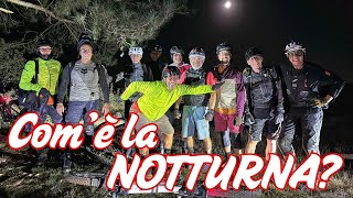
![Discesa NOTTURNA in MTB da Poggio Pratone a...]()

trail: Monte Ceceri DH
5:48 |
68 |
Sep 11, 2025 , fiesole
youtuber
![Discesa NOTTURNA in MTB da Poggio Pratone a...]()

trail: Monte fanna trail
5:48 |
45 |
Sep 11, 2025 , fiesole
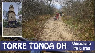
trail: Torre Tonda DH
7:34 |
128 |
Mar 25, 2024 , fiesole
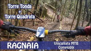
trail: Torre Tonda DH
3:44 |
86 |
Mar 25, 2024 , fiesole

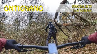
trail: Paiatici-Ontignano
6:22 |
104 |
Jan 9, 2024 , fiesole

trail: Torre Tonda DH
6:22 |
95 |
Jan 9, 2024 , fiesole
trail: Road to Poggio alle Tortore
6:22 |
102 |
Jan 9, 2024 , fiesole
Recent Trail Reports
| status | trail | date | condition | info | user |
|---|---|---|---|---|---|
| CAI 8 Val di sambre | May 2, 2026 @ 9:44am (Europe/Rome) May 2, 2026 | Ideal | MrOrangeItaly | ||
| Tortore per CAI 8 Val di Sambre | May 2, 2026 @ 9:44am (Europe/Rome) May 2, 2026 | Ideal | MrOrangeItaly | ||
| Salita di Saletta | Dec 6, 2025 @ 8:39am (Europe/San_Marino) Dec 5, 2025 | Ideal | marchettaccio | ||
| Monte fanna trail | Dec 6, 2025 @ 8:39am (Europe/San_Marino) Dec 5, 2025 | Ideal | marchettaccio | ||
| zigzag a riotorto | Dec 6, 2025 @ 8:39am (Europe/San_Marino) Dec 5, 2025 | Ideal | marchettaccio | ||
| Road to Poggio alle Tortore | Nov 23, 2025 @ 3:09pm (Europe/Rome) Nov 23, 2025 | Variable | MrOrangeItaly | ||
| Monte Ceceri DH | Nov 19, 2025 @ 10:30am (Europe/San_Marino) Nov 19, 2025 | Wet | red7mtb | ||
| aquila blu | Nov 19, 2025 @ 10:30am (Europe/San_Marino) Nov 19, 2025 | Variable | red7mtb | ||
| Road to CAI4 | Oct 19, 2025 @ 10:35am (Europe/Rome) Oct 19, 2025 | Dry | MrOrangeItaly | ||
| Variante ripida | Aug 31, 2025 @ 2:47pm Aug 31, 2025 | Ideal | MrOrangeItaly |
Activity Feed
| username | action | type | title | date |
|---|---|---|---|---|
| MrOrangeItaly | add | report | activity #94007987 and 1 more | May 3, 2026 @ 11:06pm May 3, 2026 |
| fekko | ridden | trail | activity #92127014 and 2 more | Apr 7, 2026 @ 10:18am Apr 7, 2026 |
| 9aqmys | wishlist | trail | activity #91592121 and 2 more | Mar 30, 2026 @ 9:50am Mar 30, 2026 |
| WolfgangdyUkT5 | ridden | trail | activity #91585070 and 1 more | Mar 30, 2026 @ 7:35am Mar 30, 2026 |
| 9aqmys | wishlist | trail | activity #91375859 | Mar 27, 2026 @ 8:17am Mar 27, 2026 |
Recent Comments
| username | type | title | comment | date |
|---|---|---|---|---|
| trail | OK trail, starts off easy and then gets steep... | Nov 20, 2025 @ 10:39am Nov 20, 2025 | ||
| trail | There are two spots near the end of the trail... | May 24, 2025 @ 2:32am May 24, 2025 | ||
| report | Rimosso | Sep 12, 2023 @ 2:39am Sep 12, 2023 | ||
| report | @MrOrangeItaly: grazie mille, non avevo notato... | Dec 23, 2022 @ 1:27pm Dec 23, 2022 | ||
| report | Ciao. Direi di no, anzi è un classico enduro... | Nov 18, 2022 @ 9:53am Nov 18, 2022 |
Local Badges
-

10 Blue Trails5 awarded -

Epic Mountain Bike Climb 2k3 awarded -

Climbing 10k Badge10 awarded -

Mountain Biking 100k Badge0 awarded -

Epic Ride Descent 2k3 awarded -

Descent 10k Badge10 awarded
Activity Type Stats
| activitytype | trails | distance | descent | descent distance | total vertical | rating | global rank | state rank | photos | reports | routes | ridelogs |
|---|---|---|---|---|---|---|---|---|---|---|---|---|
| Mountain Bike | 50 | 25 miles | 10,482 ft | 16 miles | 1,644 ft | #4,736 | #327 | 14 | 184 | 1,126 | ||
| E-Bike | 46 | 24 miles | 10,023 ft | 15 miles | 1,644 ft | #3,765 | #357 | 184 | 238 | |||
| Horse | 7 | 5 miles | 1,348 ft | 2 miles | 1,572 ft | #2,210 | #143 | 1 | ||||
| Hike | 43 | 21 miles | 8,950 ft | 13 miles | 1,644 ft | #6,604 | #350 | 184 | 1 | 51 | ||
| Trail Running | 44 | 22 miles | 8,950 ft | 13 miles | 1,644 ft | #6,015 | #322 | 184 | 23 |
Frequently Asked Questions About Fiesole
▼
What are the highest rated mountain biking trails in Fiesole?
The highest rated mountain biking trails in Fiesole are:
- Borro di Cucina alto (4.1/5)
- Casa Cucina - Riotorto (4.1/5)
- Legnaia delle Tortore (4.1/5)
- CAI 8 Val di sambre (4.1/5)
- Salita di Saletta (4.1/5)
▼
What is the best time of the year to ride in Fiesole?
Based on ride log data, the most popular months to ride in Fiesole are:
- February (10 activities)
- May (9 activities)
- July (9 activities)
▼
Where can I park to ride in Fiesole?
Check the Fiesole trail map for trailhead and parking information. Community members regularly update access and parking details for trails in the area.
▼
What is the longest trail in Fiesole?
The longest trail in Fiesole is Torre Tonda DH at 2.6 km. View all trails sorted by distance.
Activities
- By MrOrangeItaly & contributors
- Admins: DanielePracchia
- #28884 - 2,527 views
- fiesole activity log | embed map of Fiesole mountain bike trails | fiesole mountain biking points of interest
Downloading of trail gps tracks in kml & gpx formats is enabled for Fiesole.
You must login to download files.