close
-
Layers w
- Weather Layers
- Pro
- Pro
- Pro
- Pro
- Pro
- Pro
- More Layers
- Pro
- Pro
- Pro
- Pro
-
Upgrade to

3D
Trail Conditions
- Unknown
- Snow Groomed
- Snow Packed
- Snow Covered
- Snow Cover Partial
- Freeze/thaw Cycle
- Icy
- Prevalent Mud
- Wet
- Variable
- Ideal
- Dry
- Very Dry
Trail Flow (Ridden Direction)
Trailforks scans users ridelogs to determine the most popular direction each trail is ridden. A good flowing trail network will have most trails flowing in a single direction according to their intension.
The colour categories are based on what percentage of riders are riding a trail in its intended direction.
The colour categories are based on what percentage of riders are riding a trail in its intended direction.
- > 96%
- > 90%
- > 80%
- > 70%
- > 50%
- < 50%
- bi-directional trail
- no data
Trail Last Ridden
Trailforks scans ridelogs to determine the last time a trail was ridden.
- < 2 days
- < 1 week
- < 2 weeks
- < 1 month
- < 6 months
- > 6 months
Trail Ridden Direction
The intended direction a trail should be ridden.
- Downhill Only
- Downhill Primary
- Both Directions
- Uphill Primary
- Uphill Only
- One Direction
Contribute Details
Colors indicate trail is missing specified detail.
- Description
- Photos
- Description & Photos
- Videos
Trail Popularity ?
Trailforks scans ridelogs to determine which trails are ridden the most in the last 9 months.
Trails are compared with nearby trails in the same city region with a possible 25 colour shades.
Think of this as a heatmap, more rides = more kinetic energy = warmer colors.
- most popular
- popular
- less popular
- not popular
ATV/ORV/OHV Filter
Max Vehicle Width
inches
US Cell Coverage
Legend

Radar Time
Activity Recordings
Trailforks uses anonymized public activity data.
?
Activity Recordings
Trailforks uses anonymized public activity data.
?
Personal Heatmap
▶
Activity Types
all
/
none
▶
Options
2
Date range
month
–
Winter Trails
Warning
A routing network for winter maps does not exist. Selecting trails using the winter trails layer has been disabled.
Missing Trails
Most Popular
Least Popular
Trails are colored based on popularity. The more popular a trail is, the more red. Less popular trails trend towards green.
Jump Magnitude Heatmap
Heatmap of where riders jump on trails. Zoom in to see individual jumps, click circles to view jump details.
BC Backroad Status
![map legend]()
Service Road Atlas is a free to use, community-driven service for viewing and creating reports on the numerous back-country service roads around B.C. and Alberta.

Slope Aspect
Direction the slope faces
Trails Deemphasized
Trails are shown in grey.
Only show trails with no bike usage.
Suggested Layers
Based on selected activity type
Save the current map location and zoom level as your default home location whenever this page is loaded.
SavePopular Trail Networks
view all areas »
No description for Finland has been added yet!
Login or register to submit one.
Region Details
- 1,293
- 710
- 2,814
- 3,147
- 646
- 96
- 26
Stats
- Avg Trail Rating
- Trails (view details)
- 8,857
- Trails Mountain Bike
- 8,837
- Trails E-Bike
- 7,638
- Trails Gravel Bike
- 13
- Trails Adaptive Bike
- 1
- Trails Horse
- 34
- Trails Hike
- 8,618
- Trails Trail Running
- 8,661
- Trails Dirtbike/Moto
- 104
- Trails Observed Trials
- 7
- Trails ATV/ORV/OHV
- 3
- Trails Snowmobile
- 35
- Trails Snowshoe
- 437
- Trails Downhill Ski
- 63
- Trails Backcountry Ski
- 463
- Trails Nordic Ski
- 912
- Total Distance
- 4,200 miles
- Total Descent
- 299,468 ft
- Total Vertical
- 2,636 ft
- Highest Trailhead
- 2,636 ft
- Reports
- 5,929
- Photos
- 708
- Ridden Counter
- 80,102
Sub Regions
- Åland (7)
- Mariehamn (6)
- Mariehamn (6)
- Central (114)
- Jyväskylä Region (38)
- Saarijärvi-Viitasaari (2)
- Jämsä (2)
- Joutsa (36)
- Keuruu (9)
- Kuhmoinen (10)
- Saarijärvi (19)
- Central Ostrobothnia (57)
- Jomala (0)
- Kainuu (19)
- Suomussalmi (19)
- Suomussalmi (19)
- Kymenlaakso (60)
- Kotka-Hamina (44)
- Kouvola (13)
- Miehikkälä (2)
- Virolahti (1)
- Lapland (524)
- North Karelia (0)
- Northern Ostrobothnia (119)
- Northern Savonia (119)
- Kuopio (70)
- Iisalmi (23)
- Kuopio (48)
- Nilsiä (19)
- Varpaisjärvi (1)
- Upper Savonia (13)
- Suonenjoki (36)
- Kuopio (70)
- Ostrobothnia (299)
- Päijänne Tavastia (257)
- Pirkanmaa (150)
- Satakunta (98)
- Harjavalta (4)
- Noormarkku (1)
- Pori (38)
- Ulvila (55)
- Harjavalta (4)
- South Karelia (77)
- Imatra (2)
- Imatra (1)
- Ruokolahti (1)
- Lappeenranta (74)
- Lappeenranta (54)
- Savitaipale (20)
- Taipalsaari (0)
- Imatra (2)
- Southern Ostrobothnia (25)
- Southern Savonia (256)
- Mikkeli (221)
- Mikkeli (253)
- Pieksämäki (1)
- Mikkeli (221)
- Southwest (170)
- Tavastia Proper (442)
- Uusimaa (5,952)
- Greater Helsinki (4,226)
- Nurmijärvi (570)
- Porvoo (27)
- Raseborg (34)
- Hanko (309)
- Hyvinkää (377)
- Hyvinkaa (45)
- Inkoo (34)
- Kaarina (2)
- Kirkkonummi (700)
- Lohja (87)
- Mäntsälä (12)
- Nurmijärvi (44)
- Raasepori (188)
- Riihimäki (170)
- Sipoo (297)
- Tuusula (163)
- Vantaa (411)
- Vihti (142)
- Hämeenkyro (4)
- Joensuu (36)
- Kannus (6)
- Kimito (4)
- Padasjoki (20)
- Puumala (1)
- Salo (13)
Popular Finland Mountain Biking Trails
• 95 ★ 4.7 • 2,008 ft • 0 ft • 164 •
Popular black diamond difficulty singletrack. This mountain bike primary trail can be used one direction. It features berm and drop. On average it takes 1 minutes to complete this trail.
• 85 ★ 4.3 • 2,802 ft • 3 ft • 162 •
Popular green difficulty singletrack. This mountain bike primary trail. It features berm, drop and jump. Trail visibility is always easy to follow. On average it takes 1 minutes to complete this trail.
• 90 ★ 4.0 • 478 ft • 0 ft • 142 •
Popular blue difficulty singletrack. This mountain bike primary trail can be used one direction. It features berm. On average it takes minutes to complete this trail.
• 70 ★ 0.0 • 656 ft • 0 ft • 137 •
Popular blue difficulty singletrack. This mountain bike primary trail can be used one direction. It features berm. On average it takes minutes to complete this trail.
• 60 ★ 4.0 • 2,322 ft • 0 ft • 137 •
Moderately popular blue difficulty singletrack. This mountain bike primary trail can be used one direction. It features berm and jump. On average it takes 2 minutes to complete this trail.
• 55 ★ 3.0 • 952 ft • 0 ft • 135 •
Moderately popular green difficulty singletrack. This mountain bike primary trail can be used one direction. It features berm. On average it takes minutes to complete this trail.
• 65 ★ 0.0 • 1,392 ft • 0 ft • 129 •
Moderately popular black diamond difficulty singletrack. This mountain bike primary trail can be used one direction. It features berm. On average it takes 1 minutes to complete this trail.
• 95 ★ 3.4 • 1,207 ft • 9 ft • 104 •
Popular blue difficulty singletrack. This mountain bike primary trail can be used downhill primary. It features berm, drop and jump. On average it takes minutes to complete this trail.
Finland Mountain Bike Routes
VO2 max Norjalainen 29km Loop Featured
18 miles • 571 ft • 10 • Loop •
Norwegian VO2 max of 4x4min intervals with 3 minute rest in terrain. Heart rate around 90%. Rest below...
25 miles • 903 ft • 28 • Loop •
4 about 4km about 12 minute Super Segments on an ebike. Elite riders on a normal bike probably a few...
31 miles • 1,646 ft • 14 • Loop •
Training route for Himos Epic event. 50km might feel like a fairly standard ride but when you are racing...
34 miles • 1,661 ft • 14 • Loop •
Training route for Himos Epic event. 50km might feel like a fairly standard ride but when you are racing...
ErkyläSpeedways Featured
30 miles • 1,019 ft • 17 • Loop •
The easiest and fastest sections of Erkylä. Tour through the best fast flowing trails of the area. Couple...
★ 4.4 • 13 miles • 1,356 ft • 20 • Loop •
The top of Fell provides a spectacular view towards the fells of Pallas-Yllästunturi National Park. This...
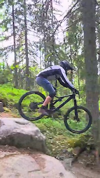
Photos of Finland Mountain Bike
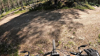
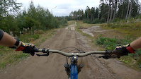
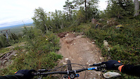
Videos of Finland Mountain Bike
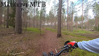
trail: Mätäkivi Central
6:13 |
9 |
May 15, 2026
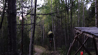
trail: Roketrail Bike Park
0:13 |
22 |
Sep 12, 2025
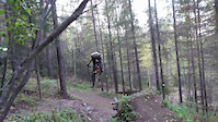
trail: Roketrail Bike Park
0:58 |
53 |
Sep 12, 2025
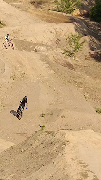
trail: Tornari Hyppylinja
0:06 |
25 |
Jun 17, 2025
trail: Setämies
0:09 |
60 |
Jul 6, 2024
trail: Rövarberget D
5:06 |
35 |
Jun 26, 2024
trail: Icebreaker
0:16 |
127 |
Sep 17, 2023
trail: Chaka bahn
0:07 |
62 |
Sep 3, 2022
Recent Comments
| username | type | title | comment | date |
|---|---|---|---|---|
| report | Berms fixed yesterday. Now mint👌 | Oct 14, 2025 @ 11:16am Oct 14, 2025 | ||
| trail | Marked on official trail map black color, with... | Sep 26, 2025 @ 6:24am Sep 26, 2025 | ||
| trail | Awesome trail in good condition | Aug 17, 2025 @ 3:51am Aug 17, 2025 | ||
| trail | Goes around frisbee lanes | May 19, 2025 @ 10:35am May 19, 2025 | ||
| trail | Puunkaato estää kulun koillispäädyssä | May 17, 2025 @ 9:00am May 17, 2025 |
Bike & Skill Parks
| name | type | city | rating |
|---|---|---|---|
| Laajis Bikepark | bike park | Jyväskylä | |
| Kokonniemi Bike Park | bike park | Porvoo | |
| Ylläs Bike Park | bike park | Ylläs | |
| Uuperi | bike park | Hamina | |
| Meri-Teijo Bike Park | bike park | Teijo |
Activity Type Stats
| activitytype | trails | distance | descent | descent distance | total vertical | rating | global rank | state rank | photos | reports | routes | ridelogs |
|---|---|---|---|---|---|---|---|---|---|---|---|---|
| Mountain Bike | 8,837 | 4,174 miles | 296,194 ft | 1,483 miles | 2,500 ft | #16 | 703 | 5,925 | 198 | 150,542 | ||
| E-Bike | 7,638 | 3,434 miles | 225,325 ft | 1,234 miles | 2,441 ft | #14 | 1 | 5,764 | 142 | 24,466 | ||
| Gravel Bike | 13 | #26 | 7 | 1,640 | ||||||||
| Adaptive Bike | 1 | #33 | ||||||||||
| Horse | 34 | 31 miles | 1,821 ft | 10 miles | 696 ft | #34 | 216 | 2 | ||||
| Hike | 8,608 | 4,042 miles | 255,138 ft | 1,404 miles | 2,635 ft | #16 | 5,851 | 36 | 5,512 | |||
| Trail Running | 8,661 | 4,058 miles | 256,952 ft | 1,412 miles | 2,635 ft | #16 | 5,866 | 36 | 5,629 | |||
| Dirtbike/Moto | 104 | 29 miles | 2,182 ft | 12 miles | 502 ft | #32 | 212 | 15 | ||||
| Observed Trials | 7 | 6 miles | 381 ft | 3 miles | 108 ft | #28 | 4 | |||||
| ATV/ORV/OHV | 3 | 3 miles | 318 ft | 1 mile | 135 ft | #34 | 212 | 1 | ||||
| Snowmobile | 35 | 27 miles | 1,368 ft | 9 miles | 787 ft | #23 | 2 | 3 | ||||
| Snowshoe | 437 | 296 miles | 20,850 ft | 110 miles | 1,755 ft | #19 | 7 | 7 | 513 | |||
| Downhill Ski | 63 | 89 miles | 8,845 ft | 36 miles | 1,736 ft | #21 | 2 | 2,942 | ||||
| Backcountry Ski | 463 | 328 miles | 21,909 ft | 121 miles | 1,755 ft | #19 | 7 | 2 | 633 | |||
| Nordic Ski | 912 | 365 miles | 24,285 ft | 136 miles | 1,755 ft | #17 | 15 | 1 | 15,505 |
Activities
- Finland Mountain Biking Trails
- Finland E-Biking Trails
- Finland Gravel Biking Trails
- Finland Horseback Trails
- Finland Hiking Trails
- Finland Trail Running Trails
- Finland Dirtbiking Trails
- Finland Observed Trials Trails
- Finland Snowmobiling Trails
- Finland Snowshoeing Trails
- Finland Skiing Trails
- Finland Backcountry Skiing Trails
- Finland Nordic Skiing Trails
Trails
Points of Interest
- Hyvinvointikeskus Laavu Camping
- Lautlampi Kota Cabin
- Ladun Maja Laavu Camping
- Jänisniemi laavu Camping
- Keräkankare Kota Cabin
- Märkiö Laavu Camping
- Nukarinkoski Laavu Camping
- Långträsket Laavu Camping
- Solböle Kota Cabin
- Riutta V Kota Cabin
- Láfolvárri (1,081 m)
- Doskalhárji (1,025 m)
- Dierpmesvárri (1,024 m)
- By canadaka
 Trailforks & contributors
 - Admins: apply
- #3195 - 74,170 views
- finland activity log | embed map of Finland mountain bike trails | finland mountain biking points of interest polygons
Downloading of trail gps tracks in kml & gpx formats is enabled for Finland.
You must login to download files.