close
-
Layers w
- Weather Layers
- Pro
- Pro
- Pro
- Pro
- Pro
- Pro
- More Layers
- Pro
- Pro
- Pro
- Pro
-
Upgrade to

3D
Trail Conditions
- Unknown
- Snow Groomed
- Snow Packed
- Snow Covered
- Snow Cover Partial
- Freeze/thaw Cycle
- Icy
- Prevalent Mud
- Wet
- Variable
- Ideal
- Dry
- Very Dry
Trail Flow (Ridden Direction)
Trailforks scans users ridelogs to determine the most popular direction each trail is ridden. A good flowing trail network will have most trails flowing in a single direction according to their intension.
The colour categories are based on what percentage of riders are riding a trail in its intended direction.
The colour categories are based on what percentage of riders are riding a trail in its intended direction.
- > 96%
- > 90%
- > 80%
- > 70%
- > 50%
- < 50%
- bi-directional trail
- no data
Trail Last Ridden
Trailforks scans ridelogs to determine the last time a trail was ridden.
- < 2 days
- < 1 week
- < 2 weeks
- < 1 month
- < 6 months
- > 6 months
Trail Ridden Direction
The intended direction a trail should be ridden.
- Downhill Only
- Downhill Primary
- Both Directions
- Uphill Primary
- Uphill Only
- One Direction
Contribute Details
Colors indicate trail is missing specified detail.
- Description
- Photos
- Description & Photos
- Videos
Trail Popularity ?
Trailforks scans ridelogs to determine which trails are ridden the most in the last 9 months.
Trails are compared with nearby trails in the same city region with a possible 25 colour shades.
Think of this as a heatmap, more rides = more kinetic energy = warmer colors.
- most popular
- popular
- less popular
- not popular
ATV/ORV/OHV Filter
Max Vehicle Width
inches
US Cell Coverage
Legend

Radar Time
Activity Recordings
Trailforks uses anonymized public activity data.
?
Activity Recordings
Trailforks uses anonymized public activity data.
?
Personal Heatmap
▶
Activity Types
all
/
none
▶
Options
2
Date range
month
–
Winter Trails
Warning
A routing network for winter maps does not exist. Selecting trails using the winter trails layer has been disabled.
Missing Trails
Most Popular
Least Popular
Trails are colored based on popularity. The more popular a trail is, the more red. Less popular trails trend towards green.
Jump Magnitude Heatmap
Heatmap of where riders jump on trails. Zoom in to see individual jumps, click circles to view jump details.
BC Backroad Status
![map legend]()
Service Road Atlas is a free to use, community-driven service for viewing and creating reports on the numerous back-country service roads around B.C. and Alberta.

Slope Aspect
Direction the slope faces
Trails Deemphasized
Trails are shown in grey.
Only show trails with no bike usage.
Suggested Layers
Based on selected activity type
Save the current map location and zoom level as your default home location whenever this page is loaded.
SavePopular Trail Networks
view all areas »
No description for Firenze has been added yet!
Login or register to submit one.
This region uses the Uk/Euro style trail grading system.
Activities Click to view
- Mountain Bike
1,205 trails
- E-Bike
1,040 trails
- Horse
245 trails
- Hike
957 trails
- Trail Running
946 trails
- Dirtbike/Moto
20 trails
Stats
- Avg Trail Rating
- Trails (view details)
- 1,082
- Trails Mountain Bike
- 1,215
- Trails E-Bike
- 1,040
- Trails Gravel Bike
- 1
- Trails Adaptive Bike
- 2
- Trails Horse
- 245
- Trails Hike
- 957
- Trails Trail Running
- 946
- Trails Dirtbike/Moto
- 20
- Trails Observed Trials
- 2
- Trails ATV/ORV/OHV
- 1
- Trails Snowshoe
- 2
- Trails Downhill Ski
- 3
- Trails Backcountry Ski
- 1
- Trails Nordic Ski
- 2
- Total Distance
- 788 miles
- Total Descent
- 253,999 ft
- Total Vertical
- 5,354 ft
- Highest Trailhead
- 5,421 ft
- Reports
- 8,977
- Photos
- 819
- Ridden Counter
- 49,190
Sub Regions
- Bagno A Ripoli (85)
- Borgo San Lorenzo (104)
- Calenzano (24)
- Fiesole (50)
- Figline Valdarno (85)
- Chianti Valdarno (84)
- Firenze (286)
- Ginestra Fiorentina (34)
- Roveta (34)
- Greve In Chianti (28)
- Impruneta (30)
- Impruneta Trail Area (28)
- Loro Ciufenna (57)
- Marradi (10)
- Montaione (1)
- Montelupo Fiorentino (121)
- Montalbano Trail Area (110)
- Palazzuolo sul Senio (44)
- Pontassieve (70)
- Scandicci (9)
- Vaglia (4)
- Vallombrosa (178)
- Vinci (2)
- Calvana (43)
Popular Firenze Mountain Biking Trails
• 100 ★ 4.8 • 3,737 ft • 8 ft • 316 •
Highly rated popular blue difficulty singletrack. This mountain bike primary trail can be used downhill primary and has a easy overall physical rating with a 8 ft green climb. Trail visibility is always easy to follow. On average it takes 9 minutes to complete this trail.
• 100 ★ 4.9 • 1,975 ft • 0 ft • 316 •
Highly rated popular blue difficulty singletrack. This mountain bike primary trail. It features drop and jump. On average it takes 6 minutes to complete this trail.
• 100 ★ 4.7 • 4,222 ft • 55 ft • 269 •
Highly rated popular blue difficulty singletrack. This mountain bike primary trail can be used downhill only and has a moderate overall physical rating. Trail visibility is always easy to follow. On average it takes 5 minutes to complete this trail.
• 95 ★ 3.9 • 1,319 ft • 17 ft • 238 •
Popular green difficulty singletrack. This mountain bike primary trail can be used downhill primary and has a easy overall physical rating. It features jump. Trail visibility is always easy to follow. On average it takes 1 minutes to complete this trail.
• 100 ★ 4.4 • 4,839 ft • 17 ft • 232 •
Highly rated popular blue difficulty singletrack. This mountain bike primary trail. It features jump. On average it takes 6 minutes to complete this trail.
• 95 ★ 4.4 • 2,323 ft • 0 ft • 229 •
Highly rated popular blue difficulty singletrack. This mountain bike primary trail can be used downhill only and has a easy overall physical rating. It features jump. Trail visibility is always easy to follow. On average it takes 4 minutes to complete this trail.
• 95 ★ 4.6 • 3,825 ft • 0 ft • 228 •
Highly rated popular blue difficulty singletrack. This mountain bike primary trail. It features berm. On average it takes 6 minutes to complete this trail.
• 95 ★ 4.2 • 1,713 ft • 0 ft • 218 •
Highly rated popular blue difficulty singletrack. This mountain bike primary trail. It features log ride and skinny. On average it takes 1 minutes to complete this trail.
Firenze Mountain Bike Routes
26 miles • 4,766 ft • 1 • Loop •
Very Nice Route on Montalbano, some parts require a good technique
11 miles • 2,156 ft • 3 •
The route is intended for medium/advanced riders, almost all on singletracks, it require good technical...
★ 5.0 • 24 miles • 6,213 ft • 0 • Loop •
Percorso all'interno del Parco delle Foreste Casentinesi, necessità di zaino, intera giornata, solo per...
★ 2.0 • 58 miles • 6,870 ft • 0 • Loop •
La via dei Setteponti è una strada di origine etrusca che, nel Medioevo, svolse un ruolo di primo piano...
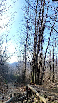
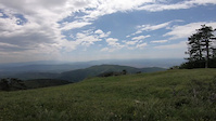
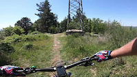
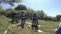
Photos of Firenze Mountain Bike
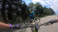
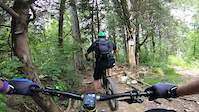
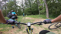
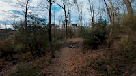
Videos of Firenze Mountain Bike
trail: Tre Marie
0:07 |
10 |
Feb 16, 2025
trail: Black Mamba 24
5:52 |
29 |
May 28, 2023
trail: Trincea
0:50 |
14 |
May 28, 2023
trail: il BunKer
2:43 |
6 |
May 28, 2023
6:42 |
62 |
May 28, 2023
trail: Puppeapera
5:10 |
19 |
May 7, 2023
trail: Pianettole vecchia
3:59 |
12 |
May 7, 2023
trail: Zibib
0:25 |
47 |
Dec 26, 2019
Current Trail Warnings
| status | trail | date | condition | user | info |
|---|---|---|---|---|---|
| Link rientro da Scorpione Calenzano | Jun 7, 2026 @ 5:07pm (Europe/Rome) Jun 7, 2026 | Very Dry | anguilla46 | ||
| La Furba Montalbano Trail Area | Jun 3, 2026 @ 8:25am (Europe/Rome) Jun 2, 2026 | Dry | marcogiordani | Prima parte completamente distrutta e... | |
| Boschetto Fonte Santa & Incontro natural trail area | Jun 2, 2026 @ 7:28am (Europe/Rome) Jun 1, 2026 | Ideal | MrOrangeItaly | Tronchetto circa a metà percorso |
Recent Trail Reports
Activity Feed
| username | action | type | title | date |
|---|---|---|---|---|
| rockfla | add | video | activity #97260222 | Jun 18, 2026 @ 10:09am 46 mins |
| rockfla | add | report | activity #97251964 | Jun 18, 2026 @ 7:51am 3 hours |
| rockfla | ridden | trail | activity #97251911 | Jun 18, 2026 @ 7:51am 3 hours |
| rockfla | vote | trail | activity #97251893 | Jun 18, 2026 @ 7:50am 3 hours |
| rockfla | add | video | activity #97251830 | Jun 18, 2026 @ 7:49am 3 hours |
Recent Comments
| username | type | title | comment | date |
|---|---|---|---|---|
| trail | troppo chiuso sopratutto i primi 200 mt | Jun 6, 2026 @ 10:29am Jun 6, 2026 | ||
| trail | Very nice uphill line for moderate pedaling.... | May 20, 2026 @ 10:33pm May 20, 2026 | ||
| trail | Nice pedaling all the way, except for a spot... | May 20, 2026 @ 10:29pm May 20, 2026 | ||
| trail | Brigante and Pezzey - super enduro fun! Very... | May 20, 2026 @ 11:55am May 20, 2026 | ||
| trail | Brigante and Pezzey - super enduro fun! Very... | May 20, 2026 @ 11:54am May 20, 2026 |
Local Badges
-

Epic Ride 50k99 awarded -

10 Green Trails4 awarded -
10 Green Trails13 awarded -
10 Green Trails113 awarded -
Epic Ride 50k242 awarded -
Epic Ride 50k139 awarded
Bike & Skill Parks
| name | type | city | rating |
|---|---|---|---|
| Rincine Trail Area | bike park | Firenze | |
| MX Polcanto | skill park | Firenze |
Activity Type Stats
| activitytype | trails | distance | descent | descent distance | total vertical | rating | global rank | state rank | photos | reports | routes | ridelogs |
|---|---|---|---|---|---|---|---|---|---|---|---|---|
| Mountain Bike | 1,205 | 785 miles | 252,654 ft | 432 miles | 5,354 ft | 769 | 8,993 | 41 | 72,452 | |||
| E-Bike | 1,040 | 674 miles | 218,612 ft | 379 miles | 5,354 ft | 46 | 8,498 | 17 | 15,611 | |||
| Gravel Bike | 1 | 12 | 27 | 581 | ||||||||
| Adaptive Bike | 2 | 11 | ||||||||||
| Horse | 245 | 214 miles | 42,680 ft | 97 miles | 5,285 ft | 165 | 1 | |||||
| Hike | 957 | 667 miles | 195,427 ft | 351 miles | 5,354 ft | 1 | 8,418 | 4 | 2,032 | |||
| Trail Running | 946 | 660 miles | 190,367 ft | 345 miles | 5,354 ft | 8,434 | 3 | 1,308 | ||||
| Dirtbike/Moto | 20 | 20 miles | 1,414 ft | 7 miles | 3,333 ft | 79 | 2 | |||||
| Observed Trials | 2 | 2 miles | 371 ft | 4,429 ft | 246 ft | 35 | ||||||
| ATV/ORV/OHV | 1 | 68 | 4 | |||||||||
| Snowshoe | 2 | 3,606 ft | 3 ft | 171 ft | 348 ft | 11 | ||||||
| Downhill Ski | 3 | 10 | ||||||||||
| Backcountry Ski | 1 | |||||||||||
| Nordic Ski | 2 | 1 |
Frequently Asked Questions About Firenze
▼
What are the best places to ride in Firenze?
Firenze has 16 areas to explore for mountain biking. The top rated areas are:
▼
What are the highest rated mountain biking trails in Firenze?
The highest rated mountain biking trails in Firenze are:
- Motta Trail (parte alta) (4.6/5)
- Scorpione (4.6/5)
- Sant'Elena Trail + Valibona Trail (4.6/5)
- Etrusco (4.6/5)
- Ratoio Trail (4.6/5)
▼
What is the best time of the year to ride in Firenze?
Based on ride log data, the most popular months to ride in Firenze are:
- May (233 activities)
- October (227 activities)
- June (216 activities)
▼
What is the longest trail in Firenze?
The longest trail in Firenze is Sommaia access Ciliegio at 13.5 km. View all trails sorted by distance.
Activities
Trails
Points of Interest
- Poggio Firenze Summit
- Rifugio Borbotto Lodge
- Poggio Ciliegio Summit
- [point of historical importance] casa natale di Leonardo da Vinci Other
- Il Cupolino Summit
- La Cupola Summit
- Informazione Information
- Vista Panoramica Viewpoint
- Mausoleo di San Donato Other
- Ponte rotto Other
- Monte Falco (1,645 m)
- Monte Pianellaccio (1,591 m)
- Croce di Pratomagno (1,581 m)
- By denitopia
 TRAILFORKS VTA & contributors
 - Admins: denitopia, marcoangeletti, cemoorelife, DanielePracchia
- #11821 - 13,817 views
- firenze activity log | embed map of Firenze mountain bike trails | firenze mountain biking points of interest
Downloading of trail gps tracks in kml & gpx formats is enabled for Firenze.
You must login to download files.