close
-
Layers w
- Weather Layers
- Pro
- Pro
- Pro
- Pro
- Pro
- Pro
- More Layers
- Pro
- Pro
- Pro
- Pro
-
Upgrade to

3D
Trail Conditions
- Unknown
- Snow Groomed
- Snow Packed
- Snow Covered
- Snow Cover Partial
- Freeze/thaw Cycle
- Icy
- Prevalent Mud
- Wet
- Variable
- Ideal
- Dry
- Very Dry
Trail Flow (Ridden Direction)
Trailforks scans users ridelogs to determine the most popular direction each trail is ridden. A good flowing trail network will have most trails flowing in a single direction according to their intension.
The colour categories are based on what percentage of riders are riding a trail in its intended direction.
The colour categories are based on what percentage of riders are riding a trail in its intended direction.
- > 96%
- > 90%
- > 80%
- > 70%
- > 50%
- < 50%
- bi-directional trail
- no data
Trail Last Ridden
Trailforks scans ridelogs to determine the last time a trail was ridden.
- < 2 days
- < 1 week
- < 2 weeks
- < 1 month
- < 6 months
- > 6 months
Trail Ridden Direction
The intended direction a trail should be ridden.
- Downhill Only
- Downhill Primary
- Both Directions
- Uphill Primary
- Uphill Only
- One Direction
Contribute Details
Colors indicate trail is missing specified detail.
- Description
- Photos
- Description & Photos
- Videos
Trail Popularity ?
Trailforks scans ridelogs to determine which trails are ridden the most in the last 9 months.
Trails are compared with nearby trails in the same city region with a possible 25 colour shades.
Think of this as a heatmap, more rides = more kinetic energy = warmer colors.
- most popular
- popular
- less popular
- not popular
ATV/ORV/OHV Filter
Max Vehicle Width
inches
US Cell Coverage
Legend

Radar Time
Activity Recordings
Trailforks uses anonymized public activity data.
?
Activity Recordings
Trailforks uses anonymized public activity data.
?
Personal Heatmap
▶
Activity Types
all
/
none
▶
Options
2
Date range
month
–
Winter Trails
Warning
A routing network for winter maps does not exist. Selecting trails using the winter trails layer has been disabled.
Missing Trails
Most Popular
Least Popular
Trails are colored based on popularity. The more popular a trail is, the more red. Less popular trails trend towards green.
Jump Magnitude Heatmap
Heatmap of where riders jump on trails. Zoom in to see individual jumps, click circles to view jump details.
BC Backroad Status
![map legend]()
Service Road Atlas is a free to use, community-driven service for viewing and creating reports on the numerous back-country service roads around B.C. and Alberta.

Slope Aspect
Direction the slope faces
Trails Deemphasized
Trails are shown in grey.
Only show trails with no bike usage.
Suggested Layers
Based on selected activity type
Save the current map location and zoom level as your default home location whenever this page is loaded.
SaveFitzpatrick Mountain is a trail network in Pictou County, NS.
Primary Trail Type: Cross-Country
 google parking directions
 Access Info:
Parking lot beside the elementary school.
Activities Click to view
- Mountain Bike
30 trails
- E-Bike
29 trails
- Horse
3 trails
- Hike
30 trails
- Trail Running
30 trails
- Snowmobile
5 trails
- Snowshoe
29 trails
- Nordic Ski
5 trails
Region Details
- 4
- 12
- 10
Region Status
Open as of May 8, 2026Local Trail Association
Stats
- Avg Trail Rating
- Trails (view details)
- 26
- Trails Mountain Bike
- 30
- Trails E-Bike
- 29
- Trails Horse
- 3
- Trails Hike
- 30
- Trails Trail Running
- 30
- Trails Snowmobile
- 5
- Trails Snowshoe
- 29
- Trails Nordic Ski
- 5
- Total Distance
- 23 miles
- Total Descent
- 2,782 ft
- Total Vertical
- 870 ft
- Highest Trailhead
- 909 ft
- Reports
- 550
- Photos
- 264
- Ridden Counter
- 2,025
Popular Fitzpatrick Mountain Mountain Biking Trails
• 85 ★ 4.3 • 2,326 ft • 4 ft • 108 •
Popular blue difficulty singletrack. This mountain bike primary trail can be used downhill primary. On average it takes 4 minutes to complete this trail.
• 90 ★ 4.0 • 4,860 ft • 115 ft • 106 •
Popular blue difficulty singletrack. This mountain bike primary trail can be used downhill primary and has a moderate overall physical rating with a 115 ft black diamond climb. On average it takes 9 minutes to complete this trail.
• 65 ★ 3.0 • 1,257 ft • 2 ft • 99 •
Easy trail with some roots at start. Has a couple of small bridges crossing streams. Large mogul at end for a finishing touch.
• 100 ★ 3.4 • 3,123 ft • 0 ft • 98 •
Rooty technical singletrack with some punchy climbs and tricky corners. Rides well in both directions can be used to climb when leaving Scotsburn.
Freerider Permanently Closed
• 5 ★ 4.0 • 2,461 ft • 0 ft • 94 •
Less popular blue difficulty closed singletrack. This mountain bike primary trail can be used both directions and has a moderate overall physical rating. On average it takes 4 minutes to complete this trail.
• 95 ★ 3.5 • 5,067 ft • 130 ft • 92 •
A fast and flowy section of trail that traverses from the tower to the windmills. Is fun in both directions.
• 55 ★ 4.0 • 2 miles • 636 ft • 89 •
One of the original trails on Fitz, flowy rollercoaster ride down with scattered technical features scattered throughout. it has been used as a climb and a decent in the annual Fitz of Fury XC race. it is shared with hikers on the Cape...
• 70 ★ 4.0 • 3,242 ft • 215 ft • 83 •
Trail winds its way behind the chalets past several look offs
Fitzpatrick Mountain Mountain Bike Routes
4 miles • 554 ft • 2 • Loop •
Short loop starting from the Chalets for the Fitzpatrick Mountain Fondo 2024.
7 miles • 975 ft • 5 • Loop •
Short loop accessing newly re-opened trails. From the group ride on Sunday, Nov 12th 2023.
10 miles • 1,272 ft • 6 • Loop •
The medium route, out to Millsvlle finishes with a loop of the Scotsburn side.
14 miles • 1,872 ft • 10 • Loop •
Long route from the group ride Nov 12th 2023
15 miles • 2,157 ft • 15 • Loop •
All the trails linked up for the Fitz Fondo. Starts with a loop to millsville and finishes with the rest...
9 miles • 1,122 ft • 11 • Loop •
An extended loop that samples much of what the Fitz network has to offer.
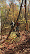
Photos of Fitzpatrick Mountain Mountain Bike
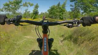
Videos of Fitzpatrick Mountain Mountain Bike

0:18 |
7 |
Oct 23, 2025
0:02 |
10 |
Oct 19, 2025
trail: Kilt
2:50 |
285 |
Jul 12, 2022 , Scotsburn
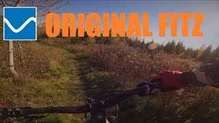
trail: Original FItz
5:48 |
412 |
Nov 9, 2021 , Scotsburn

trail: Kilt
2:14 |
303 |
Nov 9, 2021 , Scotsburn

trail: Murray's Madness
2:38 |
298 |
Nov 9, 2021 , Scotsburn

trail: Blowdown
4:00 |
309 |
Nov 8, 2021 , Scotsburn

5:24 |
249 |
Nov 8, 2021 , Scotsburn
Recent Trail Reports
| status | trail | date | condition | info | user |
|---|---|---|---|---|---|
| Original FItz | May 8, 2026 @ 8:08pm (America/Halifax) May 8, 2026 | Variable | FitzLove | ||
| Blowdown | May 8, 2026 @ 8:05pm (America/Halifax) May 8, 2026 | Ideal | FitzLove | ||
| Connector - A. MacLeod Rd Bottom | Apr 13, 2026 @ 8:03pm (America/Halifax) Apr 13, 2026 | Snow Cover Partial | FitzLove | ||
| Cape to Cape Trail - To The Windmills | Jan 18, 2026 @ 11:06am (America/Halifax) Jan 18, 2026 | Snow Covered | FitzLove | ||
| Bambi | Dec 20, 2025 @ 1:49pm (America/Los_Angeles) Dec 20, 2025 | Variable | FitzLove | ||
| Rocket Robert | Dec 5, 2025 @ 5:46pm (America/Halifax) Dec 5, 2025 | Snow Covered | FitzLove | ||
| Thumper | Oct 22, 2025 @ 7:48pm (America/Halifax) Oct 22, 2025 | Ideal | FitzLove | ||
| Cape to Cape Trail - Windmills to Millsville | Oct 23, 2025 @ 3:55pm (America/Los_Angeles) Oct 23, 2025 | Ideal | FitzLove | ||
| Reindeer Road | Oct 21, 2025 @ 7:42pm (America/Halifax) Oct 21, 2025 | Ideal | FitzLove | ||
| Murray's Madness | Oct 13, 2025 @ 6:35pm (America/Halifax) Oct 13, 2025 | Ideal | FitzLove |
Activity Feed
| username | action | type | title | date |
|---|---|---|---|---|
| Glen752 | wishlist | region | activity #94479686 | May 10, 2026 @ 11:08pm May 10, 2026 |
| FitzLove | add | report | activity #94280779 and 5 more | May 8, 2026 @ 3:24pm May 8, 2026 |
| FitzLove | add | report | activity #92413161 | Apr 11, 2026 @ 11:29am Apr 11, 2026 |
| FitzLove | add | report | activity #87624780 | Jan 22, 2026 @ 7:11am Jan 22, 2026 |
| FitzLove | add | report | activity #85865954 and 2 more | Dec 21, 2025 @ 1:47pm Dec 21, 2025 |
Recent Comments
| username | type | title | comment | date |
|---|---|---|---|---|
| trail | Fitzpatrick Mountain is a diverse group of... | Aug 7, 2024 @ 7:00am Aug 7, 2024 | ||
| trail | A fun downhill. A little grown in and some... | Aug 7, 2024 @ 6:45am Aug 7, 2024 | ||
| trail | A fun downhill especially combined with... | Aug 7, 2024 @ 6:44am Aug 7, 2024 | ||
| trail | A fun downhill paired with Fitz, Severn,... | Aug 7, 2024 @ 6:42am Aug 7, 2024 | ||
| trail | I liked this as a rooty and somewhat technical... | Aug 7, 2024 @ 6:38am Aug 7, 2024 |
Nearby Areas
| name | distance | ||||
|---|---|---|---|---|---|
| Dalhousie Mountain | 2 | 8 | 6 | 4 km | |
| McCulloch Education Centre | 3 | 8.9 km | |||
| Trenton Park | 5 | 1 | 2 | 12.2 km | |
| Melmerby Beach Provincial Park | 16.9 km | ||||
| Pat Mahaney Mountain Bike Trails | 3 | 25.4 km |
Local Badges
-

Completionist0 awarded
Activity Type Stats
| activitytype | trails | distance | descent | descent distance | total vertical | rating | global rank | state rank | photos | reports | routes | ridelogs |
|---|---|---|---|---|---|---|---|---|---|---|---|---|
| Mountain Bike | 30 | 23 miles | 2,782 ft | 9 miles | 869 ft | #4,731 | #11 | 255 | 548 | 7 | 1,584 | |
| E-Bike | 29 | 23 miles | 2,782 ft | 9 miles | 869 ft | #4,108 | #13 | 357 | 17 | |||
| Horse | 3 | 1 mile | 115 ft | 2,054 ft | 131 ft | #1,403 | #10 | 191 | ||||
| Hike | 30 | 23 miles | 2,782 ft | 9 miles | 869 ft | #6,354 | #17 | 9 | 550 | 915 | ||
| Trail Running | 30 | 23 miles | 2,782 ft | 9 miles | 869 ft | #6,203 | #14 | 550 | 30 | |||
| Snowmobile | 5 | 2 miles | 420 ft | 1 mile | 561 ft | #72 | #5 | 37 | ||||
| Snowshoe | 29 | 23 miles | 2,782 ft | 9 miles | 869 ft | #321 | #7 | 113 | 54 | |||
| Nordic Ski | 5 | 2 miles | 420 ft | 1 mile | 561 ft | #1,046 | #17 | 37 | 1 |
Frequently Asked Questions About Fitzpatrick Mountain
▼
What are the highest rated mountain biking trails in Fitzpatrick Mountain?
The highest rated mountain biking trails in Fitzpatrick Mountain are:
- Rocket Robert (4.1/5)
- Kilt (4.1/5)
- Cape to Cape Trail - Windmills to Millsville (4/5)
- Blowdown (4/5)
- Original FItz (4/5)
▼
What is the best time of the year to ride in Fitzpatrick Mountain?
Based on ride log data, the most popular months to ride in Fitzpatrick Mountain are:
- August (29 activities)
- July (27 activities)
- June (25 activities)
▼
Where can I park to ride in Fitzpatrick Mountain?
There are 1 parking locations listed in Fitzpatrick Mountain. The most popular parking spots are:
▼
What is the longest trail in Fitzpatrick Mountain?
The longest trail in Fitzpatrick Mountain is Durham Hill at 5.7 km. View all trails sorted by distance.
Activities
Trails
- Hard trails in Fitzpatrick Mountain
- Easy trails in Fitzpatrick Mountain
- Favorite trails in Fitzpatrick Mountain
- Most ridden trails in Fitzpatrick Mountain
- Singletrack in Fitzpatrick Mountain
- Viewpoint trails in Fitzpatrick Mountain
- Trails with technical features in Fitzpatrick Mountain
- Race routes in Fitzpatrick Mountain
- By JeffV
 & contributors
 - Admins: MTBPC, alpine-e
- #5864 - 22,583 views
- fitzpatrick mountain activity log | embed map of Fitzpatrick Mountain mountain bike trails | fitzpatrick mountain mountain biking points of interest
Downloading of trail gps tracks in kml & gpx formats is enabled for Fitzpatrick Mountain.
You must login to download files.