close
-
Layers w
- Weather Layers
- Pro
- Pro
- Pro
- Pro
- Pro
- Pro
- More Layers
- Pro
- Pro
- Pro
- Pro
-
Upgrade to

3D
Trail Conditions
- Unknown
- Snow Groomed
- Snow Packed
- Snow Covered
- Snow Cover Partial
- Freeze/thaw Cycle
- Icy
- Prevalent Mud
- Wet
- Variable
- Ideal
- Dry
- Very Dry
Trail Flow (Ridden Direction)
Trailforks scans users ridelogs to determine the most popular direction each trail is ridden. A good flowing trail network will have most trails flowing in a single direction according to their intension.
The colour categories are based on what percentage of riders are riding a trail in its intended direction.
The colour categories are based on what percentage of riders are riding a trail in its intended direction.
- > 96%
- > 90%
- > 80%
- > 70%
- > 50%
- < 50%
- bi-directional trail
- no data
Trail Last Ridden
Trailforks scans ridelogs to determine the last time a trail was ridden.
- < 2 days
- < 1 week
- < 2 weeks
- < 1 month
- < 6 months
- > 6 months
Trail Ridden Direction
The intended direction a trail should be ridden.
- Downhill Only
- Downhill Primary
- Both Directions
- Uphill Primary
- Uphill Only
- One Direction
Contribute Details
Colors indicate trail is missing specified detail.
- Description
- Photos
- Description & Photos
- Videos
Trail Popularity ?
Trailforks scans ridelogs to determine which trails are ridden the most in the last 9 months.
Trails are compared with nearby trails in the same city region with a possible 25 colour shades.
Think of this as a heatmap, more rides = more kinetic energy = warmer colors.
- most popular
- popular
- less popular
- not popular
ATV/ORV/OHV Filter
Max Vehicle Width
inches
US Cell Coverage
Legend

Radar Time
Activity Recordings
Trailforks uses anonymized public activity data.
?
Activity Recordings
Trailforks uses anonymized public activity data.
?
Personal Heatmap
▶
Activity Types
all
/
none
▶
Options
2
Date range
month
–
Winter Trails
Warning
A routing network for winter maps does not exist. Selecting trails using the winter trails layer has been disabled.
Missing Trails
Most Popular
Least Popular
Trails are colored based on popularity. The more popular a trail is, the more red. Less popular trails trend towards green.
Jump Magnitude Heatmap
Heatmap of where riders jump on trails. Zoom in to see individual jumps, click circles to view jump details.
BC Backroad Status
![map legend]()
Service Road Atlas is a free to use, community-driven service for viewing and creating reports on the numerous back-country service roads around B.C. and Alberta.

Slope Aspect
Direction the slope faces
Trails Deemphasized
Trails are shown in grey.
Only show trails with no bike usage.
Suggested Layers
Based on selected activity type
Save the current map location and zoom level as your default home location whenever this page is loaded.
SavePopular Trail Networks
view all areas »
No description for Flathead County has been added yet!
Login or register to submit one.
Activities Click to view
- Mountain Bike
858 trails
- E-Bike
211 trails
- Horse
232 trails
- Hike
1,001 trails
- Trail Running
994 trails
- Dirtbike/Moto
104 trails
- Observed Trials
5 trails
- ATV/ORV/OHV
83 trails
- Snowmobile
14 trails
- Snowshoe
201 trails
- Downhill Ski
187 trails
- Backcountry Ski
115 trails
- Nordic Ski
145 trails
Stats
- Avg Trail Rating
- Trails (view details)
- 1,410
- Trails Mountain Bike
- 858
- Trails E-Bike
- 211
- Trails Gravel Bike
- 127
- Trails Adaptive Bike
- 193
- Trails Winter Fat Bike
- 314
- Trails Horse
- 232
- Trails Hike
- 1,001
- Trails Trail Running
- 994
- Trails Dirtbike/Moto
- 104
- Trails Observed Trials
- 5
- Trails ATV/ORV/OHV
- 83
- Trails Snowmobile
- 14
- Trails Snowshoe
- 201
- Trails Downhill Ski
- 187
- Trails Backcountry Ski
- 115
- Trails Nordic Ski
- 145
- Total Distance
- 2,470 miles
- Total Descent
- 465,741 ft
- Total Vertical
- 7,588 ft
- Highest Trailhead
- 9,535 ft
- Reports
- 3,123
- Photos
- 2,203
- Ridden Counter
- 130,705
Articles

Video: Remy Metailler & Pro Skier Ride Legacy Bike Park
Sep 22, 2023 from pinkbike.com
There's more going on in Montana than Amazon Prime's 'Yellowstone'.
2023-Enduro-Pescado Photo Album
Aug 17, 2023 from pinkbike.com
The World's biggest biking photo gallery of photos like, crashes, north shore. 2023-Enduro-Pescado

Video: Rowdy Flow in Montana’s Gem: The Legacy Bike Park
Jun 15, 2023 from pinkbike.com
A network of first-class trails in the Montana wilderness.
12 Endangered Trails to Hike Before They're Gone
Jan 14, 2022 from backpacker.com
From climate change to energy development, various threats promise to wipe out what’s best about America’s 12 most endangered trails.
Sub Regions
- Columbia Falls (196)
- Cedar Flats (51)
- River's Edge Park (28)
- Smokey Range Gravel (17)
- The River Trail (2)
- Essex (4)
- Essex (1)
- Eureka (46)
- Hungry Horse (12)
- Kalispell (190)
- Green Gates (55)
- Happy Valley State Trust (50)
- Herron Park (37)
- Lone Pine State Park (17)
- Somers Beach State Park (2)
- Lakeside (33)
- Legacy Bike Park (32)
- Libby (14)
- Olney (2)
- Whitefish (304)
- Beaver Lakes Trails (39)
- Big Mountain Nordic (13)
- Finger Lake (5)
- Haskill Basin (3)
- Holbrook Overlook (1)
- Lion Mountain (1)
- Pig Farms (90)
- Spencer Mountain (20)
- Tally Lake Area (45)
- Whitefish Legacy Center (8)
- Whitefish Mountain Resort (28)
- Whitefish Range (27)
- Whitefish (8)
- Glacier National Park (14)
- North Fork Gravel (17)
Popular Flathead County Mountain Biking Trails
• 100 ★ 4.5 • 3 miles • 0 ft • 1,235 •
Only one word can describe this trail: flow! Intersecting six times, it’s perfect for intermediate-to-advanced riders who like to find their groove. Connects to the top of the B-Side Zone.
• 100 ★ 4.0 • 3,255 ft • 176 ft • 1,218 •
Quick Climb that takes you from the Spencer Access Road to a multiple downhill trails. Follow the trail to the top of the ridge where you'll have a great view of the valley to the west. From there you can access, , , , , and .
• 100 ★ 4.8 • 5 miles • 372 ft • 1,040 •
Highly rated popular blue difficulty singletrack. This multi-use trail can be used both directions and has a moderate overall physical rating with a 372 ft blue climb. It features berm. On average it takes 36 minutes to complete this trail.
• 95 ★ 4.3 • 2 miles • 221 ft • 879 •
Short Overlook Look that has mellow slightly bermed out corners, flows a little better than sections of the trail closer to town.
• 95 ★ 4.3 • 1 mile • 15 ft • 875 •
Great trail with more rooty and rocky steep sections than but mostly natural; not as many built features as some other trails in this area. It has some optional smaller airs as well as some more technical downhill sections. A great next...
• 95 ★ 4.4 • 1,722 ft • 0 ft • 863 •
Flowy trail filled with berms and step-ups, perfect for beginner-to-intermediate riders looking to rip some bigger berms. Connects the lift plaza to the base area.
• 95 ★ 4.0 • 1,558 ft • 0 ft • 844 •
Jumps and tables for intermediate riders to practice catching air. Connects the top of the Bad Rock Zone to the village area.
Flathead County Mountain Bike Routes
Cedar Flats Mini-Enduro Featured
★ 5.0 • 8 miles • 682 ft • 11 • Loop •
For those looking for a shorter version of the Cedar Flats Enduro route try this Cedar Flats Mini-Enduro...
Northwoods Gravel Grind Featured
★ 5.0 • 11 miles • 1,487 ft • 6 • Loop •
This gravel grind is a loop ride that will get you high above the Valley floor and has view points along...
Cedar Flats Enduro Featured
★ 4.0 • 12 miles • 1,319 ft • 16 • Loop •
This is a route that gives you a comprehensive tour of all the elements of the Cedar Flats riding complex....
★ 3.7 • 17 miles • 1,517 ft • 3 • Loop •
Looking to get away from traffic and do a medium length gravel grinder featuring both climbing and fun...
The Grand Loop Featured
★ 5.0 • 16 miles • 1,930 ft • 16 • Loop •
If you want to experience the best of Beaver Lakes, then this riding area, which includes views, flow, and...
Beaver Lakes Gravel Grind Featured
★ 4.0 • 10 miles • 863 ft • 2 • Loop •
A great gravel grinder that travels around the western perimeter and then south through the heart of the...
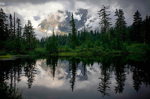
Photos of Flathead County Mountain Bike
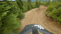
Videos of Flathead County Mountain Bike
trail: Malice in Plunderland
0:11 |
41 |
Sep 3, 2025
trail: Zeppelin Alt (Drop)
0:45 |
54 |
Nov 22, 2023
trail: Kashmir
4:39 |
26 |
Nov 22, 2023
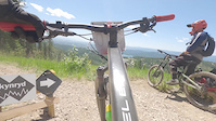
trail: Skynyrd
0:15 |
75 |
Nov 22, 2023

trail: Cedar Ridge (Upper)
0:20 |
89 |
Oct 11, 2023

trail: Freebird
0:12 |
|
Jul 29, 2023
trail: Freebird
0:12 |
|
Jul 29, 2023
trail: Lower Foy's To Blacktail
0:21 |
64 |
May 28, 2023
Current Trail Warnings
| status | trail | date | condition | user | info |
|---|---|---|---|---|---|
| The Whitefish Trail - East Spencer Loop Spencer Mountain | Jun 5, 2026 @ 1:47pm (America/Denver) Jun 5, 2026 | Prevalent Mud | toast2266 | north end of singletrack is completely... | |
| Ashley Mountain Tally Lake Area | Jun 4, 2026 @ 8:13pm (America/Denver) Jun 4, 2026 | Variable | AESchneider612 | Completely impassable with down trees.... | |
| Birch Branch Cedar Flats | Jun 3, 2026 @ 8:12pm (America/Denver) Jun 3, 2026 | Prevalent Mud | JeffVonKiper | HUGE, SIGNIFICANT in size, mudholes! ... |
Recent Trail Reports
| status | trail | date | condition | info | user |
|---|---|---|---|---|---|
| Columbia Mountain back-side Columbia Falls | Jun 17, 2026 @ 2:02pm (America/Denver) 2 days | Unknown | ridefasterthanbear | ||
| Peter's Ridge Kalispell | Jun 16, 2026 @ 9:27am (America/Denver) Jun 16, 2026 | Dry | b-man2u | ||
| Lion Hill Columbia Falls | Jun 11, 2026 @ 6:41pm (America/Denver) Jun 11, 2026 | Ideal | FAMB FAMB | ||
| Trail 10 Cedar Flats | Jun 6, 2026 @ 3:45pm (America/Creston) Jun 6, 2026 | Ideal | caudillb | ||
| Snowberry (Lower) Cedar Flats | Jun 3, 2026 @ 3:07pm (America/Creston) Jun 3, 2026 | Prevalent Mud | JeffVonKiper | ||
| Alder Cedar Flats | Jun 3, 2026 @ 3:07pm (America/Creston) Jun 3, 2026 | Prevalent Mud | JeffVonKiper | ||
| AC/ Cedar Flats | Jun 3, 2026 @ 3:07pm (America/Creston) Jun 3, 2026 | Prevalent Mud | JeffVonKiper | ||
| Bill Creek Tally Lake Area | May 29, 2026 @ 11:07am (America/Denver) May 29, 2026 | Ideal | FAMB FAMB | ||
| Aspen Alley Kalispell | May 27, 2026 @ 7:35pm (America/Denver) May 27, 2026 | Ideal | drinehart | ||
| Lower Strawberry Lake Trail Kalispell | May 27, 2026 @ 7:34pm (America/Denver) May 27, 2026 | Ideal | drinehart |
National Scenic Trails & Official Routes
-
Continental Divide Trail
- Mountain Bike
- Hike
- Trail Running
-
Pacific Northwest Trail
- Mountain Bike
- Horse
- Hike
- Trail Running

Activity Feed
| username | action | type | title | date |
|---|---|---|---|---|
| beachysdan | wishlist | route | activity #97272786 | Jun 18, 2026 @ 1:19pm 1 day |
| beachysdan | wishlist | route | activity #97272728 | Jun 18, 2026 @ 1:18pm 1 day |
| 2998BqZ9 | wishlist | route | activity #97258171 | Jun 18, 2026 @ 9:37am 2 days |
| ridefasterthanbear | add | report | activity #97205097 | Jun 17, 2026 @ 1:02pm 2 days |
| belovedone | wishlist | region | activity #97204111 | Jun 17, 2026 @ 12:46pm 2 days |
Recent Comments
| username | type | title | comment | date |
|---|---|---|---|---|
| trail | Uh | Jun 15, 2026 @ 8:43am Jun 15, 2026 | ||
| trail | yup! a good progress trail---:) | Jun 6, 2026 @ 6:24pm Jun 6, 2026 | ||
| trail | for sure---i need a clinic for those... | Jun 6, 2026 @ 6:23pm Jun 6, 2026 | ||
| trail | Oh Otter Pop---your bank turns get me EVERY... | Jun 6, 2026 @ 6:21pm Jun 6, 2026 | ||
| report | I rode a big loop yesterday---upper snowberry... | Jun 6, 2026 @ 4:10pm Jun 6, 2026 |
Local Badges
-
Cedar Flats Mini-Enduro0 awarded -
Cedar Flats Enduro0 awarded -

Completionist2 awarded -

Completionist2 awarded -

Mountain Biking 100k Badge0 awarded -

Epic Mountain Bike Climb 2k2 awarded
Bike & Skill Parks
| name | type | city | rating |
|---|---|---|---|
| Whitefish Mountain Resort | bike park | Whitefish | |
| Legacy Bike Park | bike park | Lakeside | |
| Armory Park Pump Track | skill park | Whitefish | |
| Legacy Bike Park Pumptrack | skill park | Lakeside |
Upcoming Local Events
Local Trail Supporters
- Flathead Fat Tires
![]()
![]()
![]()
![National Recreation Trail]()
- Foy's to Blacktail trails
![Pacific Northwest]()
- whitefish mountain resort
Local Trail Supporters
- Flathead Fat Tires
![]()
![]()
![]()
![National Recreation Trail]()
- Foy's to Blacktail trails
![Pacific Northwest]()
- whitefish mountain resort
Activity Type Stats
| activitytype | trails | distance | descent | descent distance | total vertical | rating | global rank | state rank | photos | reports | routes | ridelogs |
|---|---|---|---|---|---|---|---|---|---|---|---|---|
| Mountain Bike | 858 | 1,473 miles | 249,692 ft | 577 miles | 6,076 ft | 1,681 | 3,086 | 52 | 64,499 | |||
| E-Bike | 211 | 583 miles | 51,171 ft | 191 miles | 5,095 ft | 11 | 2,009 | 4 | 996 | |||
| Gravel Bike | 127 | 204 miles | 14,236 ft | 65 miles | 4,656 ft | 147 | 378 | 6 | 618 | |||
| Adaptive Bike | 193 | 414 miles | 27,119 ft | 128 miles | 4,849 ft | 360 | 14 | |||||
| Winter Fat Bike | 314 | 299 miles | 66,591 ft | 138 miles | 5,423 ft | 1,031 | 1 | 6 | ||||
| Horse | 232 | 824 miles | 104,354 ft | 291 miles | 6,184 ft | 1 | 1,022 | 4 | 73 | |||
| Hike | 1,001 | 1,983 miles | 350,853 ft | 769 miles | 7,589 ft | 224 | 2,996 | 18 | 15,483 | |||
| Trail Running | 994 | 1,974 miles | 348,648 ft | 762 miles | 7,589 ft | 23 | 2,994 | 21 | 8,592 | |||
| Dirtbike/Moto | 104 | 440 miles | 45,489 ft | 151 miles | 4,124 ft | 803 | 2 | 117 | ||||
| Observed Trials | 5 | 13 miles | 4,767 ft | 7 miles | 4,114 ft | 19 | 118 | |||||
| ATV/ORV/OHV | 83 | 364 miles | 28,323 ft | 121 miles | 4,104 ft | 2 | 764 | 1 | 46 | |||
| Snowmobile | 14 | 69 miles | 6,237 ft | 29 miles | 2,736 ft | 19 | 31 | |||||
| Snowshoe | 201 | 386 miles | 33,514 ft | 134 miles | 6,631 ft | 141 | 3 | 117 | ||||
| Downhill Ski | 187 | 78 miles | 72,283 ft | 75 miles | 2,890 ft | 2 | 20 | 2 | 5,607 | |||
| Backcountry Ski | 115 | 327 miles | 25,883 ft | 109 miles | 4,505 ft | 37 | 69 | 9 | 3,413 | |||
| Nordic Ski | 145 | 97 miles | 8,770 ft | 39 miles | 2,218 ft | 31 | 70 | 3 | 3,961 |
Frequently Asked Questions About Flathead County
▼
What are the best places to ride in Flathead County?
Flathead County has 38 areas to explore for mountain biking. The top rated areas are:
▼
What are the highest rated mountain biking trails in Flathead County?
The highest rated mountain biking trails in Flathead County are:
- Reservoir Trail (4.6/5)
- RADish (4.6/5)
- Malice in Plunderland (4.5/5)
- Columbia Mountain back-side (4.5/5)
- Otter Pop (4.5/5)
▼
What is the best time of the year to ride in Flathead County?
Based on ride log data, the most popular months to ride in Flathead County are:
- July (1,835 activities)
- August (1,207 activities)
- June (1,041 activities)
▼
What is the longest trail in Flathead County?
The longest trail in Flathead County is Kootenai - PNW Trail at 38.7 km. View all trails sorted by distance.
Activities
- Flathead County Mountain Biking Trails
- Flathead County E-Biking Trails
- Flathead County Horseback Trails
- Flathead County Hiking Trails
- Flathead County Trail Running Trails
- Flathead County Dirtbiking Trails
- Flathead County Observed Trials Trails
- Flathead County ATVing/Offroading Trails
- Flathead County Snowmobiling Trails
- Flathead County Snowshoeing Trails
- Flathead County Skiing Trails
- Flathead County Backcountry Skiing Trails
- Flathead County Nordic Skiing Trails
Trails
Points of Interest
- Sperry Campsite Camping
- Lower Nyack Patrol Cabin
- Upper Nyack Creek Campsite Camping
- Lower Nyack Creek Campsite Camping
- Beaver Womans Lake Campsite Camping
- Buffalo Woman Lake Campsite Camping
- Rockwell Falls Sight
- Sinopah Mountain Summit
- Aster Park Lookout Viewpoint
- Mount Rockwell Summit
- Snowshoe Peak (2,661 m)
- A Peak (2,625 m)
- Mount Grant (2,618 m)
- By brenthillier
 NSMBA TRAILFORKS & contributors
 - Admins: FAMB, JeffVonKiper
- #24459 - 18,811 views
- flathead county activity log | embed map of Flathead County mountain bike trails | flathead county mountain biking points of interest polygons
Downloading of trail gps tracks in kml & gpx formats is enabled for Flathead County.
You must login to download files.