close
-
Layers w
- Weather Layers
- Pro
- Pro
- Pro
- Pro
- Pro
- Pro
- More Layers
- Pro
- Pro
- Pro
- Pro
-
Upgrade to

3D
Trail Conditions
- Unknown
- Snow Groomed
- Snow Packed
- Snow Covered
- Snow Cover Partial
- Freeze/thaw Cycle
- Icy
- Prevalent Mud
- Wet
- Variable
- Ideal
- Dry
- Very Dry
Trail Flow (Ridden Direction)
Trailforks scans users ridelogs to determine the most popular direction each trail is ridden. A good flowing trail network will have most trails flowing in a single direction according to their intension.
The colour categories are based on what percentage of riders are riding a trail in its intended direction.
The colour categories are based on what percentage of riders are riding a trail in its intended direction.
- > 96%
- > 90%
- > 80%
- > 70%
- > 50%
- < 50%
- bi-directional trail
- no data
Trail Last Ridden
Trailforks scans ridelogs to determine the last time a trail was ridden.
- < 2 days
- < 1 week
- < 2 weeks
- < 1 month
- < 6 months
- > 6 months
Trail Ridden Direction
The intended direction a trail should be ridden.
- Downhill Only
- Downhill Primary
- Both Directions
- Uphill Primary
- Uphill Only
- One Direction
Contribute Details
Colors indicate trail is missing specified detail.
- Description
- Photos
- Description & Photos
- Videos
Trail Popularity ?
Trailforks scans ridelogs to determine which trails are ridden the most in the last 9 months.
Trails are compared with nearby trails in the same city region with a possible 25 colour shades.
Think of this as a heatmap, more rides = more kinetic energy = warmer colors.
- most popular
- popular
- less popular
- not popular
ATV/ORV/OHV Filter
Max Vehicle Width
inches
US Cell Coverage
Legend

Radar Time
Activity Recordings
Trailforks uses anonymized public activity data.
?
Activity Recordings
Trailforks uses anonymized public activity data.
?
Personal Heatmap
▶
Activity Types
all
/
none
▶
Options
2
Date range
month
–
Winter Trails
Warning
A routing network for winter maps does not exist. Selecting trails using the winter trails layer has been disabled.
Missing Trails
Most Popular
Least Popular
Trails are colored based on popularity. The more popular a trail is, the more red. Less popular trails trend towards green.
Jump Magnitude Heatmap
Heatmap of where riders jump on trails. Zoom in to see individual jumps, click circles to view jump details.
BC Backroad Status
![map legend]()
Service Road Atlas is a free to use, community-driven service for viewing and creating reports on the numerous back-country service roads around B.C. and Alberta.

Slope Aspect
Direction the slope faces
Trails Deemphasized
Trails are shown in grey.
Only show trails with no bike usage.
Suggested Layers
Based on selected activity type
Save the current map location and zoom level as your default home location whenever this page is loaded.
Save
No description for Flintridge MTB has been added yet!
Login or register to submit one.
 google parking directions
Primary Trail Type: Cross-Country
Land Status: Conservation Reserve
google parking directions Activities Click to view
- Mountain Bike
19 trails
- E-Bike
1 trails
- Hike
19 trails
- Trail Running
19 trails
- Observed Trials
0 trails
Region Details
- 10
- 9
Region Status
Open as of May 16, 2026Stats
- Avg Trail Rating
- Trails (view details)
- 19
- Trails Mountain Bike
- 19
- Trails E-Bike
- 1
- Trails Hike
- 19
- Trails Trail Running
- 19
- Total Distance
- 24 miles
- Total Descent
- 449 ft
- Total Vertical
- 77 ft
- Highest Trailhead
- 171 ft
- Reports
- 276
- Photos
- 156
- Ridden Counter
- 2,562
Popular Flintridge MTB Mountain Biking Trails
• 100 ★ 4.5 • 1,835 ft • 32 ft • 260 •
Popular green difficulty mixed. This mountain bike primary trail can be used both directions. On average it takes 2 minutes to complete this trail.
• 95 ★ 4.5 • 4 miles • 70 ft • 195 •
This is the SCNT Route you can get from the Crossover from Flintridge West to Burroughs and back.
• 85 ★ 4.0 • 6 miles • 53 ft • 158 •
SCNT East past Gosling to close bridge over river. Not as easy as the SCNT of Flintridge.
• 55 ★ 3.7 • 1 mile • 15 ft • 153 •
Moderately popular green difficulty gravel path. This mountain bike primary trail can be used both directions. On average it takes 4 minutes to complete this trail.
• 60 ★ 0.0 • 2,401 ft • 11 ft • 139 •
Moderately popular blue difficulty mixed. This mountain bike primary trail can be used both directions. On average it takes 1 minutes to complete this trail.
• 100 ★ 4.0 • 5,075 ft • 13 ft • 125 •
Popular blue difficulty singletrack. This mountain bike primary trail can be used both directions. On average it takes 7 minutes to complete this trail.
• 50 ★ 5.0 • 1,008 ft • 7 ft • 122 •
Moderately popular blue difficulty mixed. This mountain bike primary trail can be used both directions. On average it takes 1 minutes to complete this trail.
Flintridge MTB Mountain Bike Routes
19 miles • 253 ft • 6 • Out & Back •
This route hits the best parts of the Spring Creek Mountain Bike Trails that bypasses the Flintridge Inner...
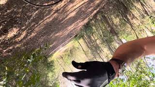
Photos of Flintridge MTB Mountain Bike
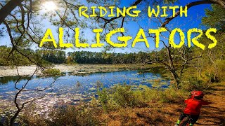
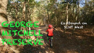
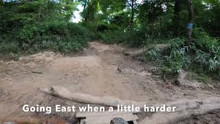
Videos of Flintridge MTB Mountain Bike
41:38 |
295 |
Feb 21, 2024 , The Woodlands
trail: SCNT - West of Crossover
7:24 |
764 |
Dec 8, 2020 , The Woodlands
trail: SCNT - West of Crossover
13:07 |
444 |
Dec 7, 2020 , The Woodlands

trail: SCNT - West of Crossover
3:41 |
447 |
Dec 7, 2020 , The Woodlands

trail: Bike Loop Trail
20:11 |
1577 |
Sep 22, 2020 , The Woodlands
2:46 |
420 |
Jul 14, 2020
Recent Trail Reports
| status | trail | date | condition | info | user |
|---|---|---|---|---|---|
| Main Trail | May 16, 2026 @ 2:04pm (America/Matamoros) May 16, 2026 | Dry | gradplanner | ||
| Connector | May 16, 2026 @ 2:04pm (America/Matamoros) May 16, 2026 | Dry | gradplanner | ||
| SCNT - West of Crossover | May 16, 2026 @ 2:04pm (America/Matamoros) May 16, 2026 | Dry | gradplanner | ||
| Racoon Trail | May 16, 2026 @ 2:04pm (America/Matamoros) May 16, 2026 | Dry | gradplanner | ||
| Gray Fox Trail | May 16, 2026 @ 2:04pm (America/Matamoros) May 16, 2026 | Dry | gradplanner | ||
| Road Runner Trail | May 16, 2026 @ 2:04pm (America/Matamoros) May 16, 2026 | Dry | gradplanner | ||
| West Trail | Mar 28, 2026 @ 4:28pm (America/Chicago) Mar 28, 2026 | Dry | mattswartz | ||
| SCNT East - Gosling to Closed Bridge | Feb 22, 2026 @ 2:20pm (America/Matamoros) Feb 22, 2026 | Dry | BigWill1836 | ||
| Spring Creek Nature Trail | Jan 16, 2026 @ 12:57pm (America/Matamoros) Jan 16, 2026 | Dry | BigWill1836 | ||
| Crossover Trail | Jan 16, 2026 @ 12:57pm (America/Matamoros) Jan 16, 2026 | Dry | BigWill1836 |
Activity Feed
| username | action | type | title | date |
|---|---|---|---|---|
| gradplanner | add | report | activity #94870146 and 5 more | May 16, 2026 @ 7:47pm May 16, 2026 |
| Joell71 | add | photo | activity #93475788 | Apr 26, 2026 @ 1:53pm Apr 26, 2026 |
| ingline | wishlist | trail | activity #91595292 and 1 more | Mar 30, 2026 @ 10:41am Mar 30, 2026 |
| mattswartz | add | report | activity #91471708 | Mar 28, 2026 @ 2:28pm Mar 28, 2026 |
| mattswartz | ridden | trail | activity #91471458 | Mar 28, 2026 @ 2:25pm Mar 28, 2026 |
Recent Comments
| username | type | title | comment | date |
|---|---|---|---|---|
| report | Thanks for the report! These are the reports... | Nov 2, 2025 @ 12:35pm Nov 2, 2025 | ||
| trail | This is a very nice roll in pleasant scenery.... | Mar 2, 2025 @ 7:56pm Mar 2, 2025 | ||
| trail | current situation 08/11/2024 cannot ve ridden... | Aug 12, 2024 @ 8:19am Aug 12, 2024 | ||
| trail | Currently wet | Mar 24, 2024 @ 12:26pm Mar 24, 2024 | ||
| trail | Lookout for the jackass on the trail today.... | Mar 24, 2024 @ 10:04am Mar 24, 2024 |
Nearby Areas
| name | distance | ||||
|---|---|---|---|---|---|
| Spring Creek Park | 3 | 8.8 km | |||
| Cypress Wood | 5 | 5 | 10.4 km | ||
| Carl Barton, Jr. Park | 1 | 10.8 km | |||
| Timberlane | 16 | 3 | 2 | 11.3 km | |
| Spring Creek Greenway | 8 | 12.3 km |
Local Badges
-

Completionist0 awarded
Activity Type Stats
| activitytype | trails | distance | descent | descent distance | total vertical | rating | global rank | state rank | photos | reports | routes | ridelogs |
|---|---|---|---|---|---|---|---|---|---|---|---|---|
| Mountain Bike | 19 | 24 miles | 449 ft | 5 miles | 79 ft | #3,357 | #1,173 | 147 | 276 | 1 | 8,192 | |
| E-Bike | 1 | 4 miles | 56 ft | 2,779 ft | 23 ft | #9,000 | #2,915 | 211 | 96 | |||
| Hike | 19 | 24 miles | 449 ft | 5 miles | 79 ft | #8,137 | #3,027 | 275 | 88 | |||
| Trail Running | 19 | 24 miles | 449 ft | 5 miles | 79 ft | #7,267 | #2,404 | 275 | 137 |
Frequently Asked Questions About Flintridge MTB
▼
What are the highest rated mountain biking trails in Flintridge MTB?
The highest rated mountain biking trails in Flintridge MTB are:
- Connector (4.2/5)
- Gray Fox Trail (4.1/5)
- Main Trail (4.1/5)
- Burroughs Park Northern Nature Trail Loop Access (4.1/5)
- Burroughs Park Northern Nature Trail Loop (4.1/5)
▼
What is the best time of the year to ride in Flintridge MTB?
Based on ride log data, the most popular months to ride in Flintridge MTB are:
- April (84 activities)
- July (81 activities)
- May (62 activities)
▼
Where can I park to ride in Flintridge MTB?
There are 3 parking locations listed in Flintridge MTB. The most popular parking spots are: View all parking and trailhead locations on the map to plan your visit.
▼
What is the longest trail in Flintridge MTB?
The longest trail in Flintridge MTB is SCNT East - Gosling to Closed Bridge at 6.1 miles. View all trails sorted by distance.
Activities
- By markholloway
 Trailforks Map Team & contributors
 - Admins: GHORBA
- #13903 - 14,796 views
- flintridge mtb activity log | embed map of Flintridge MTB mountain bike trails | flintridge mtb mountain biking points of interest
Downloading of trail gps tracks in kml & gpx formats is enabled for Flintridge MTB.
You must login to download files.