close
-
Layers w
- Weather Layers
- Pro
- Pro
- Pro
- Pro
- Pro
- Pro
- More Layers
- Pro
- Pro
- Pro
- Pro
-
Upgrade to

3D
Trail Conditions
- Unknown
- Snow Groomed
- Snow Packed
- Snow Covered
- Snow Cover Partial
- Freeze/thaw Cycle
- Icy
- Prevalent Mud
- Wet
- Variable
- Ideal
- Dry
- Very Dry
Trail Flow (Ridden Direction)
Trailforks scans users ridelogs to determine the most popular direction each trail is ridden. A good flowing trail network will have most trails flowing in a single direction according to their intension.
The colour categories are based on what percentage of riders are riding a trail in its intended direction.
The colour categories are based on what percentage of riders are riding a trail in its intended direction.
- > 96%
- > 90%
- > 80%
- > 70%
- > 50%
- < 50%
- bi-directional trail
- no data
Trail Last Ridden
Trailforks scans ridelogs to determine the last time a trail was ridden.
- < 2 days
- < 1 week
- < 2 weeks
- < 1 month
- < 6 months
- > 6 months
Trail Ridden Direction
The intended direction a trail should be ridden.
- Downhill Only
- Downhill Primary
- Both Directions
- Uphill Primary
- Uphill Only
- One Direction
Contribute Details
Colors indicate trail is missing specified detail.
- Description
- Photos
- Description & Photos
- Videos
Trail Popularity ?
Trailforks scans ridelogs to determine which trails are ridden the most in the last 9 months.
Trails are compared with nearby trails in the same city region with a possible 25 colour shades.
Think of this as a heatmap, more rides = more kinetic energy = warmer colors.
- most popular
- popular
- less popular
- not popular
ATV/ORV/OHV Filter
Max Vehicle Width
inches
US Cell Coverage
Legend

Radar Time
Activity Recordings
Trailforks uses anonymized public activity data.
?
Activity Recordings
Trailforks uses anonymized public activity data.
?
Personal Heatmap
▶
Activity Types
all
/
none
▶
Options
2
Date range
month
–
Winter Trails
Warning
A routing network for winter maps does not exist. Selecting trails using the winter trails layer has been disabled.
Missing Trails
Most Popular
Least Popular
Trails are colored based on popularity. The more popular a trail is, the more red. Less popular trails trend towards green.
Jump Magnitude Heatmap
Heatmap of where riders jump on trails. Zoom in to see individual jumps, click circles to view jump details.
BC Backroad Status
![map legend]()
Service Road Atlas is a free to use, community-driven service for viewing and creating reports on the numerous back-country service roads around B.C. and Alberta.

Slope Aspect
Direction the slope faces
Trails Deemphasized
Trails are shown in grey.
Only show trails with no bike usage.
Suggested Layers
Based on selected activity type
Save the current map location and zoom level as your default home location whenever this page is loaded.
Save
No description for Florence has been added yet!
Login or register to submit one.
Activities Click to view
- Mountain Bike
20 trails
- E-Bike
1 trails
- Gravel Bike
0 trails
- Adaptive Bike
0 trails
- Horse
15 trails
- Hike
42 trails
- Trail Running
42 trails
- Dirtbike/Moto
22 trails
- ATV/ORV/OHV
22 trails
Stats
- Avg Trail Rating
- Global Ranking
- #6,358
- State Ranking
- #2,153
- Trails (view details)
- 54
- Trails Mountain Bike
- 20
- Trails E-Bike
- 1
- Trails Horse
- 15
- Trails Hike
- 42
- Trails Trail Running
- 42
- Trails Dirtbike/Moto
- 22
- Trails ATV/ORV/OHV
- 22
- Total Distance
- 78 miles
- Total Descent
- 6,291 ft
- Total Vertical
- 1,542 ft
- Highest Trailhead
- 1,548 ft
- Reports
- 100
- Photos
- 39
- Ridden Counter
- 2,217
Sub Regions
-
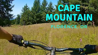
Cape Mountain Trails
- 6
- 4
-
Carl G. Washburne Memorial State Park
Popular Florence Mountain Biking Trails
• 95 ★ 3.5 • 2 miles • 185 ft • 170 •
multi direction but much better down! This trail is impacted by horses causing ditches and minor drainage issues. Some tight switchbacks. Creek crossing at bottom. Some hike a bike if climbing out but not enough to warrant black...
• 90 ★ 4.4 • 2 miles • 242 ft • 167 •
Beautiful forested trail rides well either direction. Some fun, flowy sections.
• 85 ★ 4.0 • 3 miles • 735 ft • 127 •
This is a moderate trail that combines gorgeous forest and fields with views of the Ocean. It can be ridden in either direction. From the bottom of it is a moderate climb out up to the open fields. It is also a fun ride down with no...
• 80 ★ 3.0 • 3,510 ft • 45 ft • 80 •
Popular black diamond difficulty singletrack. This multi-use trail can be used both directions and has a hard overall physical rating with a 45 ft black diamond climb. On average it takes 6 minutes to complete this trail.
• 65 ★ 4.0 • 1,594 ft • 39 ft • 71 •
Moderately popular black diamond difficulty singletrack. This multi-use trail can be used both directions and has a hard overall physical rating with a 39 ft black diamond climb. On average it takes 3 minutes to complete this trail.
• 75 ★ 3.0 • 1 mile • 22 ft • 69 •
Popular blue difficulty singletrack. This multi-use trail can be used both directions. On average it takes 7 minutes to complete this trail.
Florence Mountain Bike Routes
★ 4.0 • 6 miles • 1,150 ft • 6 • Loop •
Wasn't my favorite ride in the world, but it was fun. It is primarily a horse trail which means it is a...
7 miles • 1,316 ft • 4 • Loop •
This loop is the best direction to experience Cape Mountain and avoid a big climb up Berry Creek. Do not...
16 miles • 2,857 ft • 5 • Loop •
This is an excellent way to experience the Cape mountain trail system. You get to start at Baker Beach...
Photos of Florence Mountain Bike
Videos of Florence Mountain Bike

trail: Princess Tasha
0:30 |
111 |
Oct 24, 2024 , Florence
trail: Cape Mountain
0:30 |
83 |
Oct 24, 2024 , Florence

trail: Nelson Ridge
0:30 |
110 |
Oct 24, 2024 , Florence
trail: Nelson Ridge
7:02 |
593 |
Nov 6, 2021 , Florence
Recent Trail Reports
| status | trail | date | condition | info | user |
|---|---|---|---|---|---|
| Wapati | Feb 28, 2026 @ 9:43am (America/Los_Angeles) Feb 28, 2026 | Unknown | shannonhood | ||
| Nelson Ridge | Aug 1, 2025 @ 9:03pm Aug 1, 2025 | Ideal | krustykarlos | ||
| Lookout Loop | Mar 7, 2025 @ 9:57am Mar 7, 2025 | Ideal | Jasonschmitt | ||
| Lookout Peak | Mar 7, 2025 @ 9:57am Mar 7, 2025 | Ideal | Jasonschmitt | ||
| NFR 789 | Mar 7, 2025 @ 9:57am Mar 7, 2025 | Ideal | Jasonschmitt | ||
| Shelter Cove Access | Feb 23, 2025 @ 1:34pm Feb 23, 2025 | Unknown | lwiser | ||
| Cape Mountain | Oct 24, 2024 @ 10:13am Oct 24, 2024 | Ideal | biketothetop | ||
| Berry Creek | Oct 24, 2024 @ 10:13am Oct 24, 2024 | Ideal | biketothetop | ||
| Princess Tasha | Oct 24, 2024 @ 10:13am Oct 24, 2024 | Ideal | biketothetop | ||
| Blue Horizon | May 12, 2023 @ 2:46am May 12, 2023 | Ideal | endurajerbikerun |
Activity Feed
| username | action | type | title | date |
|---|---|---|---|---|
| jsirotek33 | wishlist | region | activity #97735263 | Jun 24, 2026 @ 5:21pm 14 hours |
| jarenargyle | ridden | trail | activity #97492917 | Jun 21, 2026 @ 9:27am Jun 21, 2026 |
| Hugo19 | wishlist | region | activity #97047550 | Jun 15, 2026 @ 9:38am Jun 15, 2026 |
| Jared24Redmon | wishlist | region | activity #95998316 | May 31, 2026 @ 9:27pm May 31, 2026 |
| hillkilla | wishlist | trail | activity #94488090 and 1 more | May 11, 2026 @ 5:05am May 11, 2026 |
Recent Comments
| username | type | title | comment | date |
|---|---|---|---|---|
| trail | Definitely not a black diamond-rated trail. It... | Oct 12, 2024 @ 10:47am Oct 12, 2024 | ||
| trail | Just keep in mind this entire area is a horse... | Aug 11, 2024 @ 9:28pm Aug 11, 2024 | ||
| trail | Very nice flowy trail. I loved it! Loam angels... | Jul 13, 2024 @ 4:42pm Jul 13, 2024 | ||
| trail | I think this was my favorite trail in this... | Jul 13, 2024 @ 4:41pm Jul 13, 2024 | ||
| trail | This trail was a lot of fun. It’s certainly... | Jul 13, 2024 @ 4:39pm Jul 13, 2024 |
Local Badges
-

Epic Ride Climb 2k22 awarded -

Climbing 10k Badge3 awarded -

Climbing 100k Badge0 awarded -

Epic Ride Descent 2k23 awarded -

Descent 10k Badge3 awarded -

Descent 100k Badge0 awarded
Local Mountain Biking Directory
-
Bicycles 101Bike Shop
Activity Type Stats
| activitytype | trails | distance | descent | descent distance | total vertical | rating | global rank | state rank | photos | reports | routes | ridelogs |
|---|---|---|---|---|---|---|---|---|---|---|---|---|
| Mountain Bike | 20 | 25 miles | 2,749 ft | 10 miles | 1,453 ft | #6,358 | #2,153 | 36 | 99 | 3 | 1,049 | |
| E-Bike | 1 | 2 miles | 13 ft | 866 ft | 554 ft | #9,333 | #2,878 | 55 | 90 | |||
| Horse | 15 | 19 miles | 3,064 ft | 9 miles | 1,453 ft | #1,926 | #1,082 | 57 | 1 | |||
| Hike | 42 | 62 miles | 6,076 ft | 25 miles | 1,542 ft | #3,840 | #1,359 | 1 | 99 | 1 | 605 | |
| Trail Running | 42 | 62 miles | 6,076 ft | 25 miles | 1,542 ft | #3,880 | #1,160 | 2 | 99 | 1 | 159 | |
| Dirtbike/Moto | 22 | 24 miles | 262 ft | 6 miles | 230 ft | #855 | #312 | 21 | 16 | |||
| ATV/ORV/OHV | 22 | 24 miles | 262 ft | 6 miles | 230 ft | #523 | #185 | 18 | 14 |
Frequently Asked Questions About Florence
▼
What are the best places to ride in Florence?
Florence has 6 areas to explore for mountain biking. The top rated areas are:
▼
What are the highest rated mountain biking trails in Florence?
The highest rated mountain biking trails in Florence are:
- Princess Tasha (4.1/5)
- Nelson Ridge (4/5)
- Wapati (4/5)
- Blue Horizon (4/5)
- Scurvy Ridge (3.8/5)
▼
What is the best time of the year to ride in Florence?
Based on ride log data, the most popular months to ride in Florence are:
- July (36 activities)
- August (29 activities)
- September (21 activities)
▼
Where can I park to ride in Florence?
There are 23 parking locations listed in Florence. The most popular parking spots are: View all parking and trailhead locations on the map to plan your visit.
Activities
Trails
Points of Interest
- Viewpoint Cape Mountain
- Horsfall Campground Camping
- Heceta Head Lighthouse Viewpoint
- Rock Creek Campground Camping
- Washburne Campground Camping
- Sutton Campground Camping
- Baker Beach Campground Camping
- Alder Dune Campground Camping
- Driftwood II Camping
- Spinreel Campground Camping
- Roman Nose Mountain (2,851 ft)
- Baldy Mountain (2,513 ft)
- Mount Grayback (2,221 ft)
- By todd
 Trailforks & contributors
 - Admins: OTA
- #19785 - 11,481 views
- florence activity log | embed map of Florence mountain bike trails | florence mountain biking points of interest
Downloading of trail gps tracks in kml & gpx formats is enabled for Florence.
You must login to download files.