close
-
Layers w
- Weather Layers
- Pro
- Pro
- Pro
- Pro
- Pro
- Pro
- More Layers
- Pro
- Pro
- Pro
- Pro
-
Upgrade to

3D
Trail Conditions
- Unknown
- Snow Groomed
- Snow Packed
- Snow Covered
- Snow Cover Partial
- Freeze/thaw Cycle
- Icy
- Prevalent Mud
- Wet
- Variable
- Ideal
- Dry
- Very Dry
Trail Flow (Ridden Direction)
Trailforks scans users ridelogs to determine the most popular direction each trail is ridden. A good flowing trail network will have most trails flowing in a single direction according to their intension.
The colour categories are based on what percentage of riders are riding a trail in its intended direction.
The colour categories are based on what percentage of riders are riding a trail in its intended direction.
- > 96%
- > 90%
- > 80%
- > 70%
- > 50%
- < 50%
- bi-directional trail
- no data
Trail Last Ridden
Trailforks scans ridelogs to determine the last time a trail was ridden.
- < 2 days
- < 1 week
- < 2 weeks
- < 1 month
- < 6 months
- > 6 months
Trail Ridden Direction
The intended direction a trail should be ridden.
- Downhill Only
- Downhill Primary
- Both Directions
- Uphill Primary
- Uphill Only
- One Direction
Contribute Details
Colors indicate trail is missing specified detail.
- Description
- Photos
- Description & Photos
- Videos
Trail Popularity ?
Trailforks scans ridelogs to determine which trails are ridden the most in the last 9 months.
Trails are compared with nearby trails in the same city region with a possible 25 colour shades.
Think of this as a heatmap, more rides = more kinetic energy = warmer colors.
- most popular
- popular
- less popular
- not popular
ATV/ORV/OHV Filter
Max Vehicle Width
inches
US Cell Coverage
Legend

Radar Time
Activity Recordings
Trailforks uses anonymized public activity data.
?
Activity Recordings
Trailforks uses anonymized public activity data.
?
Personal Heatmap
▶
Activity Types
all
/
none
▶
Options
2
Date range
month
–
Winter Trails
Warning
A routing network for winter maps does not exist. Selecting trails using the winter trails layer has been disabled.
Missing Trails
Most Popular
Least Popular
Trails are colored based on popularity. The more popular a trail is, the more red. Less popular trails trend towards green.
Jump Magnitude Heatmap
Heatmap of where riders jump on trails. Zoom in to see individual jumps, click circles to view jump details.
BC Backroad Status
![map legend]()
Service Road Atlas is a free to use, community-driven service for viewing and creating reports on the numerous back-country service roads around B.C. and Alberta.

Slope Aspect
Direction the slope faces
Trails Deemphasized
Trails are shown in grey.
Only show trails with no bike usage.
Suggested Layers
Based on selected activity type
Save the current map location and zoom level as your default home location whenever this page is loaded.
Save
No description for Flumserberg has been added yet!
Login or register to submit one.
This region uses the Uk/Euro style trail grading system.
Activities Click to view
- Mountain Bike
64 trails
- E-Bike
57 trails
- Adaptive Bike
0 trails
- Hike
65 trails
- Trail Running
65 trails
Region Details
- 7
- 5
- 28
- 18
- 5
Region Status
Open as of Jun 7, 2026Stats
- Avg Trail Rating
- Trails (view details)
- 65
- Trails Mountain Bike
- 64
- Trails E-Bike
- 57
- Trails Hike
- 65
- Trails Trail Running
- 65
- Total Distance
- 51 miles
- Total Descent Distance
- 36 miles
- Total Descent
- 30,171 ft
- Total Vertical
- 6,491 ft
- Highest Trailhead
- 7,887 ft
- Reports
- 260
- Photos
- 116
- Ridden Counter
- 4,767
Sub Regions
-
BikerBerg Flumserberg
- 2
- 1
- 4
Popular Flumserberg Mountain Biking Trails
• 100 ★ 4.1 • 2 miles • 5 ft • 587 •
Der blaue, einfache BikerTrail ist ideal für Einsteiger und Familien, da er im weniger steilen Gelände gebaut ist, viel Flow, Kurven und kleine Sprünge aufweist. Zum Start des Trails gelangt man mit der Gondel ab Tannenheim. Easy...
• 90 ★ 4.1 • 2 miles • 0 ft • 561 •
Der BikerTrail startet auf dem Prodkamm auf 1939 m und führt mit viel Flow, einem eindrücklichen Bergpanorama und Alpenidylle zurück nach auf 1576 m. Sie erreichen die ab Tannenheim mit der 12er-Gondelbahn -Express. Auf steigen Sie...
• 80 ★ 3.9 • 2 miles • 9 ft • 489 •
BikerTrail Der BikerTrail zweigt bei Twärchamm vom ab und führt mit viel Abwechslung durch Alpwiesen, über kleine Brücken, vorbei an der roten Felswand zum Chrüz und von da weiter durch den Wald nach Tannenboden. Sie erreichen die...
• 70 ★ 2.2 • 1 mile • 50 ft • 341 •
Der BikerTrail verbindet die beiden Ortschaften Tannenboden und Tannenheim und mündet in den unteren Teil des s ein. Kurze Pedalier-Abschnitte, gebaute Wellen und Kurven sind auf diesem BikerTrail anzutreffen. Family-friendly trail,...
• 60 ★ 3.4 • 1,693 ft • 0 ft • 302 •
Verbindungstrail zwischen dem und dem Blue Bunny. Einige kleine Roller welche gesprungen oder gefahren werden können. Linking trail between and with some easy rollers to either ride or jump.
• 45 ★ 4.5 • 3 miles • 21 ft • 250 •
Technically demanding downhill route for experienced bikers. It leads from Flumserberg Tannenboden to Unterterzen at the Walen lake. Roots, stone steps, waves, drops and bends have to be mastered. The panoramic views of the Churfirsten...
• 45 ★ 0.0 • 787 ft • 4 ft • 51 • • hike
Moderately popular blue difficulty singletrack. This hike primary trail can be used both directions. On average it takes 17 minutes to complete this trail.
• 95 ★ 3.0 • 1 mile • 212 ft • 51 • • hike
Popular blue difficulty singletrack. This hike primary trail can be used uphill primary. On average it takes 15 minutes to complete this trail.
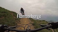
Flumserberg Mountain Bike Routes
11 miles • 2,347 ft • 4 • Loop •
Paved: 4km Forest Track: 13km SingleTrail: 0km
Photos of Flumserberg Mountain Bike
Videos of Flumserberg Mountain Bike
trail: RedRock
10:00 |
216 |
Jul 13, 2018

trail: RedRock
14:43 |
230 |
Oct 8, 2017
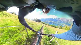
trail: See-Abfahrt
0:43 |
104 |
Aug 4, 2025 , Flumserberg
youtuber
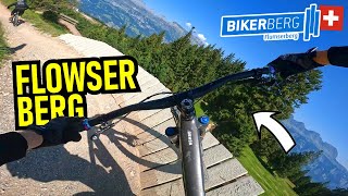
![BIKERBERG FLUMSERBERG Seeabfahrt - Lake...]()
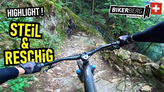
trail: See-Abfahrt
22:52 |
255 |
Apr 8, 2025 , Flumserberg
youtuber
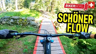
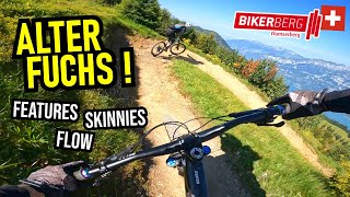
![BIKERBERG FLUMSERBERG Blue Salamander Flowline...]()
trail: Blue Salamander
9:23 |
186 |
Mar 28, 2025 , Flumserberg

trail: See-Abfahrt
13:04 |
381 |
Jul 18, 2024 , Flumserberg
Recent Trail Reports
| status | trail | date | condition | info | user |
|---|---|---|---|---|---|
| BunnyHopp | Jun 7, 2026 @ 11:02am (Europe/Vaduz) Jun 7, 2026 | Ideal | queenieman | ||
| RedRock | Jun 7, 2026 @ 11:02am (Europe/Vaduz) Jun 7, 2026 | Variable | queenieman | ||
| RedFox | Jun 7, 2026 @ 11:02am (Europe/Vaduz) Jun 7, 2026 | Variable | queenieman | ||
| Blue Salamander | Jun 7, 2026 @ 12:15pm (Europe/Vaduz) Jun 7, 2026 | Ideal | jpd333 | ||
| Pravizin Trail | Mar 12, 2026 @ 10:12pm (Europe/Zurich) Mar 12, 2026 | Variable | Fredhu5aPK | ||
| Valdarschtrail | Mar 12, 2026 @ 10:10pm (Europe/Zurich) Mar 12, 2026 | Ideal | Fredhu5aPK | ||
| Raischibe I | Mar 10, 2026 @ 4:52pm (Europe/Zurich) Mar 10, 2026 | Ideal | Fredhu5aPK | ||
| Geisswiese Trail | Nov 16, 2025 @ 5:03pm (Europe/Zurich) Nov 16, 2025 | Unknown | Fredhu5aPK | ||
| Gruppa Trail | Nov 16, 2025 @ 5:01pm (Europe/Zurich) Nov 16, 2025 | Variable | Fredhu5aPK | ||
| Weidtalweg | Oct 11, 2025 @ 12:43pm (Europe/Vaduz) Oct 11, 2025 | Ideal | eile |
Activity Feed
| username | action | type | title | date |
|---|---|---|---|---|
| steinbockrider | add | photo | activity #96989020 and 1 more | Jun 14, 2026 @ 11:18am Jun 14, 2026 |
| steinbockrider | add | photo | activity #96943403 and 1 more | Jun 14, 2026 @ 12:55am Jun 14, 2026 |
| jpd333 | vote | trail | activity #96597427 | Jun 9, 2026 @ 4:59am Jun 9, 2026 |
| queenieman | add | report | activity #96471849 and 2 more | Jun 7, 2026 @ 9:44am Jun 7, 2026 |
| jpd333 | difficultyvote | trail | activity #96451989 and 1 more | Jun 7, 2026 @ 5:59am Jun 7, 2026 |
Recent Comments
| username | type | title | comment | date |
|---|---|---|---|---|
| trail | Nothing special - a few small rocks here and... | Dec 18, 2025 @ 5:53am Dec 18, 2025 | ||
| trail | The top part is nice and technical (a bit... | Dec 18, 2025 @ 5:46am Dec 18, 2025 | ||
| trail | Very pretty and lots of "slab" riding which is... | Nov 16, 2025 @ 8:19am Nov 16, 2025 | ||
| trail | Top Trail, anspruchsvolle Abfahrt, bis zum... | Oct 13, 2025 @ 8:53am Oct 13, 2025 | ||
| trail | It’s blue, sometimes even green. In this... | Jul 1, 2025 @ 2:15pm Jul 1, 2025 |
Local Badges
-

10 Blue Trails6 awarded -

Epic Mountain Bike Climb 2k192 awarded -

Climbing 10k Badge20 awarded -

Mountain Biking 100k Badge0 awarded -

Epic Ride Descent 2k192 awarded -

Descent 10k Badge27 awarded
Bike & Skill Parks
| name | type | city | rating |
|---|---|---|---|
| BikerBerg Flumserberg | bike park | Flumserberg |
Activity Type Stats
| activitytype | trails | distance | descent | descent distance | total vertical | rating | global rank | state rank | photos | reports | routes | ridelogs |
|---|---|---|---|---|---|---|---|---|---|---|---|---|
| Mountain Bike | 64 | 49 miles | 29,180 ft | 35 miles | 6,490 ft | 113 | 259 | 2 | 2,143 | |||
| E-Bike | 57 | 41 miles | 23,435 ft | 27 miles | 6,490 ft | #1,694 | #77 | 3 | 238 | 3 | 198 | |
| Hike | 65 | 43 miles | 26,362 ft | 30 miles | 6,490 ft | #1,975 | #43 | 241 | 2 | 372 | ||
| Trail Running | 65 | 43 miles | 26,362 ft | 30 miles | 6,490 ft | #2,114 | #39 | 241 | 2 | 33 |
Frequently Asked Questions About Flumserberg
▼
What are the best places to ride in Flumserberg?
Flumserberg has 1 areas to explore for mountain biking. The top rated areas are:
▼
What are the highest rated mountain biking trails in Flumserberg?
The highest rated mountain biking trails in Flumserberg are:
- See-Abfahrt (4.3/5)
- Blue Salamander (4.1/5)
- RedFox (4/5)
- Gruppa Trail (4/5)
- Mutten (4/5)
▼
What is the best time of the year to ride in Flumserberg?
Based on ride log data, the most popular months to ride in Flumserberg are:
- July (22 activities)
- August (19 activities)
- September (17 activities)
▼
Where can I park to ride in Flumserberg?
Activities
Trails
- By trailpapst
 TRAILFORKS swiss IMBA SCHWEIZ & contributors
 - Admins: BTOS, Wägmacher
- #24825 - 4,501 views
- flumserberg activity log | embed map of Flumserberg mountain bike trails | flumserberg mountain biking points of interest
Downloading of trail gps tracks in kml & gpx formats is enabled for Flumserberg.
You must login to download files.